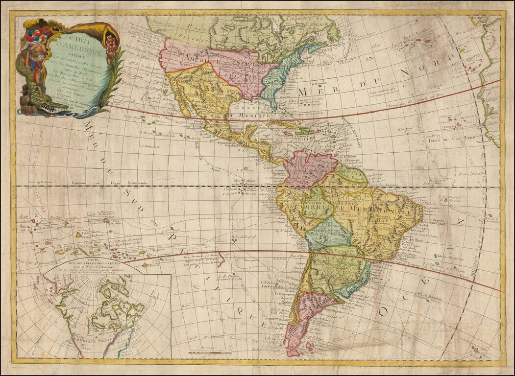
Rare and antique old maps of the South America
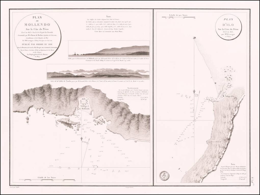
Antique Sea Chart of the The Southern Coast of Peru -- Mollendo and Ilo Rare separately published sea chart of the the areas around the southern Peruvian towns of Mollendo and Ilo, which was also issued in Volume 7 of the Neptune Francois. The plan...
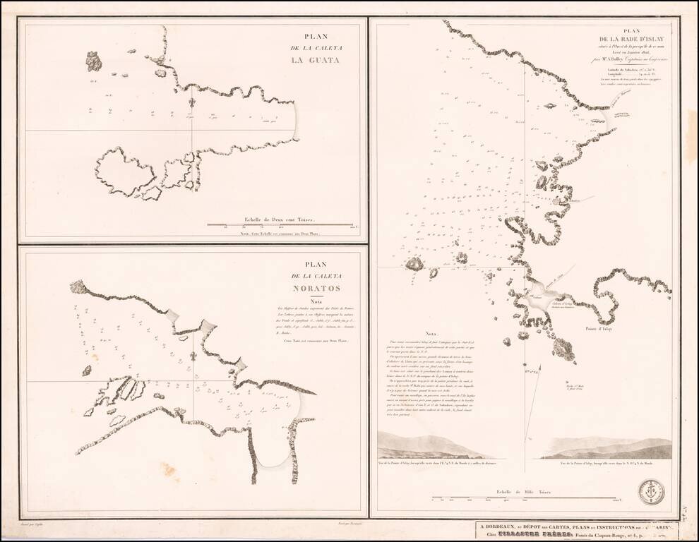
Nice set of three harbor plans from this scarce separately published sea chart.
![[Peruvian Coast] Sheet XII Peru Cape Lobos to Pescadores Point By Captn. Robert Fitz Roy R.N. The Officers of H.M.S. Beagle 1836](/map/small/58399.jpg)
Detailed chart of a portion of the Coast of Peru, with contemporary annotations showing use at sea in 1872. Includes four profile views. The present chart is based upon surveys on the coast of South America aboard the H.M.S. Beagle in 1836, during...
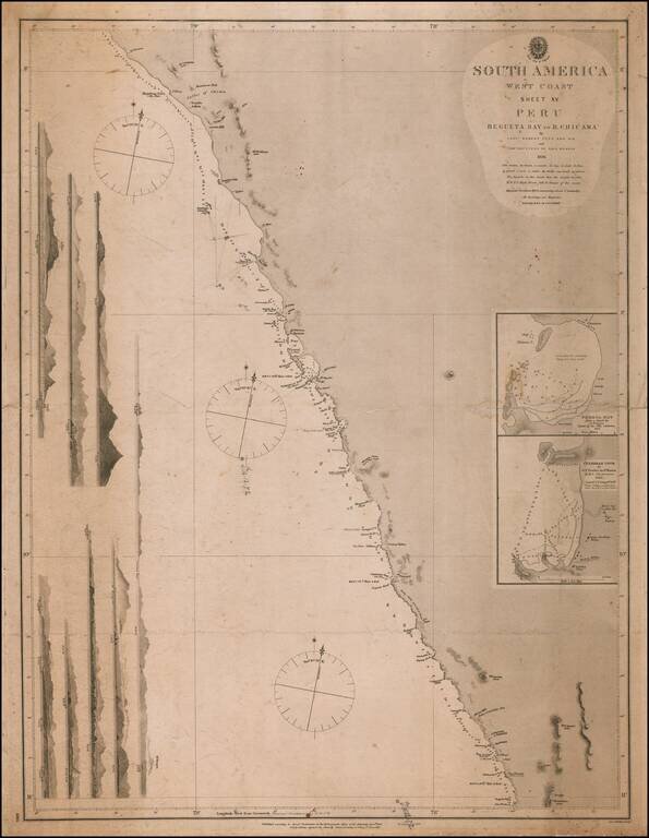
Detailed chart of a portion of the Coast of Peru, with contemporary annotations showing use at sea in 1872. Includes seven profile views. The present chart is based upon surveys on the coast of South America aboard the H.M.S. Beagle in 1836, during...
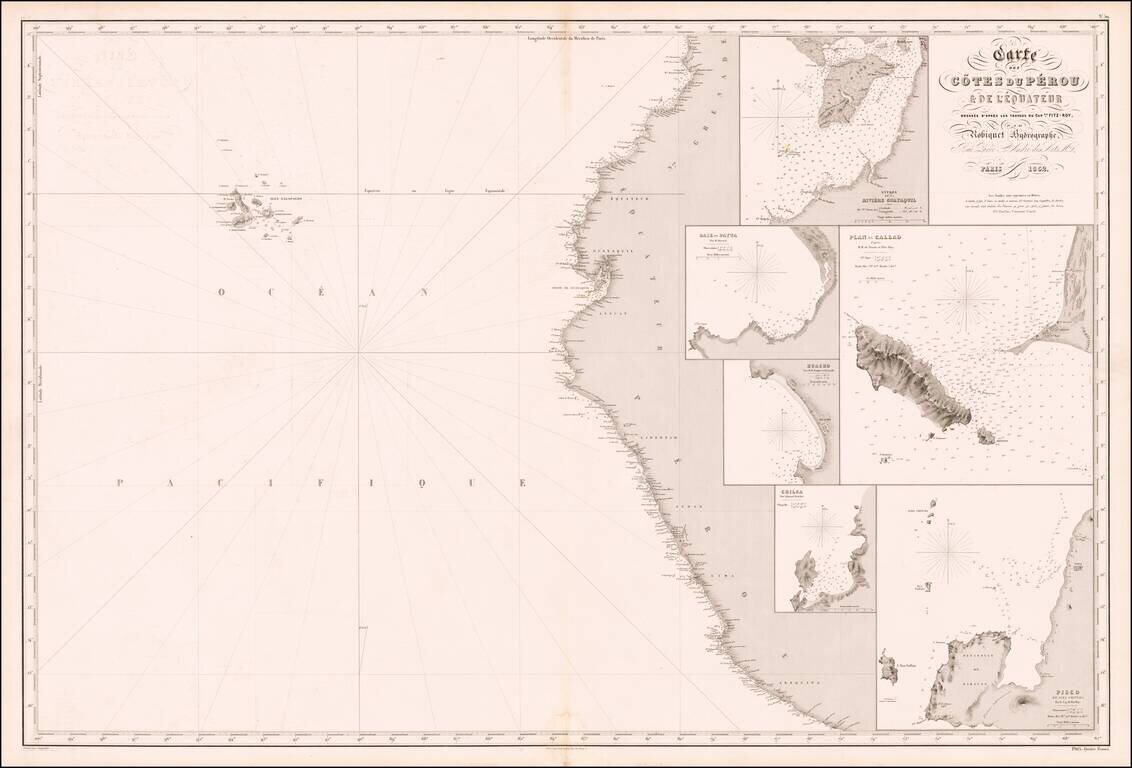
Rare French sea chart of the mouth of the coast of Peru, published in Paris by Aime Robiquet. The Galapagos Islands appear in the west. The map includes large insets of: Entrance to Guayquil River Payta Bay Callao Huacho Chica Pisco Rare...
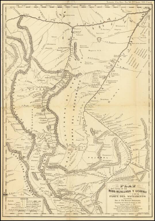
Antique lithographed map, issued in 1853 a Hoen of Baltimore, reproducing this original. Between 1789 and 1790 Father Manuel Sobreviela travelled along the Huallaga River and created a map of the area around the Huallaga and Ucayali Rivers. Sobreviela...
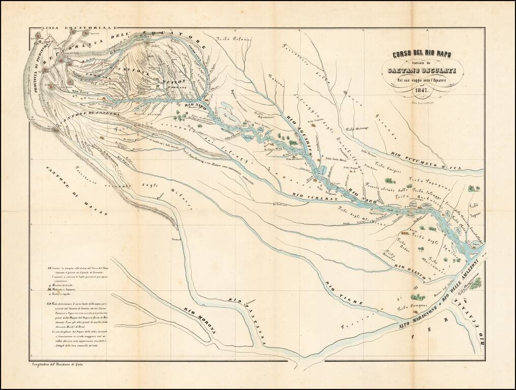
The Rio Napo and Tributaries Detailed map centered on the Rio Napo and its Tributaries, illustrating the travel of the Italian Naturalist Gaetano Osculati. The map extends from Quito in the northwest to the Upper Marangnoni and the confluence of the...
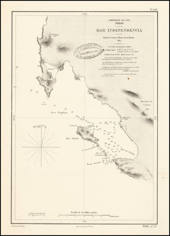
Scarce French sea chart of the area around the Peninsula de Paracas in Peru.
![[Manuscript map of the Mantaro River Valley, Peru]](/map/small/30411.jpg)
Interesting manuscript map of part of the central highlands of Peru, from Jauja in the north to Huancayo and Chupaca in the south. The map covers a little more than 50 miles north-to-south and east-to-west. Many smaller villages and hamlets are...
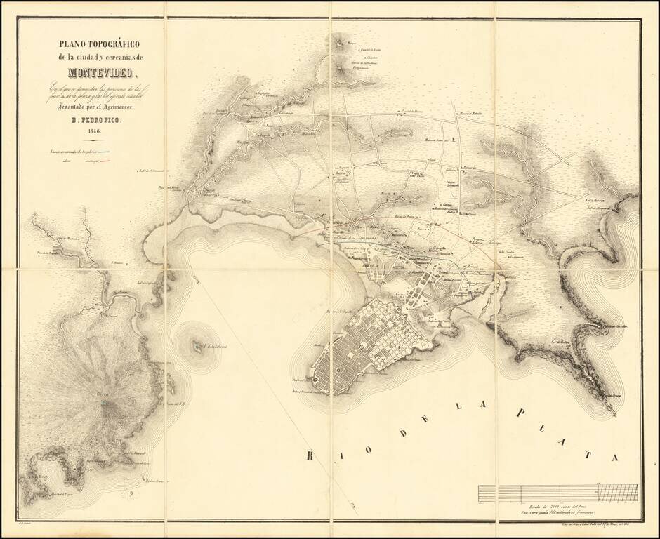
Rare early plan of Montevideo, in the midst of the Great Siege of Montevideo between 1843 and 1851, during the Uruguayan Civil War. The map illustrates in Red and Blue the lines of the enemy (red) and defensive forces (blue) protecting the city in...
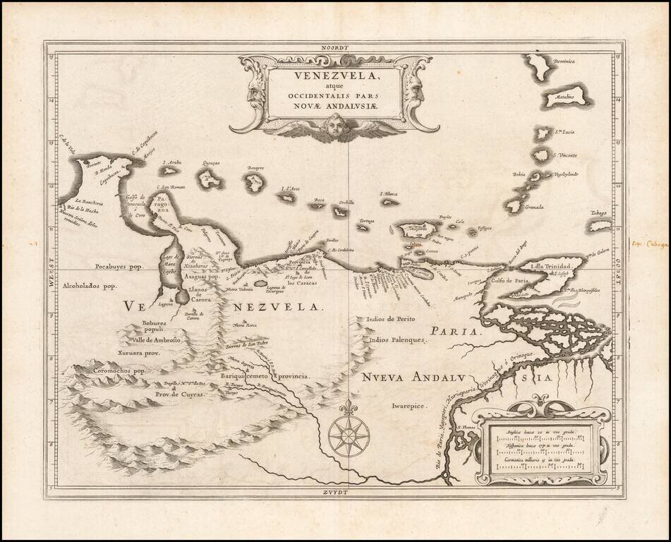
An Early Example of Hessel Gerritsz's Map of Venezuela Detailed map of Venezuela, extending to the mouth of the Orinoco River. Gerritsz' map of Venezuela served as a model for other cartographers throughout the rest of the century. Gerritsz was...

Finely colored example of Blaeu's map of Venezuela and the Northeastern part of South America. Includes 2 decorative cartouches, vignettes of various indigenous animals, a compass rose and rhumb lines, etc.
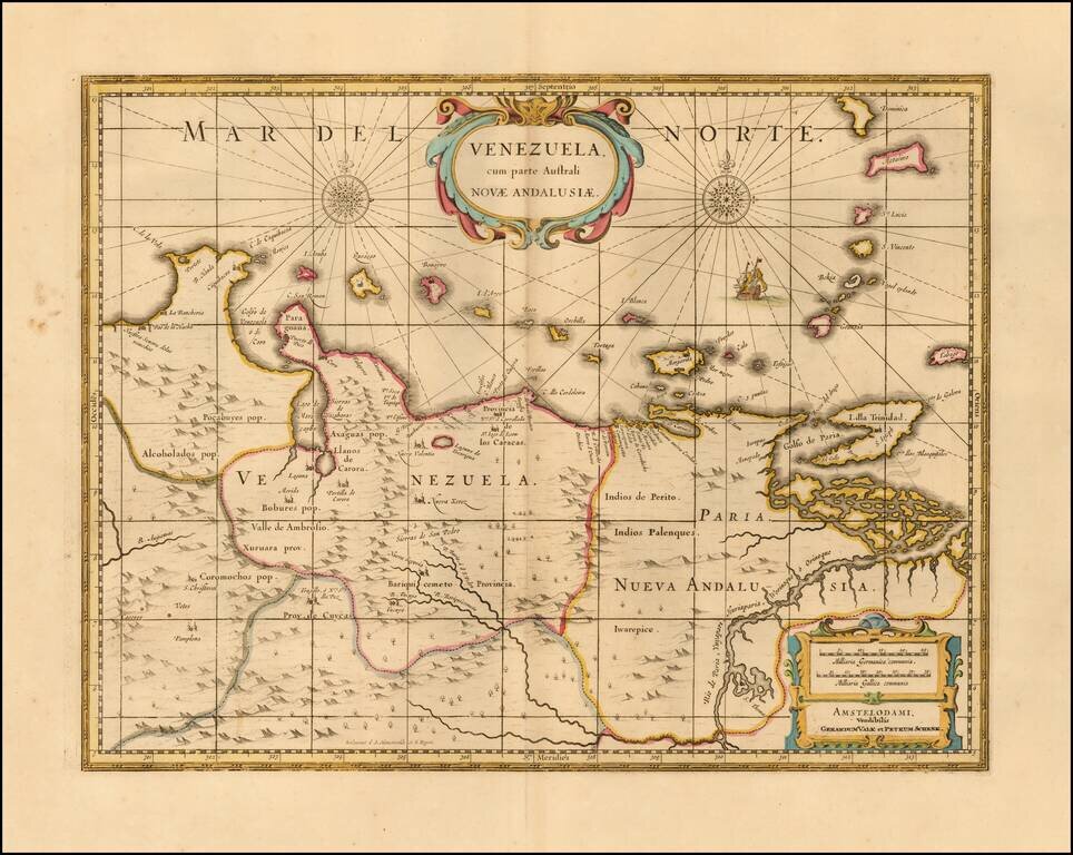
Nice example of this well executed late 17th Century map of Venezuela and the northeastern part of South America. Includes 2 decorative cartouches, vignettes of various indigenous animals, a compass rose and rhumb lines, etc. Originally engraved by...
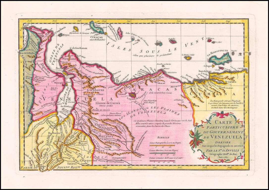
Striking D’Anville Map of Venezuela Fine example of D’Anville’s map of Venezuela, which features much of the northern part of what is today the country of Venezuela and the Leeward Antilles. The map shows the mountainous terrain in detail, with...
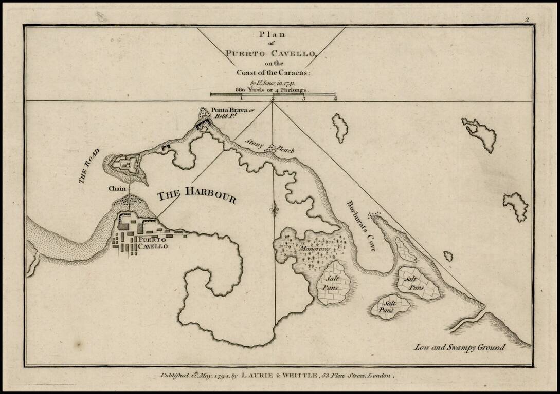
Rare plan of Puerto Cavello, Venezuela, first published by Sayer & Bennett. Includes a town plan, detailed charting of the harbor, with soundings and anchorages, forts, islands and other details. One of the earliest obtainable English language...

Rare Spanish Sea Chart of the Coast of Venezuela and Trinidad Rare first state of the edition of this rare Spanish sea chart of the coastline of Venezuela and neighboring islands, including Trinidad and Margarita. The present chart represents the...