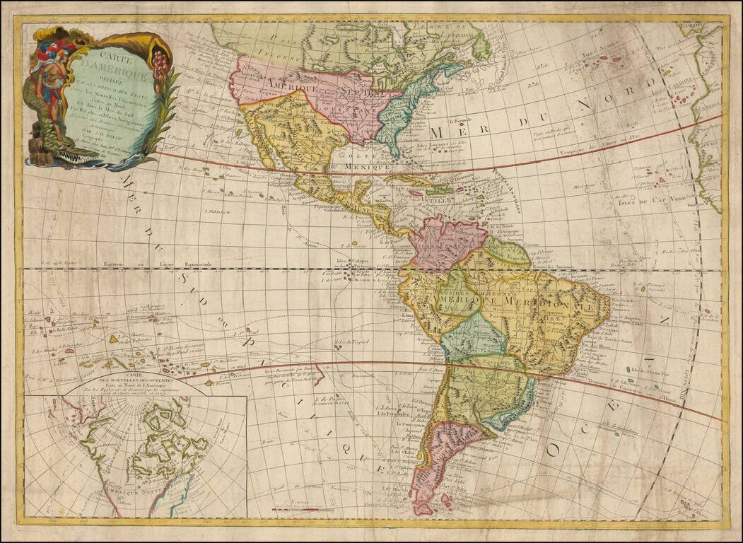
Rare and antique old maps of the South America
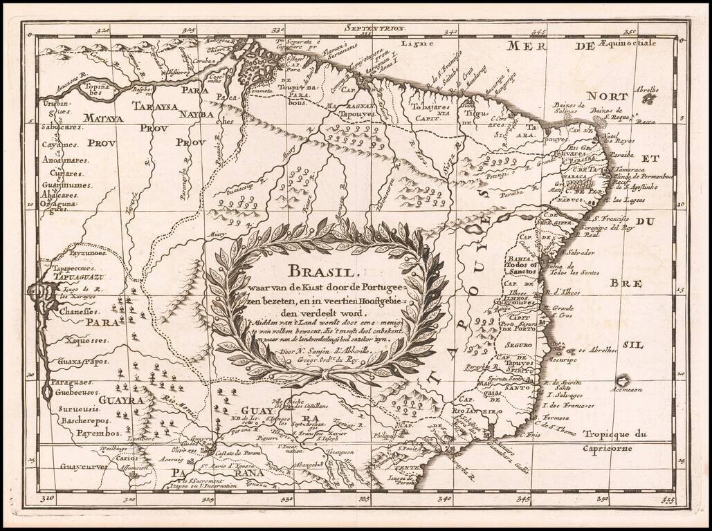
Antique Map of Brazil from the mid-17th Century Dutch edition of Sanson's important early regional map of Brazil, extending from the Amazon to the area just South of Rio de Janeiro and extending west to Tapuaguazo and Lago de R. los Xarayes. The map...
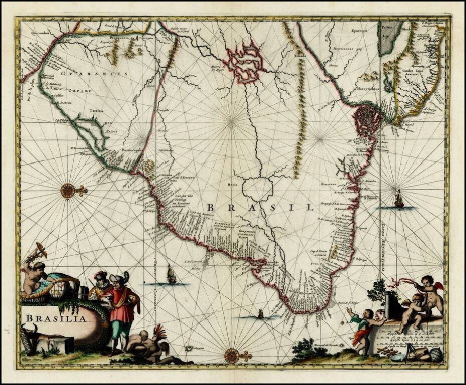
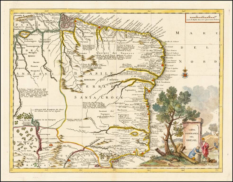
Striking full color example of the map of Brazil from Ogilby's English translation of De Nieuwe en Onbekende Wereld published by Arnold Montanus, which was used by John Ogilby as the basis of his Complete History of America. The cartography of the...
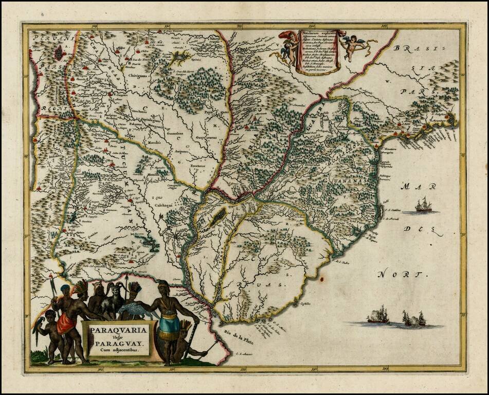
Nice full color example of this regional map, extending from the mouth of the Rio De La Plata to San Sebastian and Marambaya in Brazil, and centered on the course of the Rio De La Plata. Embellished with 2 decorative cartouches and sailing ships.
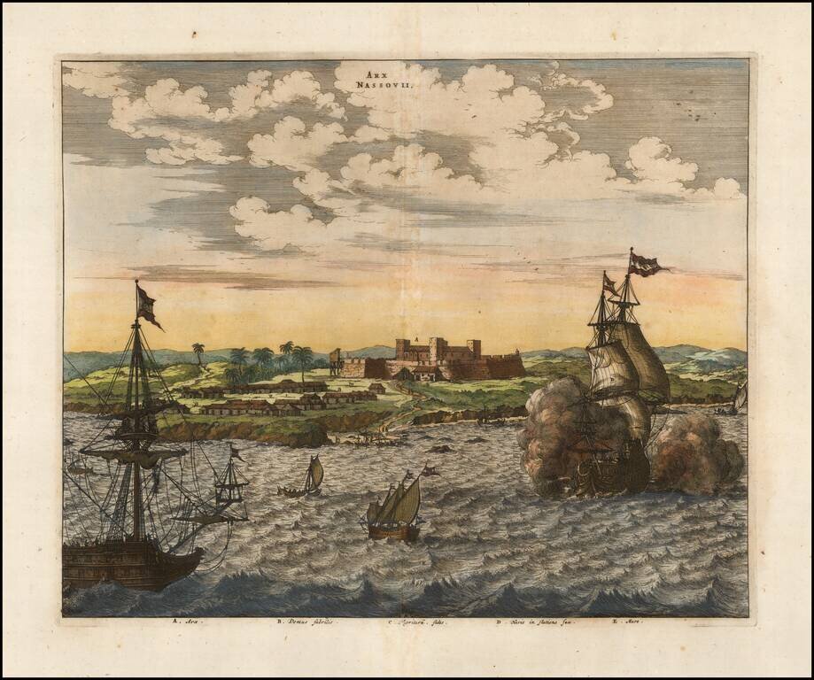
An attractive early view of Fort Nassau. This fine early view depicts the scene of a battle off the coast of Pernambuco on the east coast of Brazil, during the Dutch & Portuguese struggle to retain ownership of the area. Fort Nassau (Arx Nassovii)...
Rare English Edition of the First Sea Chart of the Mouth of the Amazon River and northern coast of Brazil. Important early sea chart of the coast of Northern Brazil, from the mouth of Rio Grande River in the south. The map is oriented with west at...
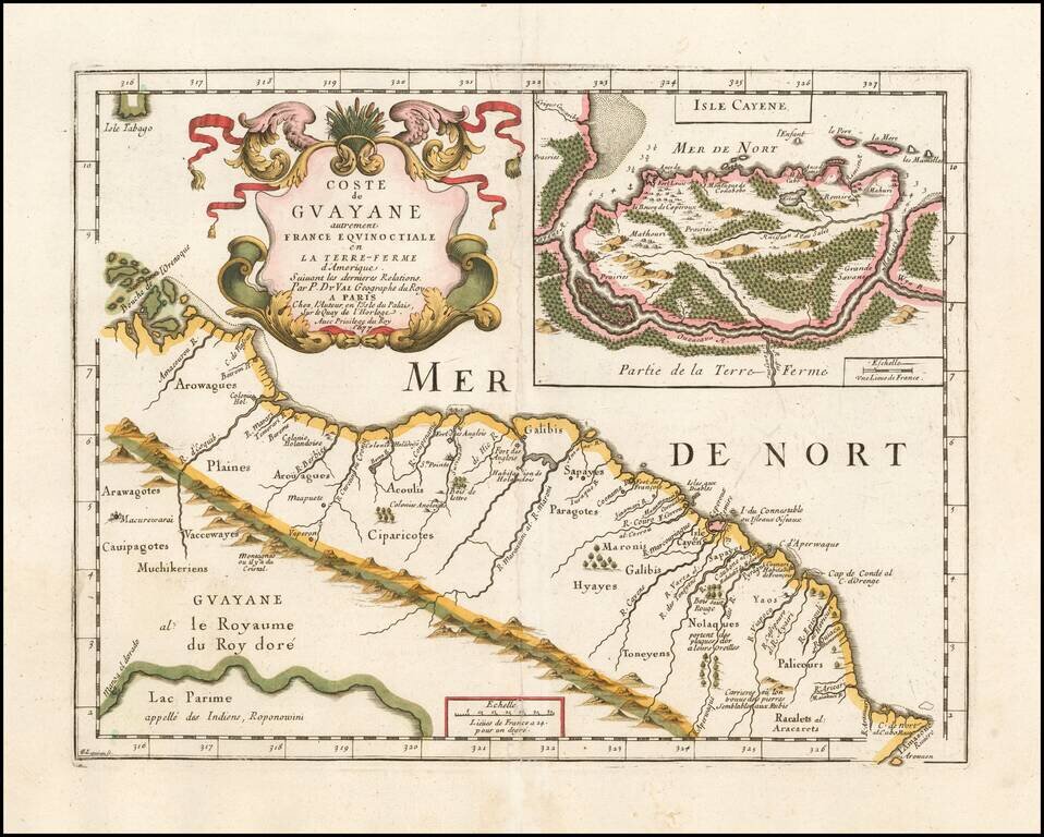
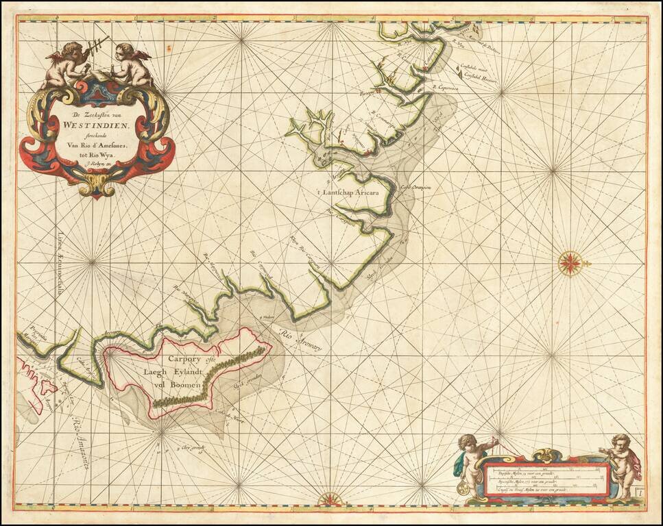
Very rare map of the Northeast coastline of South America, from the mouth of the Orinoco River to the mouth of the Amazon River, centered on Galibis, Sapayes and the Isle de Cayene. Shows a number of early place names, rivers, and a single cordillera...
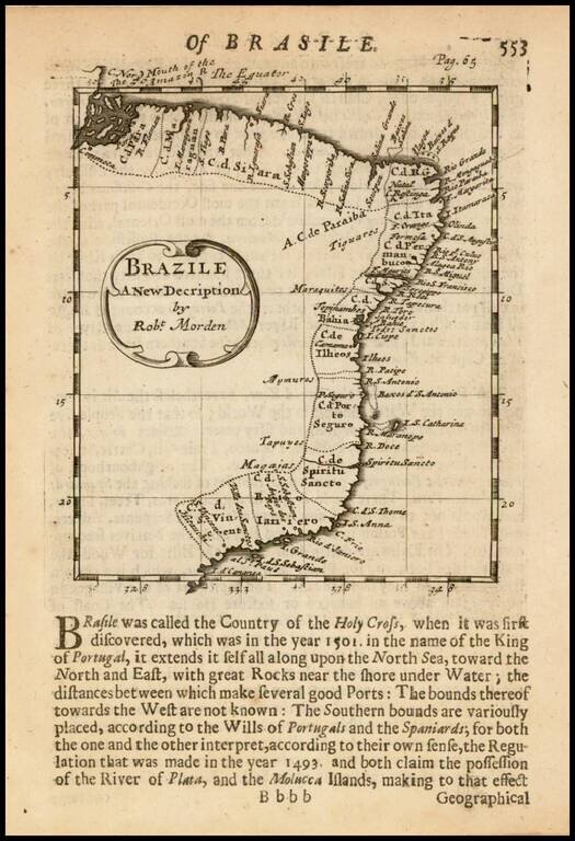
Rare early English map of Brazil, showing remarkable coastal details. The map first appeared in Morden's Atlas Terrestris and is one of the earliest obtainable maps of Brazil published in England.
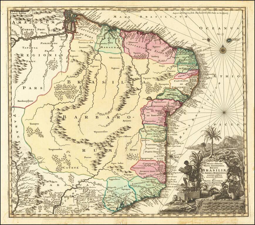
Gorgeous full color example of Seutter's scarce map of Brazil. The map covers Brazil from the mouth of the Amazon River to tSão Paulo and from the Paraguay River to the Atlantic. The map is based upon Joannes Blaeu's scarce Nova et Accurata Totius...
![Portugalliae et Algarbiae… [with large Regnum Brasiliae…inset]](/map/small/70149jd.jpg)
Portugal and Her Brazilian Colony Decorative map of Portugal with a large inset of Brazil, showing its 12 captaincies. The map is elaborately embellished, with several naval battles, a highly ornate cartouche and other details.
Scarce decorative map of Brazil by Albrizzi, based upon De L'Isle's map of the region. Decorative cartouche and a number of annotations within the body of the map in Italian.
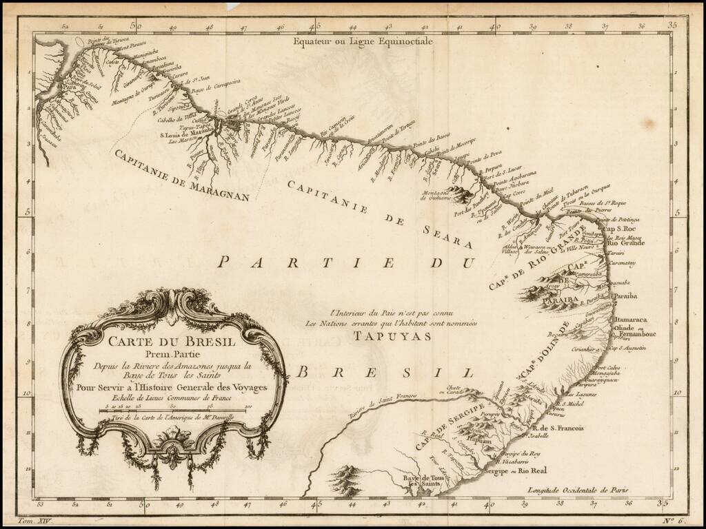
Detailed regional map of the coast of Brazil, from Maracana to Baye de Tous les Saints. Covers Capitanie De Maragnan, Seara, Rio Grande, Paraiba, D'Olinde and Sergipe. Includes a decorative title cartouche. One of the maps produced by Nichlas Bellin...

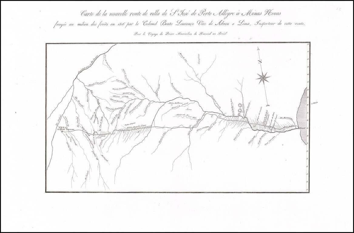
Nice example of this finely executed map of the East Coast of Brazil, prepared to illustrate the expedition of Prince Maximillian of Wied-Neuwied. Neuwied, was a German explorer, ethnologist and naturalist. He led a pioneering expedition to southeast...
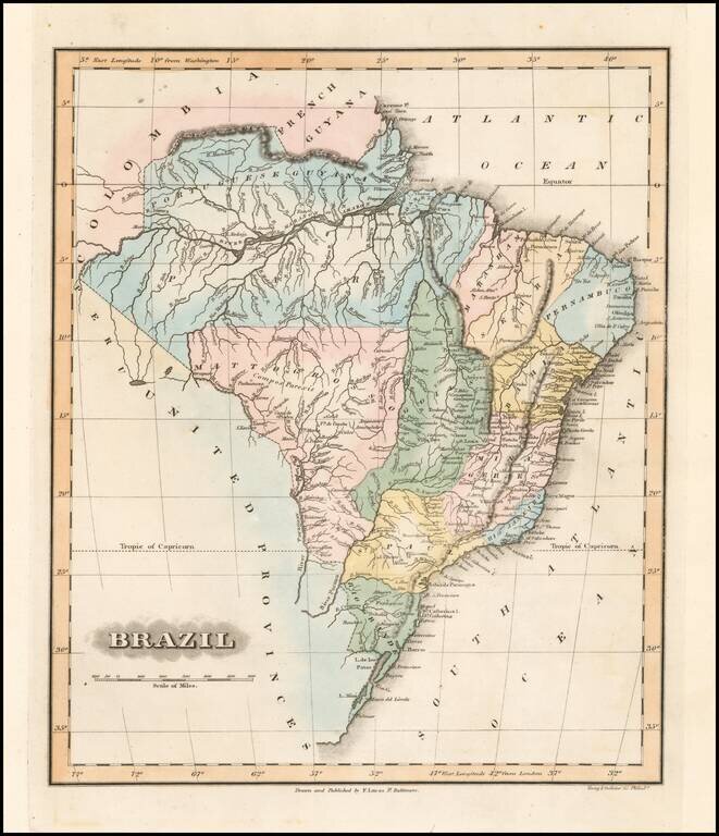
Fielding Lucas's 1823 engraved map of Brazil. Fielding Lucas' fine work distinguished him as the best publisher of the era. His maps are printed on a higher quality paper than contemporary maps by Carey & Lea and demonstrate a superior engraving...
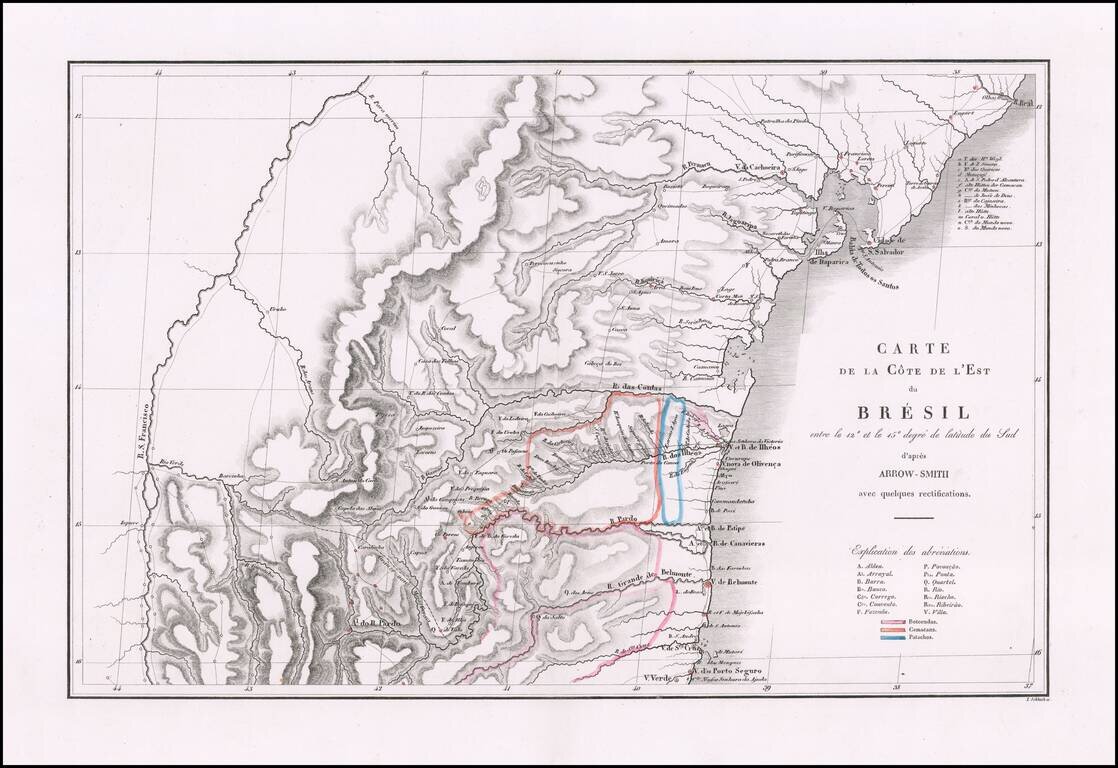
Fine map of a portion of Brazil, prepared to illustrate Prince Maximilian of Wied's expedition to Brazil in 1815-1817. Born at the end of the European Enlightenment, Maximilian of Wied was friends with two important explorers, Johann Friedrich...
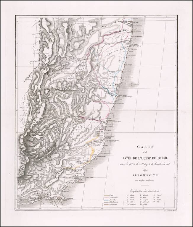
Fine map of a portion of Brazil, prepared to illustrate Prince Maximilian of Wied's expedition to Brazil in 1815-1817. Born at the end of the European Enlightenment, Maximilian of Wied was friends with two important explorers, Johann Friedrich...
Fine map of a portion of Brazil, prepared to illustrate Prince Maximilian of Wied's expedition to Brazil in 1815-1817. Born at the end of the European Enlightenment, Maximilian of Wied was friends with two important explorers, Johann Friedrich...