Map size in jpg-format: 833814B
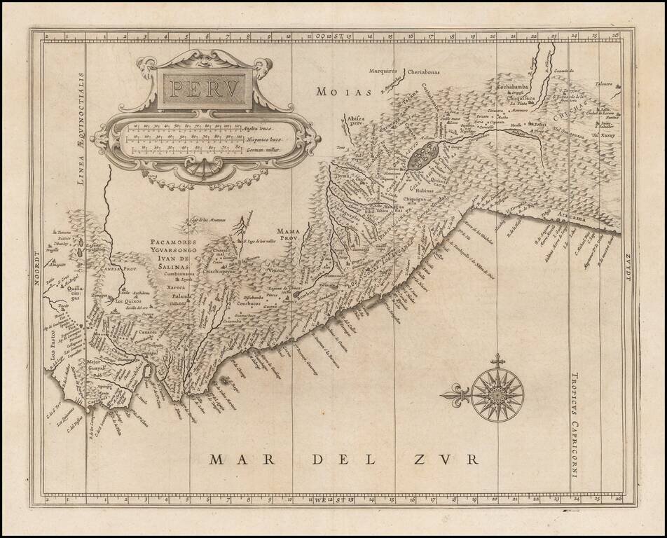
Important early map of Peru, one of the earliest obtainable maps to focus on the region and the first to rely upon the work of Hessel Gerritsz.
This remarkable early map pre-dates the maps of Peru issued by Blaeu and Jansson.
Johannes De Laet's Nieuwe Wereldt ofte Beschrijvinghe van West-Indien was one of the earliest compilation of maps to focus on America. First issued in 1625 with 14 maps and expanded 1640 to include 4 additional maps, De Laet's work brought to the public eye the finely executed maps of Hessel Gerritsz. Gerritsz (1581-1632) was a Dutch engraver, cartographer and publisher, who is considered by some to have been "unquestionably the chief Dutch cartographer of the 17th century." (Johannes Keuning "Hessel Gerritsz" (1949) Imago Mundi Vol. 6, pp. 46-66).
Johannes De Laet was an important participant in the founding of New Netherlands and a director of the Dutch West India Company, which sponsored its settlement. He also owned a large tract of land in the area of Albany. He therefore would have had access to surveys and information from Dutch colonists and traders from both North and South America.
If you are a student, write to us in telegram: @antiquemaps and indicate what material you need and for what work you need a map in high detail. We are ready to provide material on special terms. For students only!
![[Straits of Le Maire, Nova Guinea, South Pacific]](/map/small/61345op.jpg)