Map size in jpg-format: 1.27651MiB
Click to open in high resolution (open in new tab).
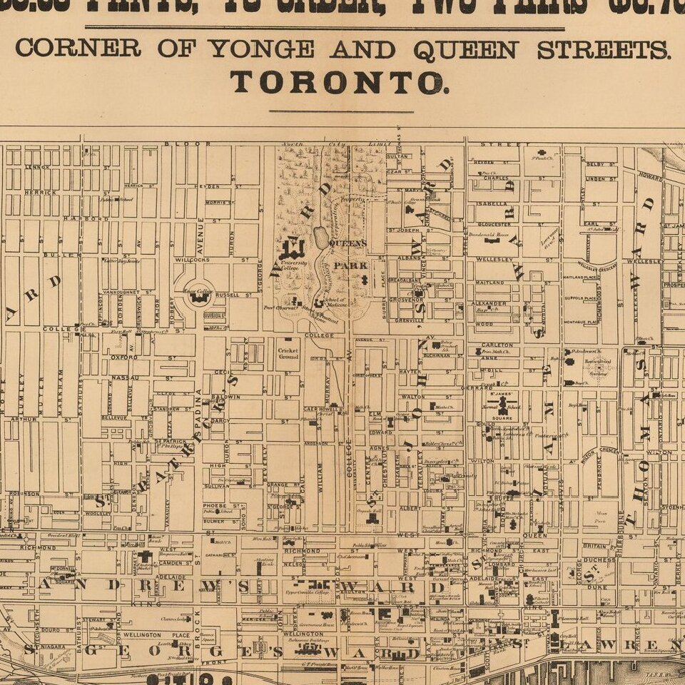
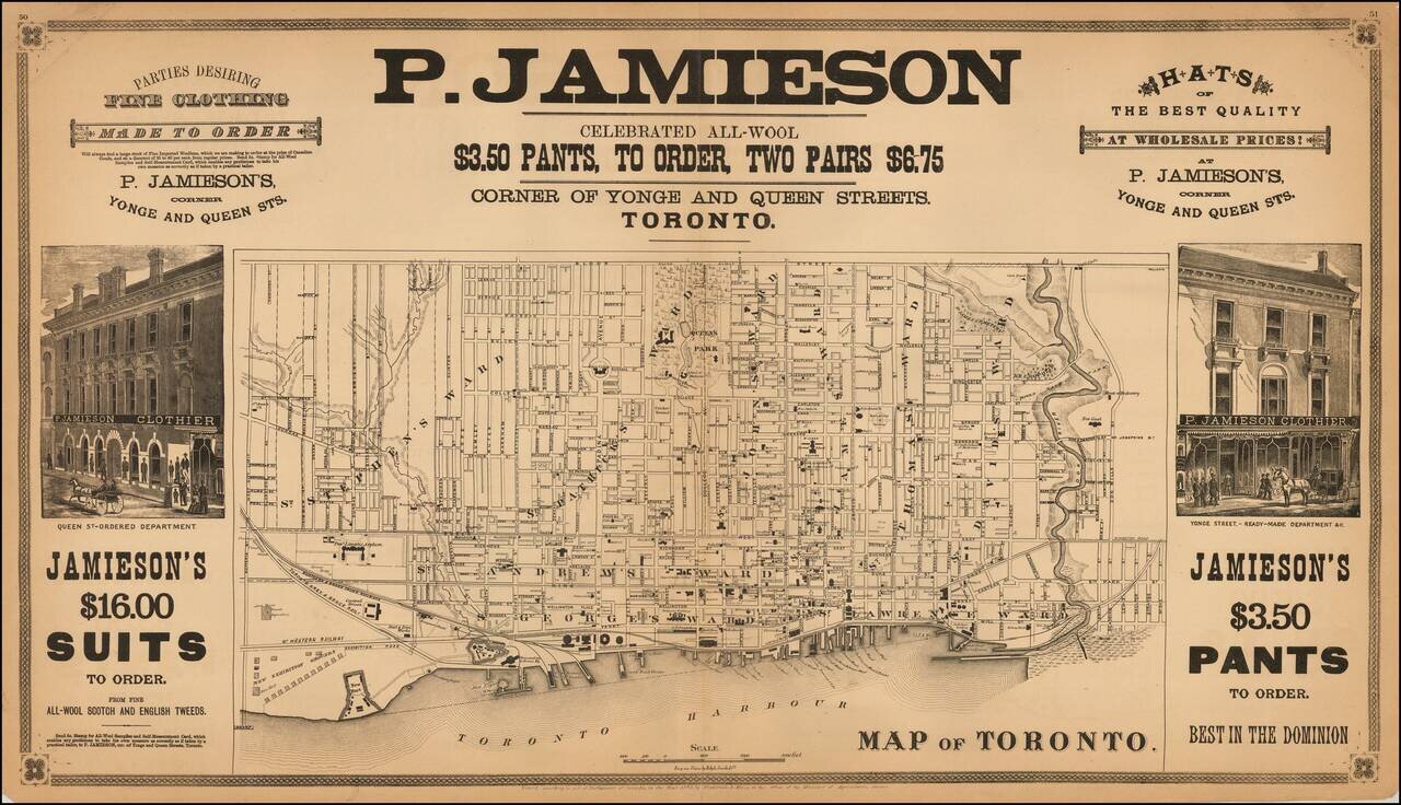
Rare double page map of Toronto, lithographed by Ralph Smith & Co. and published by Frederick B. Miles in Toronto.
The map shows Toronto at a relatively early date. Streets are named, public squares, parks and buildings identified and wards located. The waterfront show a number of wharves, with rail lines connecting the harbor to the interior. Even the location of many commercial buildings are shown.
The map is surrounded by advertising and decorative vignettes for P. Jamieson Clothier.
If you are a student, write to us in telegram: @antiquemaps and indicate what material you need and for what work you need a map in high detail. We are ready to provide material on special terms. For students only!
![[The First Maps in a la poupée Printed Color] Cartes en Couleur des Lieux Sujets aux tremblements de Terre Dans toutes les parties du Monde Selon le Sisteme de l’impulsion Solaire](/map/small/52293op.jpg)

