logo

1925. Victoria and Island Touring Map

  • Victoria and Island Touring Map
  • Victoria and Island Touring Map

Victoria and Island Touring Map information:

Year of creation: 
Resolution size (pixels): 
 6592x11337 px
Disk Size: 
 22.1554MiB
Number of pages: 
 2
Place: 
 Victoria, B.C.

Print information. Print size (Width x height in inches):
Printing at 72 dpi 
  91.56 х 157.46
Printing at 150 dpi 
 43.95 х 75.58
Printing at 300 dpi 
 21.97 х 37.79

An example of detailing the file of this map of in a printable high-resolution:

Click to open in high resolution (open in new tab).
Attention! this is just the central piece (central area 960x960 px) of the map file!
This is an example, so that you can see and study the level of detail of a given map. The entire Map will be fully available after payment!

Victoria and Island Touring Map

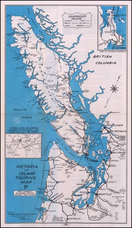
Rare promotional map, showing the roads and cruise ship lines in and around the Vancouver Island area.

Promotional advertising on the verso.


Special conditions for students!

If you are a student, write to us in telegram: @antiquemaps and indicate what material you need and for what work you need a map in high detail. We are ready to provide material on special terms. For students only!

Item information:

Year of creation:
Size:
6592x11337 px
Disk:
22.1554MiB
Number of pages:
2
Place:
Victoria, B.C.
Author:
Victoria & Island Publicity Bureau.
$14.99

Related item