
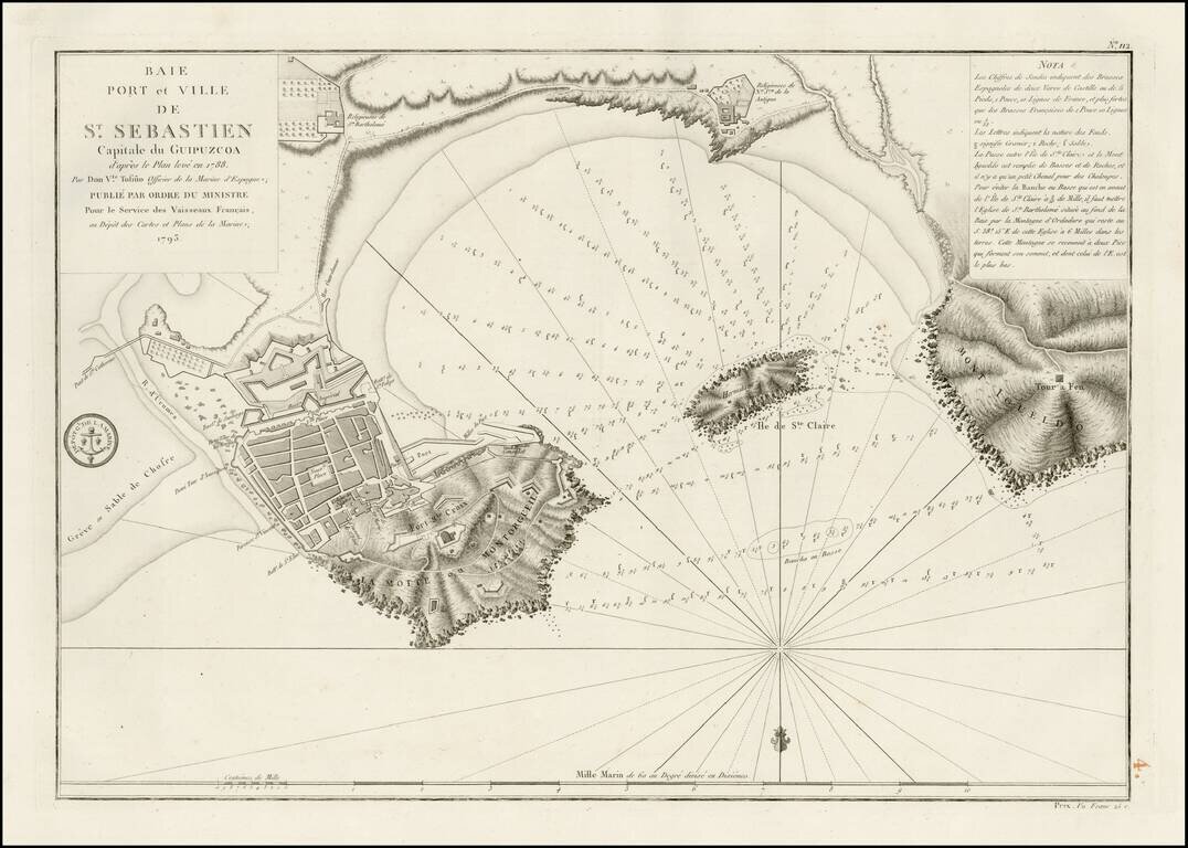
Detailed plan of the harbor and environs of St. Sebastian. The map is oriented with south at the top and includes extensive soundings, anchorages, coastal and harbor details and sailing directions. Based upon an early plan by Don Vincente Tofino de...
![Spain and Portugal, with Their General Divisions . . . [Balaeric Islands]](/map/small/65193.jpg)
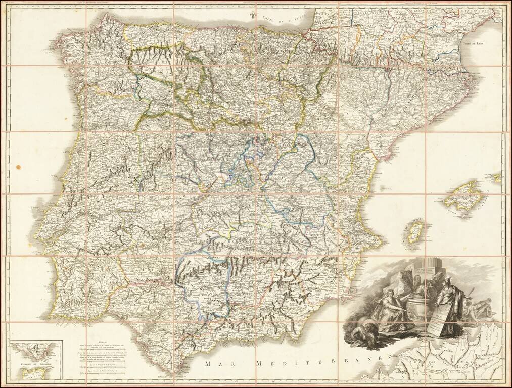
Detailed late 18th Century map of the Iberian Peninsula and contiguous islands. Scarce English language map of the region. From Dunn's New Atlas or Mundane System of Geography.
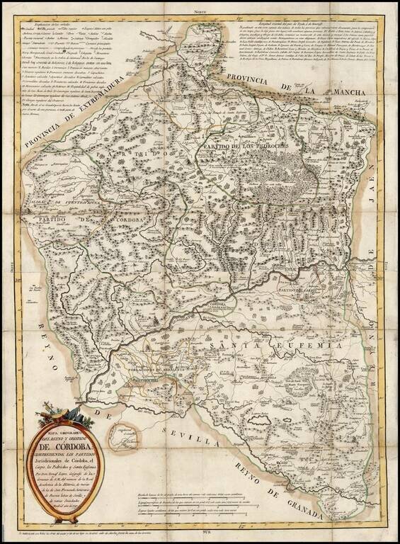
Scarce large format map of the Province of Cordoba by Tomas Lopez, published in Madrid. Lopez's maps are among the most detailed and sought after of all regional maps of Spain in the 2nd half of the 18th Century. This is a nice example of his work,...
![[9 Sheet Map of Iberian Peninsula] Carte D'Espagne et de Portugal en Neuf Feuilles . . .](/map/small/66894.jpg)
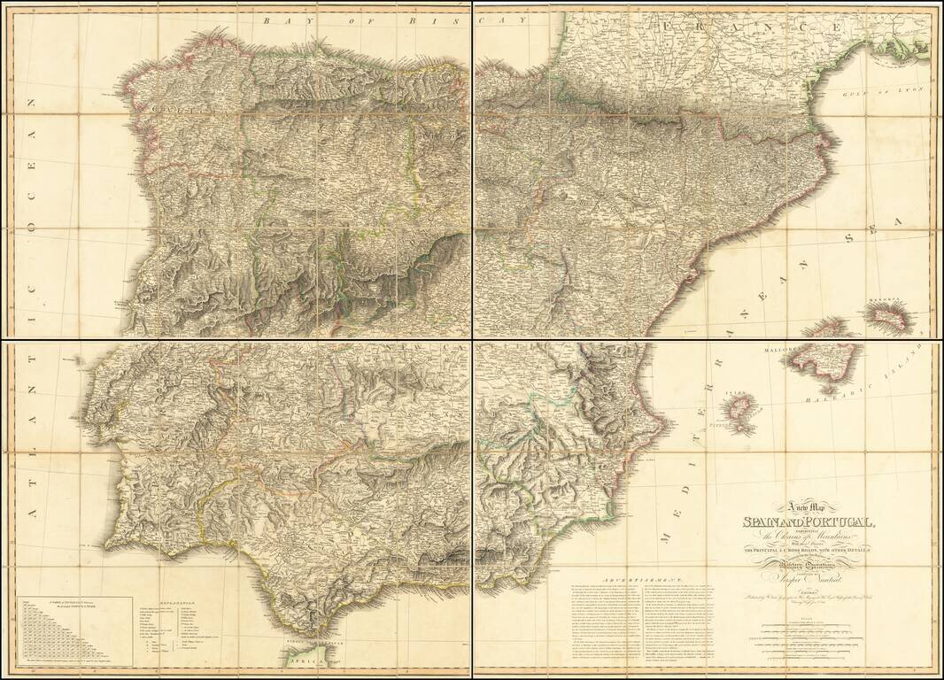
Fine large map of the Iberian Peninsula, from the period of the Anglo-Spanish War. The map is quite remarkable in its details, most notably its extensive treatment of roads and in some cases a curious number system which we could not decipher.
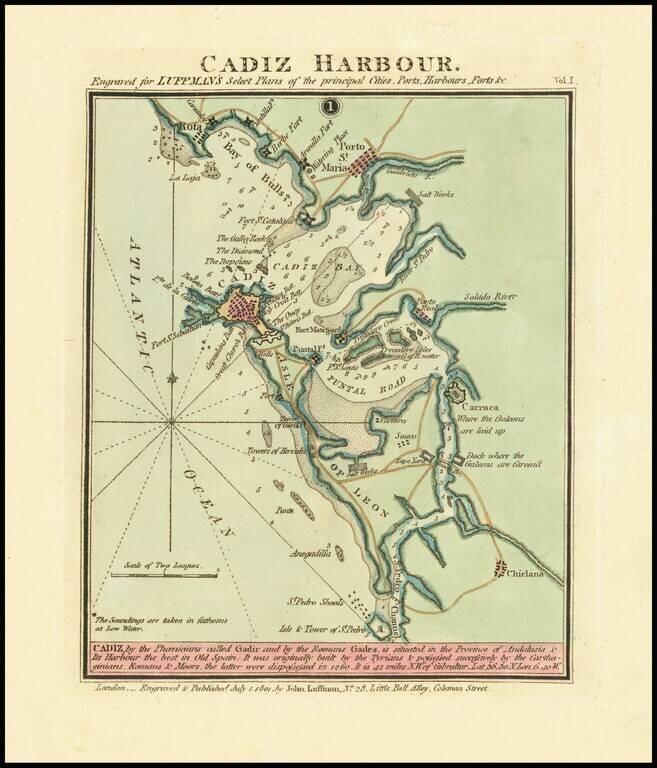
Rare harbor chart of Cadiz, published in London by John Luffman. The map shows Rota, Porto St. Maria, Fort Saint Sebastien, Puntal Road, Carraca, and Chiclana. Includes soundings, roads and other information for mariners. The text at the bottom...
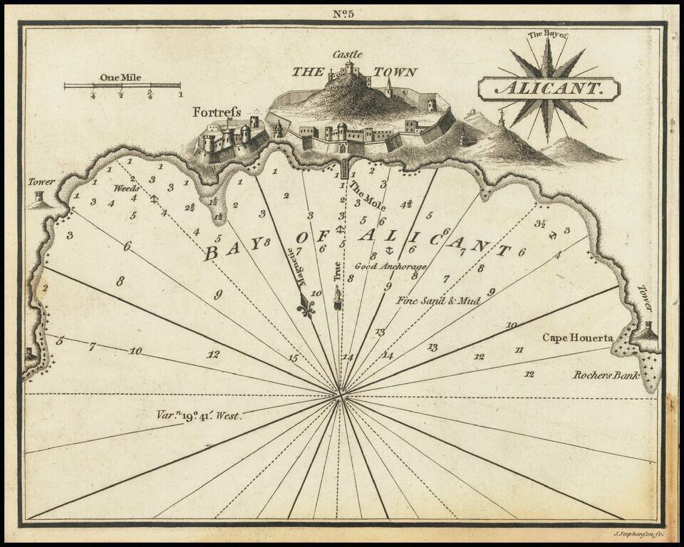
Rare chart of Alicante, Spain, published by William Heather in London. The chart is oriented with northwest at the top. Includes soundings, some topographical features, anchorages, a pictorial representation of the town and fortress, and several...
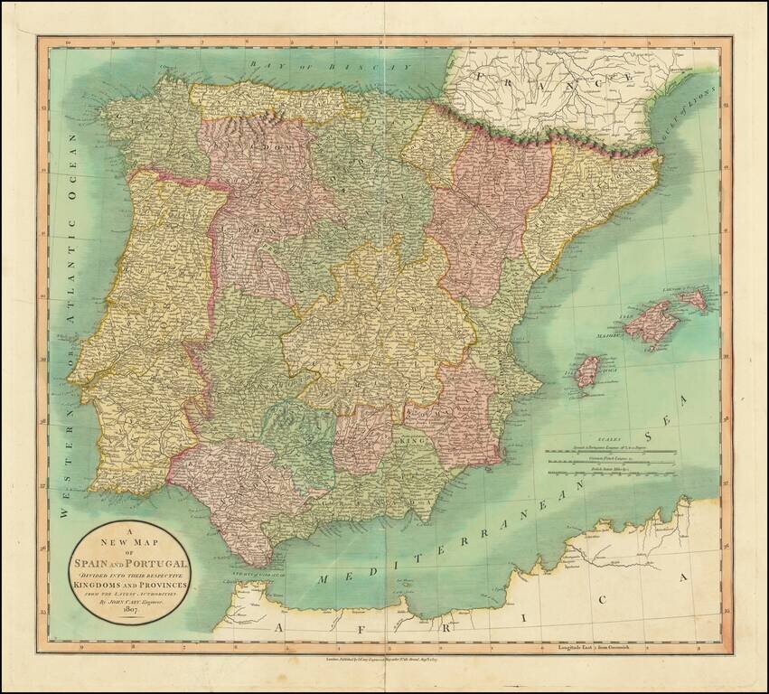
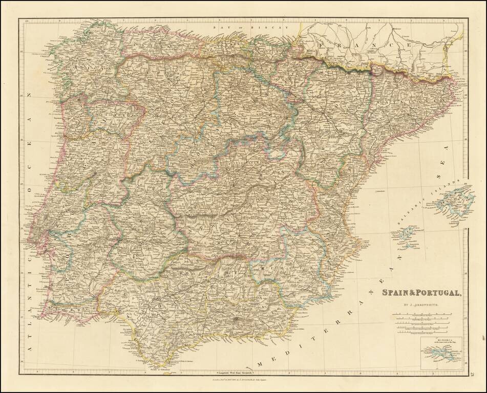
Detailed map of Spain and Portugal, hand colored by provinces. Shows roads, rivers, lakes, mountains, islands, etc. One of the best large format English atlas maps of the period.
A Tribute To Spain's Ongoing Resistance Against Napoleon In 1809 Rare separately published map of Spain during the Spanish War of Independence, published by Tomas Lopez. This remarkable map was published in Valencia, during the period of French...
First State of Faden's Rare Map of the Iberian Peninsula Monumental large format map of Spain, published in London by William Faden in 1810. This fine large format map was distributed to British officers during the Peninsular War (1807-1814). The...
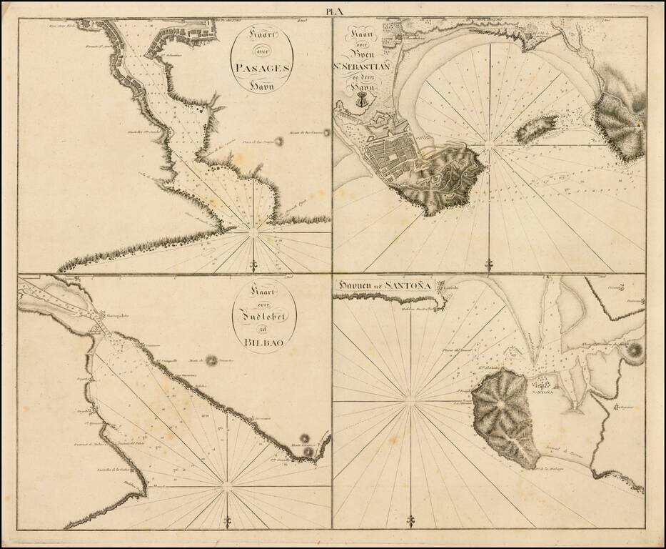
Rare set of four harbor plans (San Sebastian, Bilbao, Santoña and Pasaia) along the Basque Coast, pubilshed in Copenagen. The present set of charts appears in a very rare Danish work, which is titled "Samling af Kaart over Havne og Ankerpladse,...
![[Zaragosa] Belagerung von Saragossa / Siege de Saragosse](/map/small/67634.jpg)
Detailed battle plan illustrating the Second Siege of Zaragosa. The second siege of Zaragoza was the French capture of the Spanish city of Zaragoza (also known as Saragossa) during the Peninsular War.
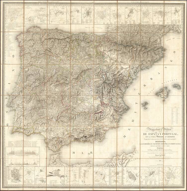
Fine large Civil and Military map of the Iberian Peninsula, published in Paris by the Catastro Real de Francia and the French Geographical Society. The map includes small plans of: Puerte (sic) of Mahon, Tudela, Mahon, Zaragoza, Lerida, Porto, Toledo,...
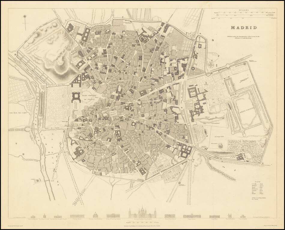
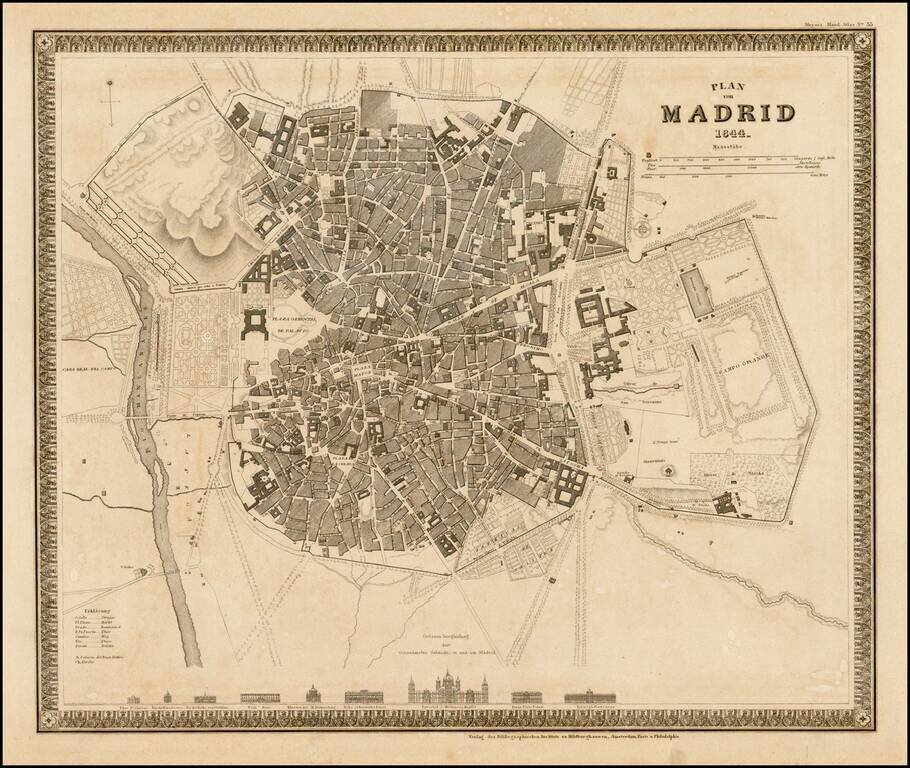
A highly detailed plan of Madrid, with a series of building profiles at the bottom. The map shows bridges, roads, rivers, gates, prados, plazas, streets, buildings, castles, gardens, and more. This is of the best plans of Madrid published in a...
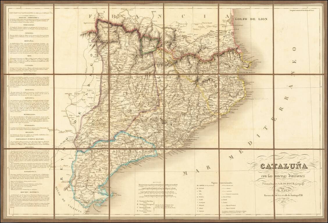
Finely executed map of Cataluña, published in Paris by A.H Dufour. The map is exceptionally detailed, showing roads, towns, rivers, mountains, forts, and a host of church related places and many other details. The location of battles, combat and...
Detailed map of the Iberian Peninsula, published in London by John Arrowsmith. The map appeared in Arrowsmith's London Atlas.
Striking town plan of Madrid, with vignettes showing 9 major churches and buildings.