Map size in jpg-format: 460.517MiB
Click to open in high resolution (open in new tab).
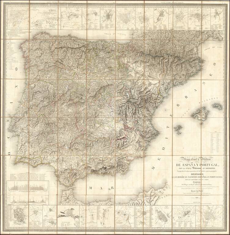
Fine large Civil and Military map of the Iberian Peninsula, published in Paris by the Catastro Real de Francia and the French Geographical Society.
The map includes small plans of: Puerte (sic) of Mahon, Tudela, Mahon, Zaragoza, Lerida, Porto, Toledo, Badajos, Tarragona, Valladolid, Burgos , Alicante, Rías de Ferrol, Coruña and Betanzos, Ferrol, San Sebastian, Santiago, Sevilla, Merida, Tarifa, Muviedro, Cadiz, Algeciras and Gibraltar.
The 6 panels of the 'Civil and Military Map of Spain and Portugal' represent both the oro-hydrographic system and road system of the Iberian Peninsula and illustrating the main fortresses (from mills to large cities), non-navigable rivers and waterways altitude sea level on Castilian measurements water sources of hot and cold mineral water.
The Battlefields (of the Peninsular War) are named by cities or locations and the years of its occurrence main deposits of precious or useful minerals (gold, lead, sulfur , etc.) and administrative division representing the regions or military provinces.
The map title translates as follows:
Civil and Military Map of Spain and Portugal, with the new Divisions in districts: Enriched with the particular plans of 34 cities and main ports; Composed of 6 Sheets and a Supplement Sheet containing the Plans. Built on the newest astronomical and nautical observations, on the most authentic maps, and on the geodesic operations made by the Spanish, French and English officers during the war of independence. By Mr. Alejo Donnet Geographical engineer Employed in the Royal Cadastre of France and the Geography Society of Paris; Engraved by the Malo Brothers disciples of the Royal Depot of the war in France.
The map was published in a number of editions from at least 1823 to 1866.
If you are a student, write to us in telegram: @antiquemaps and indicate what material you need and for what work you need a map in high detail. We are ready to provide material on special terms. For students only!
![(Pro-Spanish Republic Political Broadside) [Lift The Embargo Against The Spanish Republic] President Roosevelt says . . .](/map/small/50218.jpg)

