
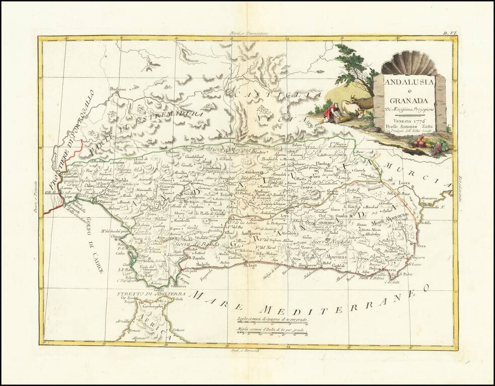
Detailed map of Granada and Andalucia. Very interesting early map, with nice detail. Decorative title cartouche. From Zatta's monumental Altante Novissimo, one of the last great decorative atlases of the 18th Century.
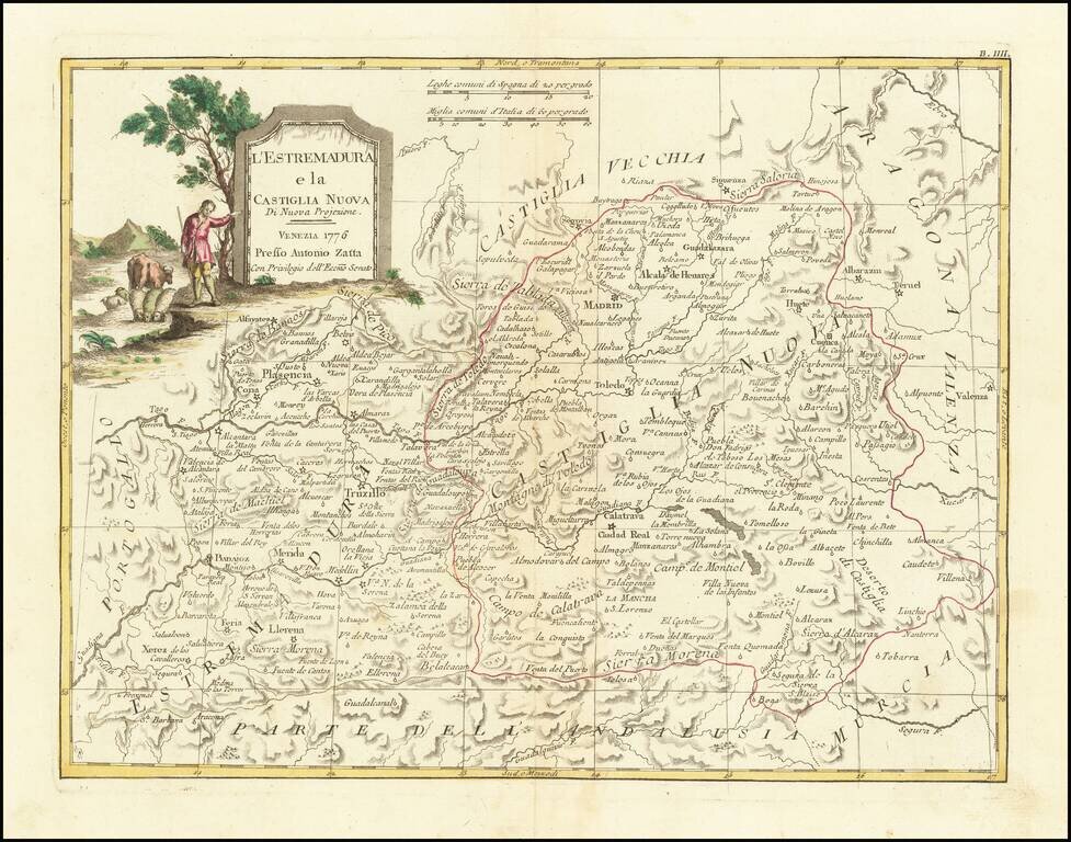
Detailed map of Castille and Extremadura, published by Zatta in Venice. Major Cities include Madrid, Toledo, Ciudad Real, Getafe, Palsencia, Badajoz, Caceres and Merida. Very interesting early map, with nice detail. Decorative title cartouche. From...
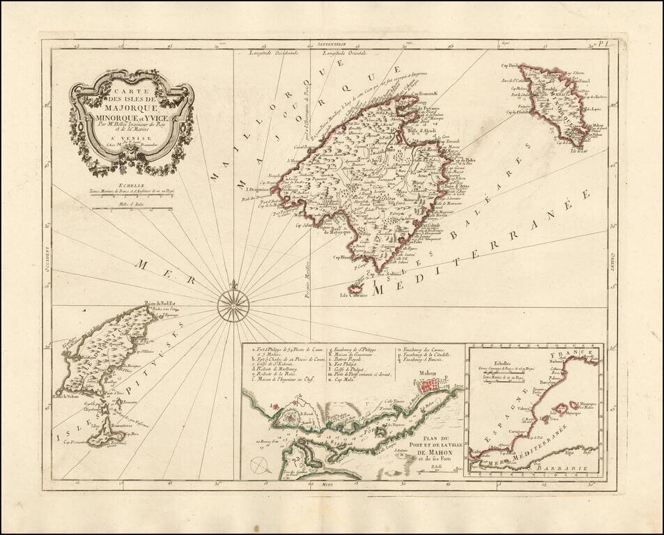
Nice example of the Paolo Santini edition of Nicolas Bellin's map of the Balearic Islands. Includes a map of Mahon Harbour and the position of the islands against the coast of Spain. A fine highly detailed map of Majorca, Menorca and Ibiza.
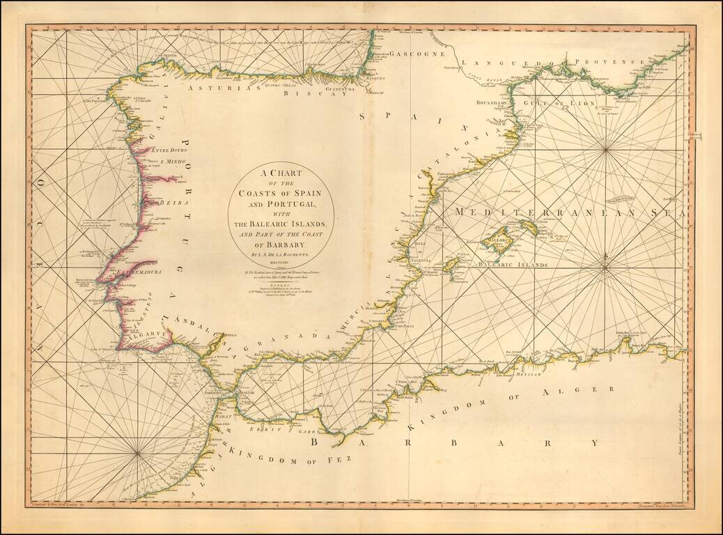
Detailed sea chart of the Balearic Islands, Spain, and Portugal. The chart extends to Provence and much of the Barbary coast to Bona. Good detail along coastal areas including the Straits of Gibraltar.
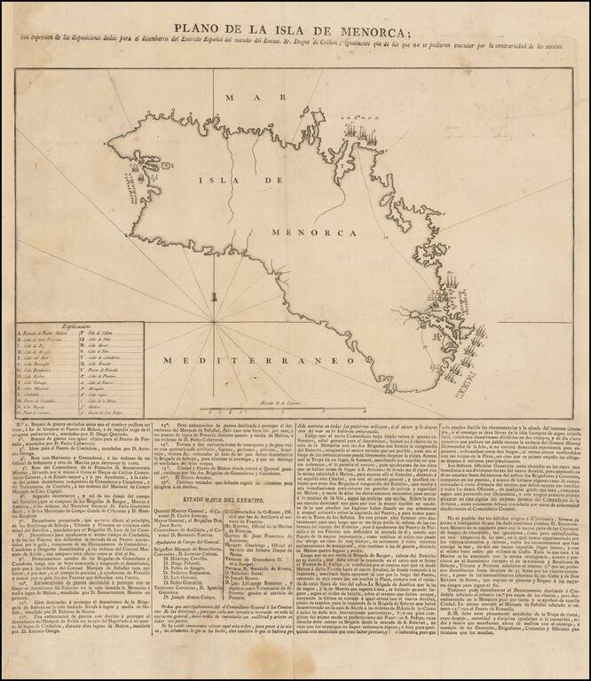
Spanish Broadside Map of the 1781-82 Conquest of Menorca. Rare separately issued broadside map showing information related to the Conquest of Menorca in February, 1782. The map shows the support provided by the Spanish in aid of the Duke of Crillon,...
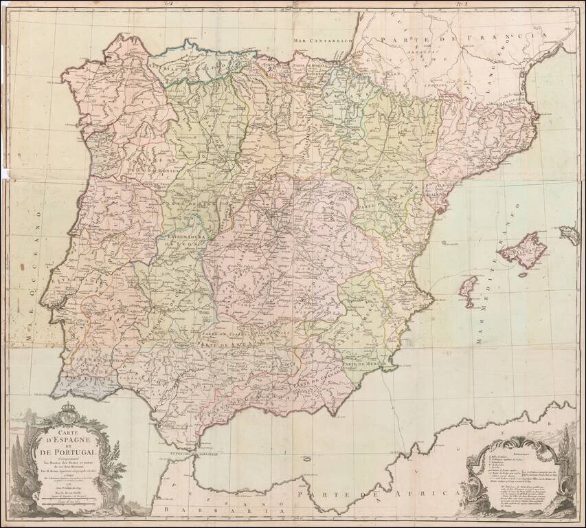
Rare Six-Sheet Postal Map of Spain and Portugal Finely executed map of the Iberian Peninsula, focusing on the postal routes throughout the region. The key at the bottom right identifies the various types of cities, towns and regions, along with...
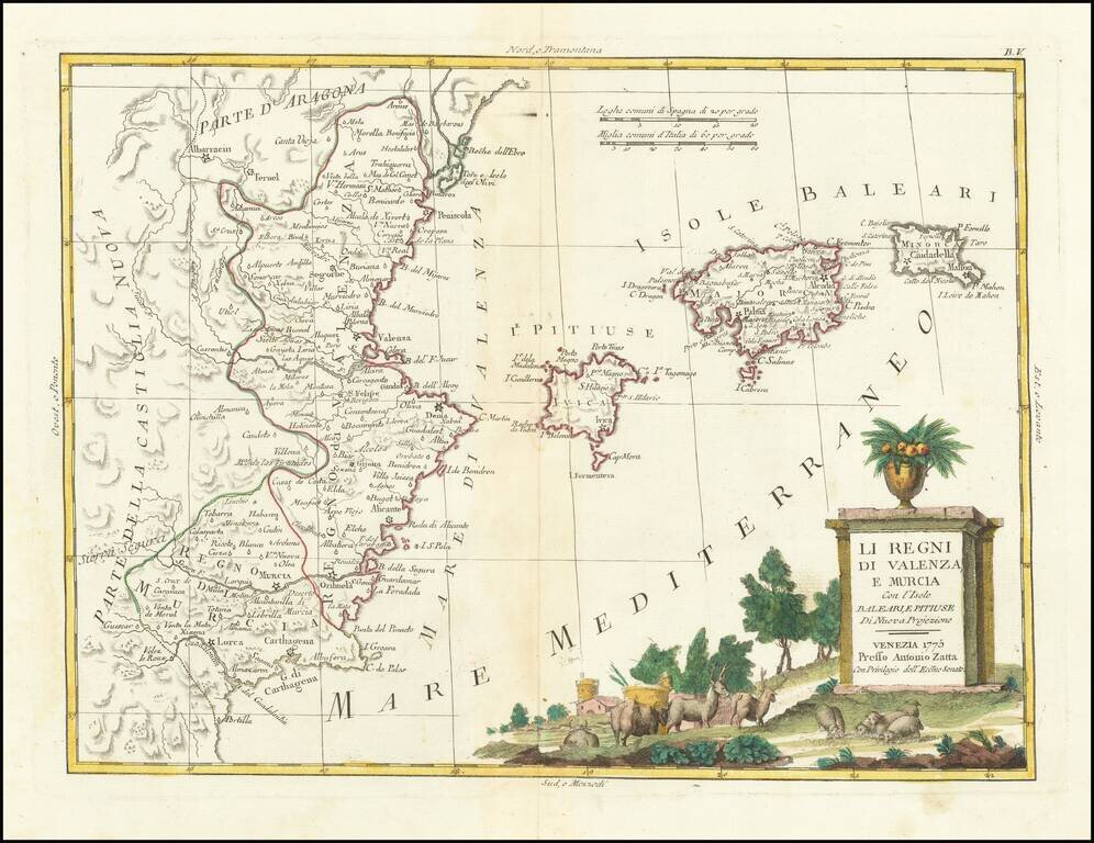
Detailed map of the eastern coastline of Spain, centered on Valencia, Murcia and the Balearic Islands of Ibiza, Minora and Majorca. Very interesting early map, with nice detail. Decorative title cartouche. From Zatta's monumental Altante Novissimo,...
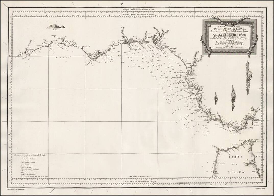
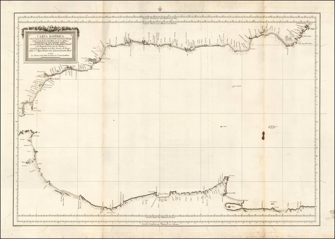
A highly detailed and historically important separately-issued sea chart of Southwestern coasts of Spain and the Straits of Gibraltar, issued by the Spanish Armada Real. This finely engraved and carefully constructed chart embraces the entire...
![[A Coruña / Ferrol] Carte Hidro-Topographique des Entrees et Ports du Ferol et de la Corogne Publiee Par M.Degaulle . . . 1786](/map/small/54546.jpg)
Rare 18th Century harbor plan of the A Coruña Bay on the Galician Coastline of Spain. The map was prepared under the direction of the French Depot de la Marine, showing soundings, coastal features, towns, anchorages, the primary channel through A...
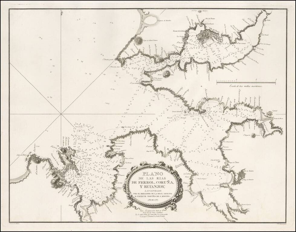
Detailed sea chart of a part of Galicia, showing the harbors at the mouths of the Rivers Ferrol, Coruña and Betanzos, published for the Spanish Hydrographical Society in 1787. This chart was one of the most important early modern surveys of the...
Scarce blue back chart of the Western Mediterranean, published under the direction of the Spanish Hydrographical Department.
![[Catalan Portolan Sea Chart] Descripcion de la Costa de España Portugal y Parte de la Barbaria contiene la sonda con la calidad de Fondo segun se a Podida y moestiear Advartencia . . . Sacado de su original en la Havana 1776](/map/small/50534.jpg)
18th Century Portolan Sea Chart of the Southern Iberian Coastline -- Escuela Nautica de Mataro (Catalonia) Finely executed 18th Century Manuscript Sea Chart of the southern coast of Spain & Portugal, extending from the Algarve region to Marbella,...
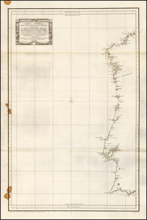
First edition of this rare separately issued Spanish Sea Chart of the Coast of Portugal and western Spain. The map was part of the first modern Hydrographical Atlas of Spain.
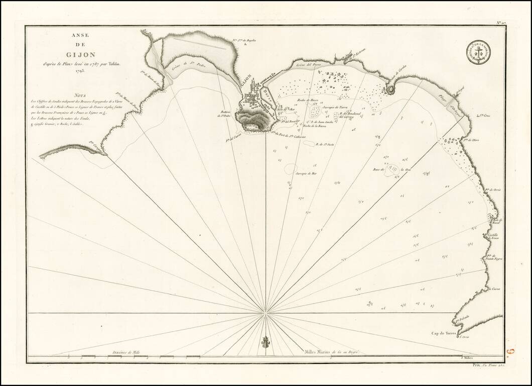
Detailed plan of the harbor and environs of Gijon, extending from Cap de Torres to Pointe Cervigon. The map is oriented with south at the top and includes extensive soundings, anchorages, coastal and harbor details and sailing directions. Based upon...
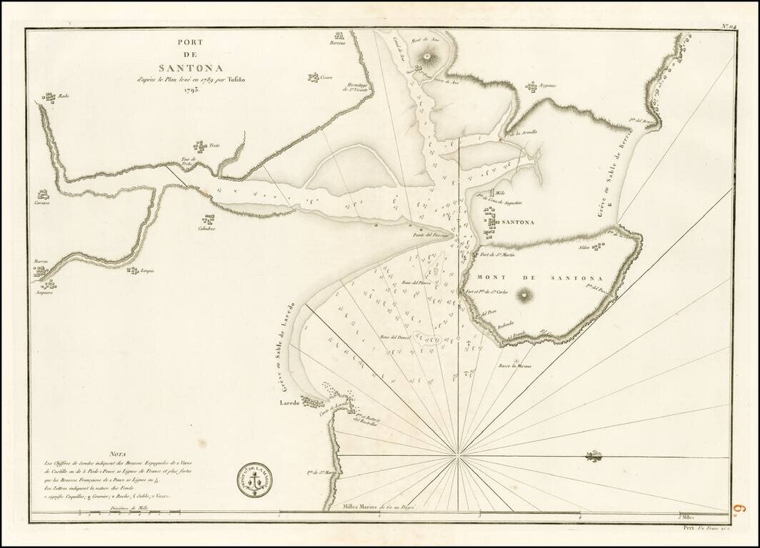
Detailed plan of the harbor and environs of Santona, from Laredo to Barcena. The map is oriented with west at the top and includes extensive soundings, anchorages, coastal and harbor details and sailing directions. Based upon an early plan by Don...
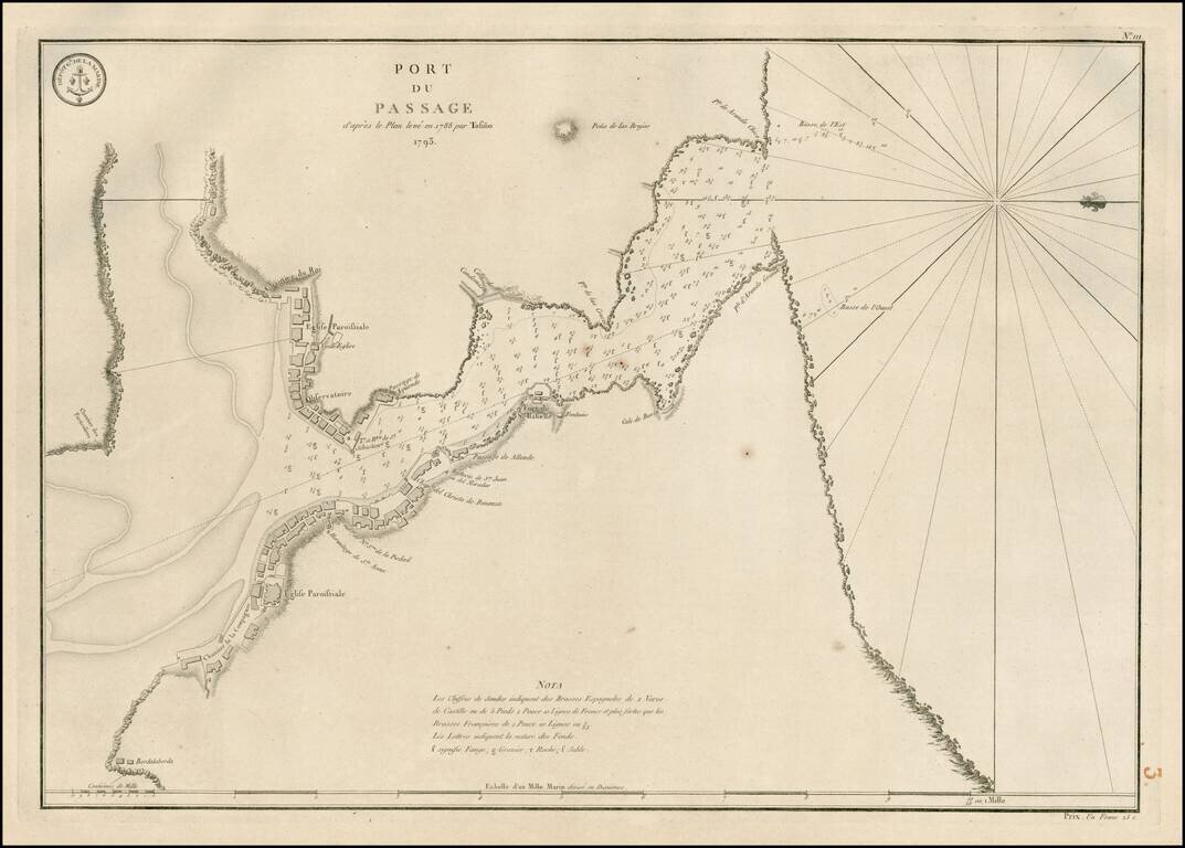
Detailed plan of the harbor and environs of Pasaia, Spain, extending from the mouth of the Harbor to Bordalaborda, with a number of forts, churches and other structures located along the coastline. The map is oriented with west at the top and includes...