
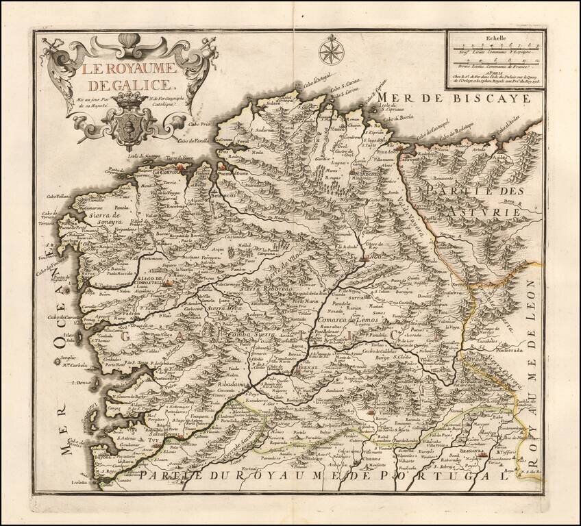
Scarce map of Galicia, published by Nicolas de Fer in Paris. De Fer's map is marvelously engraved in the style unique to De Fer, with excellent emphasis on the topographical details of Galicia, especially the depiction of the mountains in the region....
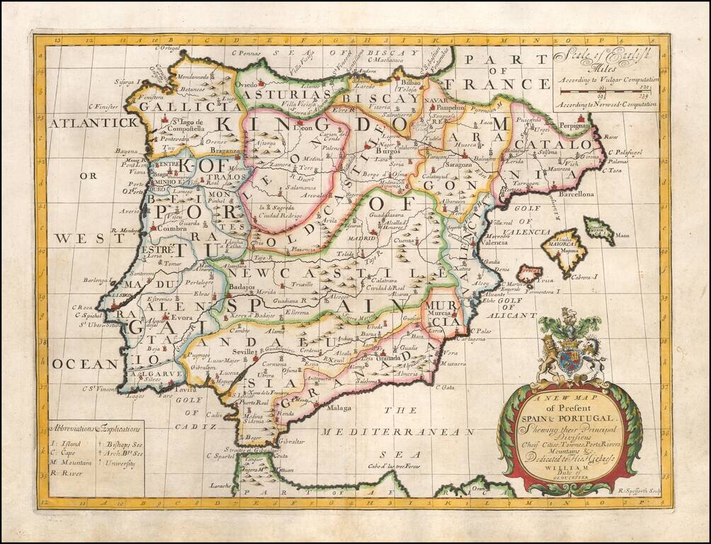
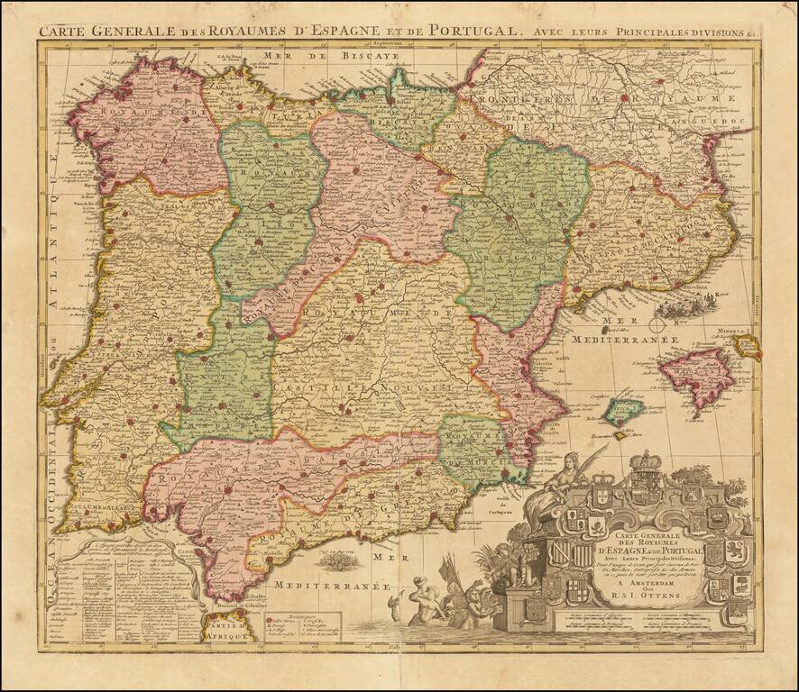
Decorative map of the Iberian Peninsula, colored by regions. This decorative map was part of a set of 22 maps dedicated to William, Duke of Glouchester, who was then an 11 year old student at Oxford.
![[Majorca] Ergebung der auf dem Mittellandischen Meer gelegenen Balearischn Insul Maiorica](/map/small/46077.jpg)
Admiral John Leake's Attack on Majorca Finely executed engraved map and naval battle scene, depicting the September 1706 Seige of Majorca by the British Fleet under the command of Sir John Leake. The siege was part of the War of the Spanish...
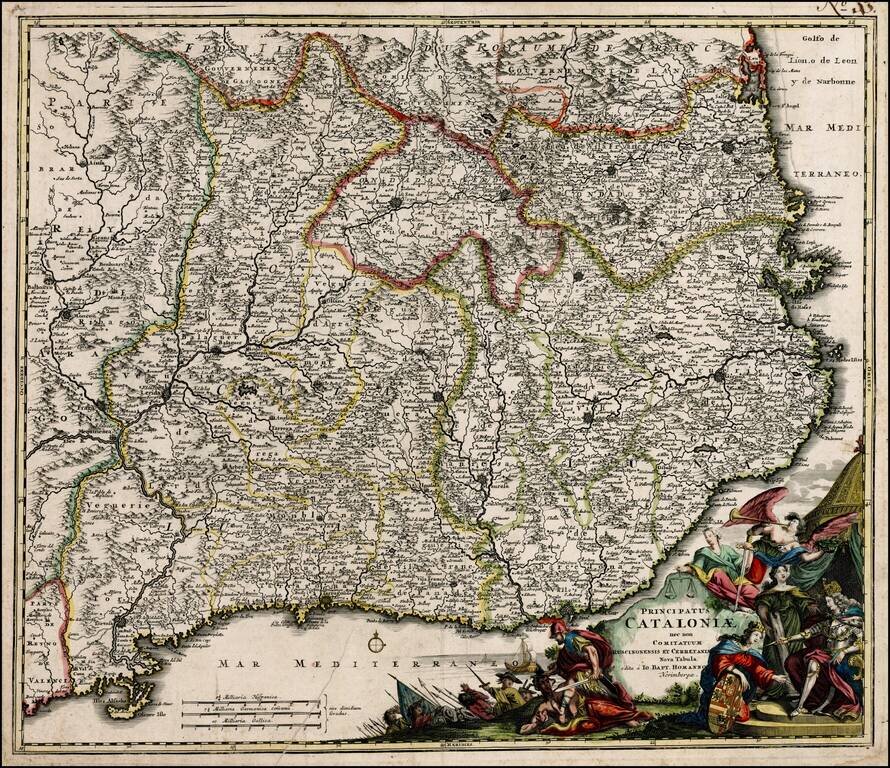
Decorative example of Homann's map of Catalonia. Includes ornate cartouche, coat of arms, etc. The present example would appear to be an early example of the map, pre-dating Homann's privilege.
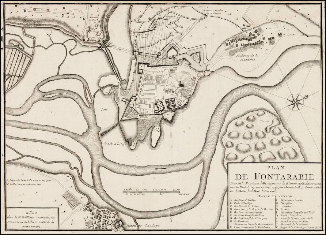
Rare plan of the siege of Fontarabia, published by Gaspar Bailleul in Paris. Fontarabia was attacked by French in May 1719. The main body of the army, in all forty thousand strong, crossed the frontier soon afterwards, and entered upon the blockade,...
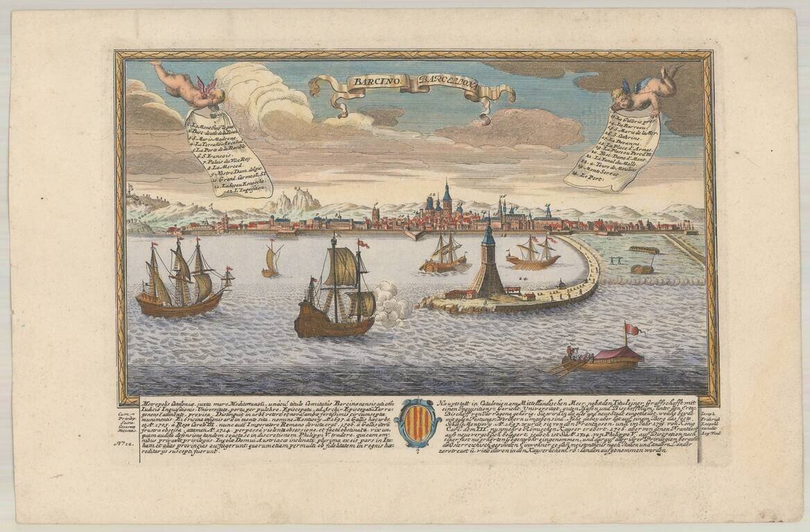
Rare birdseye view of Barcelona, published in Augsburg by Leopold. Includes a decorative coat of arms and a key listing 24 important places within the view. Not in Fauser.
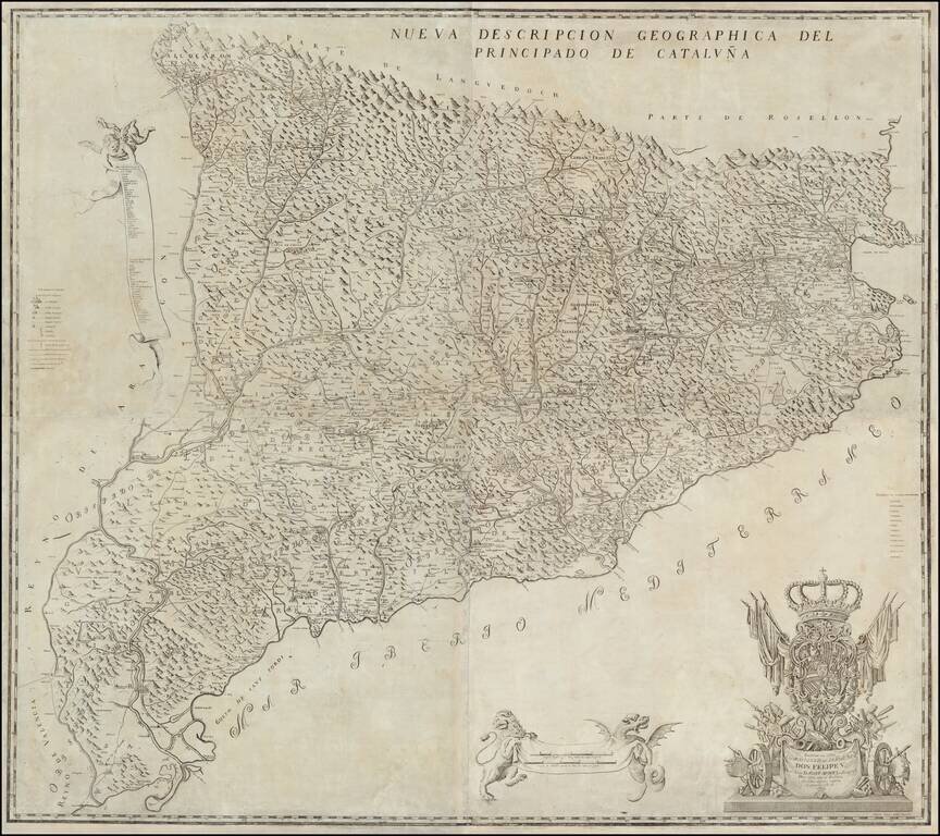
The First and Most Famous Domestically Produced Map of Catalonia of the Eighteenth Century Fine map of Catalonia by Josef Aparici, the first large format map of Catalonia published by a Catalan. The map was first published in 1720, with a second...
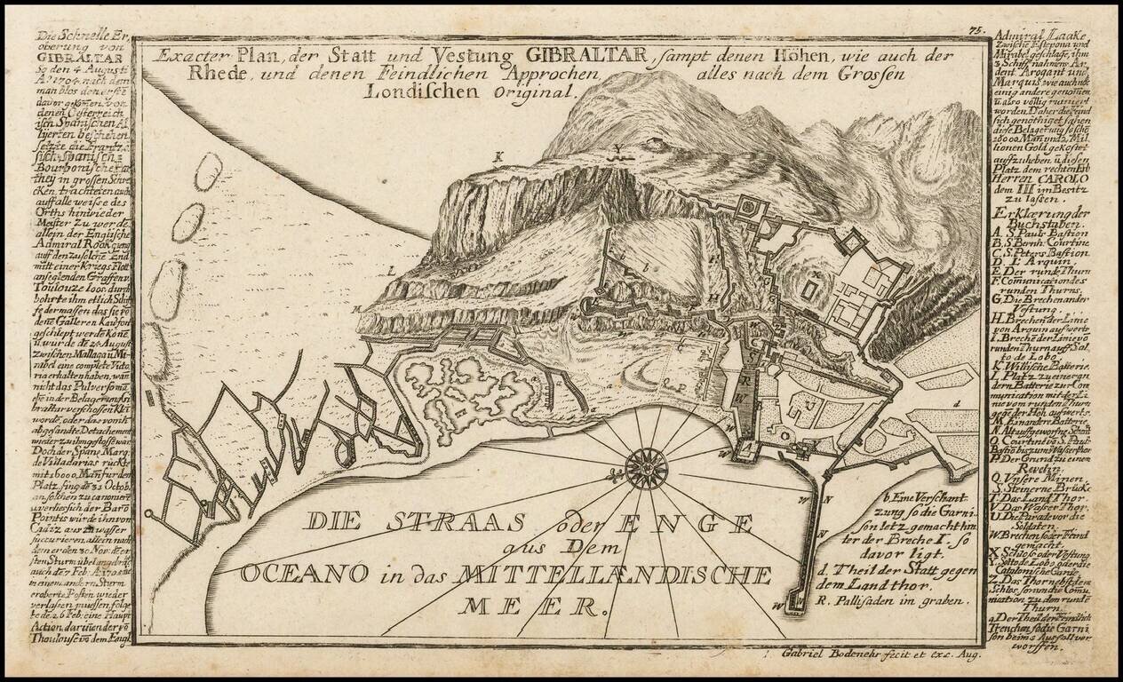
Detailed antique engraved Gibraltar, probably published in Bodenehr's Curioses Staats und Kriegs Theatrum. The plan features a detailed treatment of the topography of Gibraltar, as well as the fortification and major buildings of the famous peninsular...
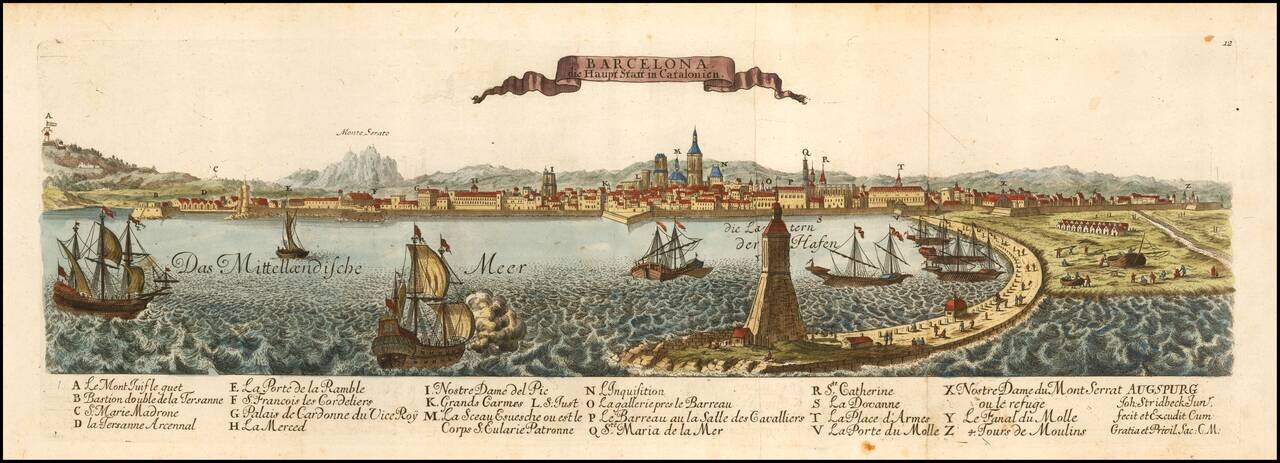
Rare View of Barcelona, Capital of Catalonia. Finely engraved view of Barcelona, published in Augsburg by Johann Stridbeck. Includes a striking harbor view.
Decorative map of Spain and Portugal, identifying a number of the significant battles fought during the war of Spanish Succession. The map includes a number of battles, including a graphic depiction of the naval Battle of Velez-Malaga (August 24,...
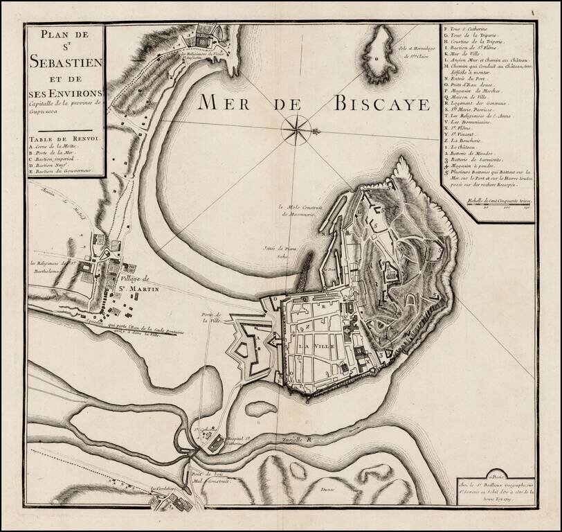
Rare plan of San Sebastien, published by Gaspar Bailleul in Paris. The map shows the bay and fortifications of San Sebastien, St. Martin and environs. The roads and gates between the settlement area also shown. A key locates approximately 30 points of...
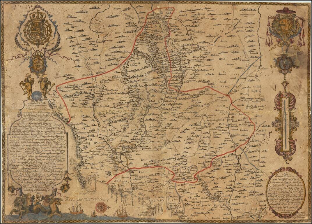
A Spanish Rarity of the Bishoprick of Cartagena and Kingdom of Murcia A very rare engraved map of the Murcia region in southeastern Spain. Oriented with west at the top, the map shows the diocese of Cartagena with the Mediterranean coast from Vera,...
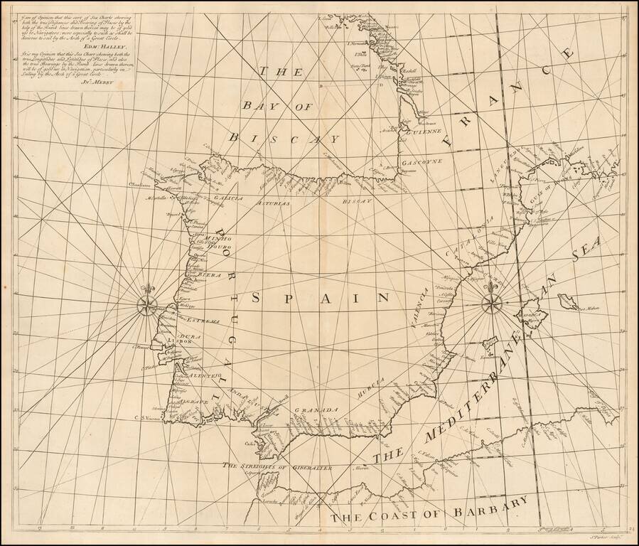
Southern Sheet of Scarce Sea Chart Exhibiting a New Projection Rare chart showing the Iberian Peninsula on a 'globular projection' (i.e. on the same projection as a double-hemisphere map). The charts consists of two sheets, and this is the...
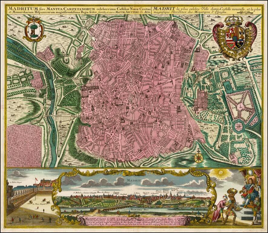
Fine old color example of Seutter's decorative and highly detailed plan of Madrid, with a striking view of the City below. The map includes 2 coats of arms, and a unique view of the City from across the Xarama River, set within a scene on the palace...
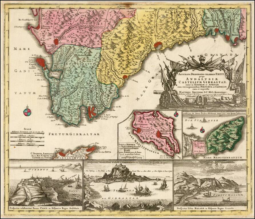
Decorative regional map of the southern parts of Spain, with large inset maps of Minorca, Ceuta, Cadiz, Gibralter and Malaga.
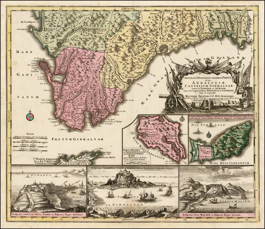
Decorative regional map of the southern parts of Spain, with large inset maps of Minorca, Ceuta, Cadiz, Gibralter and Malaga.