Map size in jpg-format: 218.15MiB
Click to open in high resolution (open in new tab).

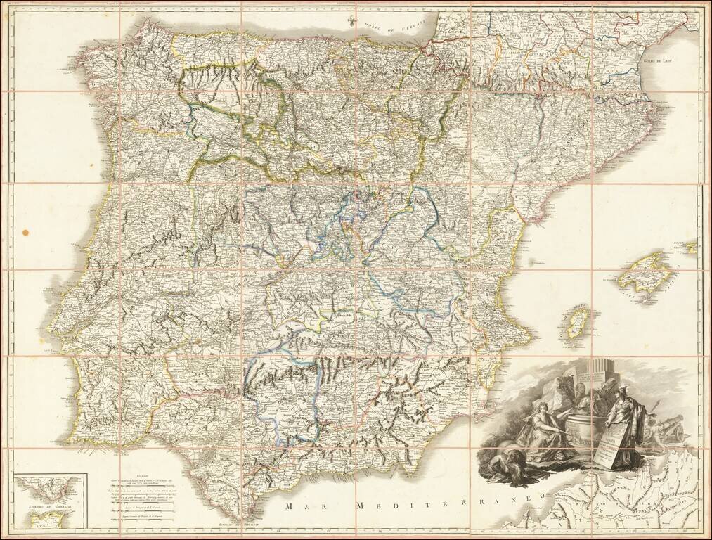
A Tribute To Spain's Ongoing Resistance Against Napoleon In 1809
Rare separately published map of Spain during the Spanish War of Independence, published by Tomas Lopez.
This remarkable map was published in Valencia, during the period of French Occupation of Madrid. This is one of only a few maps published in Valencia during the occupation, during a period where loyalty to the Spanish crown was in crisis.
The map is dedicated to Pedro Caro, the Third Marquis de la Romana. The title cartouche is decorated with allegorical figures, including a bust of the Marquis de la Romana next to the flags of Spain and England, representing the Spanish and English defeat of France during the War of Independence. Behind the bust an inscription on the basis of a column: “He dealt with the rationale and injustice; He saved his hosts, rescued Galicia. ” Athena holds a tombstone, showing a map of Spain, with the second (Europe?) pointing toward a naval scene.
Marquis de la Romana
Don Pedro Caro y Sureda, 3rd Marquis of la Romana (1761-1811) was a Spanish general of the Spanish War of Independence.
In 1807, King Charles IV of Spain, under pressure from Napoleon, agreed to provide a veteran infantry division to bolster the French army in Germany. Romana was made commander of this "Division of the North" and spent 1807 and 1808 performing garrison duties in Hamburg and later Denmark under Marshal Bernadotte.
When the Spanish War of Independence War broke out, La Romana made plans with the British to return to Spain. The success of the evacuation of the La Romana Division was chiefly credited to his subterfuge and resourcefulness. At least 9,000 men of the 15,000-strong division were immediately able to board British ships on August 27, 1808 and escape to Spain. Their defection reduced Bernadotte's "Hanseatic Army" to a string of glorified coastal garrisons, severely weakening Napoleon's left (north) wing in the contest with Austria for mastery over central Europe in 1809.
Romana arrived at Santander on the Cantabrian front and received command of the Army of Galicia on November 11, 1898. This army, under General Blake, was destroyed in battle that same day. On November, 25, 1808, La Romana assumed effective command of what remained of the army, about 6,000 men.
With this force, he fought some rearguard actions for General Moore's retreat westwards to Corunna. Using his limited means, Romana conducted small scale attacks against the French in 1809. These met with success and his men were able to distract the French and overwhelm isolated garrisons such as Villafranca. Following the French defeat at Puente San Payo on June 6, 1809, Marshal Soult abandoned his attempts to reestablish French rule in Galicia. When Soult moved against the British on the Portuguese frontier, Romana drove the French from Asturias as well.
Romana was appointed to the Central Junta on August 29, 1809 and served until 1810. He then returned to military operations under Wellington but died suddenly on January 23, 1811 while preparing the relief of Badajoz. With Castaños, Romana was the Spanish general most trusted and respected by Wellington. At news of his death, Wellington wrote, "his loss is the greatest which the cause could sustain."
Tomas Lopez (1730-1802) was one of Spain’s most prominent cartographers in the eighteenth century. Along with a small cadre of Spanish geographers, Tomas sought training in Paris and studied under Juan Bautista Bourguignon d’Anville. When he returned to Spain he was named geografo de los dominios de Su Magestad and placed in charge of the geographic collections of Charles III. Some of his most famous maps are those of regions of the Iberian Peninsula. At the end of his life, he embarked on a project of a grand atlas of Spain. The project was finished by his children.
If you are a student, write to us in telegram: @antiquemaps and indicate what material you need and for what work you need a map in high detail. We are ready to provide material on special terms. For students only!
![(Pro-Spanish Republic Political Broadside) [Lift The Embargo Against The Spanish Republic] President Roosevelt says . . .](/map/small/50218.jpg)

