
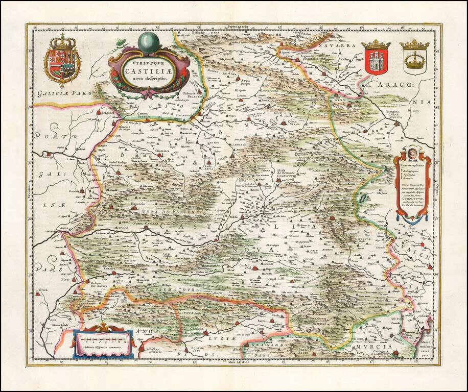
Ornate and richly embellished map of Castille, showing Zaragoza, Valencia, Alicante, Cartagena, Madrid, Cordoba, Sevilla, Salamanca, Palencia, Segovia, Toledo, Cuenca, Granada, etc. Includes 3 decorative cartouches and 3 large coats of arms. Nice wide...
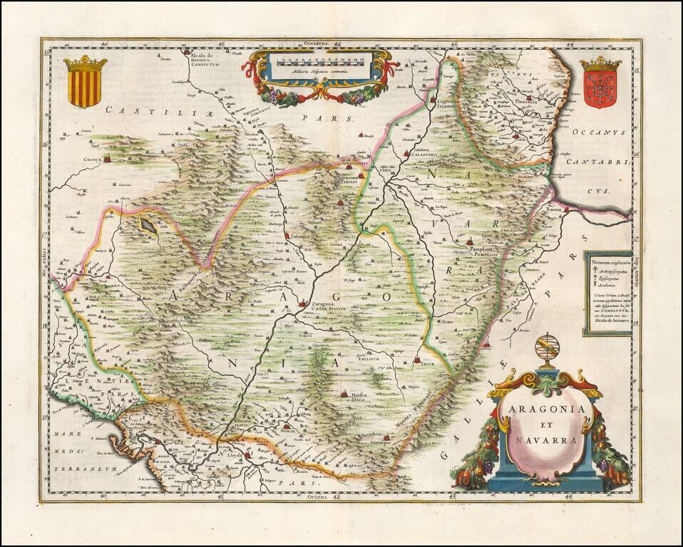
First edition of Blaeu's decorative map of Aragon & Navarra, centered on Zaragoza, and showing Pamplona, Bayonne, Logronno Alcala de Henares, Huesca, Venasque, etc. Roman names shown for major cities. Two large decorative cartouches and two coats...
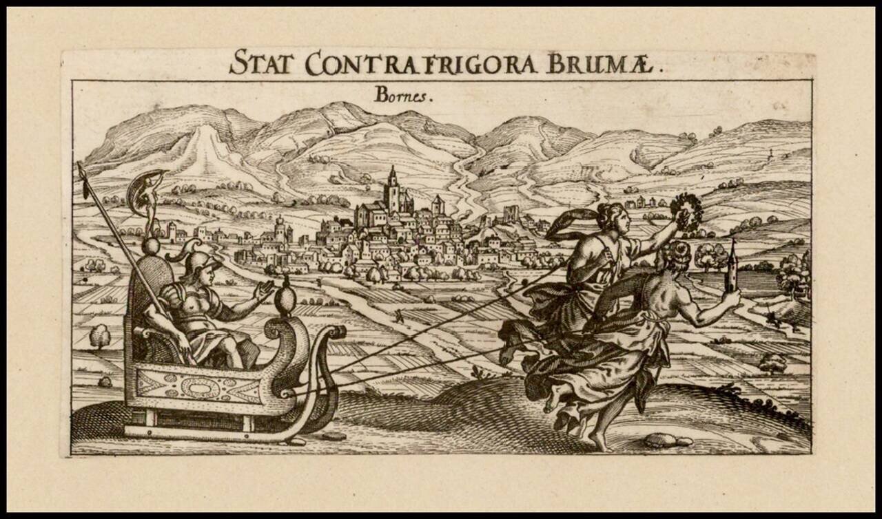
Rare view of the Spanish town of Bornos, to the east of Jerez, published in Nurember by Meisner.

Striking birdseye view of Burgos, from Merian's Neuwe Archontologica Cosmica . . ., published in 1638. Shows town and hillside, buildings, churches, etc.
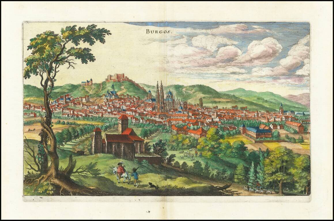
Striking birdseye view of Burgos, from Merian's Neuwe Archontologica Cosmica . . ., published in 1638. Shows town and hillside, buildings, churches, etc.
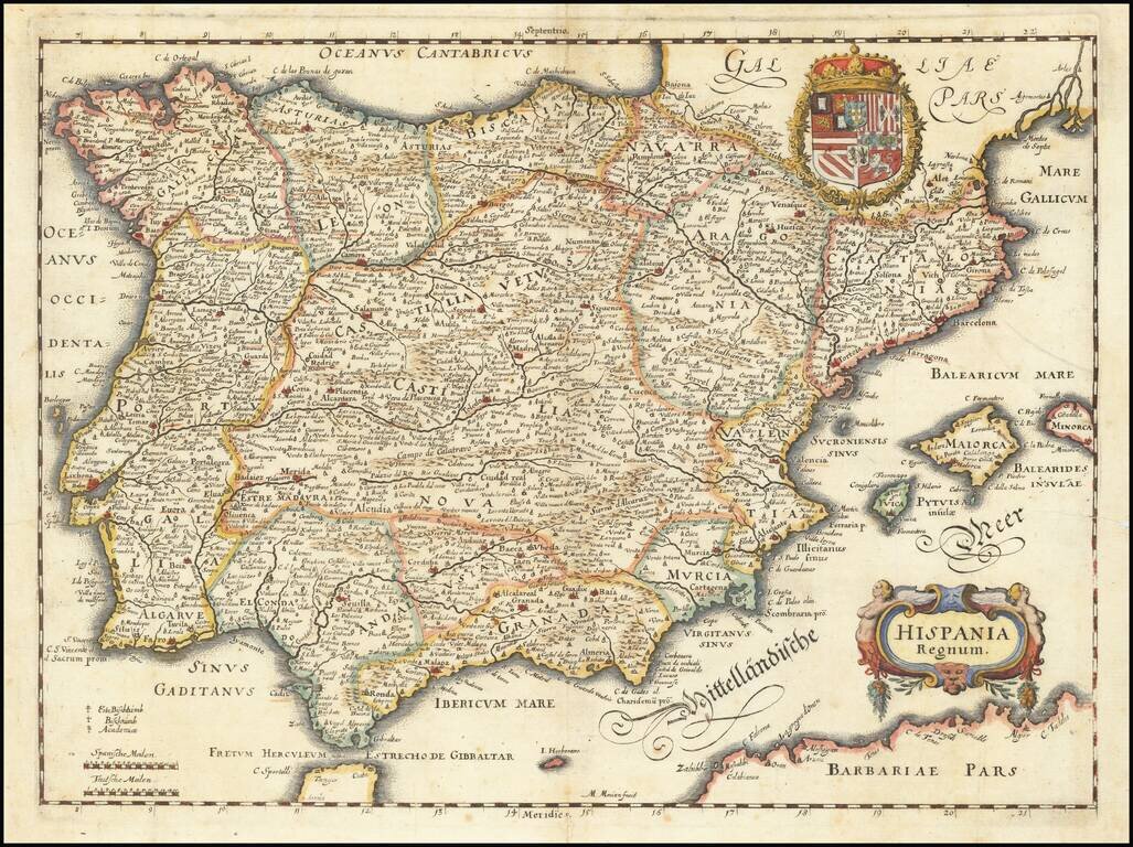
Decorative map of the Iberian Peninsula, including Majorca, Minorca and Ibiza, from Merian's Neuwe Archontologica Cosmica . . ., published in 1638. Includes decorative coat of arms and title cartouche.
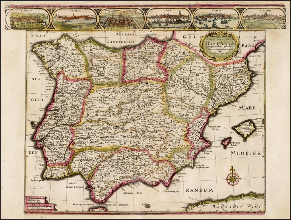
Rare separately issued map of the Iberian Peninsula, published in Amsterdam by Cornelis Danckerts in 1640. Includes views of Barcelona, Madrid, Escorial Palace, Sevilla, Lisbone and Valladolid. Rarely seen map, in early English Color. Side panels...
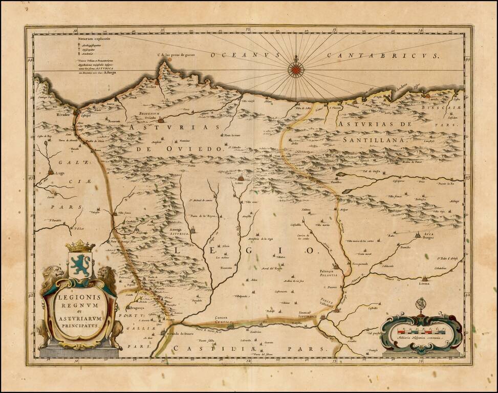
Decorative map of the Northwest Coastal region of Spain, published by Blaeu. The map is bounded by Rivadeao, Lugo and Camora, Simancas, Valladolid, Palencia, Lerma, Burdos Laredo and Santillana and centered on Astorga, Leon, Oviedo, Aviles and Villa...
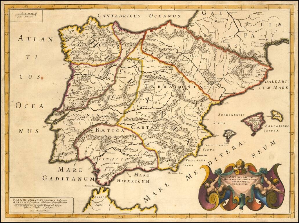
Striking example of Tavernier's map of the Iberian Peninsula, showing the divisions or the region during the times of the Roman Empire. The map is elegantly engraved with a beautiful cartouche.
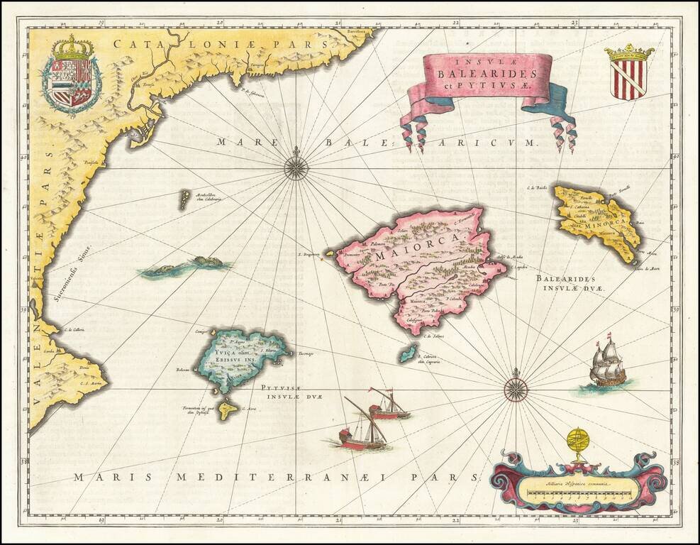
A beautiful map of the islands of Majorca, Minorca, and Ibiza, along with the contiguous Catalan Coastline. The map appeared in Blaeu's Atlas Novus. Includes sea monsters, ships, royal coats of arms, and an elegant title scroll.
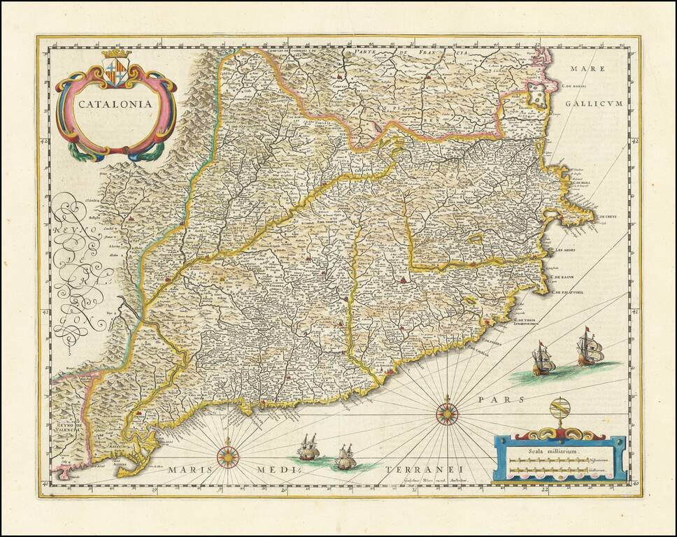
Old color example of Blaeu's map of Catalonia, extending from C. De Romani on the Northern Coast to Alfachs and Panicola in Valencia on the southern end of the coast and showing the entirety of Catalonia in tremendous detail. Nearly 1000 towns and...
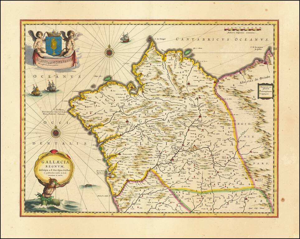
Old color example of Blaeu's map of the Kingdom of Galicia, extending from the Asturias de Oviedo region and Aviles in the Northeast, to Bayona and the Portugese border on the South, centered on Santiago di Compostella. Major cities include Corunna,...
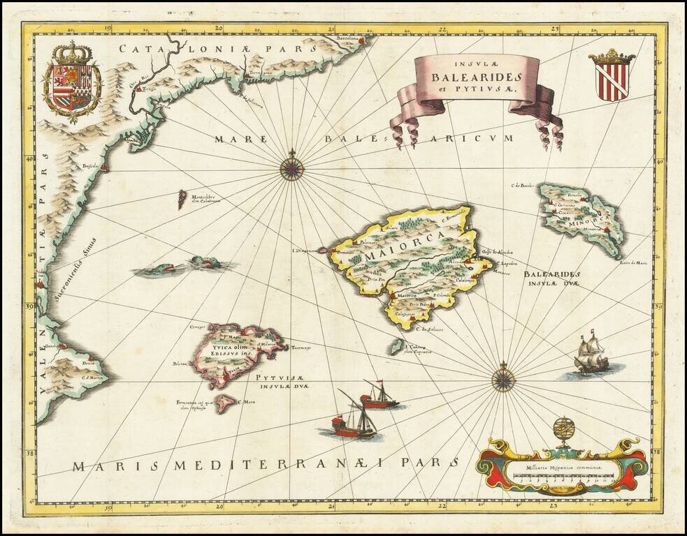
A beautiful map of the islands of Majorca, Minorca, and Ibiza, along with the contiguous Catalan Coastline. The map is based upon a larger map which appeared in Blaeu's Atlas Novus. Includes Sea monsters, ships, royal coats of arms, and an elegant...
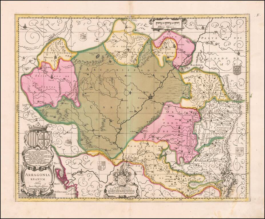
Gorgeous map of Valk & Schenk's map of Aragon, centered on Zaragoza and extending to Balbasdtor, Huesca, Calataiud, Tortosa, Tervel, Albarrazin, Cuenca etc. Shows towns, rivers, mountains, lakes, valleys, etc. Includes 2 large cartouches and 5...
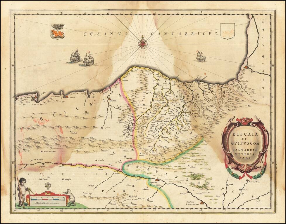
A nice example of Blaeu's map of the Basque Country region centered on Bilbao and extending from S. Andero to Calgurris and Baiona. From the Dutch edition of Blaeu's Atlas Novus.
![[Western Mediterranean] Carta Particolare del Mare Mediterranio che Comincia con lo Stretto di Gibilterra e Finisce con il Porto di Cartagena in Ispagna e del Capo Falcone in Barberia](/map/small/53991.jpg)
Robert Dudley's Sea Chart of the Western Mediterranean Detailed map of the western Mediterranean and Straits of Gibraltar, from Dudley's Dell'Arcano del Mare. Shows the Spanish coast from Trafalgar to Capo de Paulas (Murcia) and from Tangier,...