Map size in jpg-format: 8.47645MiB
Click to open in high resolution (open in new tab).
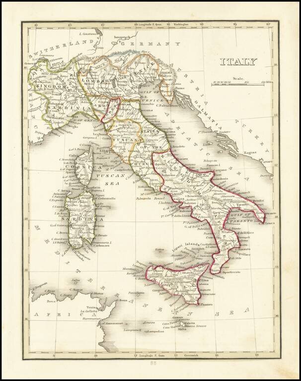
Nice map of Italy from the early 19th Century.
Thomas Gamaliel Bradford (1802-1887) was an American geographic publisher. He hailed from Bradford, Massachusetts and began his publishing career by working for the America Encyclopedia. Then, he edited and republished the Atlas Designed to Illustrate the Abridgement of Universal Geography, Modern & Ancient, which had originally been offered in French by Adrian Balbi. In 1835, he published another atlas, A Comprehensive Atlas: Geographical, Historical & Commercial, and, in 1838, An Illustrated Atlas Geographical, Statistical and Historical of the United States and Adjacent Countries. His interests were primarily in educational publishing and he was one of the first mapmakers to show Texas as an independent country.
If you are a student, write to us in telegram: @antiquemaps and indicate what material you need and for what work you need a map in high detail. We are ready to provide material on special terms. For students only!


