logo

1581. Veronae Urbis Territorium a Bernardo Bragnolo descriptium

  • Veronae Urbis Territorium a Bernardo Bragnolo descriptium

Veronae Urbis Territorium a Bernardo Bragnolo descriptium information:

Year of creation: 
Resolution size (pixels): 
 2327x1712 px
Disk Size: 
 1.24434MiB
Number of pages: 
 1
Place: 
 Antwerp
Author: 

Print information. Print size (Width x height in inches):
Printing at 72 dpi 
  32.32 х 23.78
Printing at 150 dpi 
 15.51 х 11.41
Printing at 300 dpi 
 7.76 х 5.71

An example of detailing the file of this map of in a printable high-resolution:

Click to open in high resolution (open in new tab).
Attention! this is just the central piece (central area 960x960 px) of the map file!
This is an example, so that you can see and study the level of detail of a given map. The entire Map will be fully available after payment!

Veronae Urbis Territorium a Bernardo Bragnolo descriptium

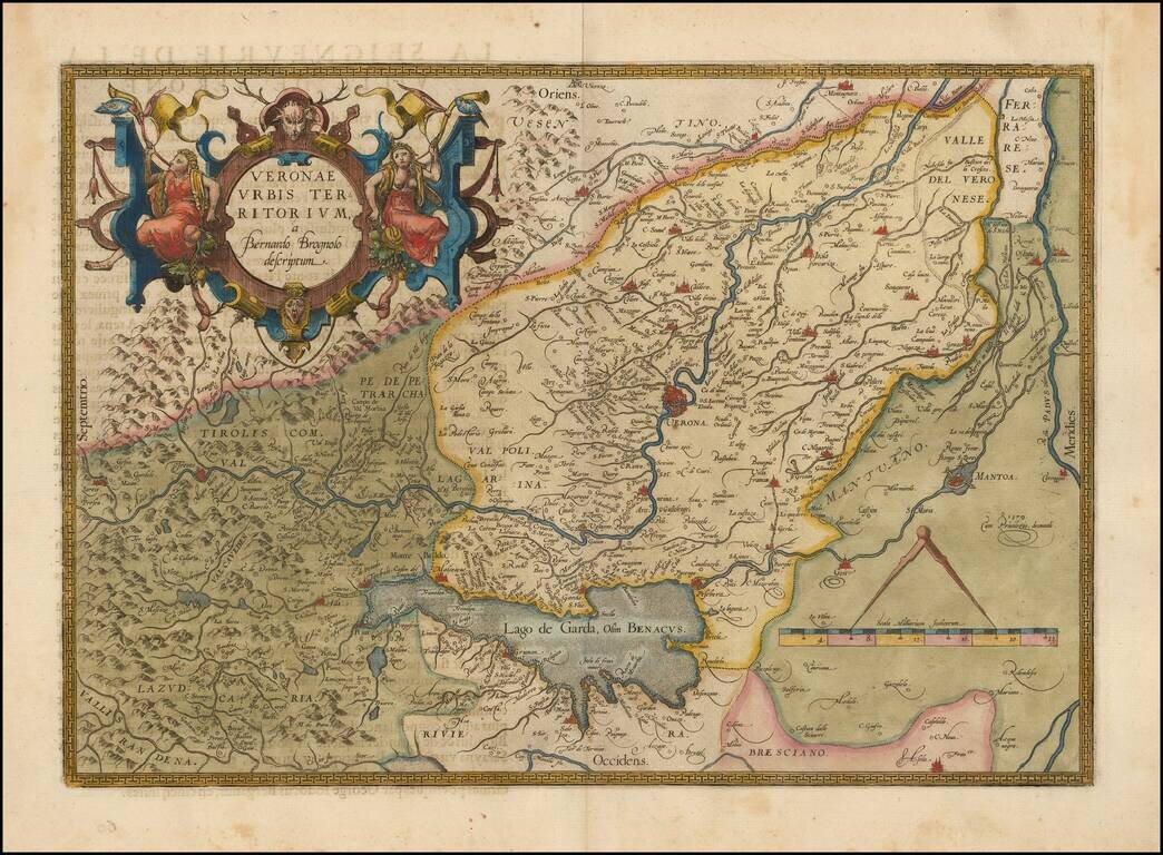
Decorative example of the Ortelius' map of Verona, based upon Brugnoli's map, which was issued by Forlani in Venice in 1574.

The map appeared in Ortelius' Theatrum Orbis Terrarum, the first modern atlas of the world.

Striking massive cartouche and decorative scale of miles. Centered on Verona, and including Mantua, and Lago de Garda.

Van Den Broecke 120

Special conditions for students!

If you are a student, write to us in telegram: @antiquemaps and indicate what material you need and for what work you need a map in high detail. We are ready to provide material on special terms. For students only!

Item information:

Year of creation:
Size:
2327x1712 px
Disk:
1.24434MiB
Number of pages:
1
Place:
Antwerp
Author:
Abraham Ortelius.
$9.99

Related item