Map size in jpg-format: 58.2575MiB
Click to open in high resolution (open in new tab).
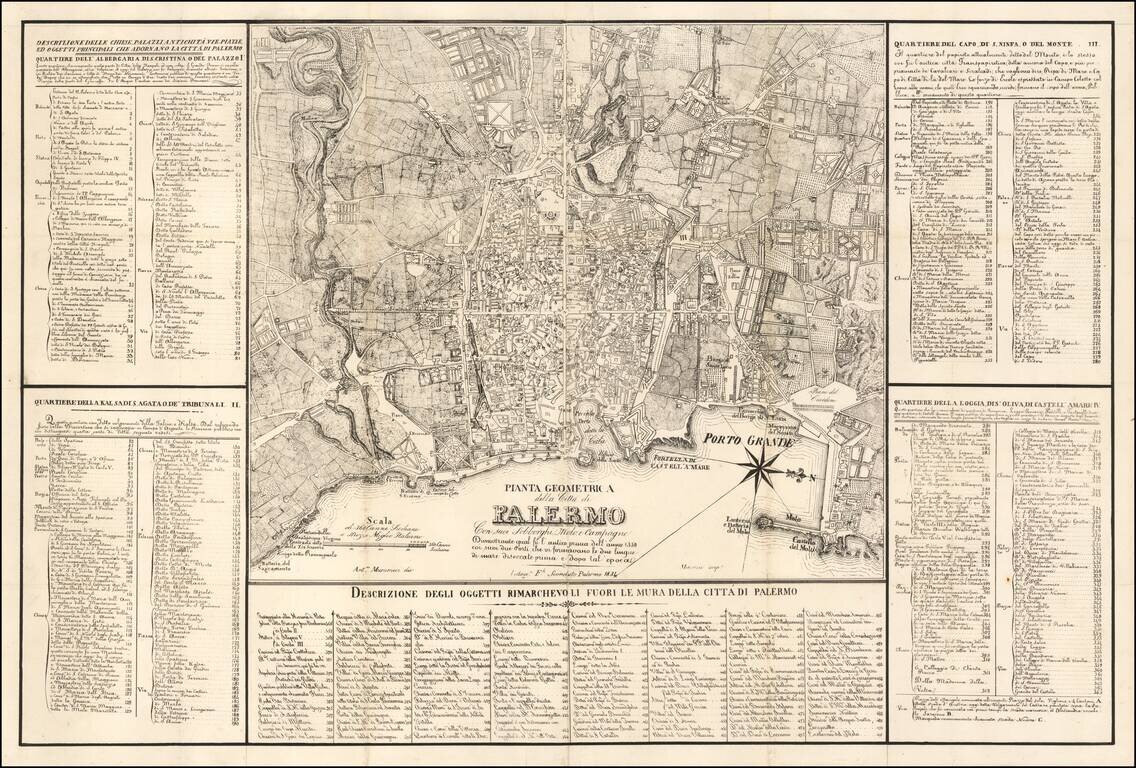
Detailed Map of Palermo, published in Palermo
Large map of the city of Palermo and its surroundings, designed by A. Musucemi, lithographed by F. Sconduto in Palermo in 1838 and printed by Mercurio.
The map is accompanied by a table of references of the remarkable places located around Palermo, and four detailed lists of places for the four districts of the city: Albergaria, Kalsa, Capo and Loggia. These lists contain the names of churches, parishes, palaces, squares and streets.
The map is very rare--we know of only a single example (this example) on the market in the past 20 years (previously offered by Librairie LeBail of Paris in 2007).
If you are a student, write to us in telegram: @antiquemaps and indicate what material you need and for what work you need a map in high detail. We are ready to provide material on special terms. For students only!


