
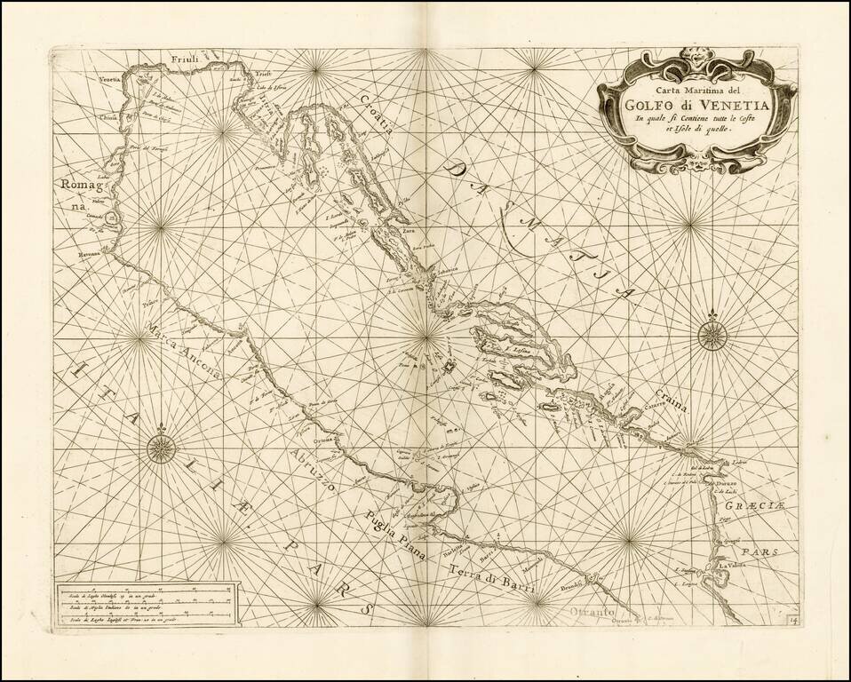
Fine chart of the Gulf of Venice and Northern Part of the Adriatic Sea, which appeared in Volume 1 of Coronelli's Corso Geographico, published in Venice. The sea chart would appear to be the chart originally issued in 1663 by Francesco Maria Levanto...

Decorative map of the region north of the Adriatic Sea, with a decorative cartouche.
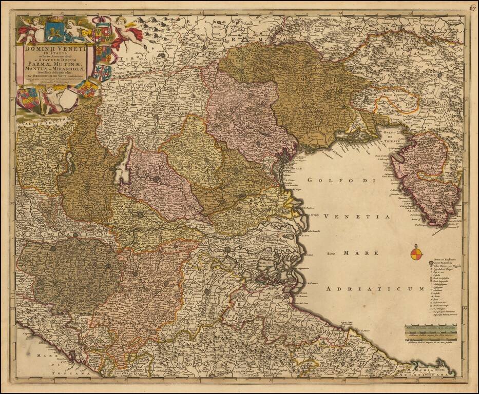
Nice old color example of this decorative map of the region, including much of Northeastern Italy and the Gulf of Venice. Extends from Istria and Ancona to the Gulf of Spezia and the Tirol and Bergamo. Includes Lago di Garda, Verona, Vicenza and...
![Constantinoplen en Egypten door Nicolaus Schmidt in enn zes Jarige Reystogt uyt Duytsland [shows Cyprus]](/map/small/57615.jpg)
Decorative map of the region bounded by Italy, Corsica, Sardinia and Sicily in the west and extending to Cyprus, Asia Minor and the Holy Land in the east. Centered on Greece and the Balkans. The map was engraved to illustrate a Dutch translation of...
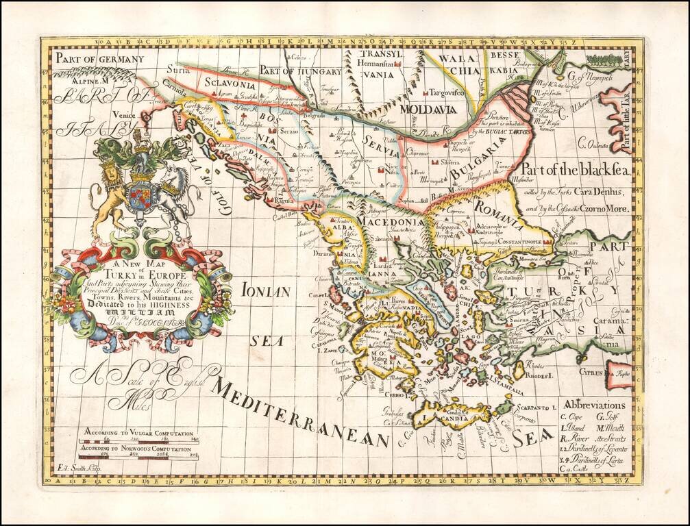
Decorative map of Turkey and the Balkans, colored by regions. This decorative map was part of a set of 22 maps dedicated to William, Duke of Glouchester, who was then an 11 year old student at Oxford.
![Pas-Caart van de Weder zytsche Zee-kusten soo van Italia als Dalmatia en Griecken inde Golff van Venetien , , , 1716 [Large inset of Corfu]](/map/small/20108.jpg)
Striking full color example of Van Keulen's chart of the Gulf of Venice, from his De Nieuwe Groote Lichtende Zee-Fackel, part III. Includes an ornate cartouche and other embellishments, with large insets of Corfu, the mouth of the Po River and Paxoi...
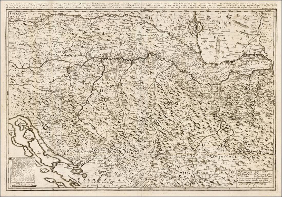
Rare map of of the Kingdom of Bosnia by Etienne Briffuant and published in Vienna. The map extends from Varazdin and Zagreb (Agram) and Senj (Zeng) in the west, to Belgrade in the east, following the course of the Danube and Sava Rivers, encompassing...

Detailed map of Istria, from Remondini. Detailed map of the region, with decorative cartouche.
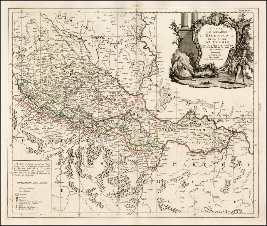
Fine map of Slovenia, published in Venice by Paolo Santini. The map is dissected by the Danube River and shows the region south and west of the Danube, extending south to Bosnia and part of Serbia but with greatest focus on the region north on the...
Detailed map of the Balkans regions and Greece, toward the end of the Ottoman Empire.
![A New Map of Turkey in Europe Divided into All Its Provinces; With the Adjacent Countries of Europe and Asia . . . 1794 [shows Cyprus]](/map/small/49114.jpg)
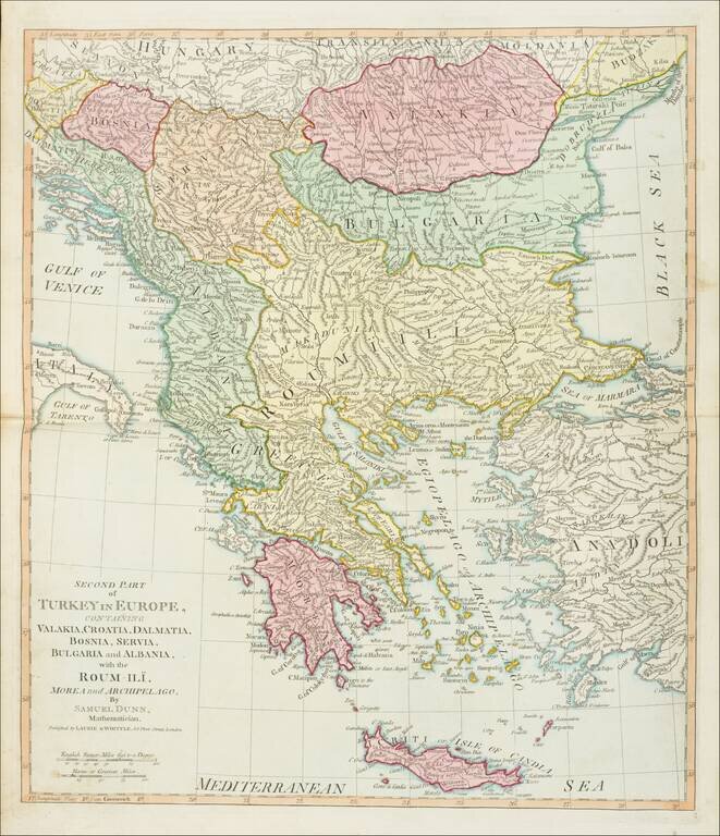
Striking map of the eastern Mediterranean, Greece, Turkey & Cyprus, bounded by Cyprus and the Mediterranean, the Black Sea, the Adriatic and Crete, centered on Greece and Turkey. Laurie & Whittle credit as sources maps published by the...
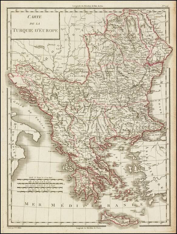
Detailed map of Greece and environs from Crete and the Mediterranean to the Black Sea and the Balkans, centered on Roum-Ili. From Dunn's New Atlas or Mundane System of Geography.
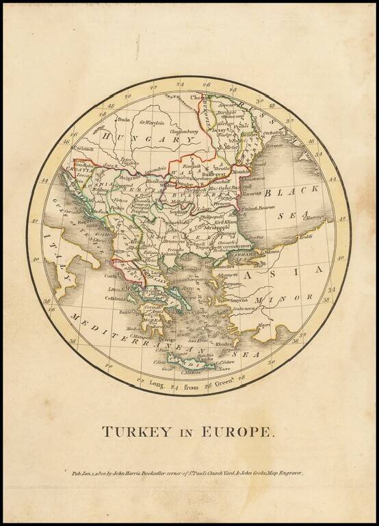
Extremely rare miniature map of Turkey in Europe, which was published by J. Cooke & J. Harris in London in 1801. The map style, in the circular disk, is quite unusual. This is the first time we have offered this map for sale.
![A New Map of Turkey In Europe, Divided into its Provinces . . . 1801 [Cyprus]](/map/small/71260.jpg)
Detailed map of Turkey, Greece, Bosnia, Dalmatia, Serbia, Bulgaria, Moldova, Romania and Albania, and the contiguous islands, including Cyprus and Crete. Colored by countries. One of the best large format English atlas maps of the period.
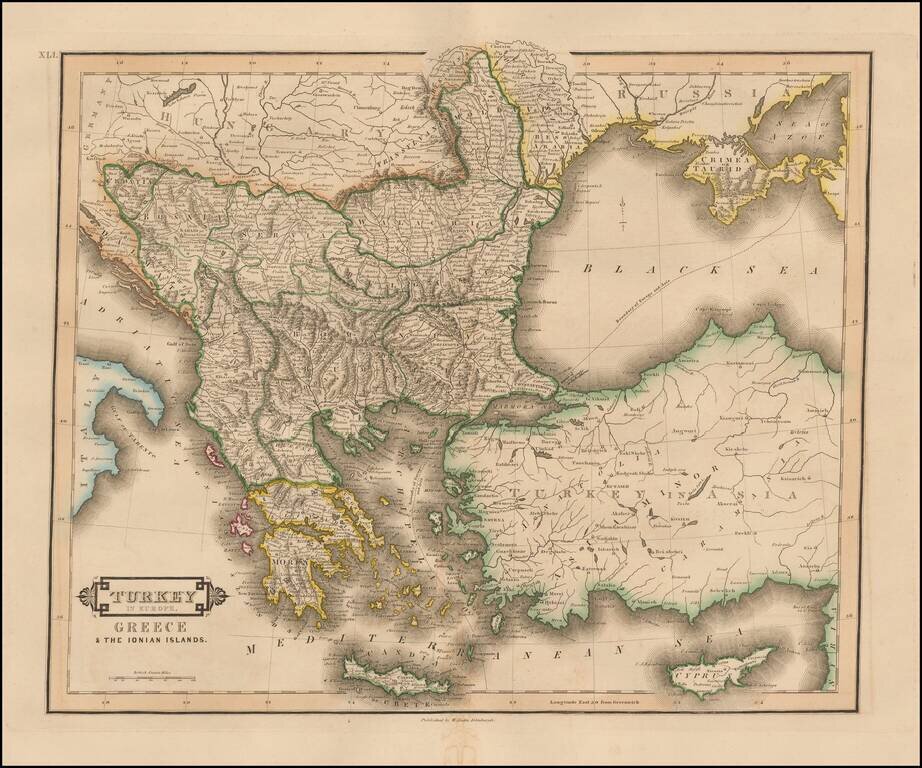
Striking and highly detailed map of Turkey, Greece, the Balkans, Cyprus and the Black Sea. Colored by regions. Excellent detail throughout.
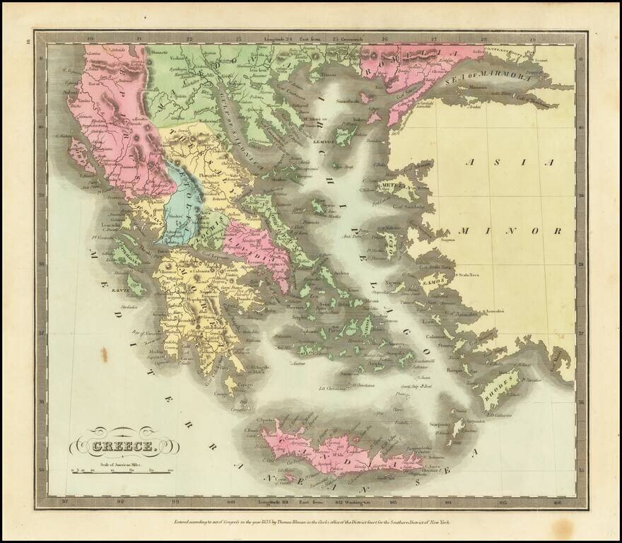
Marvelous detailed map of Greece, Turkey, Macedonia, Crete, and surrounding islands from this scarce American atlas.