
![Turcici Imperii Imago [shows Cyprus]](/map/small/68676.jpg)
Fine Map of the Ottoman Empire from the Mercator-Hondius Atlas Striking example of this map of the Ottoman Empire, showing their territories in the Balkans, Anatolia, the Levant, the Arabian Peninsula, and North Africa. It was published by Henricus...
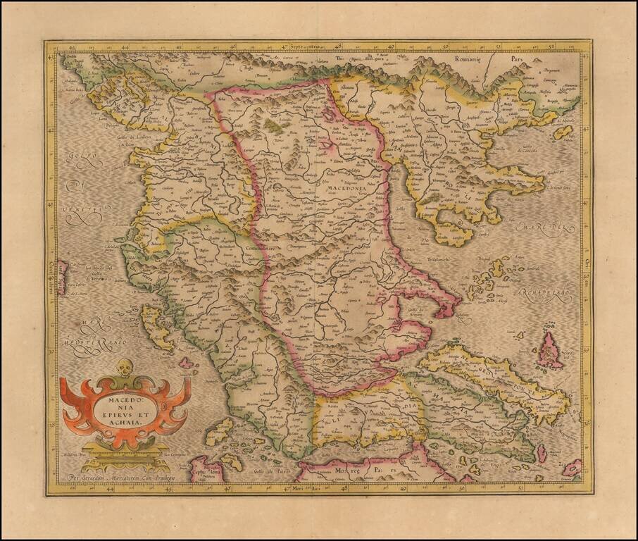
Nice old color example of Hondius's detailed regional map of Macedonia, with a decorative cartouche.
Decorative early map of the Balkans and the Gulf of Venice, with a large decorative cartouche. Finely engraved and highly detailed.

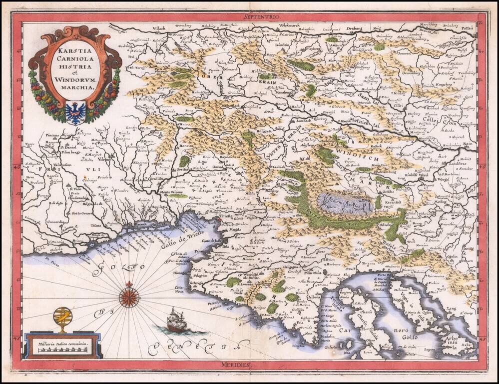
Nice old color example of Jansson's second map of Istria, with east oriented at the top. Jansson's map is based upon Magini's map of 1620, which appeared in his atlas of Italy, the first modern atlas to focus on Italy. Shows the Istria peninsula,...
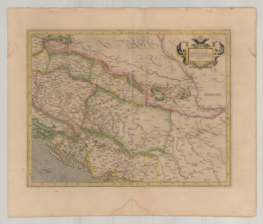
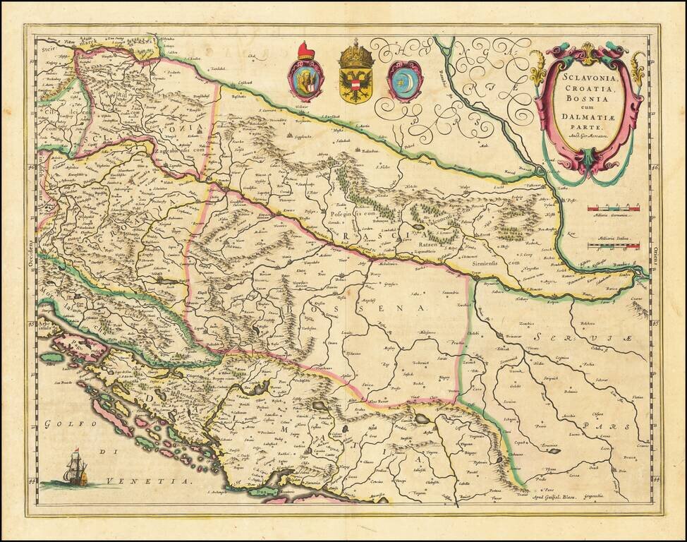
Decorative old color example of this fine map of the Balkans and the Gulf of Venice, with a large decorative cartouche. Includes Slovenia, Croatia, Bosnia, Herzegovina and the western half of Serbia, extending to Belgrad. Includes 3 large coat of arms.
Detailed regional map of the Gulf of Venice and Gulf of Trieste regions, including Friuli and Istria. Includes Slovenia, northwestern Croatia and parts of Italy and Austria. The map is based upon earlier maps by Gerard Mercator and Guillaume Blaeu.
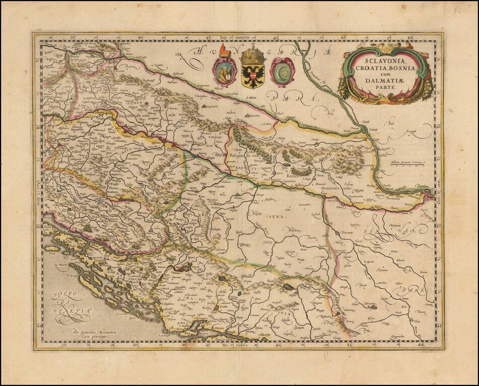
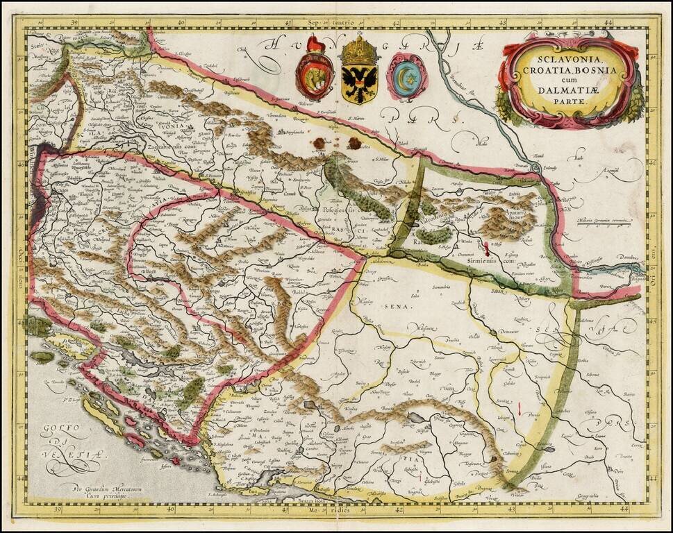
Nice example of Blaeu's decorative early map of the Balkans and the Gulf of Venice, with a large decorative cartouche. Includes Bosnia, Serbia, Croatia, and Slovenia. Includes 3 coats of arms and a sailing ship.
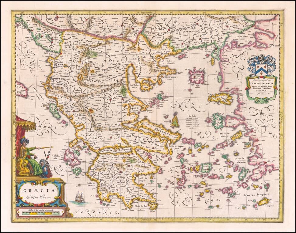
Fine old color example of Blaeu's map Greece, which appeared in Blaeu's Atlas Major. Includes large decorative cartouche and coat of arms.
Decorative old color example of this fine map of the Balkans and the Gulf of Venice, with a large decorative cartouche. The map is in original ENGLISH color, which is very rare on the market and easily distinguished from contemporary Dutch color.
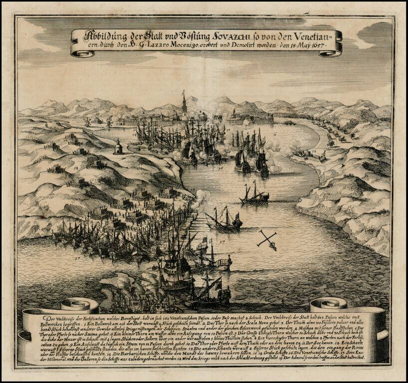
Early battle scene of the attack on Split on the Adriatic coast, on May 18, 1657. The bay is filled with ships shrouded in clouds of smoke and armies are shown throughout the countryside. German text explanation in banner at bottom.

Antique engraved map of the parts of Bosnia, Herzegovina, and Serbia that fall along the route from Paris to Constantinople. The map explains the four ways to reach Constantinople from Paris. The roads from Ragusa (Dubrovnik) to Nisse and Belgrade to...
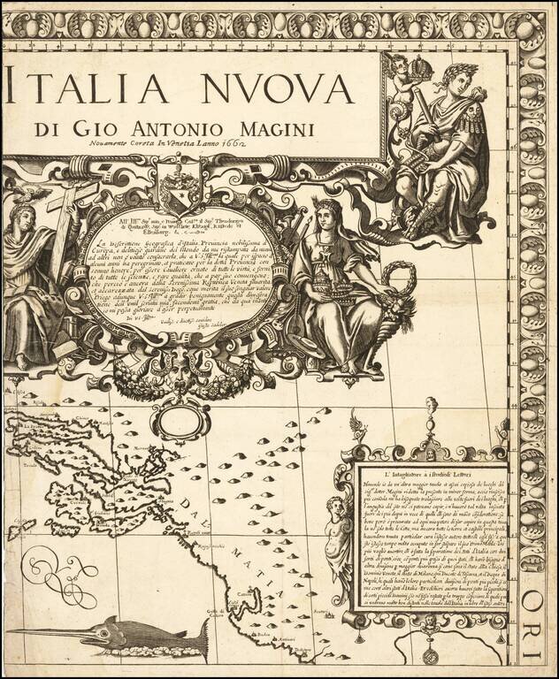
Fine example of the title sheet from Giovanni Antonio Magini's 8 sheet wall map of Italy. The map covers the Dalmatian Coastine centered on Ragusa (Dubrovnik). Extends south to Cattaro (Koro) and Budva and north to Spit. Fine large titled and...

Map illustrating the route between Belgrade and Ragusa taken by Sieur Quiclet during his travels to and from Constantinople in 1657 and 1658. The map shows the itinerary described by Quiclet between Belgrade and Ragusa on the Adriatic, by way of Bsona...
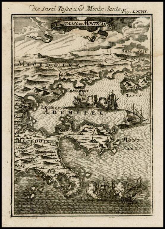
Decorative map of the Macedonian Coastline and contiguous islands, from Mallet's Description de L'Univers, first published in Paris in 1683.

Detailed map of the Balkans, etc, from Mallet's Description de l'Univers.

The Cantelli-Rossi map of Croatia, Bosnia-Herzegovina and Montenegro Highly detailed map of the Adriatic Coastline, from Montenegro in the south to the coast of central Croatia (Zadar, etc.), and covering a large part of Bosnia-Herzegovina. Shows...