
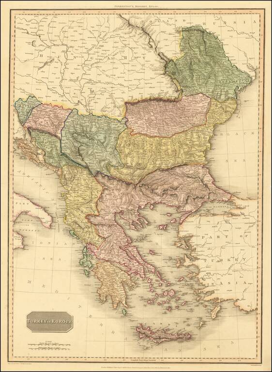
An excellent detailed regional map of the Balkans, Turkey and Greece, showing towns, roads, rivers, mountains, lakes, and other items of interest. Hand colored by regions.
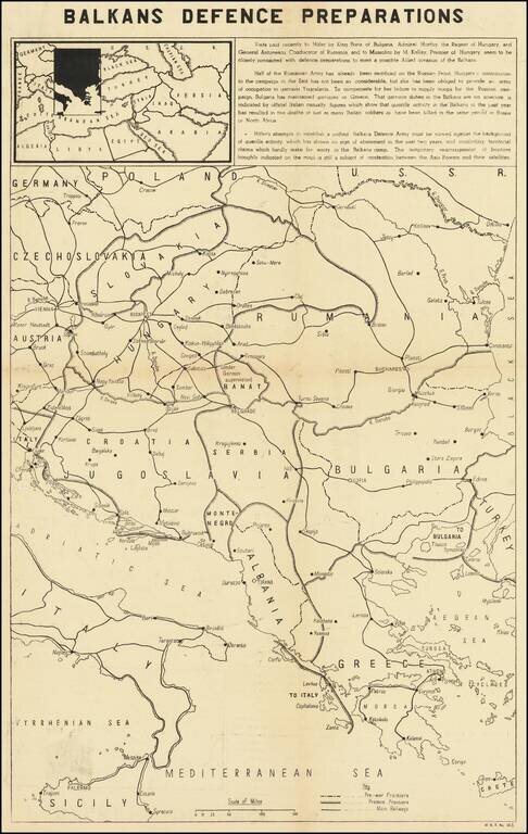
Balkans Related Anti-Nazi Propaganda Broadside Published in the British Empire Fascinating WWII broadside propaganda map, published in India, in order to keep the local populous informed about the War. The map describes Hitler's overtures to Tzar...
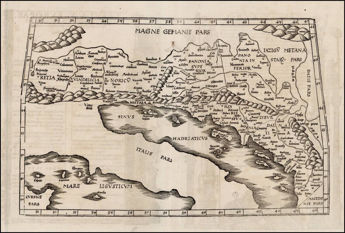
Rare, Early Map of the Adriatic Based on Ptolemy’s Famous Geographia Nice example of Lorenz Fries’ map of part of the Adriatic and the Balkans from his 1535 edition of Claudius Ptolemy’s Geographia. The present map depicts part of Europe in the...
![Tabula Europae IX [Greece & Turkey]](/map/small/60435.jpg)
Interesting map covering the region west of the Black Sea and north of the Aegean and Adriatic Seas, including the Straits of Bosphorus, from the 1542 edition of Munster's Geographia. The map is unchanged from the 1540 edition. Munster's Geographia...
![Tabula Europae IX [Greece & Turkey]](/map/small/45661.jpg)
Interesting map of the region including Greece and Turkey, along with part of Dalmatia, extending east to Istanbul and the Bosphorus, from the 1548 edition of Ptolemy's Geographia. Gastaldi's maps are considered important early maps for regional...
![[Balkans / Adriatic / Italy] Tabula Europae V](/map/small/59530.jpg)
Nice example of Gastaldi's map of Italy and the Balkans, based on Ptolemy. Giacomo Gastaldi's Atlas of 1548 has been called the most comprehensive atlas produced between Martin Waldseemüller's Geographiae of 1513, and the Abraham Ortelius Theatrum of...
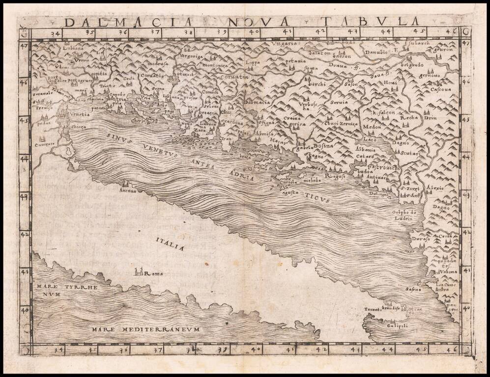
Nice example of Gastaldi's modern map of the coastal parts of Dalmatia, including parts of Slovenia, Croatia, Bosnia and Hezegovina, Montenegro, and Albania, along with portions of Venice and Istria.and the Adriatic Coast. The map is one of the...
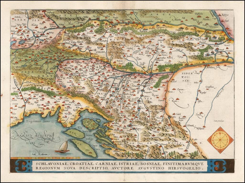
An Unrecorded Issue! Nice full color example of Ortelius' map of the region centered on the Drag and Sava Rivers, extending south to the Adriatic, near Zara, and east to the Danube and west to Triest, Meron, Villach and Karlsberg. The present...
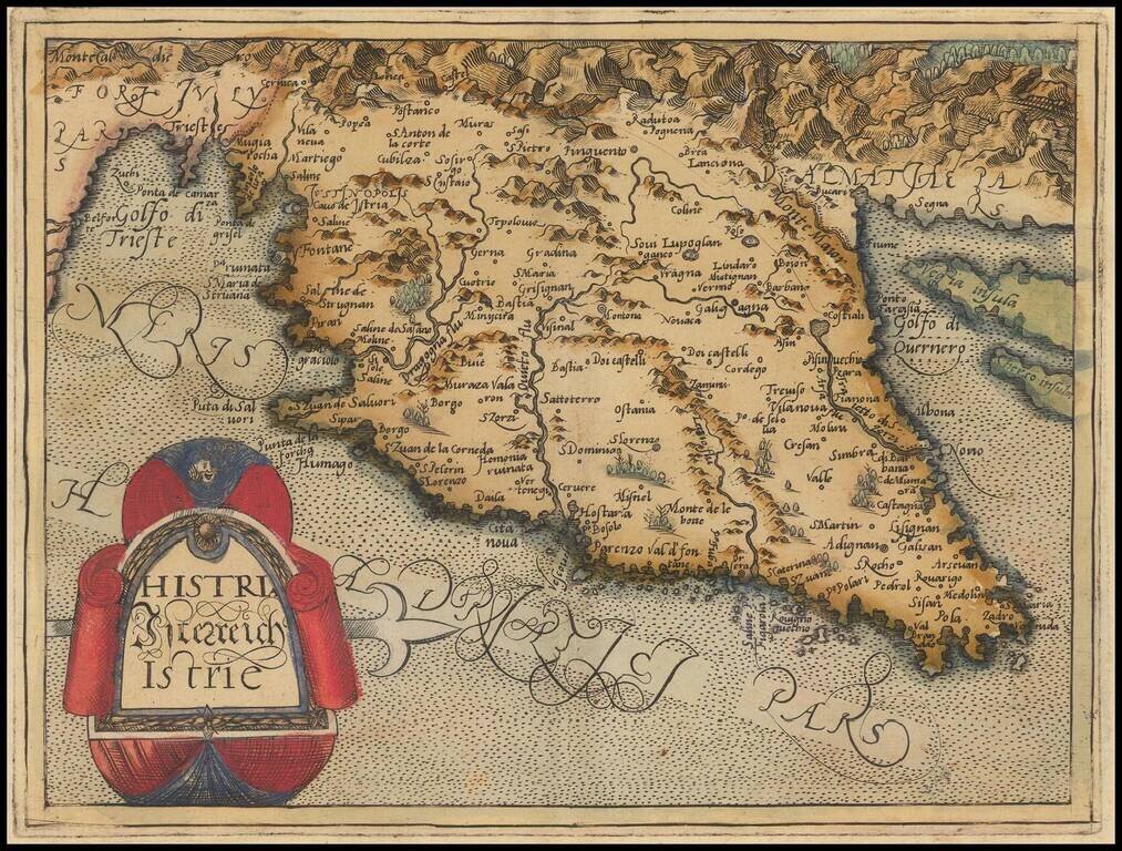
Rare modern map of Istria, published in Cologne by Johannes Metellus in 1579 in fine original color. The map is one of the earliest obtainable modern maps published by the so-called Cologne School of mapmakers, which consisted primarily of Flemish and...
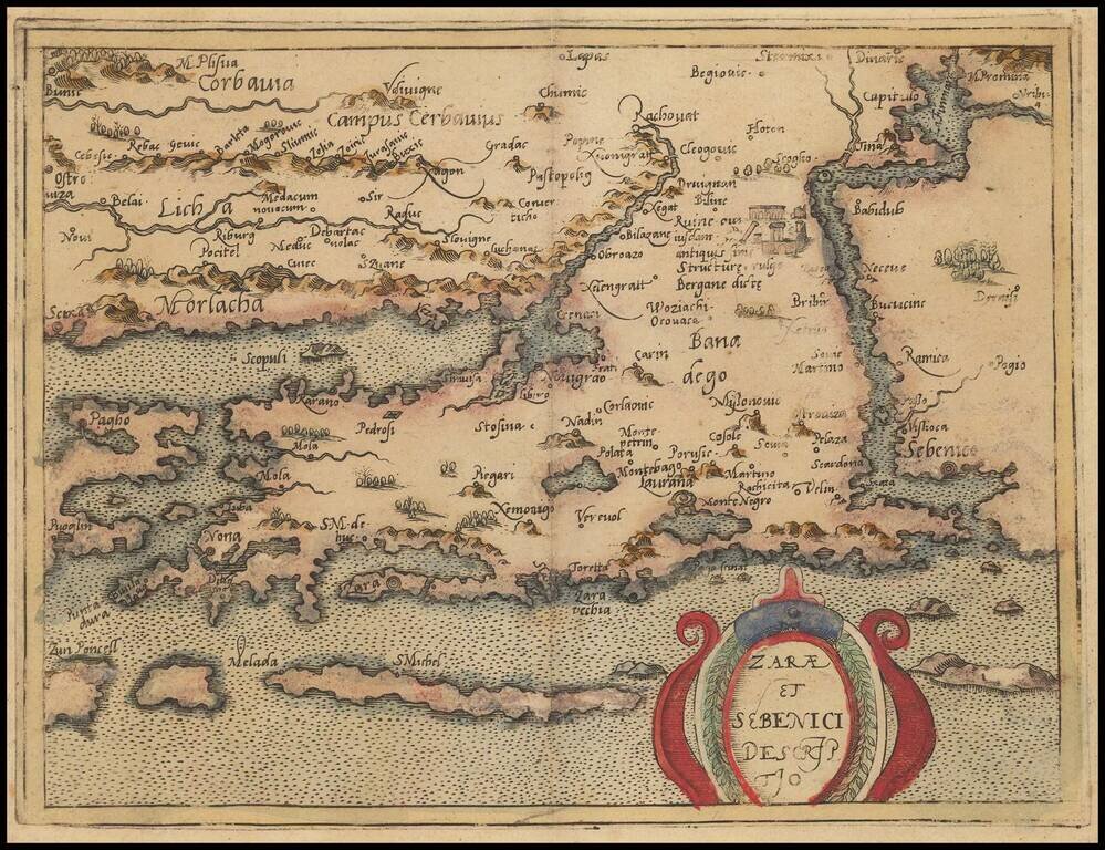
Rare modern map of a portion of the Croatian Coastline, centered on Zadar, published in Cologne by Johannes Metellus in 1579 in fine original color. The map is one of the earliest obtainable modern maps published by the so-called Cologne School of...

Rare modern map of the northern Balkan region of Illyricum, published in Cologne by Johannes Metellus in 1579 in fine original color. The map is one of the earliest obtainable modern maps published by the so-called Cologne School of mapmakers, which...
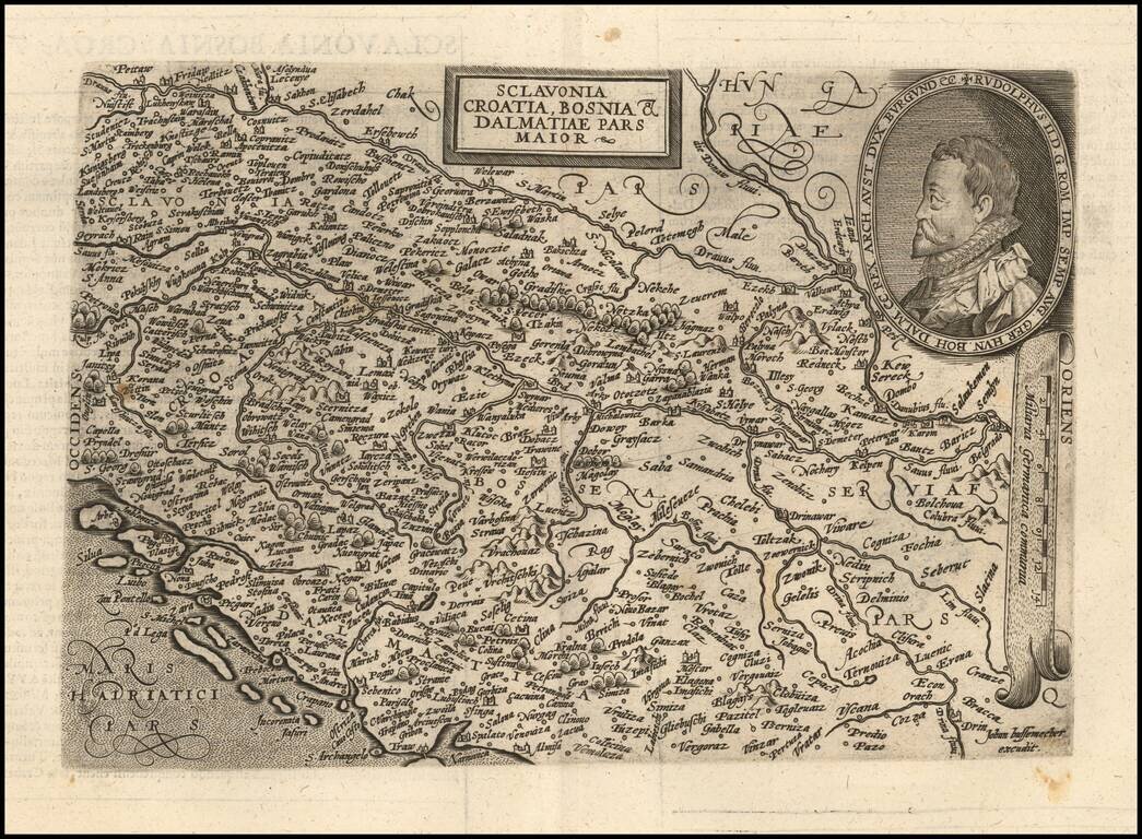
Scarce early map of the region from Slovenia to Serbia, engraved by Johann Bussemacher and published by Quad. The map is centered on Croatia and Bosnia Herzogovina, extending south to Split on the coastline and east to Belgrade. Includes a large...

One of the earliest separately published maps of Croatia. Rare early map of Croatia, published in 1593, published to commemorate a critical turning point in the Croation Wars with the Ottoman Turks. Published to commemorate the battle successes of...
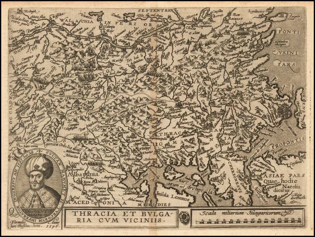
Nice example of this scarce map of Bulgaria and Western Turkey, published in Cologne. The map extends north to the Danube and east to Istanbul, centered on Philipolis (Plovdiv). Sophia is named, but is a small town. Adrianapolis (Edirne) is another...
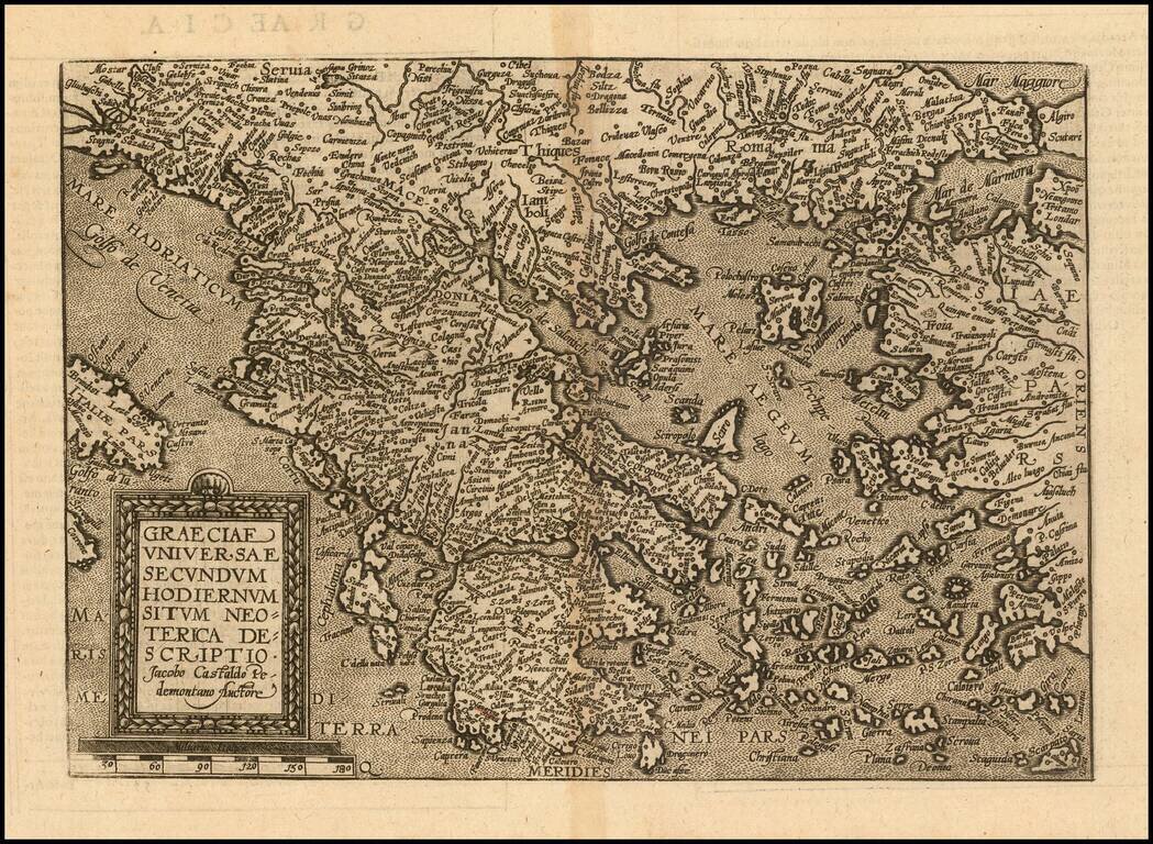
Detailed map of Greece and neighboring regions, based upon Giacomo Gastaldi's map. The map appeared in Quad's Geographische Handtbuch . . . .