
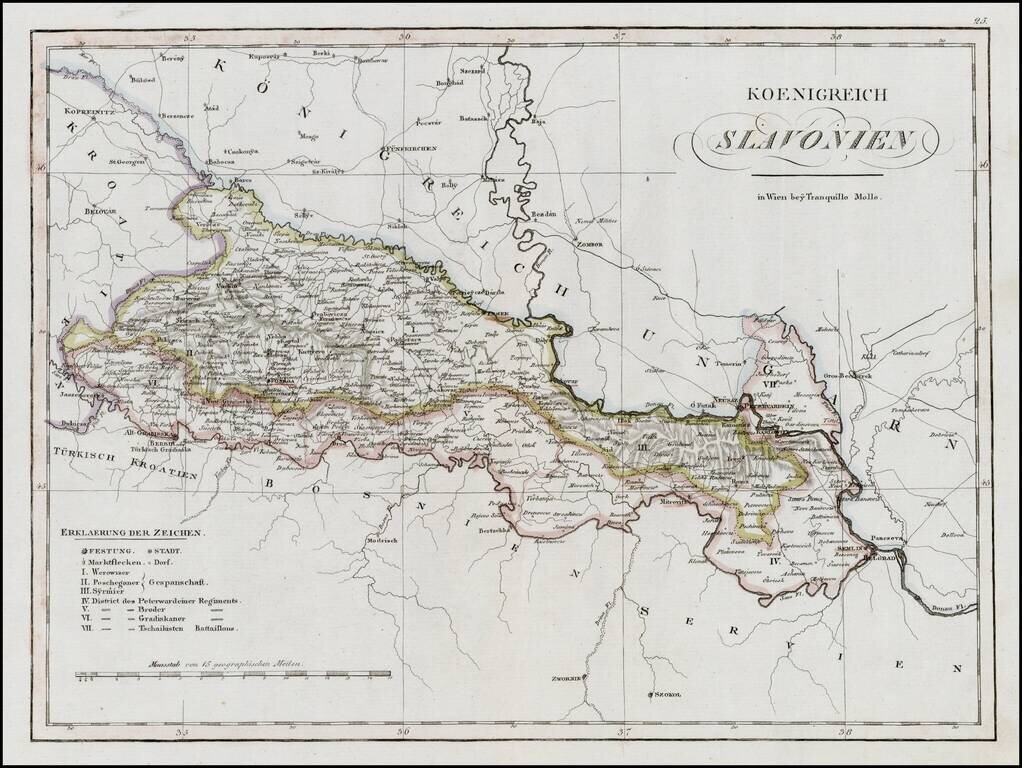
Rare regional map of the Kingdom of Slovenia and neighboring regions, published in Vienna at the begnning of the 19th Century. One of the few regional maps of the period to focus on this region.
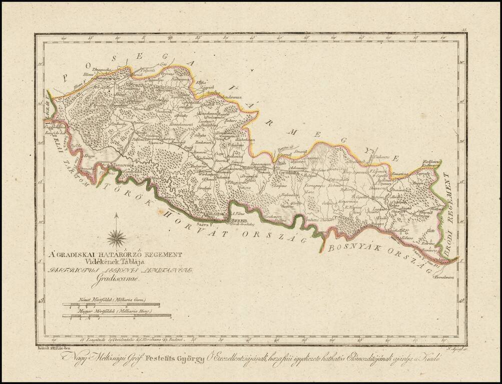
Finely engraved hand colored in outline map of the Gradisca region. Showing administrative boundaries, cities, towns, rivers, forests and mountains. Includes compass rose. Relief shown by hachures. The map is from Gorog's Magyar Atlas, the first...
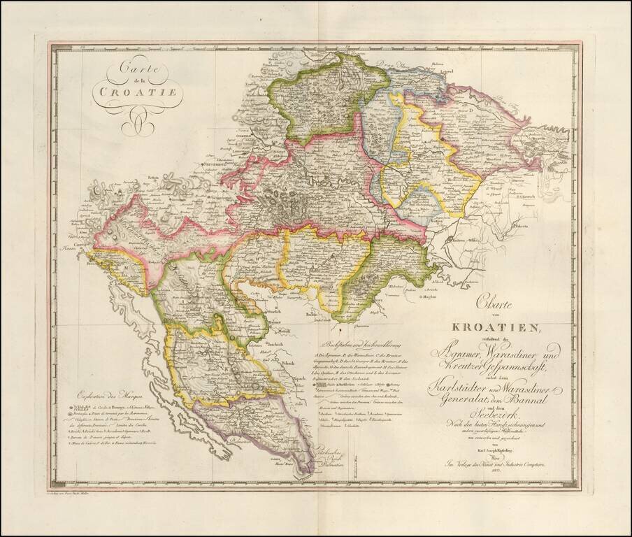
Fine large format map of Croatia and Krajina, which appeared in Kipferling's rare Atlas des Österreichischen Kaiserthums, published in by the Kunst und Industrie Comptoirs in Vienna in 1805. The map was issued shortly after the Venetian Republic in...
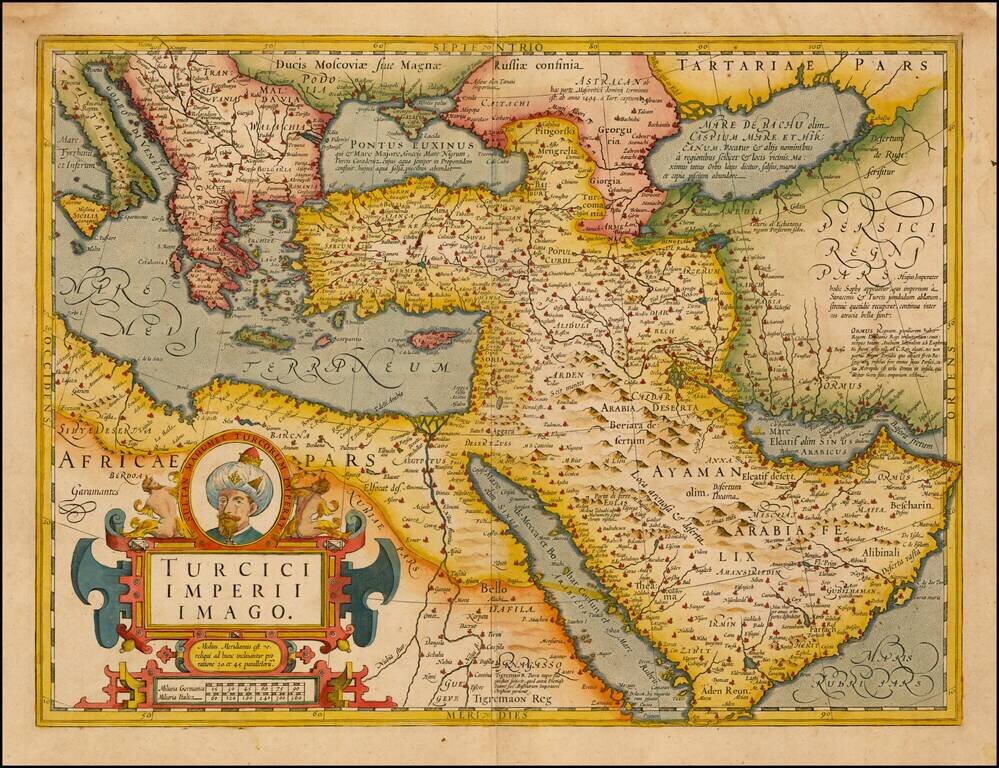
Fine Map of the Ottoman Empire from the Mercator-Hondius Atlas Striking example of this map of the Ottoman Empire, showing their territories in the Balkans, Anatolia, the Levant, the Arabian Peninsula, and North Africa. It was published by Henricus...
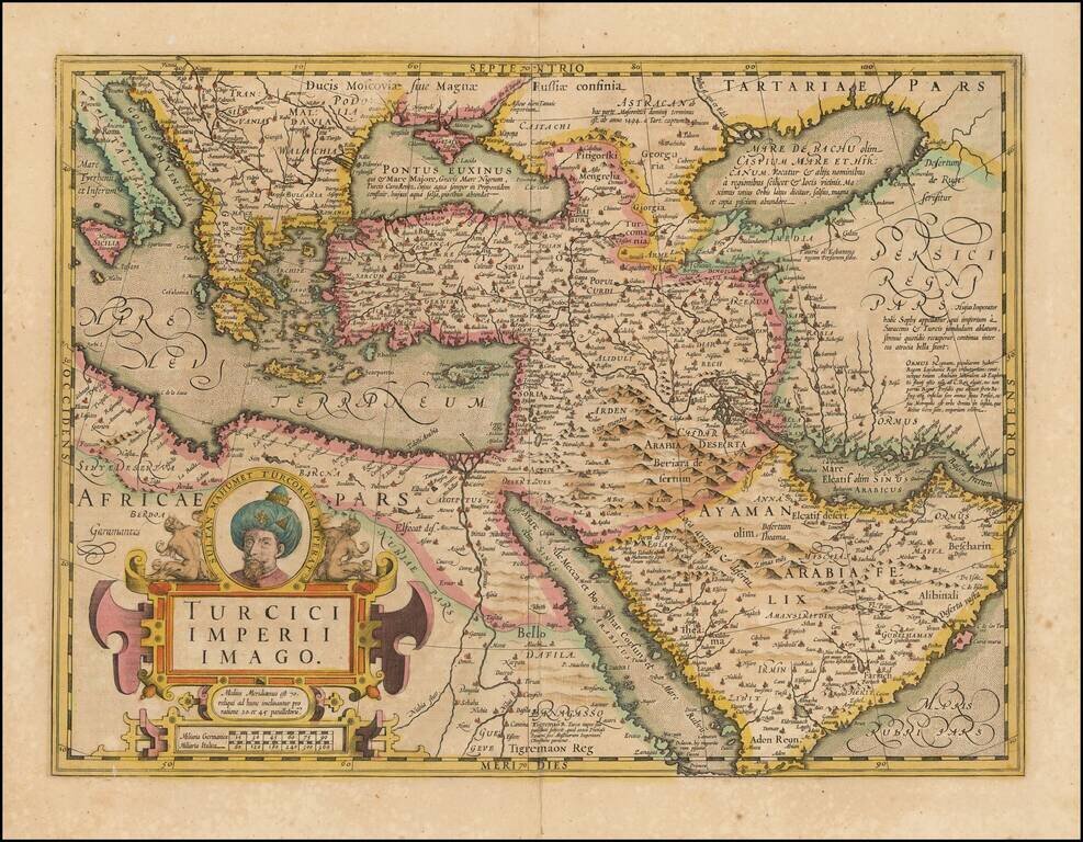
Fine Map of the Ottoman Empire from the Mercator-Hondius Atlas Striking example of this map of the Ottoman Empire, showing their territories in the Balkans, Anatolia, the Levant, the Arabian Peninsula, and North Africa. It was published by Henricus...