logo

1851. The Great Bahama Bank Sheet IV From Exuma to New Providence

  • The Great Bahama Bank Sheet IV From Exuma to New Providence

The Great Bahama Bank Sheet IV From Exuma to New Providence information:

Year of creation: 
Resolution size (pixels): 
 17433x23671 px
Disk Size: 
 72.2447MiB
Number of pages: 
 1
Place: 
 London

Print information. Print size (Width x height in inches):
Printing at 72 dpi 
  242.13 х 328.76
Printing at 150 dpi 
 116.22 х 157.81
Printing at 300 dpi 
 58.11 х 78.9

An example of detailing the file of this map of in a printable high-resolution:

Click to open in high resolution (open in new tab).
Attention! this is just the central piece (central area 960x960 px) of the map file!
This is an example, so that you can see and study the level of detail of a given map. The entire Map will be fully available after payment!

The Great Bahama Bank Sheet IV From Exuma to New Providence

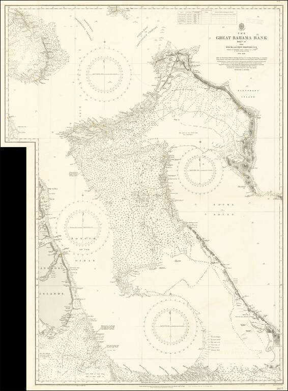
Large engraved sea chart of the Bahamas, issued by the British Admiralty first in 1851, and with numerous corrections over the years to this edition in 1921.

The map shows parts of the Andros Islands, New Providence Island with Nassau (Lyford Cay is named), cays and islands around Exuma Sound are shown, as are the island to the west of the Providence Channel.

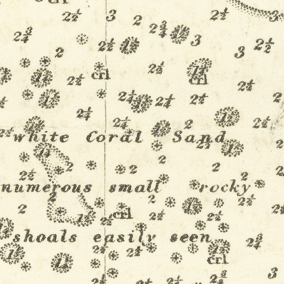
The map includes a plethora of soundings and bathymetric data. Topography is rendered by hachures.

The chart is scarce in any edition; this being the first time we have handled it.


Special conditions for students!

If you are a student, write to us in telegram: @antiquemaps and indicate what material you need and for what work you need a map in high detail. We are ready to provide material on special terms. For students only!

Item information:

Year of creation:
Size:
17433x23671 px
Disk:
72.2447MiB
Number of pages:
1
Place:
London
Author:
Admiralty War Staff Intelligence Division.
$21.99

Related item