logo

1729. The Island of Bermudos, Divided into its Tribes, with the Castles, Forts &c. . . . (with) Part of Providence Island -- (Bahamas)

  • The Island of Bermudos, Divided into its Tribes, with the Castles, Forts &c. . . .  (with)  Part of Providence Island -- (Bahamas)

The Island of Bermudos, Divided into its Tribes, with the Castles, Forts &c. . . . (with) Part of Providence Island -- (Bahamas) information:

Year of creation: 
Resolution size (pixels): 
 1574x1208 px
Disk Size: 
 481340B
Number of pages: 
 1
Place: 
 London
Author: 

Print information. Print size (Width x height in inches):
Printing at 72 dpi 
  21.86 х 16.78
Printing at 150 dpi 
 10.49 х 8.05
Printing at 300 dpi 
 5.25 х 4.03

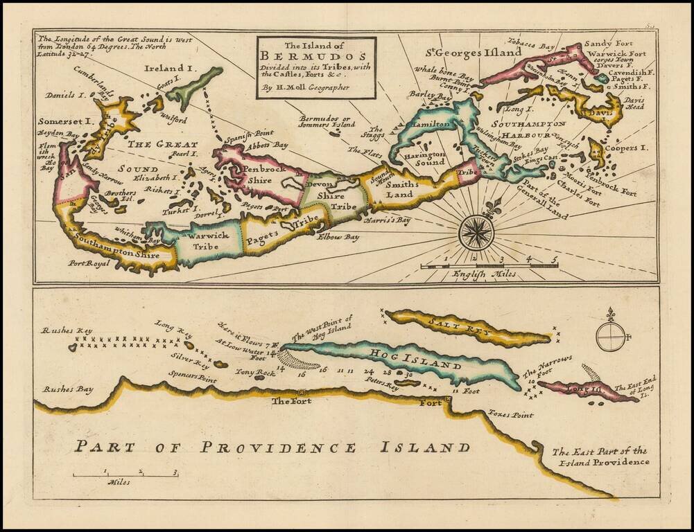
Striking full color example of this Moll's map of Bermuda and the North Coast of Providence Island, with Hog Island, Long Island, Salt Key, etc.

The Bermuda map includes significant details, including Tribes, towns, bays, islands, sounds, and other details.

The Providence Island map locates reefs, shallow water and several forts on Providence Island.

MCC 19 (Palmer) #30, pl.16.

Special conditions for students!

If you are a student, write to us in telegram: @antiquemaps and indicate what material you need and for what work you need a map in high detail. We are ready to provide material on special terms. For students only!

Item information:

Year of creation:
Size:
1574x1208 px
Disk:
481340B
Number of pages:
1
Place:
London
Author:
Herman Moll.
$9.99

Related item