Map size in jpg-format: 2.05046MiB
Click to open in high resolution (open in new tab).
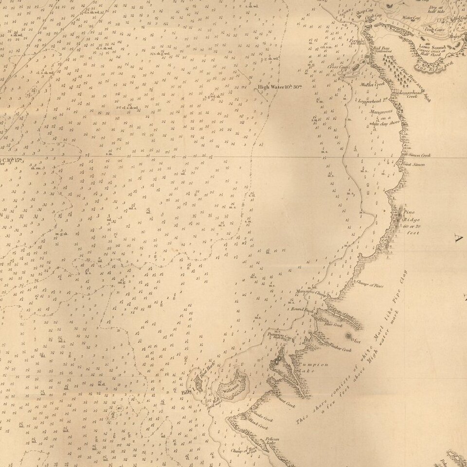
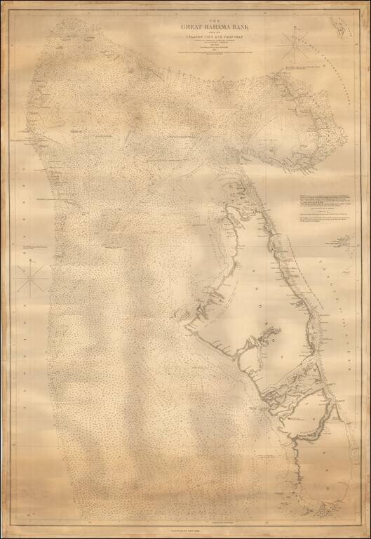
One of the Earliest Modern Sea Charts of the Central Section of the Great Bahama Banks.
Fine chart of the Bahama Banks, focusing on Andros Island and the neighboring islands, etc., published by Blunt.
The map reaches east to New Providence Island and Cay Gordo in the Abaco Bank and west to Bimini, Gun Cay and North Cat Cay.
On New Providence Island, Clifton, Clifton Pint, Goulding Cay and Simms Point are noted.
The islands around Great Harbour Cay and Chub Cay are also shown.
The map would appear to be based upon a British Admiralty chart dated 1844, which focuses on the surveys of the British Royal Navy in the region between 1836 and 1842.
Rarity
OCLC locates only a single example of this edition of Blunt's chart (Boston Public Library).
This is the second state of this sea chart, which was first issued in 1845 (2 locations in OCLC: Princeton University; Bilbliotheque National de France), with later editions issued in 1864 (1 location: British Library).
If you are a student, write to us in telegram: @antiquemaps and indicate what material you need and for what work you need a map in high detail. We are ready to provide material on special terms. For students only!


![[Wall Map] West-Indische Paskaert waer in de graden der breedde over weder zyden vande middelyn wassende so vergrooten dat die geproportioneert syn tegen hunne nevenstaende graden de lengde.](/map/small/60169.jpg)