logo

1854. Westindische Inselen

  • Westindische Inselen

Map size in jpg-format: 15.3416MiB

Download "Westindische Inselen", in high resolution.

Westindische Inselen information:

Year of creation: 
Resolution size (pixels): 
 10289x8434 px
Disk Size: 
 15.3416MiB
Number of pages: 
 1
Place: 
 Glogau
Author: 

Print information. Print size (Width x height in inches):
Printing at 72 dpi 
  142.9 х 117.14
Printing at 150 dpi 
 68.59 х 56.23
Printing at 300 dpi 
 34.3 х 28.11

An example of detailing the file of this map of in a printable high-resolution:

Click to open in high resolution (open in new tab).
Attention! this is just the central piece (central area 960x960 px) of the map file!
This is an example, so that you can see and study the level of detail of a given map. The entire Map will be fully available after payment!

Westindische Inselen

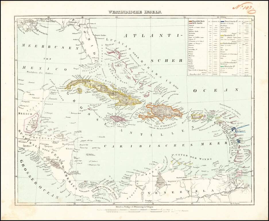
Detailed map of the Caribbean, from Florida to the cCoast of Venezuela and the Yucatan.

Includes a key identifying populations, sizes and colonial possessions.


Special conditions for students!

If you are a student, write to us in telegram: @antiquemaps and indicate what material you need and for what work you need a map in high detail. We are ready to provide material on special terms. For students only!

Item information:

Year of creation:
Size:
10289x8434 px
Disk:
15.3416MiB
Number of pages:
1
Place:
Glogau
Author:
Carl Flemming.
$14.99

Related item