
![[Virgin Islands] Cartes De Supplement Pour Les Isles Antilles](/map/small/70820.jpg)
Excellent map of the Virgin Islands from Puerto Rico to Barbuda, centered on the American and British V.I., extending from Crab Island, St. Thomas and St. Croix to Sable Island, Sombrero Island, St. Barts, St. Martin and Anguilla. Includes 8 large...
![[St. Barths] Charta ofver On St. Barthelemy -- Konungen af Sverige Gustaf den IV. Adolph . . .](/map/small/46387.jpg)
Rare Sea Chart of the Island of St. Barts Rare chart of the island of St. Barts, one of only 3 printed maps to focus on St. Barts prior to modern times. The map is divided into Quartiers and then further sub-divided. Bays are noted, pathways and the...
![Carte Reduite Des Iles Antilles . . . [and] Carte reduite des debouquements de St. Domingue . . . . 1775 [Includes Bahamas]](/map/small/58201.jpg)
A magnificent two-in-one map of the Lesser Antilles (from the eastern tip of Puerto Rico to St. Vincent and Barbados) and of the Turks and Caicos (including part of the Bahamas and the northern coast of Hispaniola). A later reissue and compilation of...
![[Heightened in Gold] Tabula Novissima atque Accuratissima Caraibicarum Insularum sive Cannibalum quae etiam Antille Gallicae Dicuntur Item Insulae Supraventum, et in Archipelago Mexicano](/map/small/60450op.jpg)
Fine contemporary color example of Ottens map of the Windward Islands, with a large inset map of Martinique. The map is heightened in gold and colored in the most deluxe fashion -- the best example we have ever seen. The map bears the imprint of the...
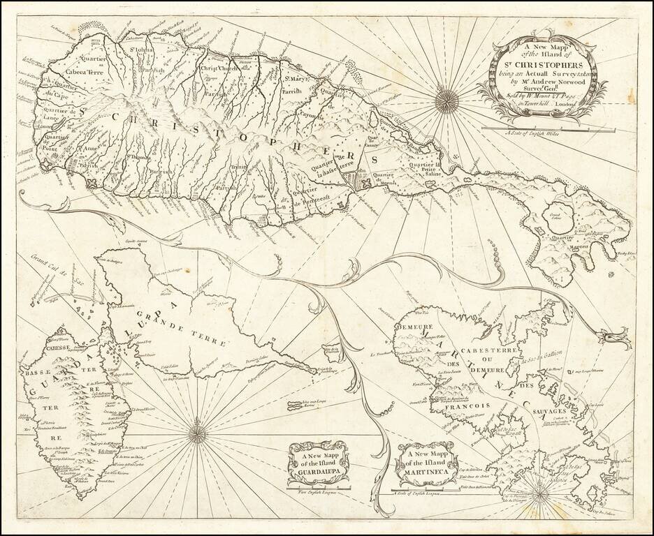
Nice example of John Thornton's sea chart of St. Kitts, Guadalupe and Martinique, which first appeared in the English Pilot, Fourth Book, in about 1706. Includes a fine map of St. Christophers, now known as St. Kitts, showing the parishes, forts,...
![[Barbados] Nieuwe Land en Zeekaart van het Eyland Barbados Geleegen in West Inida onder de Caribesse Eylanden. Afgeteekent na de Nieuste Opservatien . . .](/map/small/60428op.jpg)
Early Chart of Barbados in Fine Contemporary Color Fine contemporary colored example of Gerard Van Keulen's rare sea chart of Barbados. The chart is oriented with west at the top, illustrating Barbados in exceptional details. Within the interior...
![[Antigua] A New and Accurate Map of the Island of Antigua or Antego taken from Surveys, and adjusted by Astronl. Observations. Containing all the Towns, Parish Churches, Forts . . .](/map/small/68333.jpg)
Decorative and highly detailed map of Antigua. Shows towns, parishes, roads, mountains, islands, forts, plantations, sugar works, castles, etc. Decorative cartouche, compass rose and annotations.
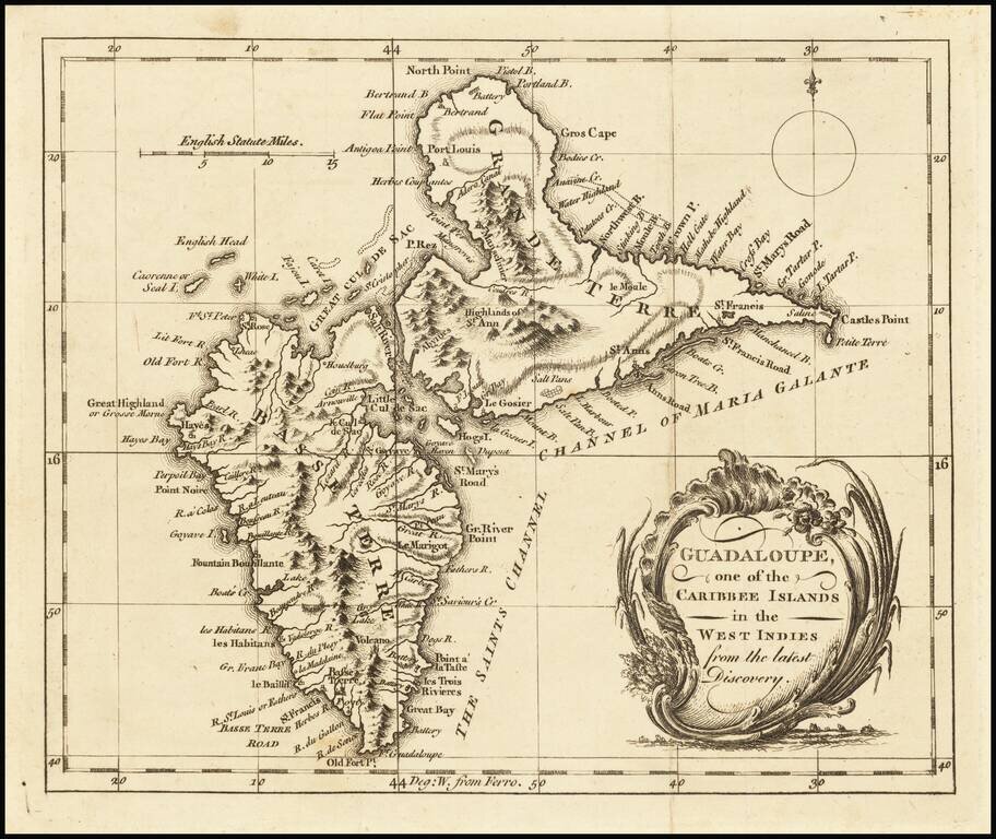
Detailed map of Guadalupe, showing towns, harbors, bays, rivers, lakes, and a host of other details. Decorative cartouche and compass rose.
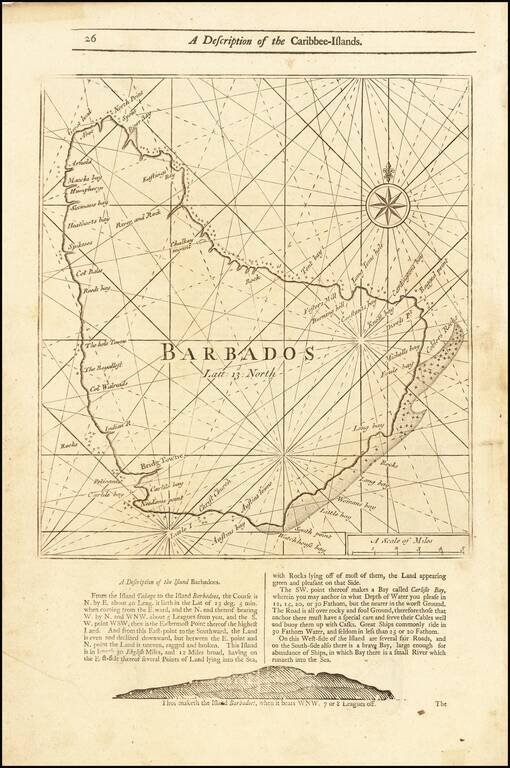
Detailed coastal map of the Island of Barbados, from Mount & Page's English Pilot, Fourth Book. The map includes a number of bays, harbors and other coastal feature, with sailing directions and a profile view below and on the verso.
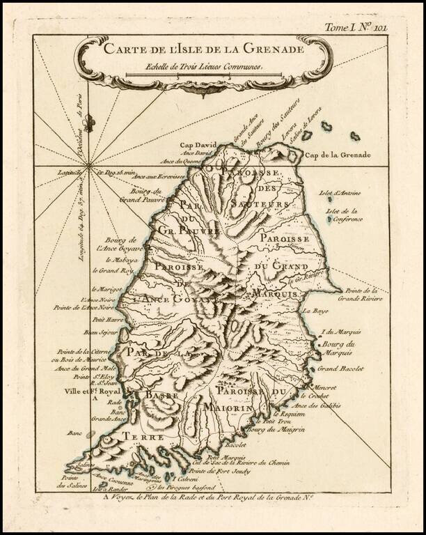
Antique Map of Grenada Detailed map of the Island of Grenada, showing remarkable detail for the period. Includes a large decorative title cartouche. From Bellin's Petit Atlas Maritime.
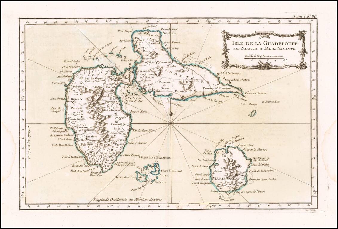
Detailed map of Guadalupe, Mari-Galante and the Isles de Saintes. Includes a decorative title cartouche, smaller cartouche and Rhumb lines. One of the maps produced by Nichlas Bellin for the Petit Atlas Maritime.
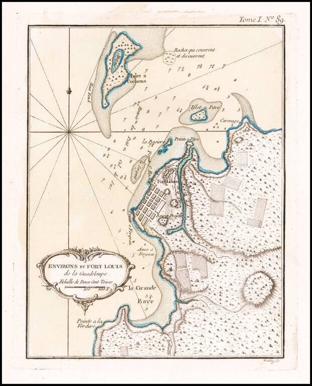
Detailed map of the environs of Fort Louis on the island of Guadalupe. Includes a decorative title cartouche and Rhumb lines. One of the maps produced by Nichlas Bellin for the Petit Atlas Maritime.
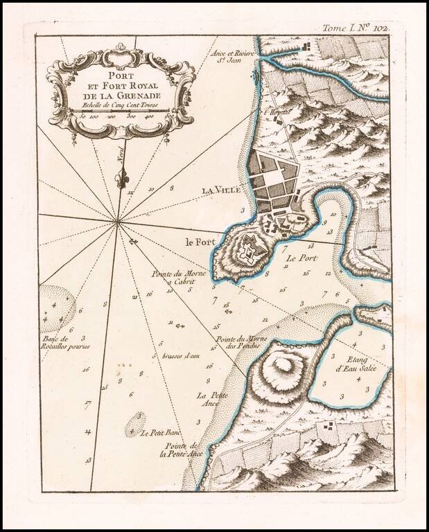
Antique Map of St. George's / Port Royal, Grenada Excellent map of the area around Port Royal, in Grenada. Includes marvelous geographical and topographical detail, the fortifications of the Fort, a town plan, etc. Includes a large decorative title...
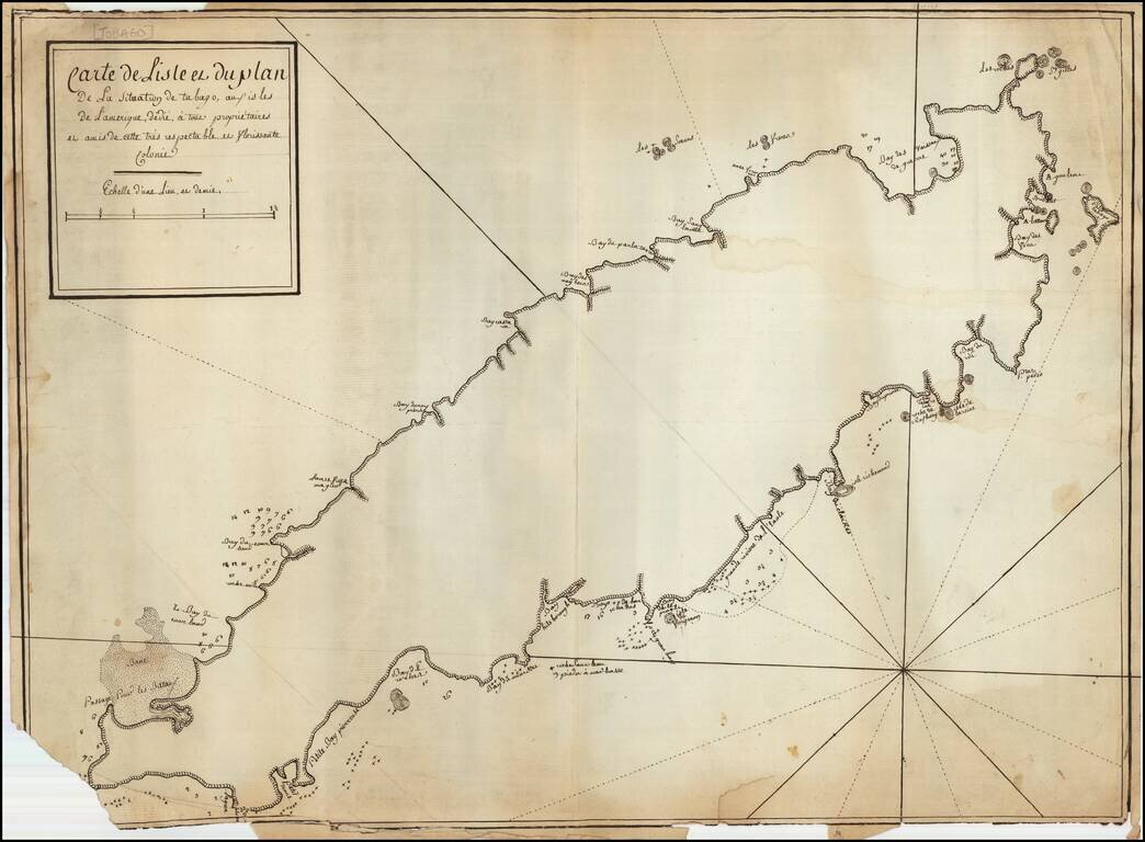
French Manuscript Map of Tobago Revealing its Complex Colonial History Manuscript map showing the island of Tobago and revealing its complicated history of European settlement. The map shows continued interest in Tobago across Europe and could have...
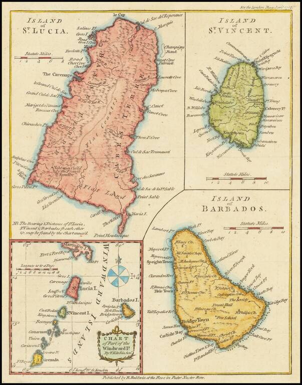
Interesting map of St. Lucia, St. Vincent, Barbados and the Windward Islands, published in the London Magazine.

The Return of the First Fleet -- Fundamental Map for Australian Collectors A highly important map in the history of settling Australia, with the present example including annotations in pencil noting a ship wreck and other details. The track of the...