Map size in jpg-format: 29.2243MiB
Click to open in high resolution (open in new tab).
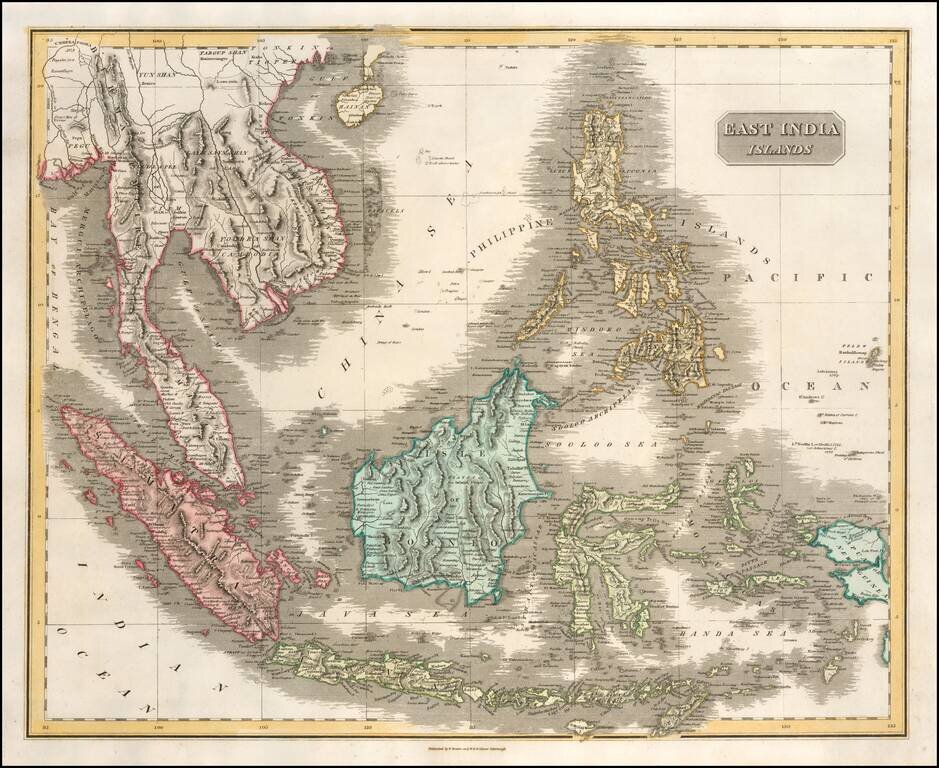
Scarce and highly detailed map of Southeast Asia and the Philippines, published by Lizars.
The map extends from Hainan and the Gulf of Tonkin to Pegu and the Bay of Bengal, in the North and showing all of the Philippines, Papual New Guinea, Timor, Java, Sumatra and the Malaysian Peninsula in remarkable detail.
If you are a student, write to us in telegram: @antiquemaps and indicate what material you need and for what work you need a map in high detail. We are ready to provide material on special terms. For students only!
![[Signed Political Satire Artwork] Vietnam ... Vietnam ... Vietnam ...](/map/small/68726.jpg)
![[Martin Behaim Globe / Book] Pars Globi terrestris Ao. 1492 a Martino Behaim Equite Lusitano Norimbergae confecti Delineavit Christoph. Theoph de Murr 1778 (bound with:) Diplomatische Geschichte des Portugesischen berühmten Ritters Martin Behaims](/map/small/68828.jpg)
![Il Disegno Della Terza Parte Dell' Asia [Gastaldi's Wall Map of SE Asia with extra panels!]](/map/small/30554hbp.jpg)