Map size in jpg-format: 6.20286MiB
Click to open in high resolution (open in new tab).
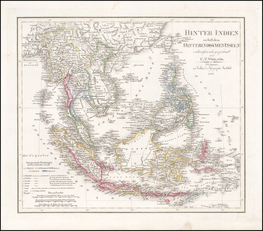
Scarce and highly detailed map of Southeast Asia, including southern China, the Philippines, the Malaysian Peninsula and extending south to Java, Timor and the northern tip of Australia.
Includes rivers, some early roads, towns, topographical details, islands and other information. The map is colored coded to note the English, Dutch, Spanish, Danish and Portuguese colonies in the region.
If you are a student, write to us in telegram: @antiquemaps and indicate what material you need and for what work you need a map in high detail. We are ready to provide material on special terms. For students only!
![[Signed Political Satire Artwork] Vietnam ... Vietnam ... Vietnam ...](/map/small/68726.jpg)
![[Martin Behaim Globe / Book] Pars Globi terrestris Ao. 1492 a Martino Behaim Equite Lusitano Norimbergae confecti Delineavit Christoph. Theoph de Murr 1778 (bound with:) Diplomatische Geschichte des Portugesischen berühmten Ritters Martin Behaims](/map/small/68828.jpg)
![Il Disegno Della Terza Parte Dell' Asia [Gastaldi's Wall Map of SE Asia with extra panels!]](/map/small/30554hbp.jpg)