

The First European Printed Map of Hong Kong Region -- Guangzhou, & Macao Fine example of Blaeu's map of the Canton or Guangdong Province, including Hong Kong, Guangzhou and Macao. Includes the Pearl River Delta and the Island of Hainan. The map...
A Rare Early English Map of China Drawn From Chinese Sources Alvarez de Smedo's map of China is one of the earliest maps of China published in Europe, derived directly from Chinese sources. This rare and important early English map is based upon...
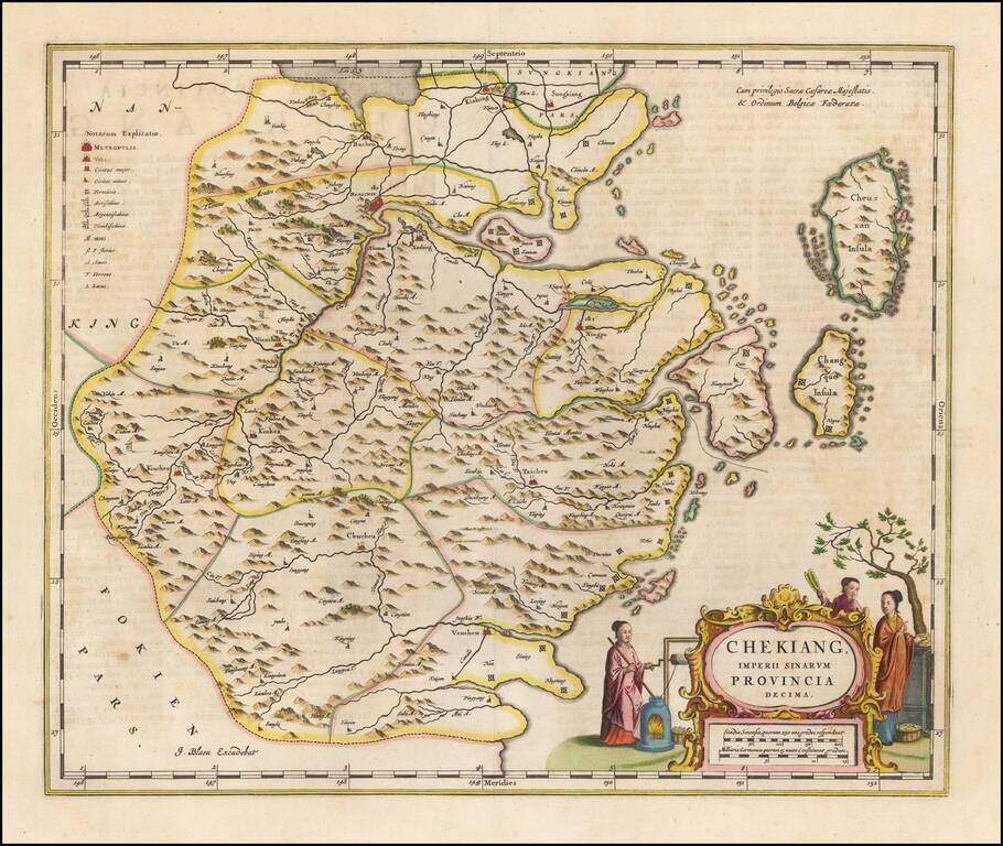
Nice old color example of Blaeu's map of the Chekiang region, including the cities of Shanghai, Hangzhou and Ningpo and the sacred islands. Decorative map of the province, based on the maps of Jesuit missionary Martino Martini, the map features many...
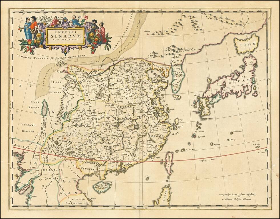
Nice example of Blaeu's map of China, from the Atlas Sinensis. A important general map of China, Korea and Japan, published by Joan Blaeu in the Jesuit Martino Martini's Atlas Sinensis , the first western atlas of China. The map Incorporates the...
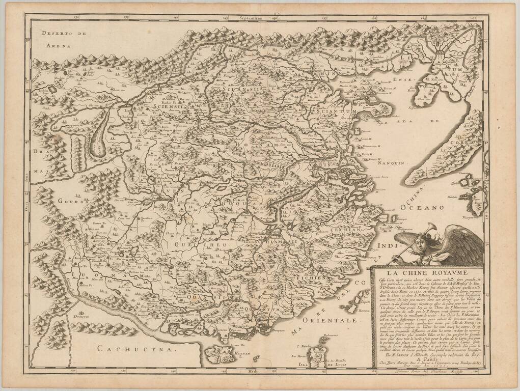
First state of Sanson's scarce map of China and Korea, first published in 1656. This important and attractive French map of China is based on an indigenous Chinese map copied by Jesuit, Matteo Ricci, and brought back to Rome in 1590 by his fellow...
![Reys-Kaerte Vande Ambassade Der Nederlantse Oost Indise Compagnie door China aen den Grooten Tartersen Cham der Johan Nieuhoff . . . [title repeated in French, Latin & German]](/map/small/58896.jpg)
An Early Dutch Map of China From VOC Sources Important early map of China, which accompanied Johann Nieuhoff's important account of his travels in China, one of the earliest non-Jesuit accounts of the region. Johann Nieuhoff was the official...
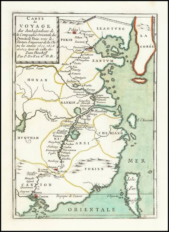
Scarce map of China, extending from Beijing, Korea and the Great Wall of China in the north to Canton, Macao and Formosa. The map illustrates the Dutch expedition to China led by Johan Nieuhof in 1655-57. In the first half of the 17th century, the...
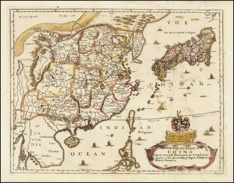
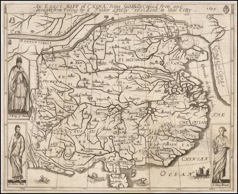
Rare Second State of Richard Blome's Map of China. Finely colored example of Richard Blome's scarce early map of China, with coat of arms and dedication to the London Lawyer Thomas Robinson. Unlike most of Blome's maps, the present map is based upon...
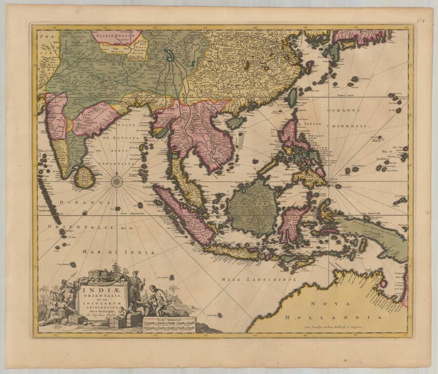
Detailed map of Southeast Asia and the North Coast of Australia, published in Amsterdam by Nicolas Visscher. The map extends from India and the Maldives in the west to New Guinea and the southern coast of Japan in the east, centered on the Stratis of...
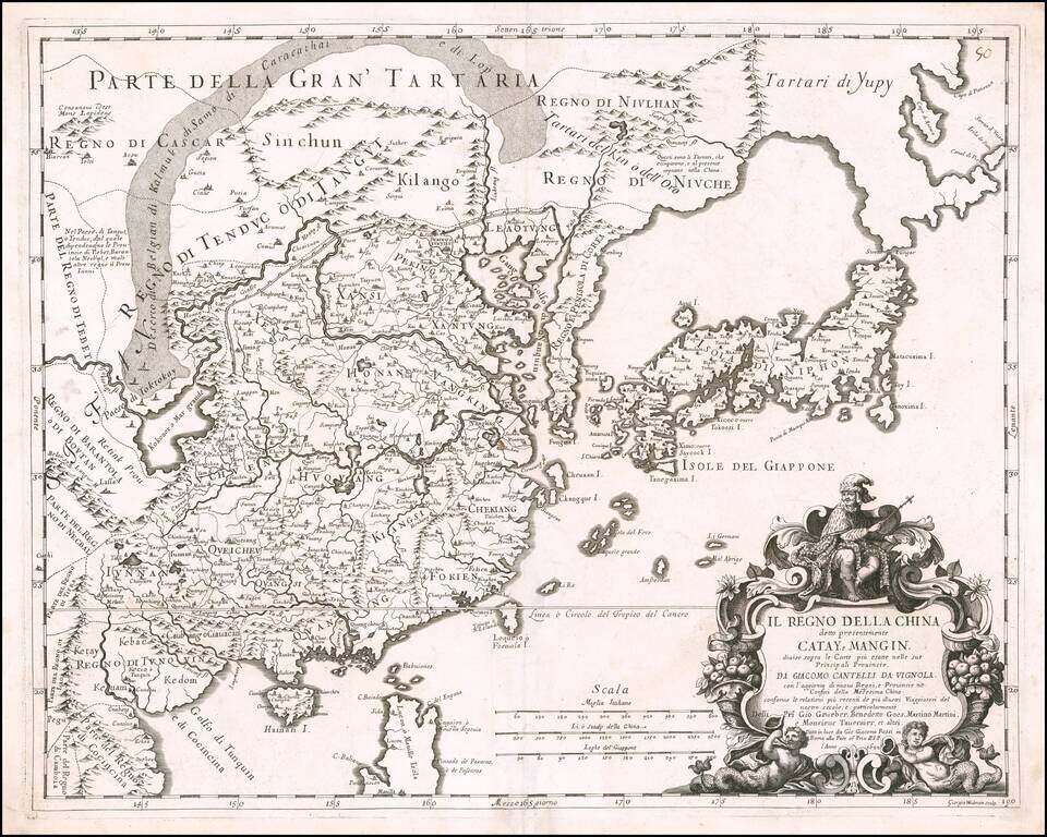
Rare 17th Century Italian Map of China Finely colored example of this rare early map of China, Japan and Korea, along with neighboring regions, by Cantelli da Vignola and published in Rome by Rossi. The map was engraved by Giorgio Widman for Rossi's...
First edition of this rare Jesuit map of China, published by Jean Baptiste Nolin in Paris. The map first appeared in 1686 in the present form, then was reissued without the text at the bottom of the map in Philippe Couplet's Tabula Chronologica...
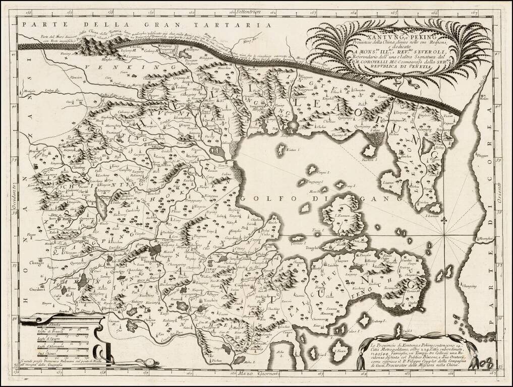
Fine example of Coronelli's map of the provinces of Shantung and Peking, from Coronelli's rare Corso Geografico Universale, one of the most decorative and ornate of the 17th century. Coronelli's map exhibits in fine detail the features of the region,...
![[Shanghai & Yangtze River] Nanking, et Honan Provincie della China . . .](/map/small/46304.jpg)
Nice example of Coronelli's regional map the eastern Chinese Provinces of Nanking and Honan with a typically ornate cartouche at lower left with title and crest above. The map provides an early look at the areas around Shanghai, Hangzhou, Jinan,...
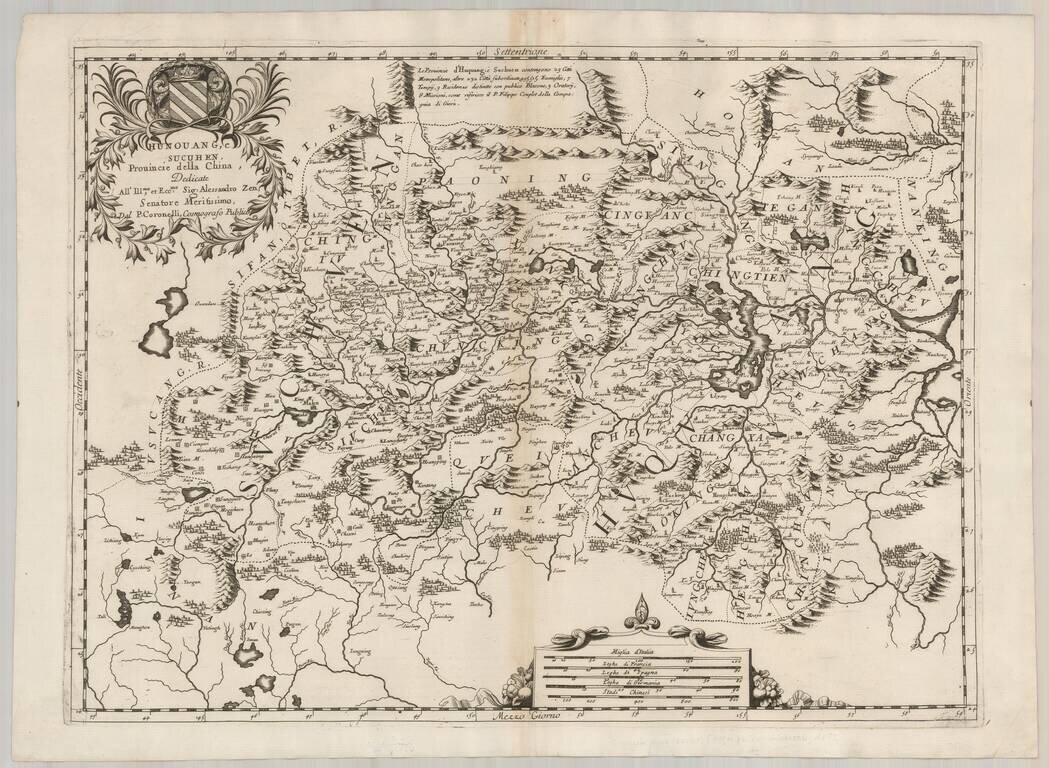
Decorative and highly detailed regional map of China, including parts of the Szechwan and Hunan Provinces. Shows the city of Chungking along the Yangtze River. Many decorative embellishments, including title cartouche and elaborate coat of arms....
![[Includes the Isle of Luzon or Manila!] Quantung, e Fokien, Provincie della China . . .](/map/small/62758.jpg)
Fine Map of Coastal China with the Island of Luzon or Manila Fine example of Coronelli's map of the provinces of Guandong, Guangxi Fujian and Jiangxi, including Hainan, Hong Kong, Guangzhou, and Taiwan from Coronelli's rare Corso Geografico...
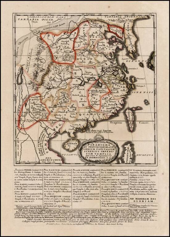
![Parte Occidentale della China . . . [with] Parte Orientale della China . . .](/map/small/64242.jpg)
Coronelli’s Map of China—Rare Original Color Example Fine example of Coronelli's striking two-sheet map of China. The work is in original color, a rarity for a map that is one of the most sought after of large-format maps of China. The map covers...