
Rare engraved map of southern Africa, from Pierre Du Val's La Gegoraphie Universelle. This is a later state of a map that first appeared in 1663. In this state Table Bay and Aghulhas Bank are named. This map was published at the time that the first...
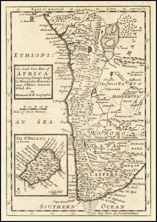
Attractive map of Southern Africa, shortly before the first Dutch settlement in the region. The area shown is from the Congo River basin around the Cape of Good Hope and up the east coast as far as northern present-day Mozambique. Many coastal names...
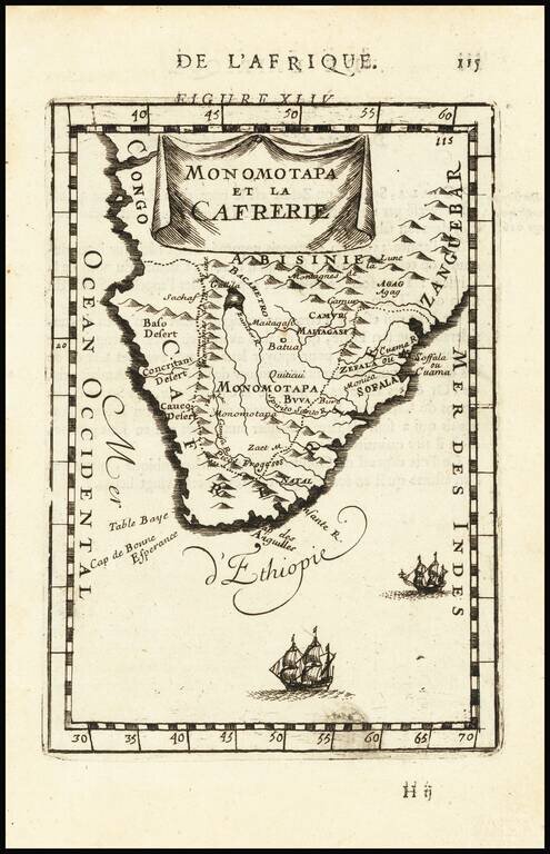
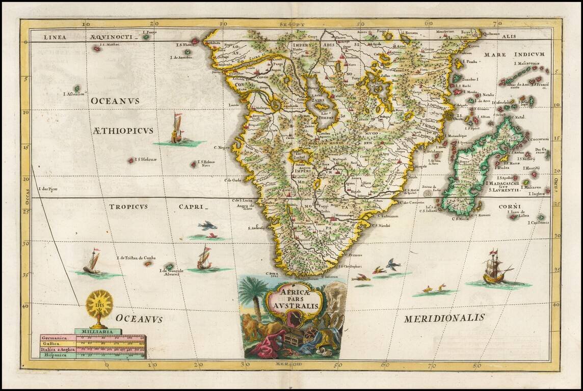
Decorative map of South Africa, from Mallet's monumental Description de l' Univers, first published in Paris in 1683, perhaps the greatest work of its kind in the 17th century.
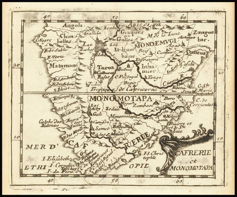
Attractive map of Southern Africa and part of Madagascar, shortly before the first Dutch settlement in the region. The area shown is from the Congo River basin around the Cape of Good Hope and up the east coast as far as northern present-day...
Decorative regional map of South Africa and Madagascar, from Scherer's monumental Jesuit inspired work.
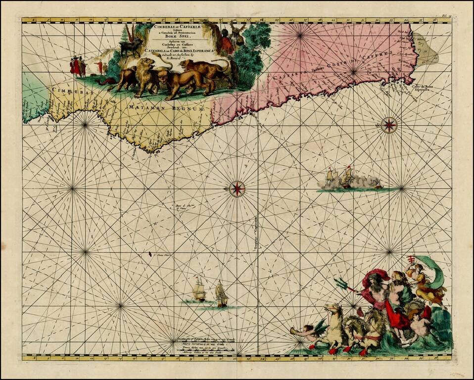
Nice old color example of Louis Renard's sea chart of the Southwestern Coast of Africa. Striking sea chart, with detailed treatment of the coastal regions, rhumb lines, compass roses, elaborate cartouches and sailing ships.
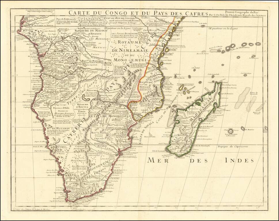
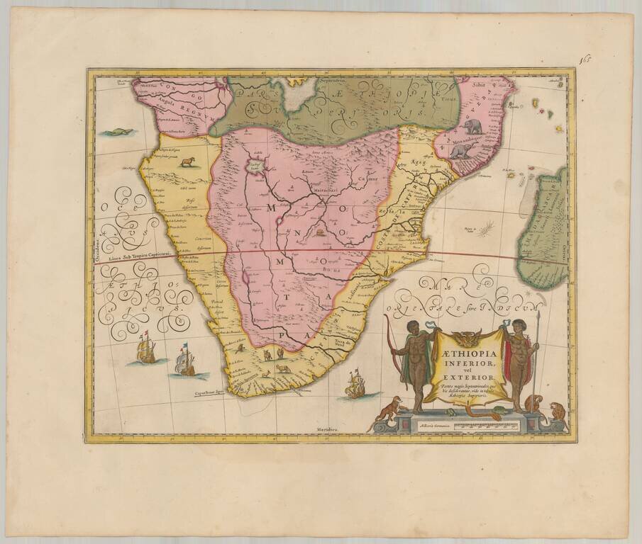
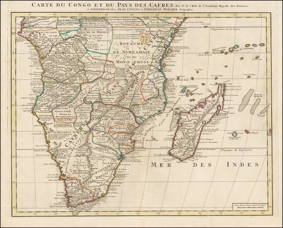
De L’Isle’s Fine Map of Southern Africa Striking example of De L'Isle's impressive map of South Africa and Madagascar, showing De L’Isle’s characteristic precision and attention to detail. Stretching from Congo in the north to what is now...
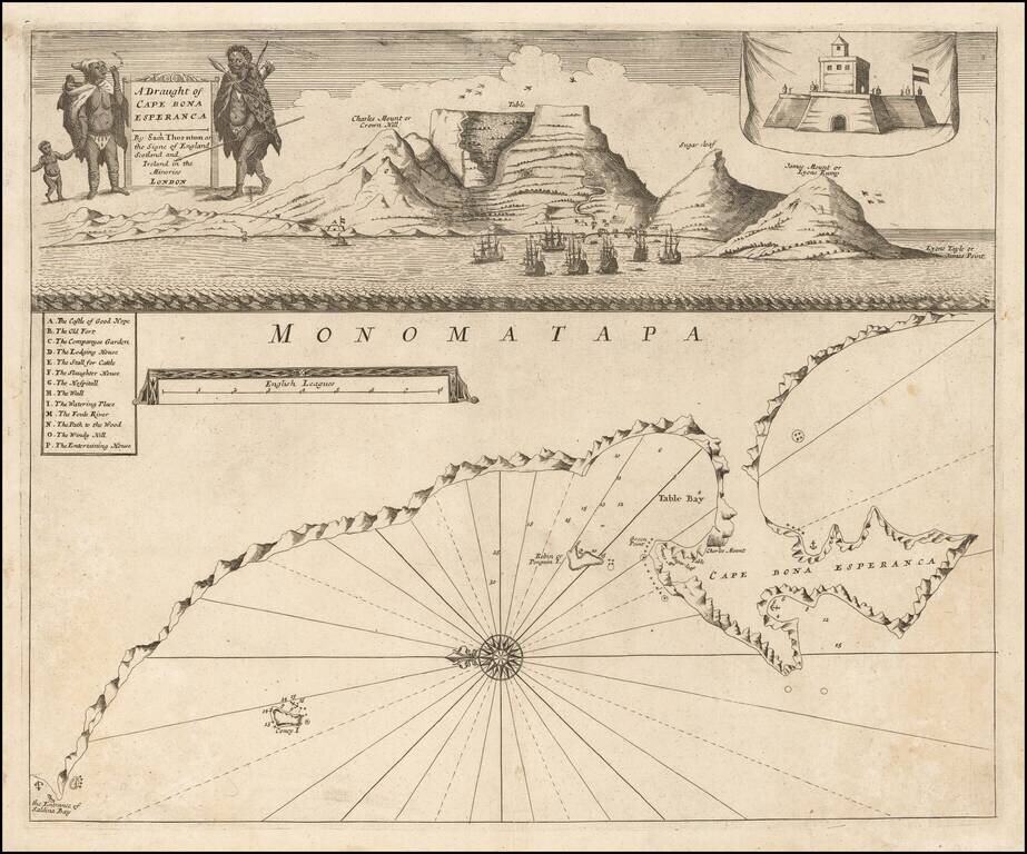
Rare 1711 edition of John Thornton's engraved chart of the Cape of Good Hope, published posthumously by his brother, Samuel Thornton. The bottom image comprises a sea cart from Table Bay to False Bay with superimposed coastal profiles. Above that is...
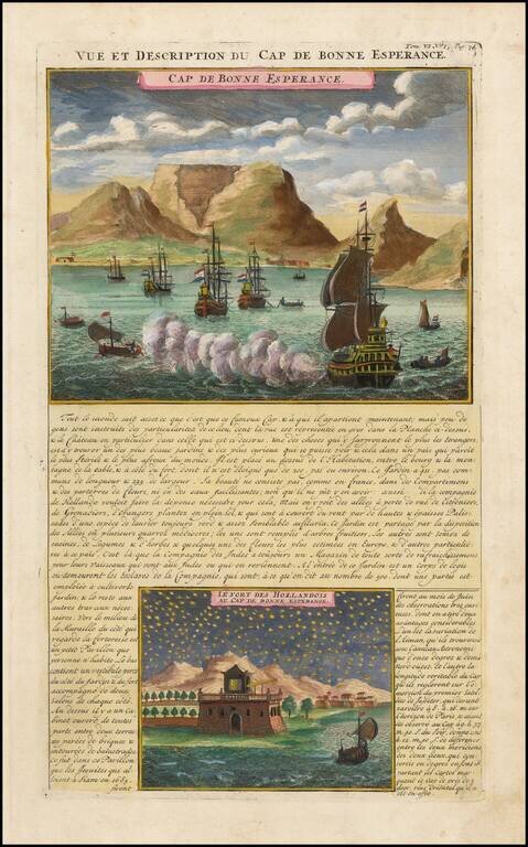
Striking view of the Cape of Good Hope, with Dutch ships in the harbor and Table Mountain in the background. A night view of the Dutch Fort at the Cape is shown below. Chatelain's Atlas Historique, published in 7 volumes at the beginning of the 18th...
![[Cape of Good Hope, South Africa]](/map/small/41893.jpg)
Fine Chart of the Cape of Good Hope from an Important History of the Dutch in the East Indies Nice example of Francois Valentijn's chart of the coast of South Africa near the Cape of Good Hope and Table Bay. It featured in his Oud en Nieuw...
Interesting early 18th Century map of a part of the Southwest Coast of Africa. Includes compass rose.
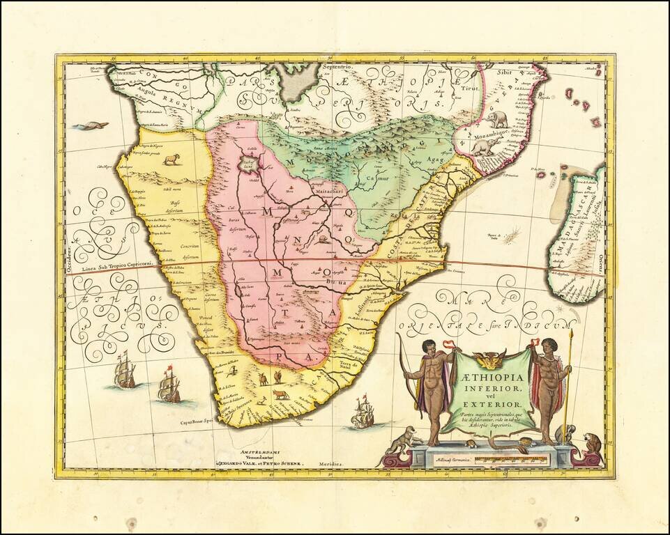
Strikingly engraved and detailed map of South Africa and Madagascar, with extensive notes regarding the local tribes, geography, mines, rivers, mountains, etc. One of the most attractive and scientifically detailed maps of the region published during...
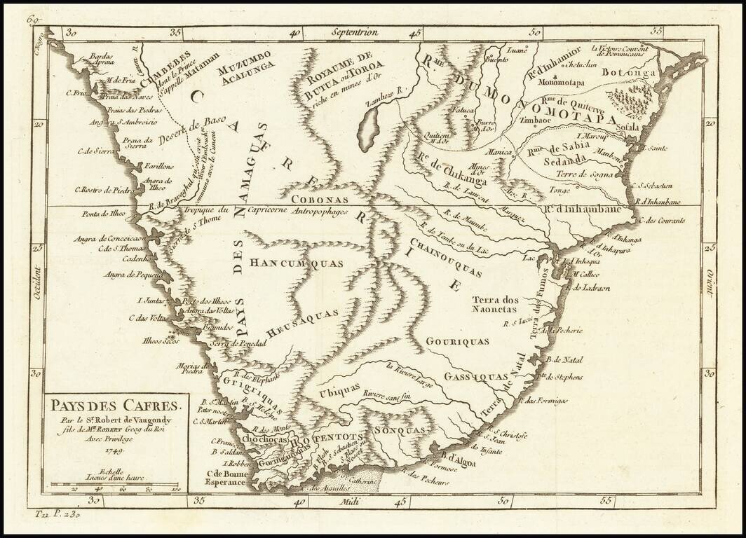
Attractive map of South Africa, from this popular atlas of the mid-18th Century.
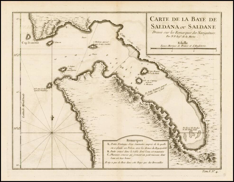
Detailed plan of Saldanha Bay, northwest of Cape Town In South Africa, published by Bellin, the Royal Hydrographer to the King of France.
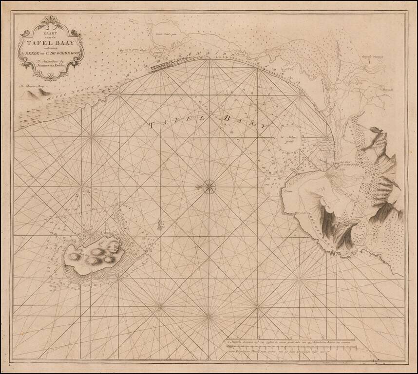
The First Modern Map of Table Bay, South Africa Cornerstone map of Table Bay and Cape Town, South Africa, from the extremely rare and important "Secret Atlas" of the Dutch East India Company (VOC). While it has been suggested that the chart may have...
![[False Bay] In de Baay Falso](/map/small/61861.jpg)
False Bay / Cape Town, South Africa Rare chart of False Bay, which appeared in the so-called VOC Secret Atlas. The map shows "Post-huys", the signal blockhouse built as an observation post controlling False Bay and which was completed in 1673, a year...