
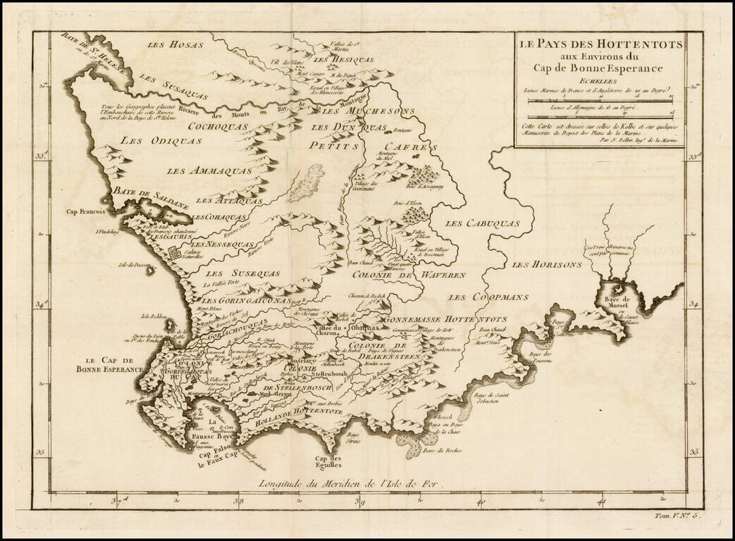
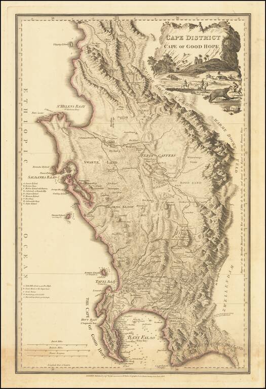
Detailed map of a portion of South Africa, from Baye de St. Helen and Baye Saldane in the West, to Baye de Musssel in the East, centered on the Dutch Hottentot regions and Petit Cafres. Shows tribes, rivers, towns, mountains, lakes, bays, capes, and a...
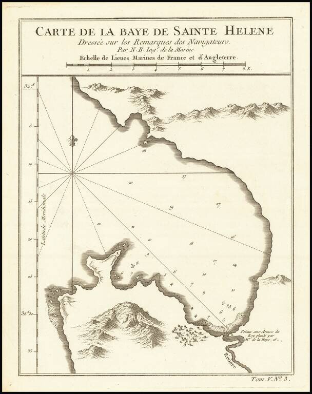
Detailed plan of St. Helena Bay, northwest of Capetown, South Africa.
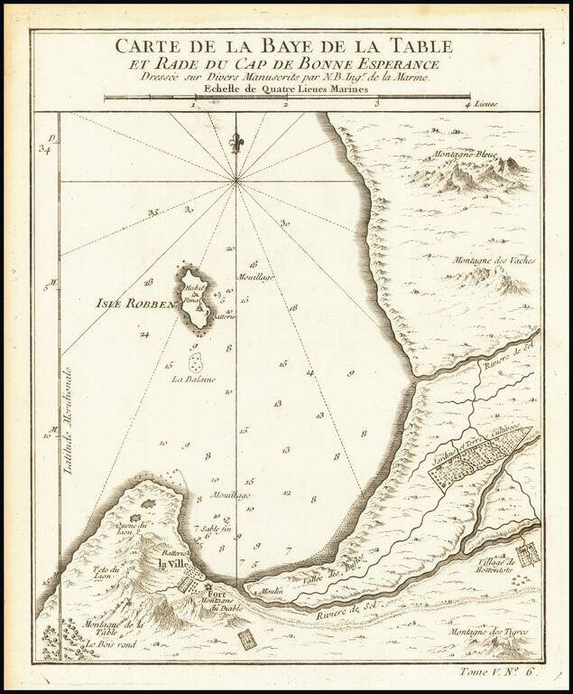
Detailed map of the Table Bay and Robben Island, extending north to Montagne Bleue. Includes nice topographical detail. Shows towns, fortifications, cultivated farming areas, etc.
Rare and quite late separately published map of South Africa, including inset maps of the Cape of of Good Hope/Table Bay, Saldanha Bay, and Cape Fort. The "Com Post" near Seekoe Valley, the east, became Vergelegen the famous farm, still in existence,...
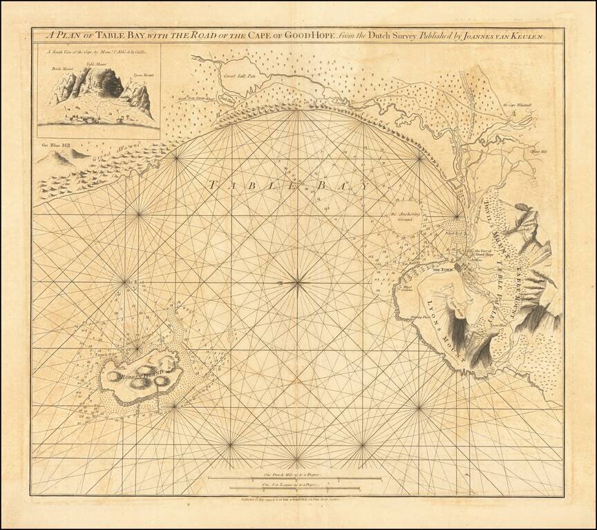
Rare First State of Sayer's Map of Table Bay Scarce chart of Table Bay and the Cape of Good Hope, published by Robert Sayer. The route of the Salt River is shown entering the bay just to the east of Capetown, which is shown in detail with the fort,...
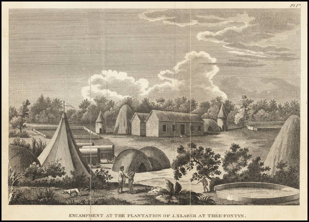
Copper plate engraved image of a plantation in South Africa, from New travels into the interior parts of Africa, by the way of the Cape of Good Hope, in the years 1783, 84 and 85. . . . by Francois Valliant. François Levaillant was a French author,...
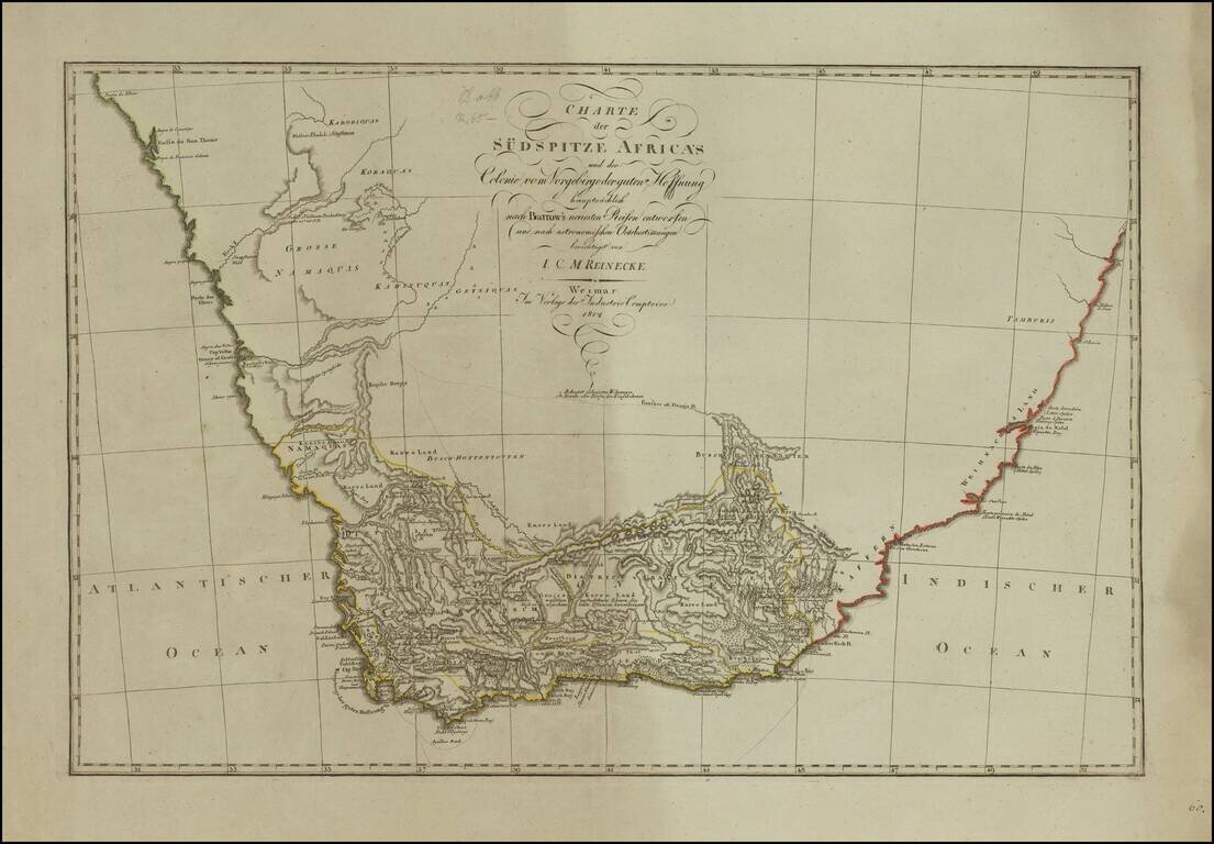
German edition of the First Modern Map of South Africa Detailed map of South Africa, published in Weimar in 1802, based upon a map produced by Sir John Barrow, which is considered the first modern map of South Africa. The map shows the settled and...
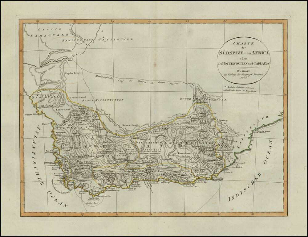
Scarce map of South Africa, published in Weimar in 1806. Includes details on Boer Villages and other colonist details in the region. A scarce map -- this is the first example we have seen.
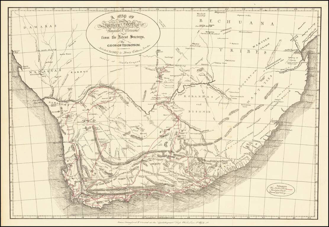
Early map of Southern Africa, illustrating the travels of George Thompson. The map illustrates Thompson's route, the Mantatee track (indigenous people) and the boundaries of the colony. Thompson was the author of a two-volume travelogue describing...
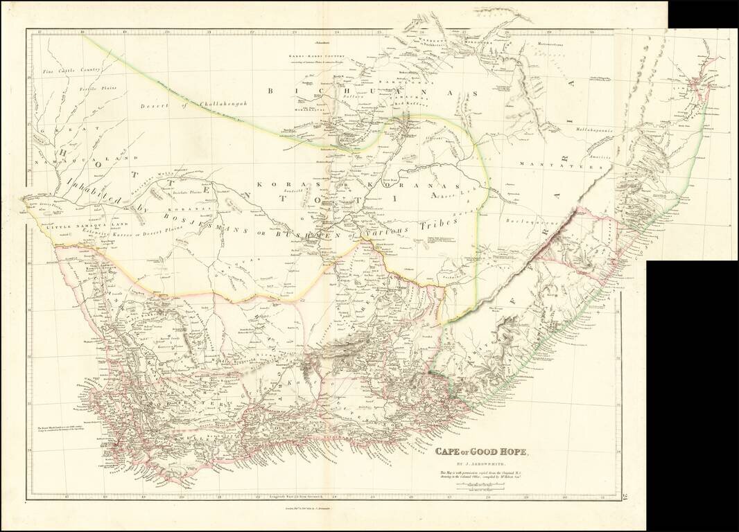
Early Appearances of Durban and Victoria. Fine example of the 1836 state of Arrowsmith's map of the Cape of Good Hope, one of the earliest maps to show Durban ("D'Urban") and Victoria. Lydiana appears, now a suburb of Pretoria. One of the best maps...
Wyld's Reissue of Faden's Detailed Map of the Cape Town Region. 1838 edition of this highly detailed map of the Dutch Colony on the Cape of Good Hope, first published in 1782. This attractive map gives an idea of contemporary knowledge of the area...
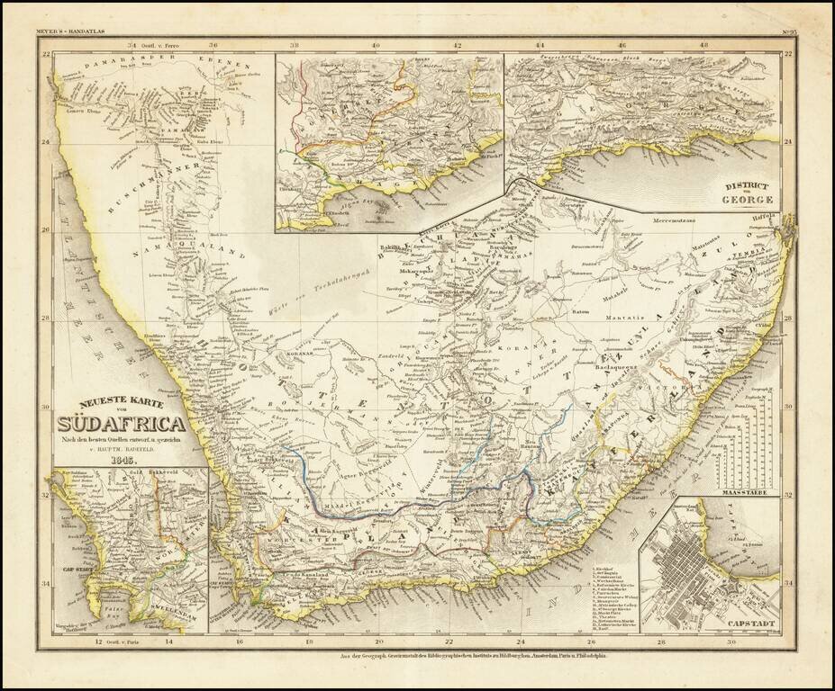
Detailed regional map of South Africa, with 4 inset maps. From Meyer's Hand Atlas. Extremely detailed regional map. A marvelous example of the fine, precise German engraving style of the mid-19th Century.
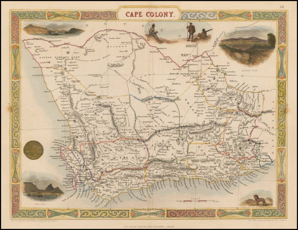
Striking full color example of Tallis' decorative map of Cape Colony, South Africa. Decorative vignettes of Entrance to the Knysna, Graham Town anand Cape Town. Engraved for R. Montgomery Martin's Illustrated Atlas. Tallis was one of the last great...
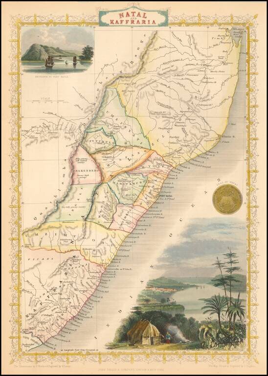
Striking full color example of this marvelous map. Decorative vignettes of Entrance to Port Natal. Engraved for R. Montgomery Martin's Illustrated Atlas. Tallis was one of the last great decorative map makers. His maps are prized for the wonderful...
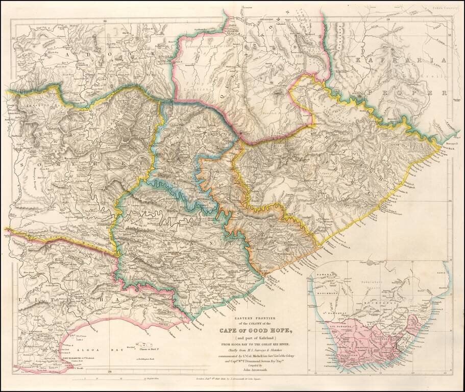
Highly detailed map of the Eastern Frontier of the Colony of the Cape of Good Hope, published by John Arrowmsith in London. Fine example of John Arrowsmith's meticulous style and remains one of the finest nineteenth century maps of the area. The map...
![Africa [Southern Sheet]](/map/small/70118.jpg)
Interesting map of Southern Africa and Madagascar, covering the region from Zanzibar and Lower Guinea to Cape Colony. A large Unrecorded Area appears in the interior, with several annotations and early information for the region. Many placenames,...