
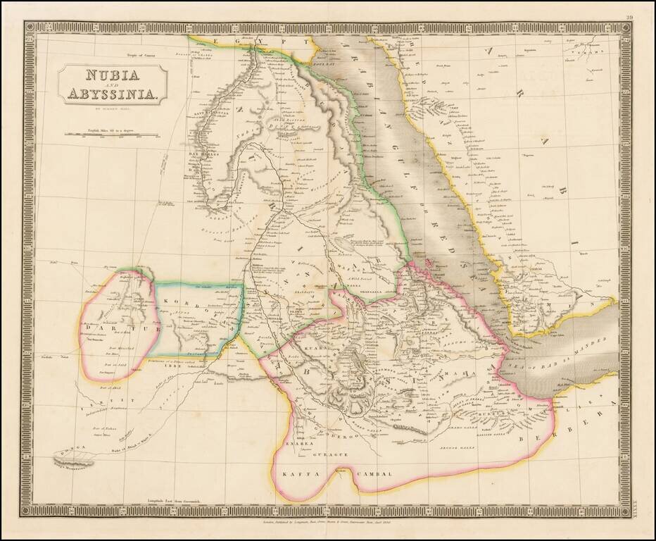
Decorative map of Nubia, Abyssinia and the Arabian Sea, published in London by Sidney Hall. Excellent detail. Includes towns, roads, annotations and other fine details.
![Карта Варварийскихъ Владѣній [Map of the Barbary Possessions]](/map/small/66623.jpg)
Detailed and very rare Russian-language map of North Africa, focused on the Barbary Coast, published in Saint Petersburg in 1836. The map differentiates between "Morocco", "Algier", "Tunis", and "Tripoli". Rarity The map is very scarce. We have been...
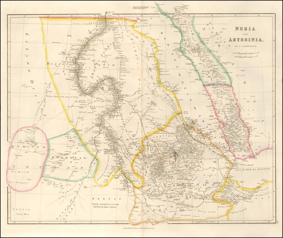
An attractive map of the region centered on the Red Sea and the upper Nile, starting at the first cataract. The map extends to Somalia, Sudan, and Darfur in the west and to Yemen and the Sea of Bab-El-Mandeb in the east. Numerous towns, mountains,...
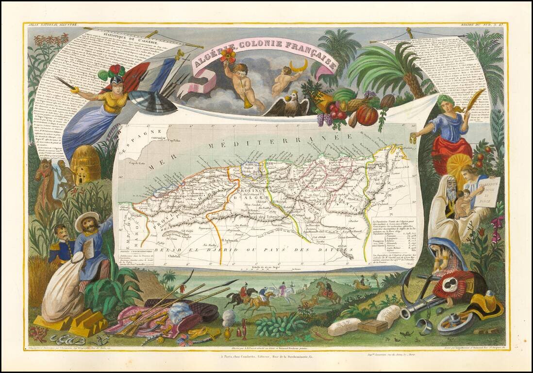
Decorative map of the French Colonie of Algeria. Engraved by Raimond Bonheur, father of the famous French artist Rosa Bonheur.
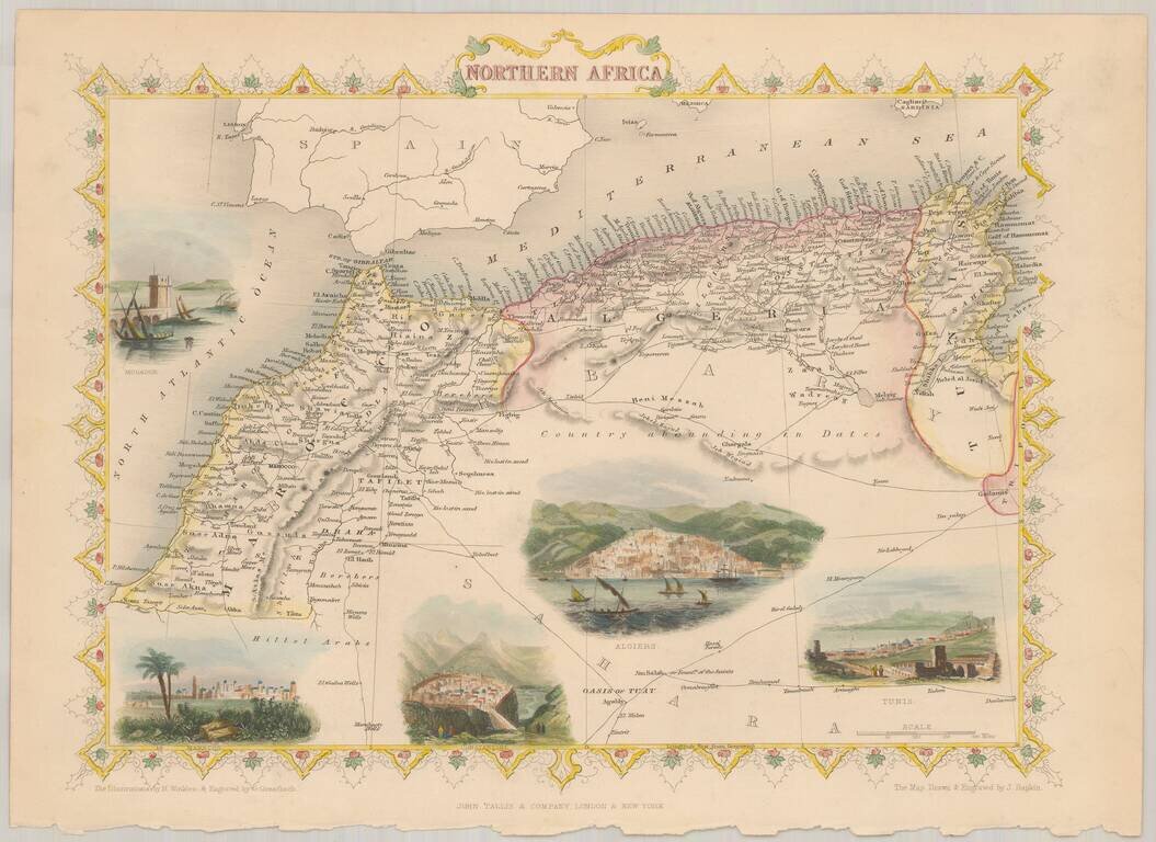
Decorative full color example of Tallis' map of Northern Africa, with vignettes showing Morocco, Constantine, Tunis, Algiers and Mogador. The map was engraved for R. Montgomery Martin's Illustrated Atlas. Tallis was one of the last great decorative...
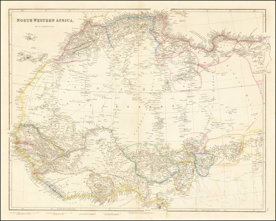
Detailed map of north and west Africa, published by John Arrowsmith in his London Atlas. The map is dominated by the Sahara Desert. In the Sahara, map is cris-crossed with early trading routes, oasises, and the location of Desert Wells.
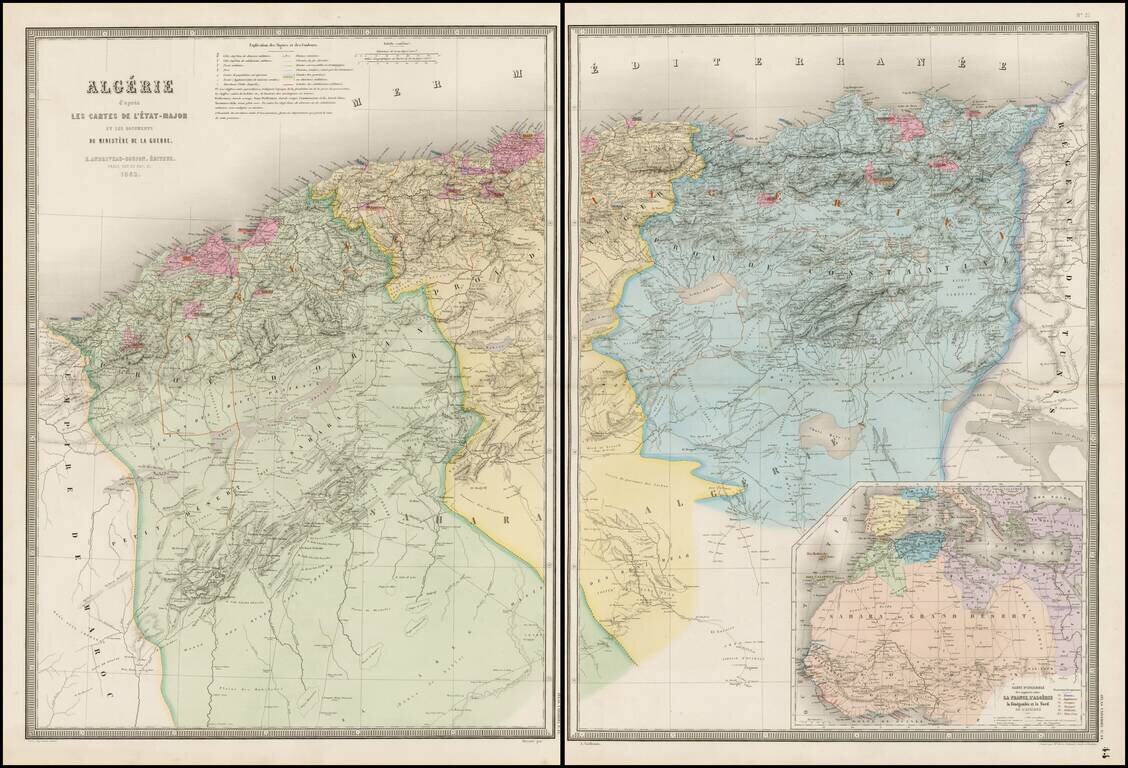
Stunning full color example of Andriveau-Goujon's 2-sheet map of Algeria. Fantastically detailed map of Algeria, with towns, roads, rivers, mountains, lakes, etc.
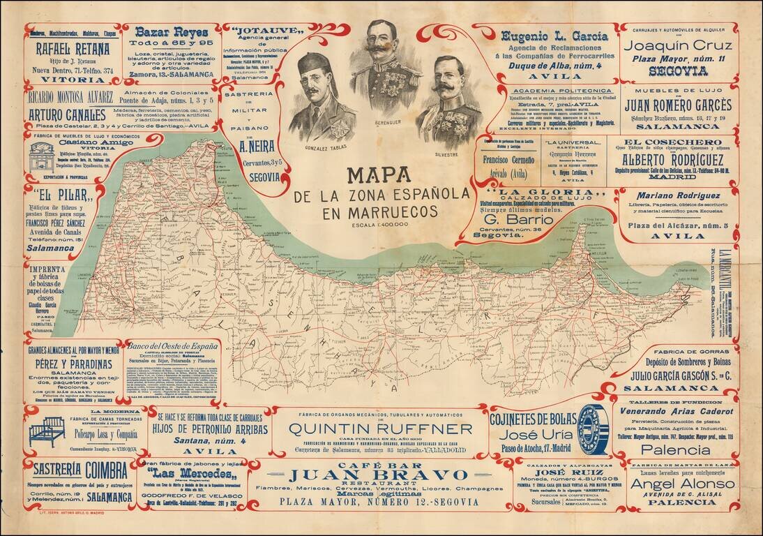
A Rare Promotional Map of Spanish Morocco Rare advertising map of Northern Morocco, during the Spanish Protectorate Period. The map includes the portraits of Spanish Foreign Legion "Africanistas": Lieutenant Colonel Santiago Gonzalez Tablas...
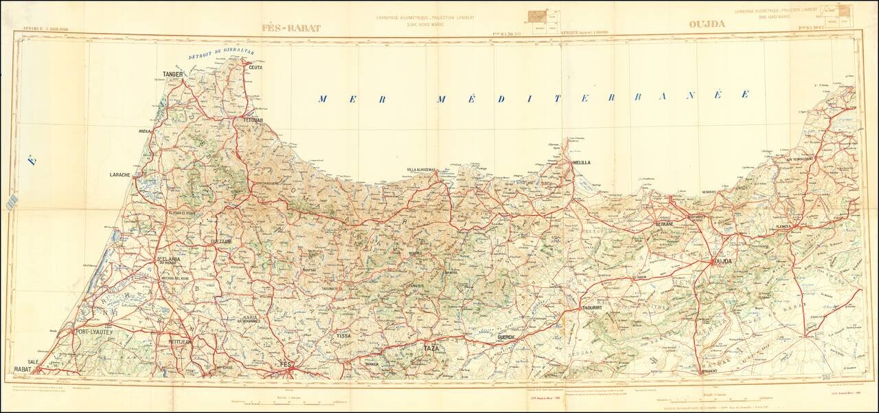
Detailed 2-sheet folding map of the northern part of Morocco, published by the Moroccan Geographical Service. The map focuses on roads and topographical features.
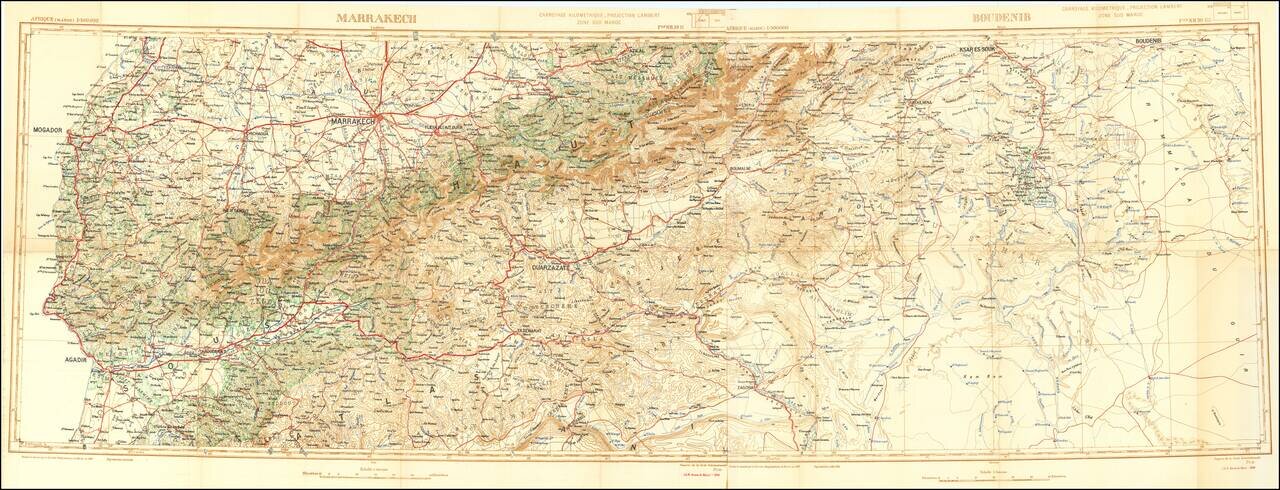
Detailed 2-sheet folding map of the central part of Morocco, published by the Moroccan Geographical Service. The map focuses on roads and topographical features.
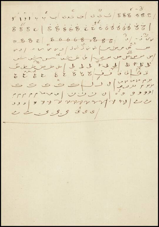
Remarkable Manuscript Collection of the French Invasion of Algeria, From the Collection of the Duke of Orléans Striking collection of 46 manuscript maps, and a few documents, showing northern Algeria. The maps date from the French invasion of Algeria...
Remarkable Manuscript Collection of the French Invasion of Algeria, From the Collection of the Duke of Orléans Striking collection of 46 manuscript maps, and a few documents, showing northern Algeria. The maps date from the French invasion of Algeria...
Remarkable Manuscript Collection of the French Invasion of Algeria, From the Collection of the Duke of Orléans Striking collection of 46 manuscript maps, and a few documents, showing northern Algeria. The maps date from the French invasion of Algeria...
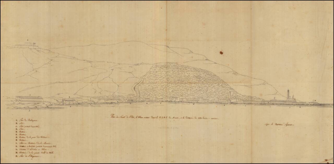
Remarkable Manuscript Collection of the French Invasion of Algeria, From the Collection of the Duke of Orléans Striking collection of 46 manuscript maps, and a few documents, showing northern Algeria. The maps date from the French invasion of Algeria...
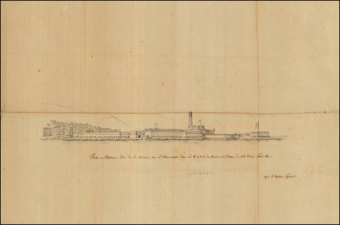
Remarkable Manuscript Collection of the French Invasion of Algeria, From the Collection of the Duke of Orléans Striking collection of 46 manuscript maps, and a few documents, showing northern Algeria. The maps date from the French invasion of Algeria...
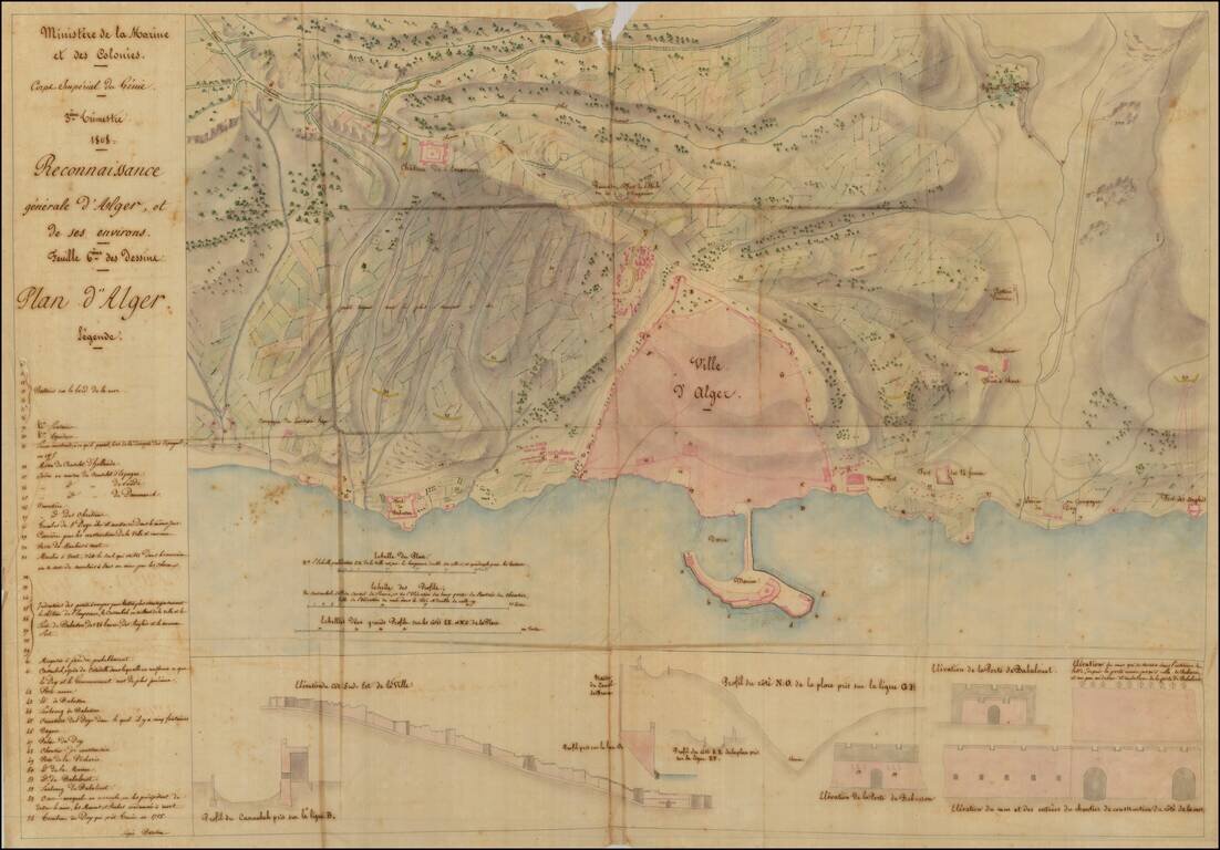
Remarkable Manuscript Collection of the French Invasion of Algeria, From the Collection of the Duke of Orléans Striking collection of 46 manuscript maps, and a few documents, showing northern Algeria. The maps date from the French invasion of Algeria...