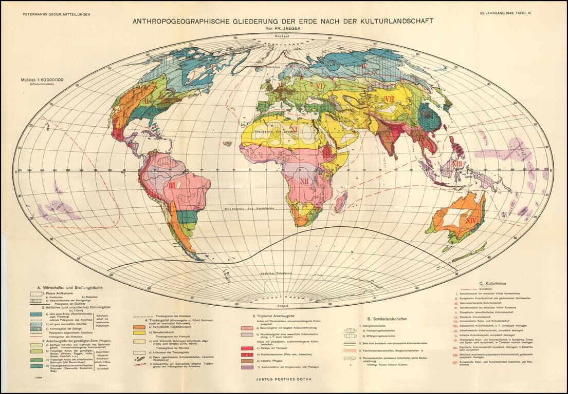
Fritz Jaeger's Anthropogeographic Outline of the Earth After the Cultural Landscape. The world is illustrated in 3 major groups: Economic and Sectarian Special Landscapes -- Regions conducive to manufacturing, mining, etc. Cultural Landscapes
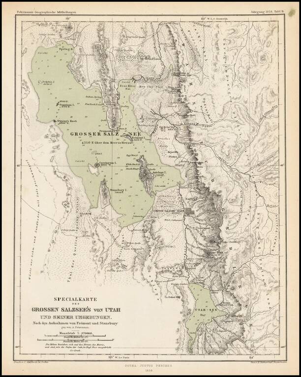
Scarce and highly detailed map of part of Utah in the Salt Lake and Wasatch region, published by Augustus Petermann. The map names numerous early Utah towns, including: Provo Salt Lake City (with a town grid) Springville Brigham City Palmyra Payson...
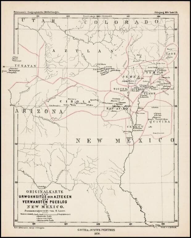
Scarce German map showing locating the major Indian Tribes of New Mexico and the Ancient Indian Regions, from Petermann's Geographishce Mittheilungen. Names of the regions of the old Aztecs settlements are given on the map: Aztlan, Tusayan, Cibola,...
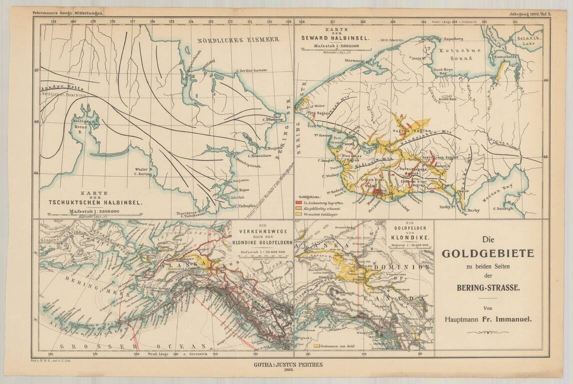
Fine set of four maps, highlighting the gold regions in Alaska and the Behring Straits, published by A.H. Petermann. The maps including the following: The Klondike Gold Region The Seward Peninsula Gold Region Routes to the Klondike Gold Fields...
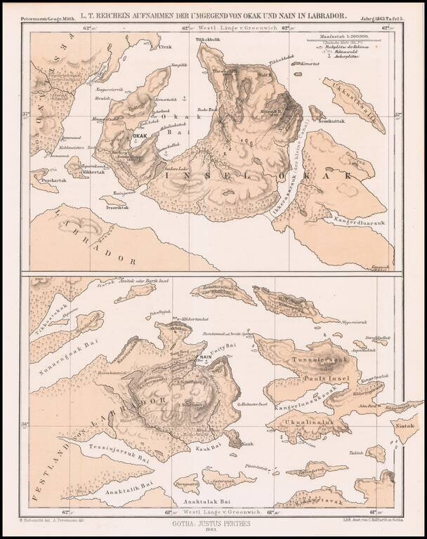
Detailed map of a portion of Labrador, published by Augustus Peterman. Includes Petermann's report on the region.
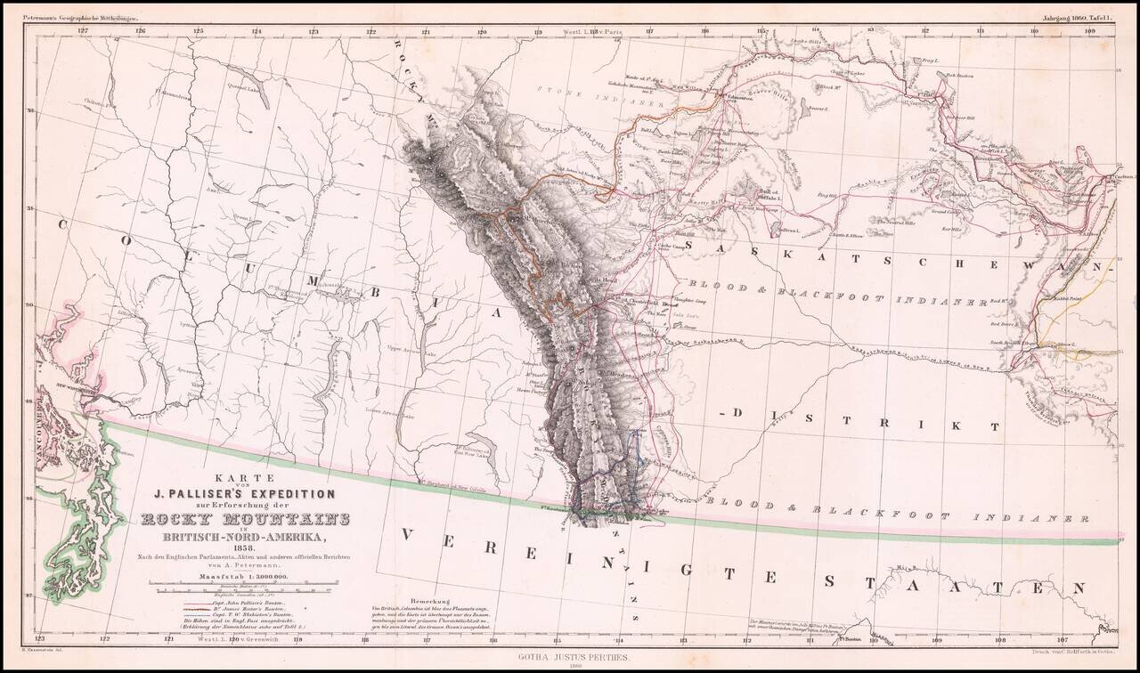
Detailed map of Western Canada illustrating the western part of Captain John Palliser's explorations in Western Canada, based upon Palliser's virtually unobtainable map published about three years earlier. The map shows the disputed boundary claim...
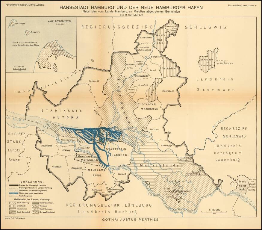
Detailed map of the area around the city of Hamburg. The map illustrates the growth of the various regions of this Hanseatic port, on the eve of World War II. The map translates as follows: Hanseatic City of Hamburg and the New Hamburg Harbor...
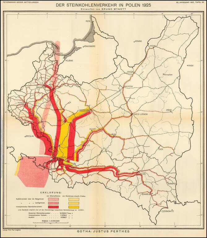
Thematic map of Poland, showing the Coal Industry in 1925, based upon the work of Bruno Mynett, Der Steinkohlenverkehr innerhalb Polens. The map was published by Augustus Petermann in 1937, based upon Bruno Mynett's book

Detailed map of the Nova Zemla region, focusing on the polar voyages in the region in the 1870s. The following explorer routes are noted: Johannsen 1869 Johannsen 1870 F.C. Mack 1871 Johannsen 1871 Tobiesen 1871 Isacksen 1871 Dorma 1871 Rosenthal...
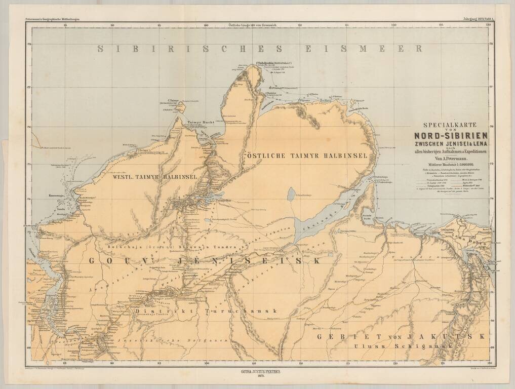
Finely detailed map of Asian Russia and Western Siberia, illustrating Russian Exploration in the reigon. The map is based upon earlier maps by Faden and other mapmakers, and illustrates the explorations and routes of the following explorers of the...
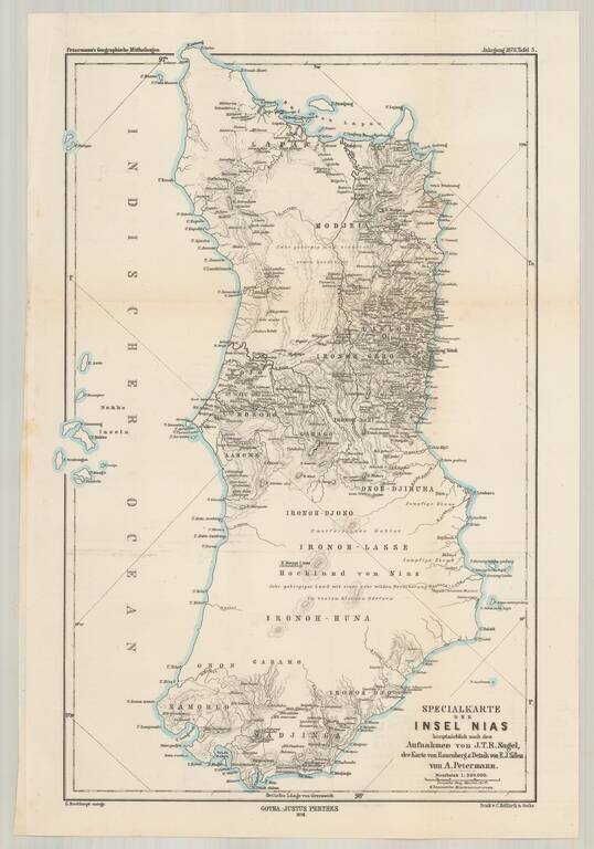
Highly detailed map of the Island of Nias (Pulau Nias) off the west coast of Sumatra , depicting the most recent explorations. This is one of the earliest printed maps to provide significant detail for this island and includes a fairly extensive...
![[Lake Tanganyika, Lake Victoria and Northwest Tanzania]](/map/small/63611.jpg)
Fine early map of Northeast Tanzania, published as part of a Petermann & Hassenstein's map of Inner Africa. The map features a number of roads and the routes of 19th Century African explorers, including: Burton & Speke - 1857-58 Speke -...
![[Uganda - South Sudan ]](/map/small/63642.jpg)
Fine early map of Northern Uganda,Lake Albert and the southern part of South Sudan, published as part of a Petermann & Hassenstein's map of Inner Africa. The map features a number of roads and the routes of 19th Century African explorers,...
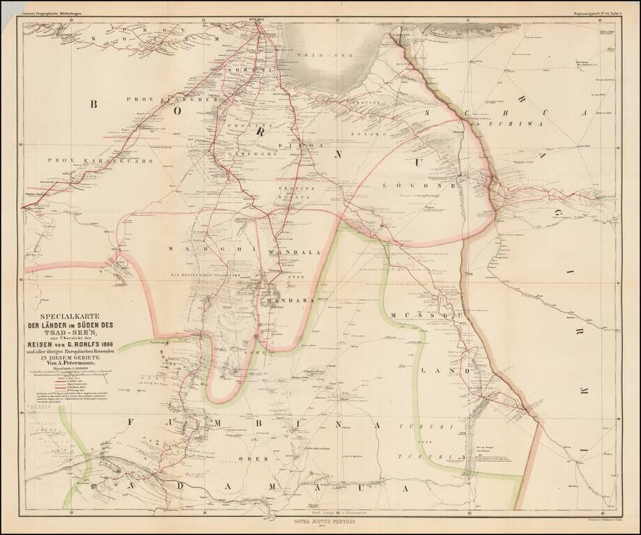
Scarce map of central Africa, illustrating the region to the south of Lake Chad, focusing on the explorations of Gerhard Rohlfs. The map identifies the routes of a number of explorers, including: Gerhard Rohlfs -- 1866 Major Denham -- 1824 Dr. M....
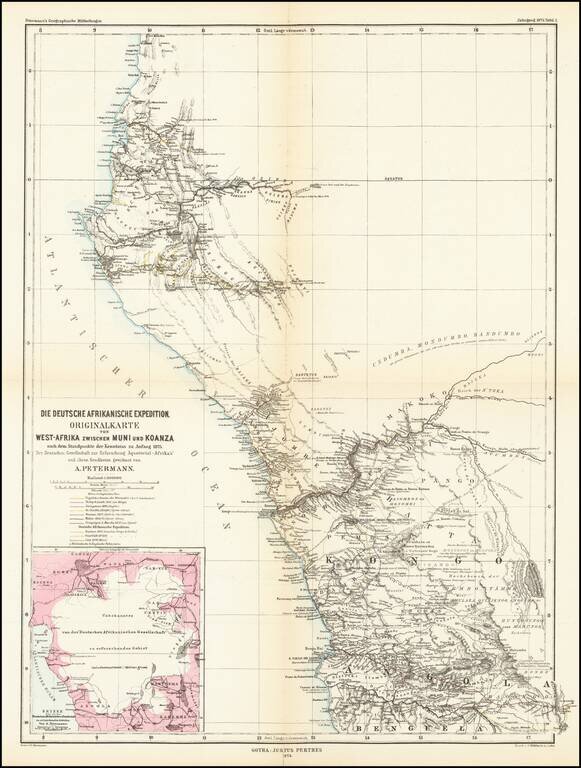
Detailed map of West Africa, showing explorers routes in the region. The map shows the expeditions between Muni River Region (Equatorial Guinea) to Koanza River Region of northern Angola. The map shows the routes of the following explorers: 16th...
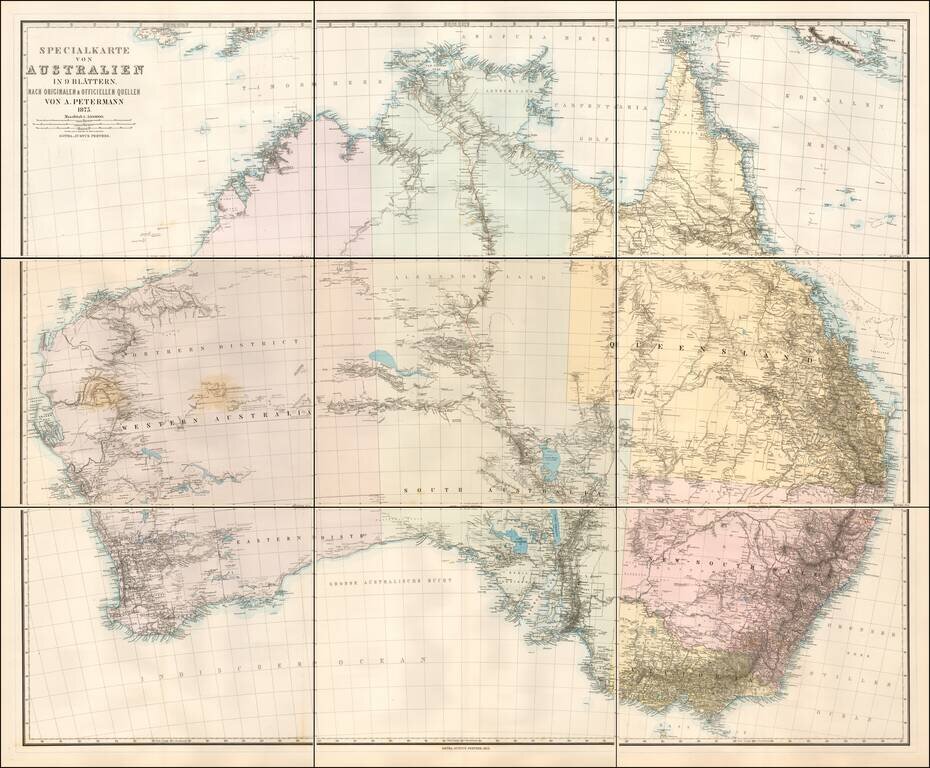
Scarce 9 sheet map of Australia, published by Augustus Petermann. Large map of Australia showing towns, river system, railways and telegraph lines and county boundaries. The map features the routes taken by a number of important overland explorers,...