logo

1873. Specialkarte von Nord-Sibirien Zwischen Jenisei & Lena nach allen bisherigen Aufnahmen & Expeditionem . . . .

  • Specialkarte von Nord-Sibirien Zwischen Jenisei & Lena nach allen bisherigen Aufnahmen & Expeditionem . . .  .

Specialkarte von Nord-Sibirien Zwischen Jenisei & Lena nach allen bisherigen Aufnahmen & Expeditionem . . . . information:

Year of creation: 
Resolution size (pixels): 
 6380x4818 px
Disk Size: 
 6.17558MiB
Number of pages: 
 1
Place: 
 Gotha

Print information. Print size (Width x height in inches):
Printing at 72 dpi 
  88.61 х 66.92
Printing at 150 dpi 
 42.53 х 32.12
Printing at 300 dpi 
 21.27 х 16.06

An example of detailing the file of this map of in a printable high-resolution:

Click to open in high resolution (open in new tab).
Attention! this is just the central piece (central area 960x960 px) of the map file!
This is an example, so that you can see and study the level of detail of a given map. The entire Map will be fully available after payment!

Specialkarte von Nord-Sibirien Zwischen Jenisei & Lena nach allen bisherigen Aufnahmen & Expeditionem . . .  .

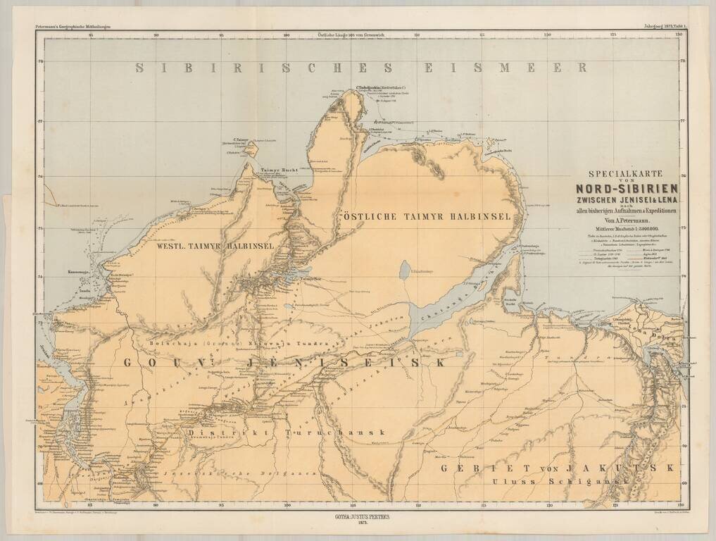
Finely detailed map of Asian Russia and Western Siberia, illustrating Russian Exploration in the reigon.

The map is based upon earlier maps by Faden and other mapmakers, and illustrates the explorations and routes of the following explorers of the region:

  • Prentsckischtschew (1736)
  • Ch. Laptew (1739-41)
  • Tschetjuskin (1742)
  • Minin & Sterlegow (1740)
  • Anjou (1823)
  • Middendorff (1843).


Special conditions for students!

If you are a student, write to us in telegram: @antiquemaps and indicate what material you need and for what work you need a map in high detail. We are ready to provide material on special terms. For students only!

Item information:

Year of creation:
Size:
6380x4818 px
Disk:
6.17558MiB
Number of pages:
1
Place:
Gotha
Author:
Augustus Herman Petermann.
$14.99

Related item