Pierre, or Pieter, Mortier (1661-1711) was a Dutch engraver, son of a French refugee. He was born in Leiden. In 1690 he was granted a privilege to publish French maps in Dutch lands. In 1693 he released the first and accompanying volume of the Neptune Francois. The third followed in 1700. His son, Cornelis (1699-1783), would partner with Johannes Covens I, creating one of the most important map publishing companies of the eighteenth century.
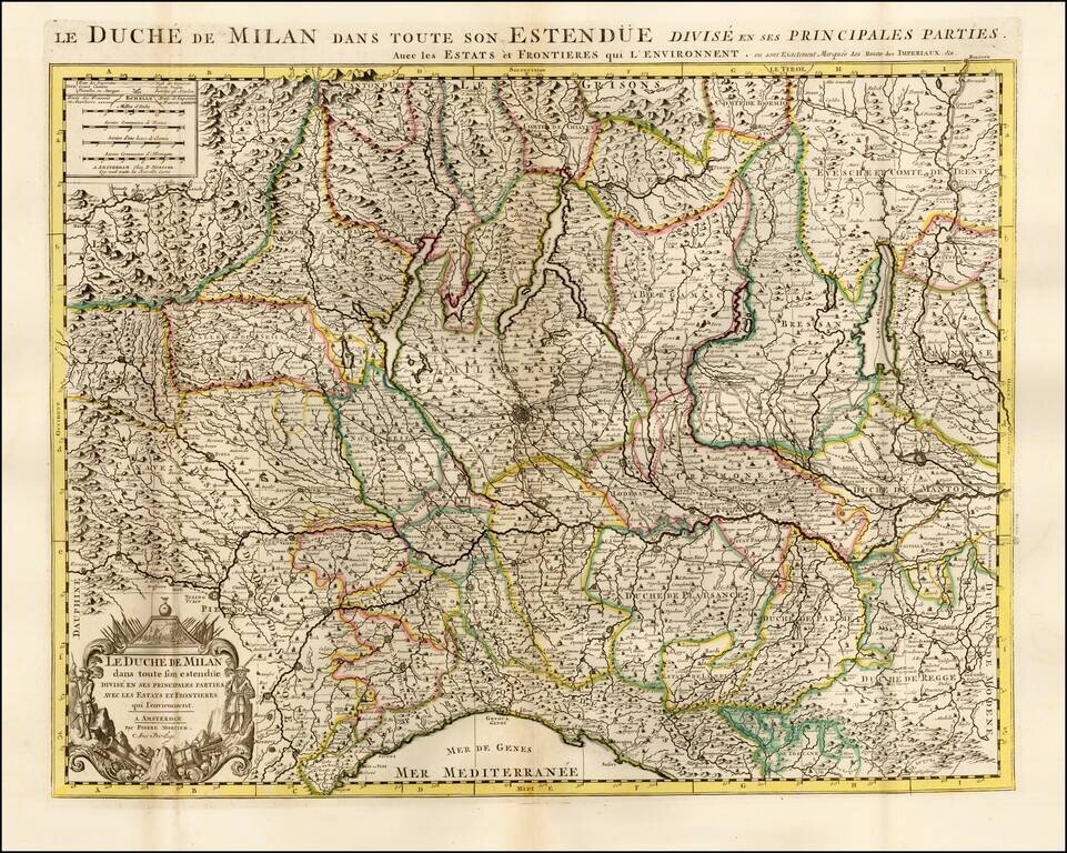
Highly detailed map of the Duchy of Milan, published by Pierre Mortier. The map is centered on Milan and shows the region from Genoa to Lago di Como, Lago Magiore, Lago di Garda and the Swiss Alps.
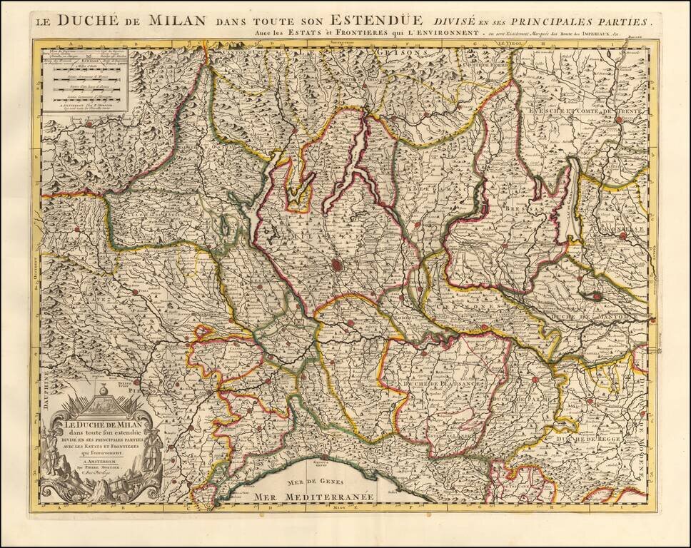
Highly detailed map of the Duchy of Milan, published by Pierre Mortier. The map is centered on Milan and shows the region from Genoa to Lago di Como, Lago Magiore, Lago di Garda and the Swiss Alps. The map features a decorative cartouche in the lower...
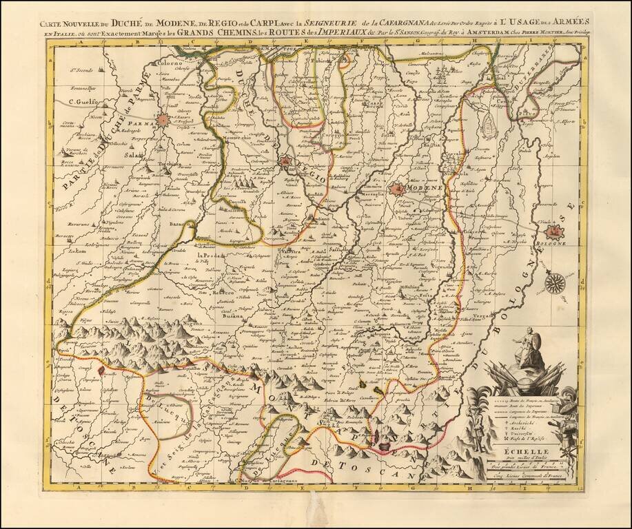
Map showing the Duchy of Modena, Reggio and Carpi in northern Italy, illustrating the roads and pathways utilized by the Italian and French armies throughout the region. The map highlights key fortified zones in and around Modena, Reggio, Parma, and...
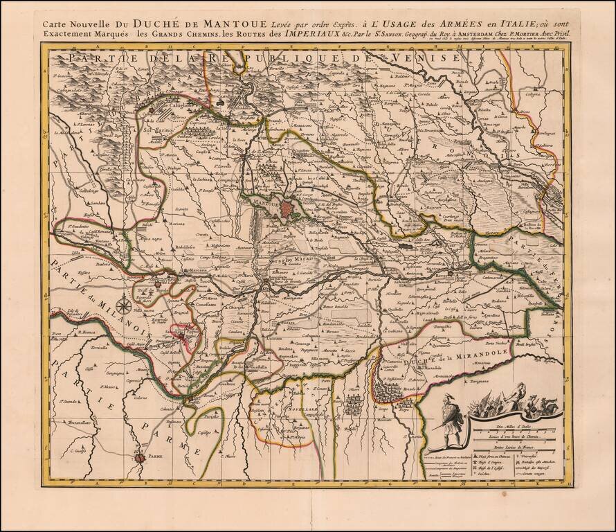
Detailed map of the Duchy of Mantua in Italy. Includes roads, pathways, mountainous regions and forests the Italian and French armees used to navigate through the region. The map also illustrates fortified zones colored in red, such as Mantua, Rever,...
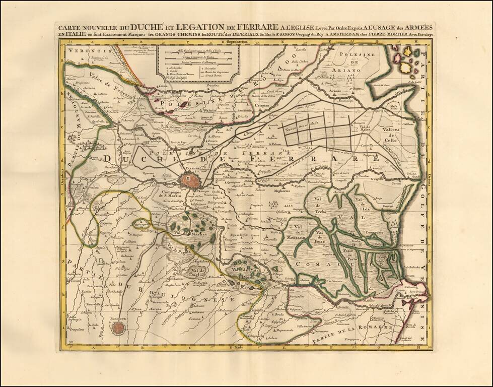
Detailed map of the Duchy of Ferrara in Italy. Includes major roads, pathways, and valleys the Italian and French armees used to navigate through the region. The map also illustrates fortified zones in Ferrare and Bologna. The map features...
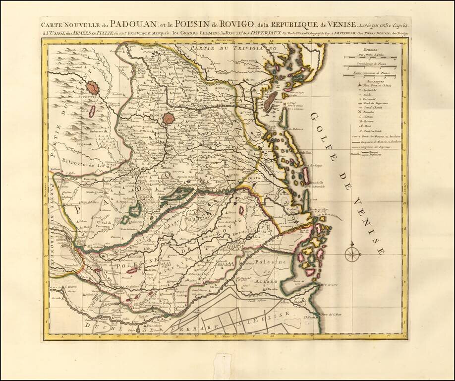
Detailed map of Padua, Italy. Includes the Province of Rovigo and the Gulf of Venice. The map illustrates the islands, roads, pathways, valleys, mountainous regions, forests and waterways the Italian and French armees used to navigate through the...
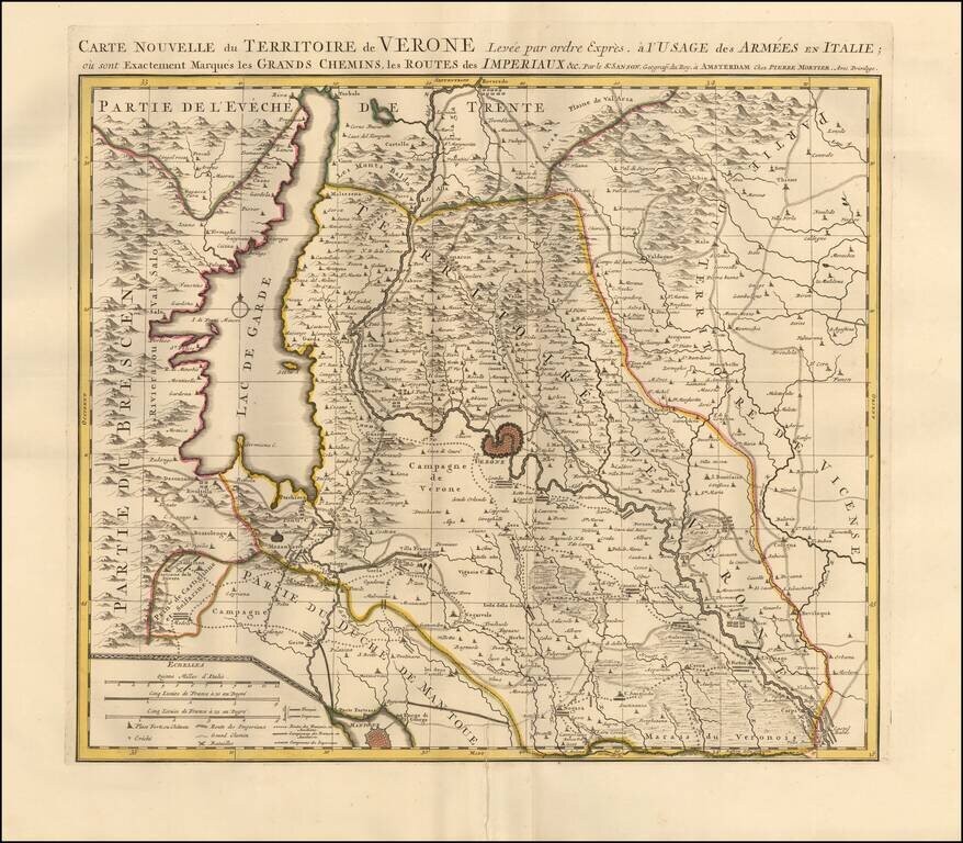
Detailed map centered on Verona, Italy. Published in Amsterdam, circa 1700. The map illustrates roads, lakes, mountain ranges, and plains the armees traveled through the region. Lago Di Garda is prominently featured along with the mountain ranges of...
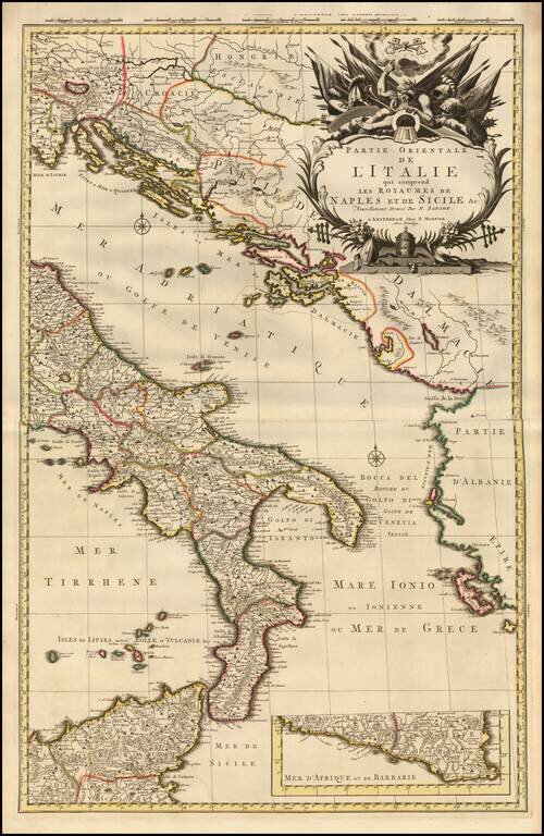
A fine example of Pieter Mortier's map of Eastern Italy which includes the Kingdoms of Naples and Sicily. The map details the surrounding areas of Italy such as the Dalmatian Islands in the Adriatic, the Aeolian Islands north of Sicily in the...
![[Siena] Sienne Ville de la Toscane, Elle est Capitale du Sienois . . .](/map/small/70587.jpg)
One of the Earliest Obtainable Large Plans / Views of Siena Fine early bird's-eye view of Siena, published by Pierre Mortier in his Nouveau Theatre de Toute L'Italie in 1704. Mortier's view shows the a fortified hill town, including the principal...
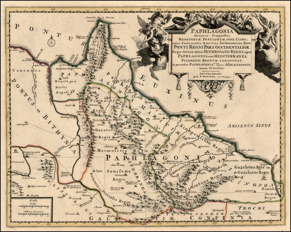
Scarce map of the Turkish Coastline of the Black Sea, centered on Sinope, based upon an earlier map by Nicholas Sanson. Remarkable decorative carouche. The map has not been recorded in a dealer catalog in the past 25 years.
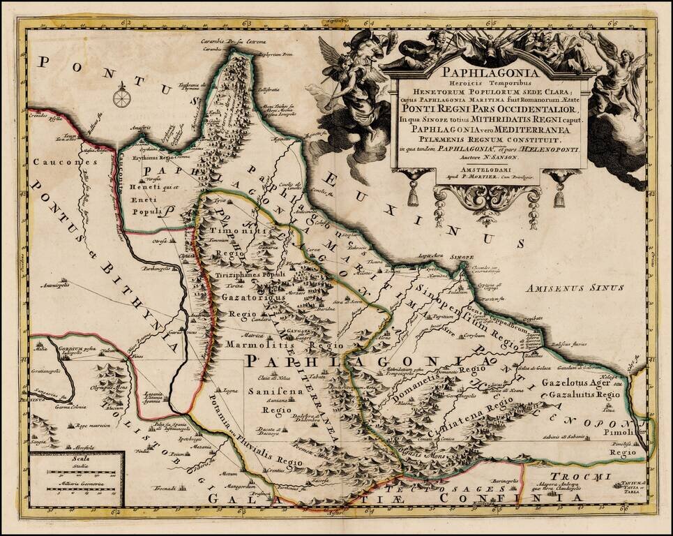
Scarce map of the Turkish Coastline of the Black Sea, centered on Sinope, based upon an earlier map by Nicholas Sanson. Remarkable decorative carouche.
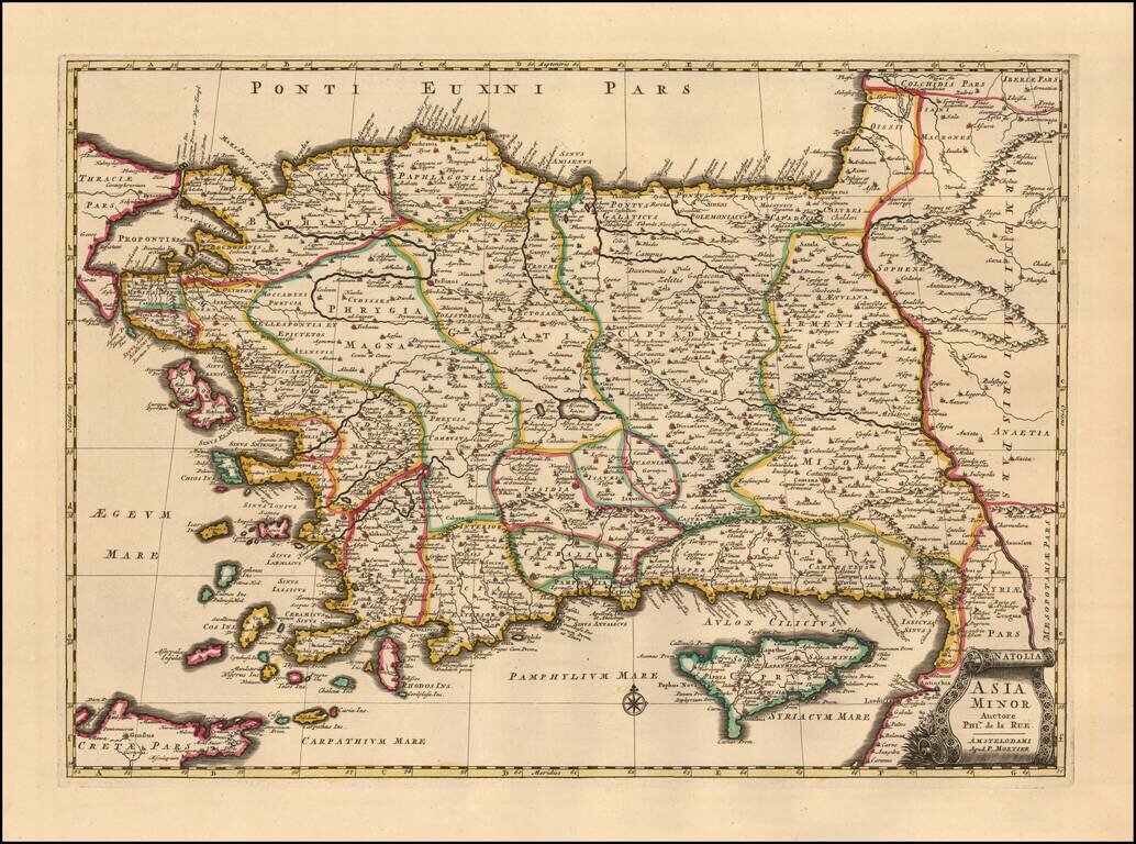
A finely detailed example Mortier's edition o of Philipe de la Rue's map of Asia Minor also known as the Anatolian peninsula, or the Anatolian plateau, which makes up the majority of modern-day Turkey. The map is centered on Ascanius Lacus (Lake...
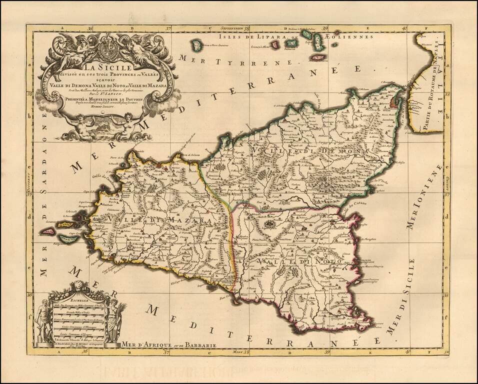
Fine Pierre Mortier edition of Jaillot's large decorative map of Sicily, showing the eruption of Mount Aetna both on the map and below the decorative title cartouche. The island is divided into 3 provinces including Valle Di Demona, Valle De Mazara...
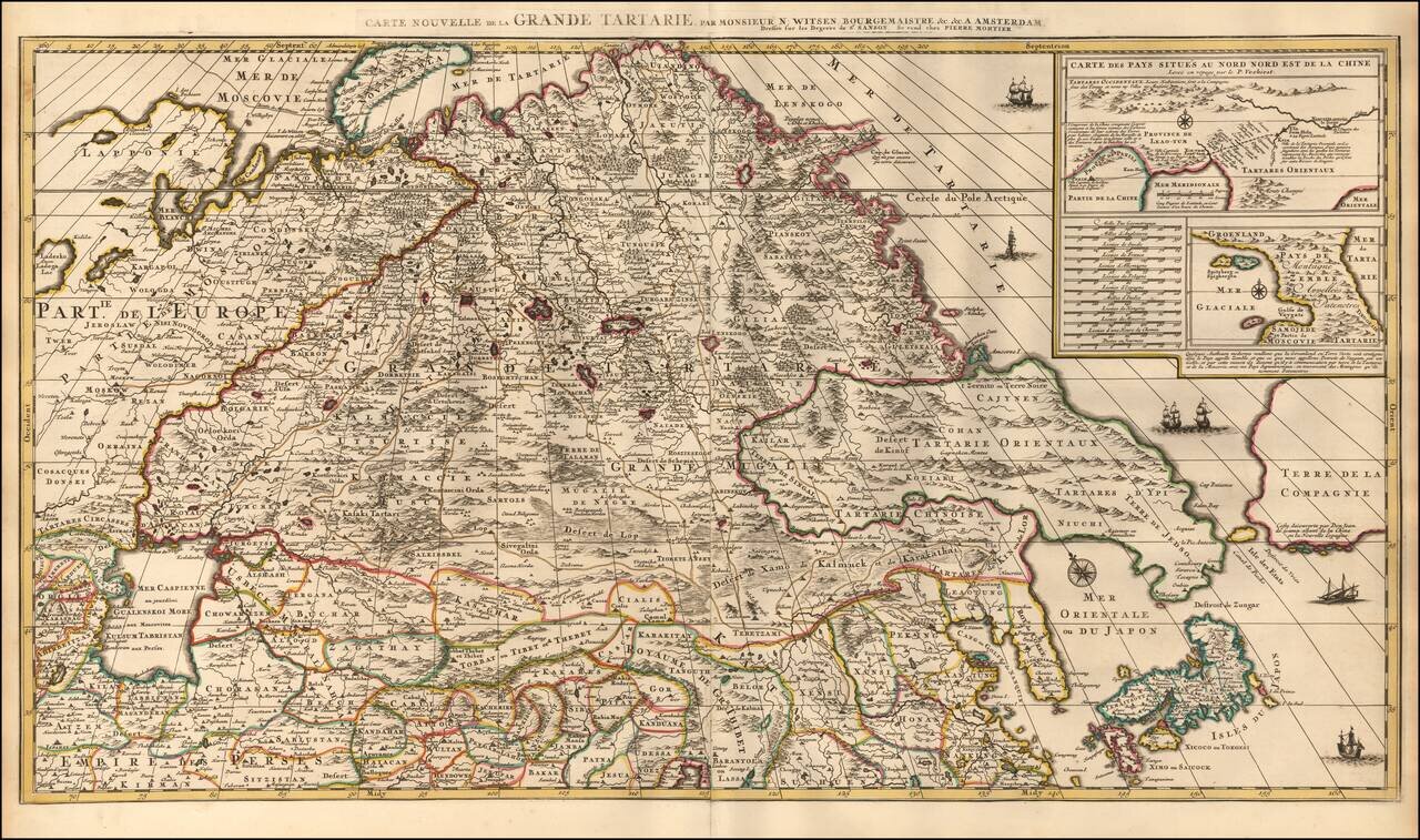
Highly Detailed Map of Tartary by Dutch Statesman and Russian Specialist Nicolaas Witsen with details from the Travels of Verbiest in China and De Vries in the North Pacific Nice example of Pierre Mortier's decorative and detailed map showing Central...
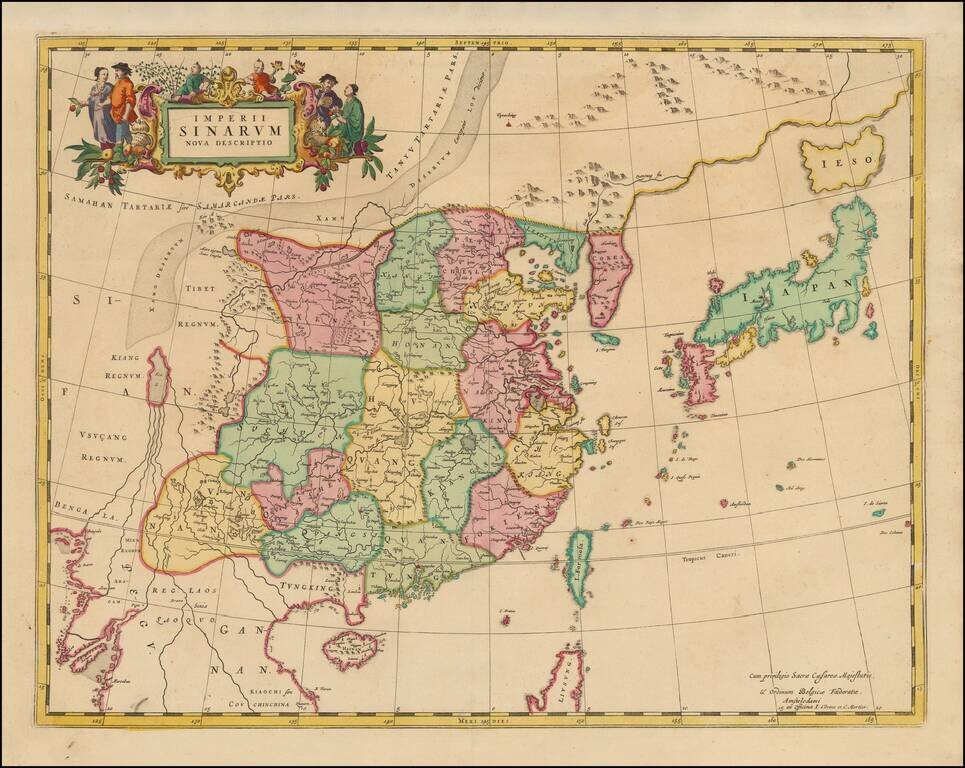
Rare Covens & Mortier's edition of Blaeu's map of China. An important general map of China, Korea and Japan, published by Joan Blaeu in the Jesuit Martino Martini's Atlas Sinensis , the first western atlas of China. The map incorporates the...