Pierre, or Pieter, Mortier (1661-1711) was a Dutch engraver, son of a French refugee. He was born in Leiden. In 1690 he was granted a privilege to publish French maps in Dutch lands. In 1693 he released the first and accompanying volume of the Neptune Francois. The third followed in 1700. His son, Cornelis (1699-1783), would partner with Johannes Covens I, creating one of the most important map publishing companies of the eighteenth century.
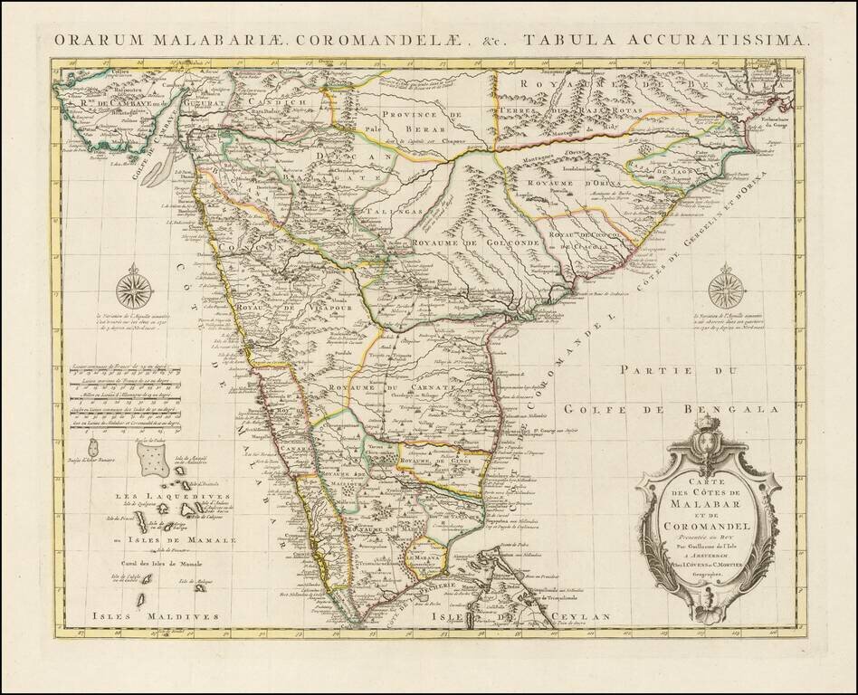
Finely Detailed Map of Southern India Emphasizing Trade Finely engraved map of the southern part of India, first issued in 1723 by acclaimed French mapmaker Guillaume De L’Isle. It focuses on trade routes within India, as well as the Coromandel and...
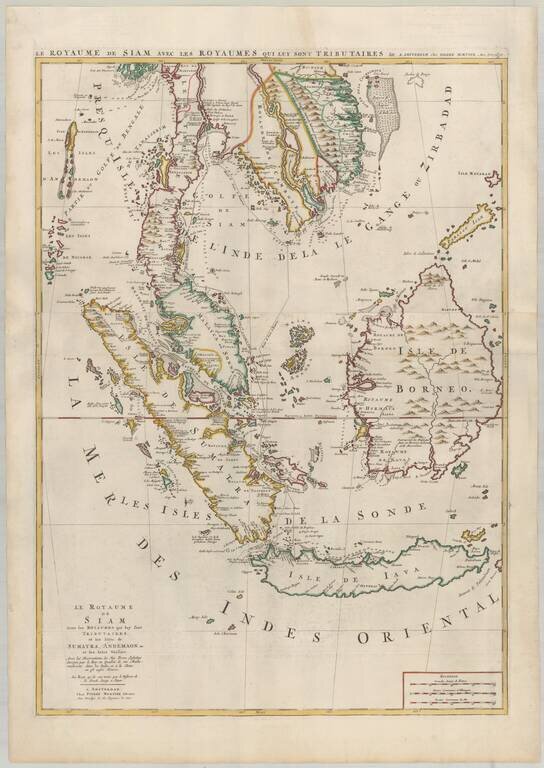
Mortier's Large Format Map of the Kingdome of Siam, Malaysian Peninsula, Singapore, Indonesia, etc. Finely colored example of Pierre Mortier's map of Southeast Asia, extending from Thailand, Cambodia, Viet Nam, and the Malay Peninsula and Gulf of...
![[Singapore, Sumatra, Borneo and Java] Le Royaume de Siam Avec les Royaumes qui luy sont Tributaires et les Isles de Sumatra, Andemaon, etc. et les Isles Voisine Avec les Observations des Six Peres Jesuits Envojez par le Roy en Qualite de Ses Mathematici](/map/small/64646.jpg)
Singapore, Sumatra, Borneo and Java Nice example of the lower sheet of Pierre Mortier's 2-sheet map, extending from Sinagpore to Java and Sumatra in the South. One of the more fascinating notes shows a discovery attributed to "Pierre Bertollo" in...
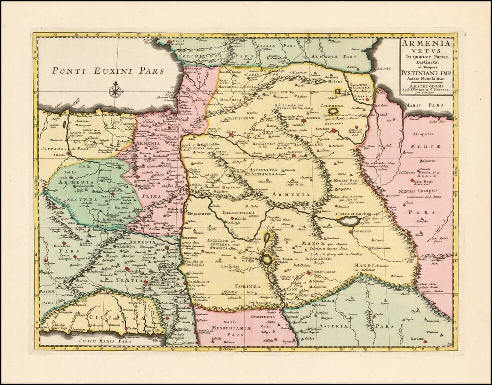
Scarce and highly detailed map of Ancient Armenia by Covens & Mortier, based upon an earlier map by Philippe De La Rue. One of the earliest printed maps to focus on Armenia.
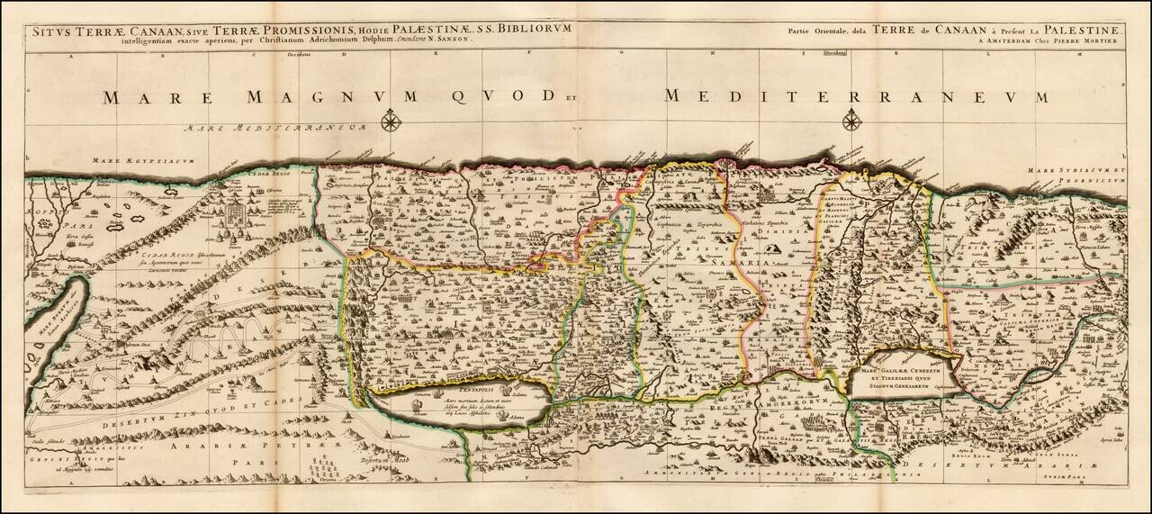
Fine 2 sheet map of the Holy Land, first issued by Pierre Mortier circa 1700. The map is based on the Holy Land on Christiaan van Adrichom's stunning map, Situs Terrae Promissionis, however with the Mediterannean oriented at the top of the map. The...
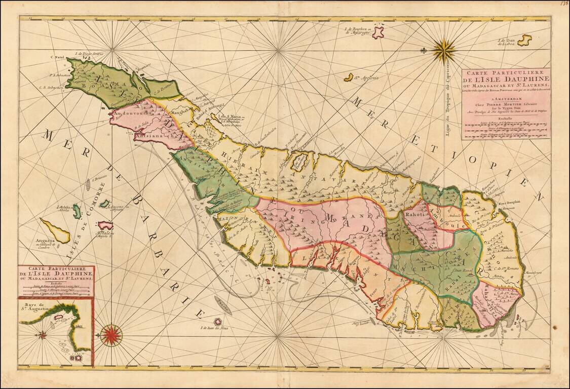
Madagascar -- Pirate Haven Fine old color example of Mortier's large sea of Madagascar, published in Amsterdam by Pierre Mortier. Fine large format chart of Madagascar, orientated with north to the left, appears in Pierre Mortier's sea-atlas, 'Le...
![[Title Page] Table des Cartes etc: Du Sr. Sanson Contenues Dans ce Vollume](/map/small/42946.jpg)
One of the most famous and recognizable illustrated index pages, from a large Mortier Atlas. Four elaborate allegorical scenes are shown, including Atlas holdng the World aloft and an illustration of a woman beside a celestial globe, with pointer and...