Pierre, or Pieter, Mortier (1661-1711) was a Dutch engraver, son of a French refugee. He was born in Leiden. In 1690 he was granted a privilege to publish French maps in Dutch lands. In 1693 he released the first and accompanying volume of the Neptune Francois. The third followed in 1700. His son, Cornelis (1699-1783), would partner with Johannes Covens I, creating one of the most important map publishing companies of the eighteenth century.
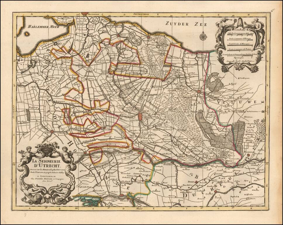
Detailed map centered on the Utrecht region, published in Amsterdam by Pierre Mortier circa 1700. Includes a decorative title and scale cartouche. The map features towns such as Yselstein, Woerde, Montfoort, Kulenborg, etc. and includes roads and...
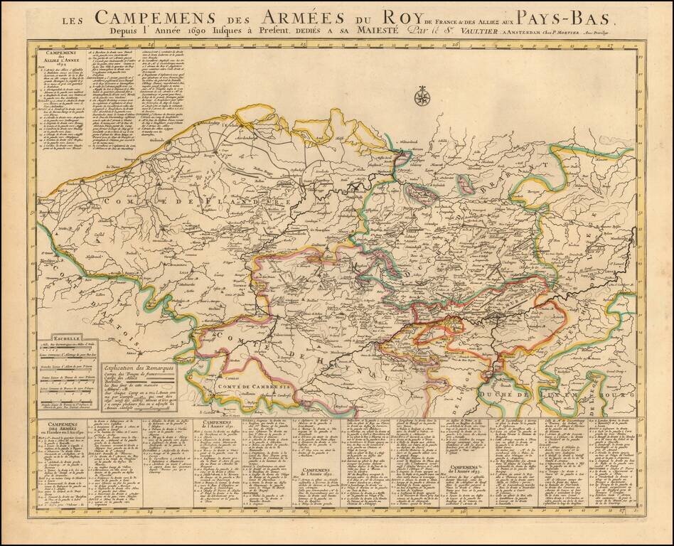
Published by Chez Pierre Mortier in Amsterdam, circa 1700, this "Theatre de la Guerre" (Theater of War) map showcases the intense battles raging in the Netherlands region between the time of the Franco-Dutch War (1672-1678) and the Spanish War of...
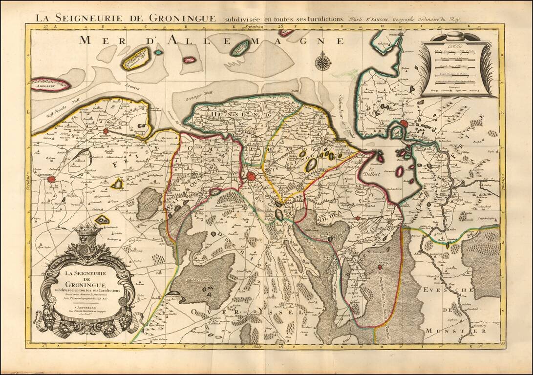
Fine map of the Groningen region, published by Mortier in his Atlas Nouveau. Major towns appearing on the map include Groningen, Winschoote, Emden, Leuwarden, and Dockum.
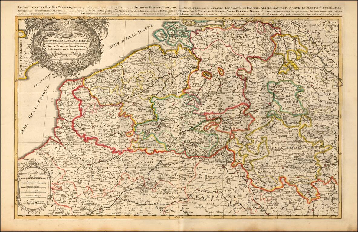
A finely detailed map of the Cathlolic Low Countries, published in Amsterdam, circa 1700. The map illustrates the main provinces of the Catholic Low Countries, including Brabant, Limburg, Luxembourg, Gueldre, Flandres, Artois, Hainaut, Namur,...
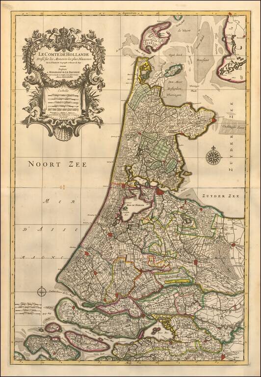
A finely detailed map of Holland published in Amsterdam, circa 1700. The map extends from Amsterdam in the south to Texel in the north, outlining key municipalities and cities across the region, including Goeree-Overflakkee, Voorne-Putten, Utrecht,...
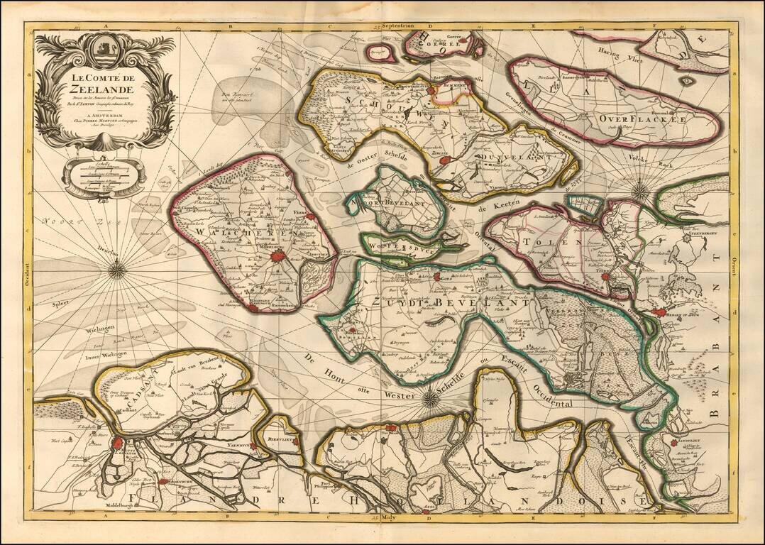
A finely detailed map of Zeeland, published in Amsterdam, circa 1700. The map outlines the islands and municipalities of Walcheren, Schouwen-Duiveland, Noord-Beveland, Wolfersdyck, Zuid-Beveland, Goeree-Overflakkee, Tholen, Cadzand, etc. Main cities...
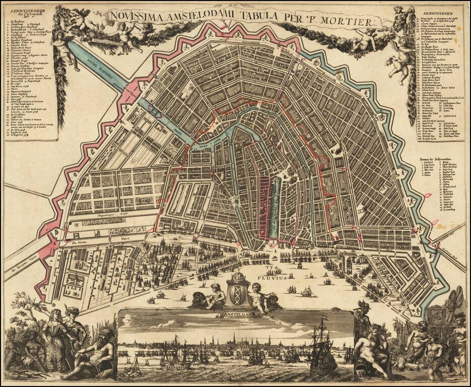
Rare and decorative map, showing allegorical representations of the continents in the lower corners. The panoramic view at the bottom depicts the IJ River, filled with sailing ships, based upon Jochem Bormeester's view of 1685. The plan shows...
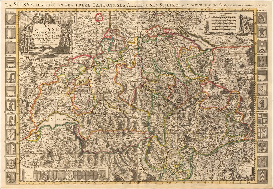
Map of Switzerland with decorative title cartouche at top left. The map is flanked at each side by a total of 24 coats of arms of the Swiss cantons, principal cities, and allies. A panel at the bottom left includes a further nine arms of "Sujets Des...
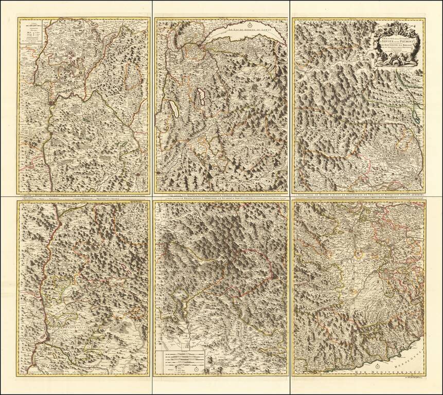
Rare 6-sheet map of the Savoy and Piemonte region, published by Pierre Mortier in Amsterdam. The map provide a highly detailed treatment of the topography of the region. Lake Geneva at the top center, with Monaco and the Italian Riviera at the bottom...
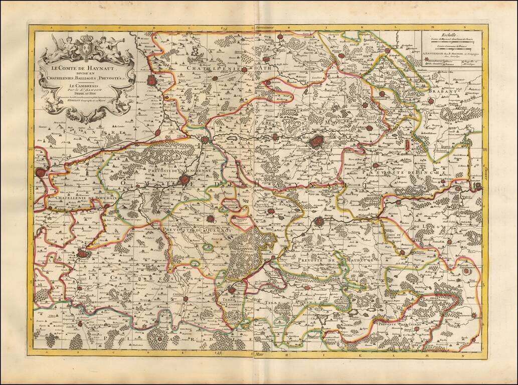
Detailed map of the French Hainaut region, published in Amsterdam. The map includes a second sheet, illustrating 8 fortified towns (2 of Conde, Valenciennes, Maubeuge, Landrecy, Bouchain, Auesnes and Quesnoi) and an Index page. The map shows the...
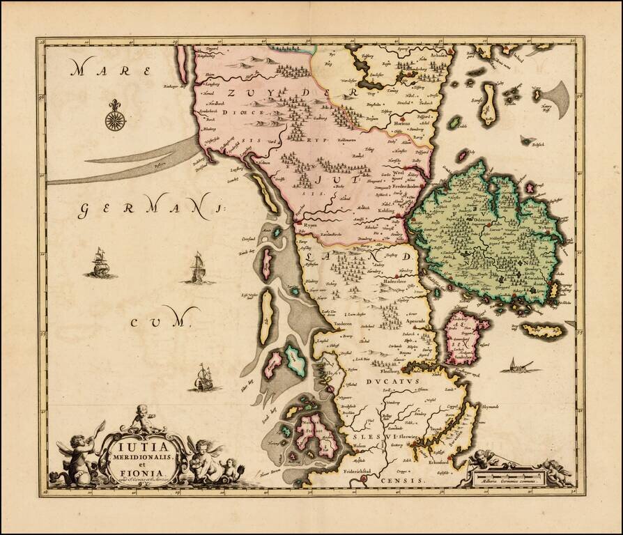
Rare map of the southern part of Jutland and the island of Fionia, published by Covens & Mortier. The map was originally issued by Hugo Allard, circa 1690. All editions are very rare on the market.
Detailed map the course of the Rhine River, from the Wesel area in the Duche of Cleves to Coblentz. Major towns in the region shown include Rheinberg, Duisberg, Dusseldorf, Leverkeusen, Cologne, and Bonn. Fine old color and 2 decorative cartouches.
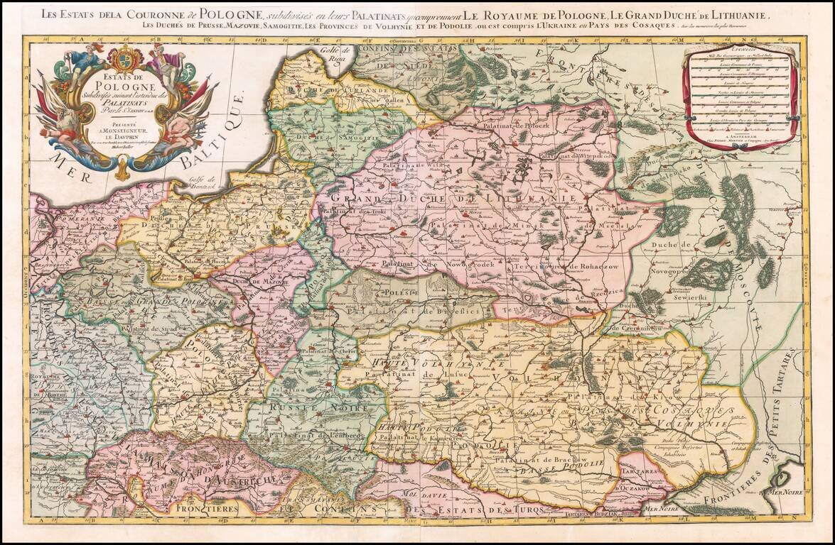
Nice example of the Pierre Mortier edition of this large format map of Poland, Lithuania, the Ukraine and part of Russia, first published by Hubert Jaillot in Paris, in 1679. One of the largest atlas maps of the late 17th Century to focus on Poland,...
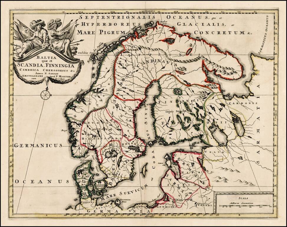
Scarce map of Scandinavia, the Baltic Region and contiguous parts of Finland and Russia. The map appeared in Mortier's Atlas Antiquus, based upon the work of Nicolas Sanson.
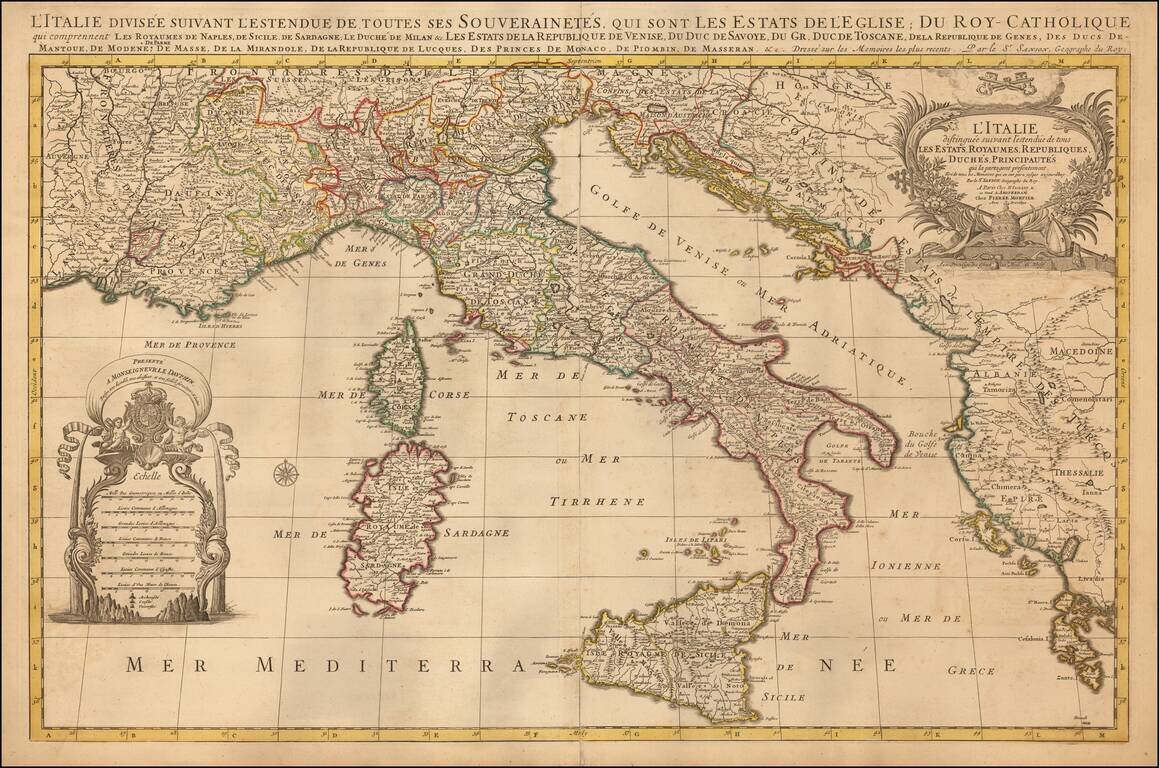
Striking large and highly detailed map of Italy and the Adriatic, published in Amsterdam by Mortier. Includes two decorative cartouches.
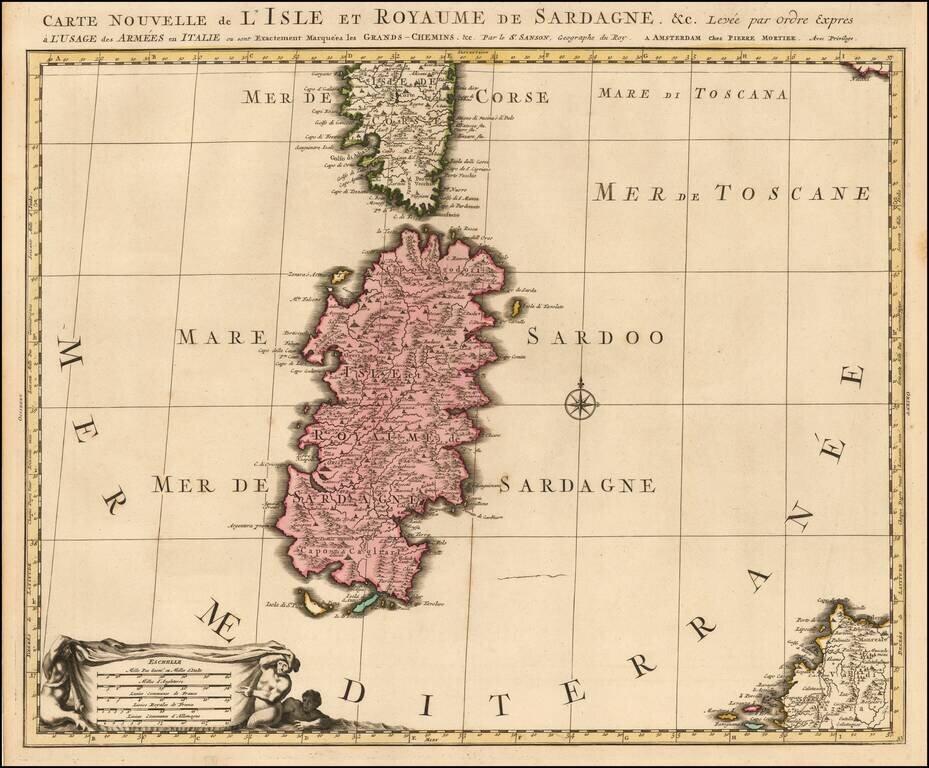
Early state of the Mortier map of Sardinia. The map would later be re-issued by Coven & Mortier, with a number of ships and battle scenes.