Map size in jpg-format: 65.7148MiB
Click to open in high resolution (open in new tab).

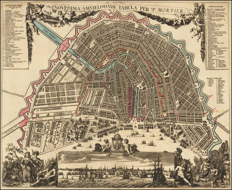
Rare and decorative map, showing allegorical representations of the continents in the lower corners.
The panoramic view at the bottom depicts the IJ River, filled with sailing ships, based upon Jochem Bormeester's view of 1685. The plan shows Amsterdam at the height of its world influence, with the great Three Canals Project well under way.
The map provides an historical look at the growth of Amsterdam, superimposed over its existing situation at the beginning of the 18th Century:
This is Hameleer's 3rd state (of with "per P. Mortier" in the title-banner). The map would later be re-issued by Covens & Mortier, with the title revised.
Rarity
The map is apparently very rare on the market.
OCLC locates copies at the Bayerische Staatsbibliothek and the Sachsische Landesbibliothek.
If you are a student, write to us in telegram: @antiquemaps and indicate what material you need and for what work you need a map in high detail. We are ready to provide material on special terms. For students only!


