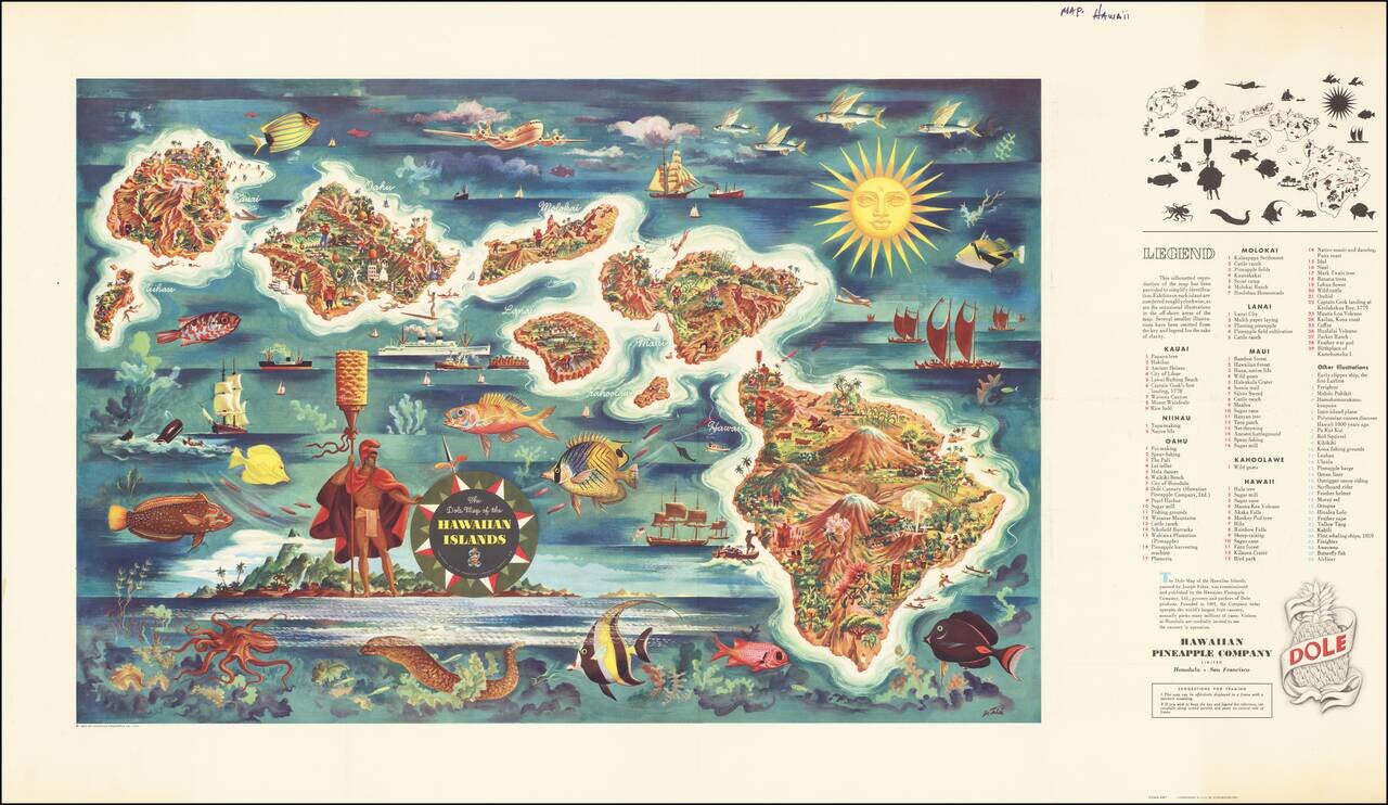
Decorative map of Hawaii, from a painting by Joseph Feher, commissioned by the Hawaiian Pineapple Company. This is the second of Dole's iconic maps, which have been sought after by collectors almost since the initial printing.
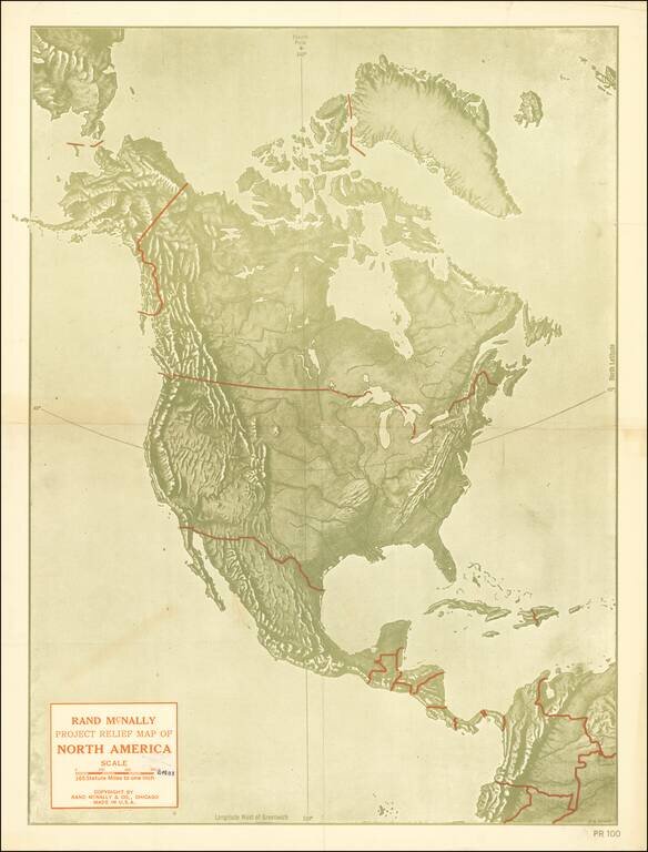
Fine large format map of the United States, executed by R.W. Berry and printed by Rand McNally & Company. The map is apparently very rare -- we locate only the Library of Congress copy.
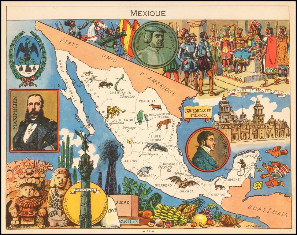
Decorative pictorial map of Mexico, published by Children's book illustrator JP Pinchon. The map was used to educate primary school children in France in the first half of the 20th Century.
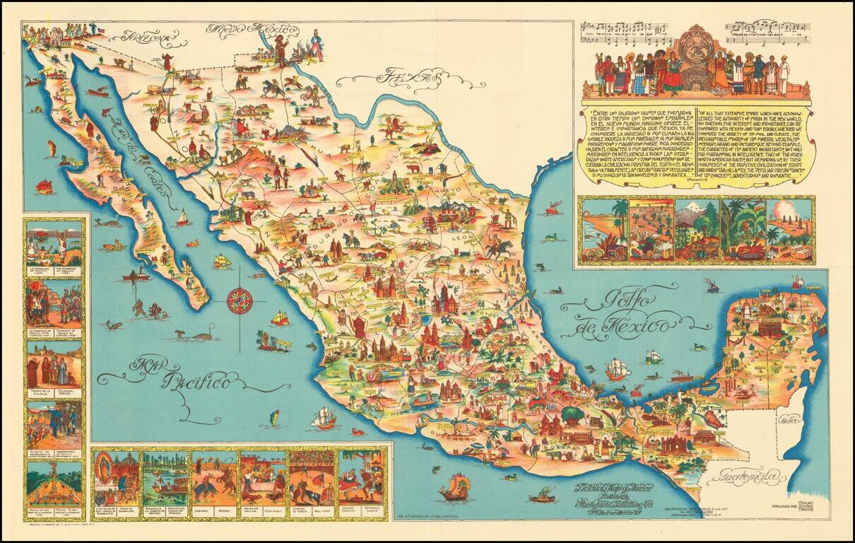
Rare large format version of this decorative map of Mexico, published in Mexico City. The map is one of the liveliest and most interesting maps of Mexico published in this pictographic style, with vivid colors and fantastic images.
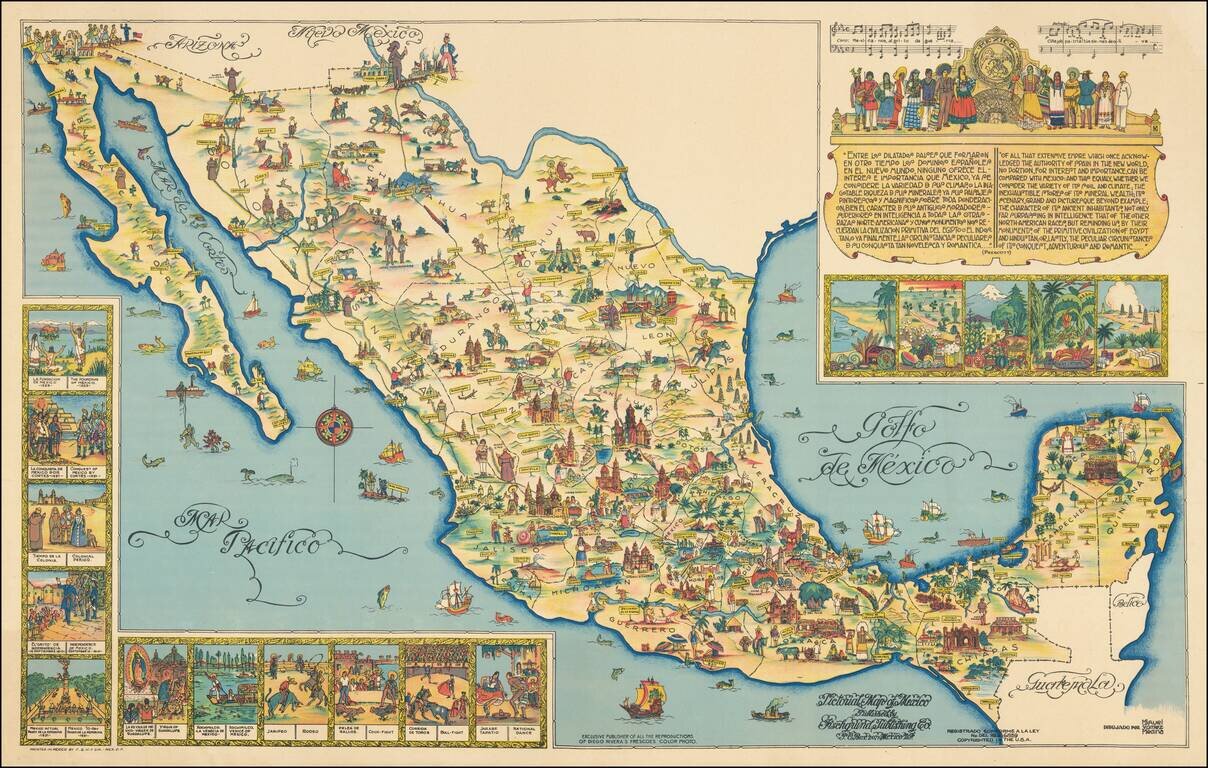
The Seldom Seen Full-Sized Poster Version. Rare large format version of this decorative map of Mexico, published in Mexico City. This is the poster-sized version of the 1950 version of Miguel Gomez Medina's 1931 pictorial map of Mexico, which was...
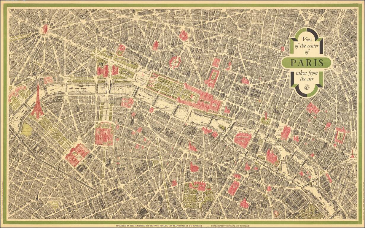
Vintage pictorial bird's eye view of Paris, based on the view Peltier and issued by Blondel La Rougery for a host of hotels and Parisian retail companies throughout the 20th century. This view is the most famous bird's eye view of Paris, second only...

Attractive print showing the hiking trails around Nesselwang and Wertarch in the Allagäu region of Swabian Bavaria. The area is shown from an aerial viewpoint, and was likely based off early aerial photographs. The region is one of the most...
![[Austrian Alps] Dachstein / Der Alt Welt Begriff, Besthende in 3 Haubt Theilen als Arica, Europa, Asia. Warinnen der Erste Meridian nach Frantzossicher art gezogen](/map/small/68924.jpg)
Lively pictorial map of the region centered on Dachstein in the distance. Centered on Traunsee, Attersee, Mondsee, Zellersee, Wofgangsee, Hallstattersee Fuschlsee, Wallersee, etc.
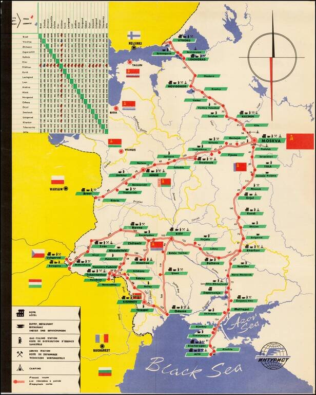
Decorative tourist map of Russia, showing the bus lines throught the country. An interesting Soviet era tourist item.
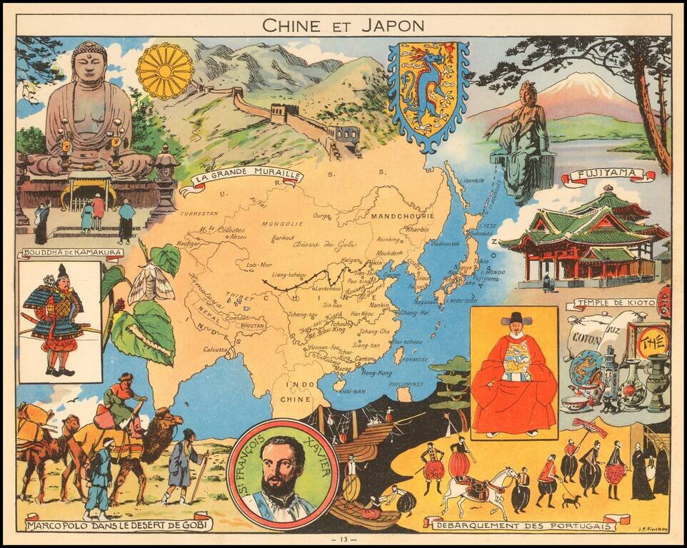
Decorative pictorial map of China, Japan and Korea, published by Children's book artist JP Pinchon.
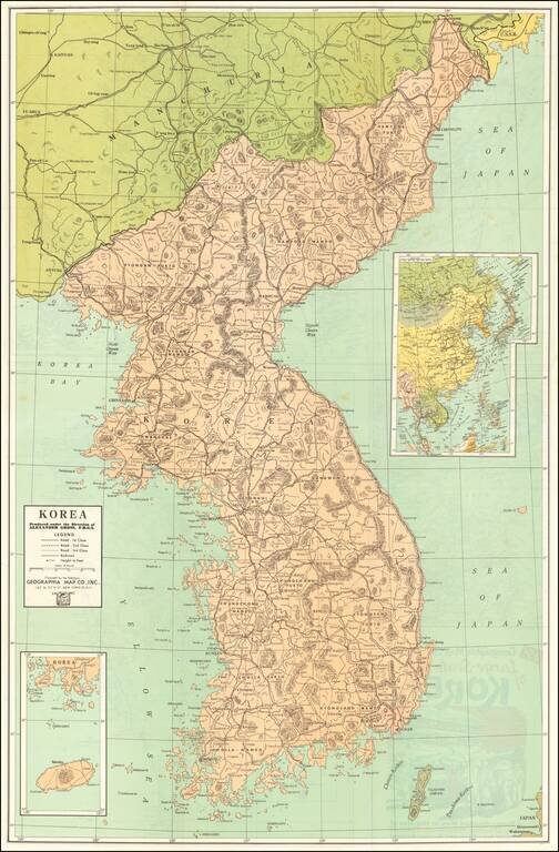
Vintage Korean War-Era map of the Korean Peninsula, published by Geographia Map Co. Inc., in New York City around 1950. The title panel on the verso of the map includes an image of an M46 Patton (?) and G.I.s in a Korean town. The verso includes a...
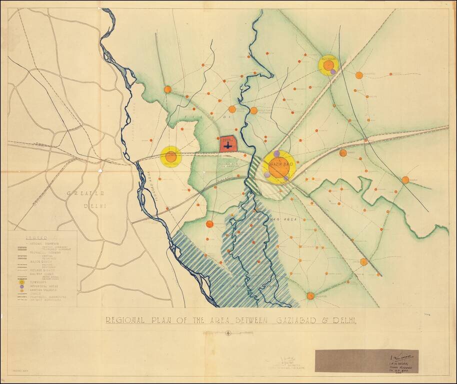
Modernizing Utter Pradesh Following Indian Independence By Renowned Urban Planner Robert Dudley Trudgett Interesting master planning document and map, prepared by the Town & Village Planning Office in Lucknow by renown American architect and urban...
![[District Bholawade]](/map/small/66013.jpg)
Fine large map of Bholawade District and environs, in the region of Maharashtra, in Western India.
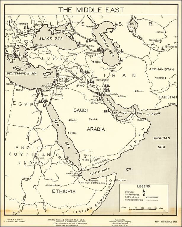
Large map of the Middle East, part of the Massachusetts Institute of Technology series of strategic area maps, issued in the 1950s. The map shows the earliest oil fields in the Middle East as they were just beginning large-scale exploitation in the...
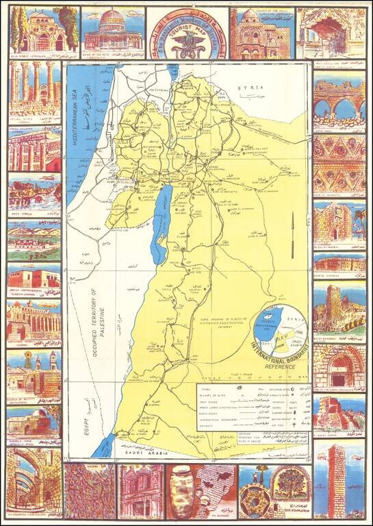
Jordan Makes the Most of Their Annexation of the West Bank. Scarce bilingual (English and Arabic) pictorial tourist map of Jordan, with extensive illustrations in the borders featuring the country's archaeological sites. The verso has maps of Amman...