Map size in jpg-format: 119.234MiB
Click to open in high resolution (open in new tab).

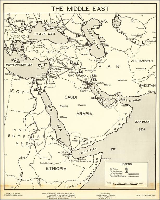
Large map of the Middle East, part of the Massachusetts Institute of Technology series of strategic area maps, issued in the 1950s.
The map shows the earliest oil fields in the Middle East as they were just beginning large-scale exploitation in the 1940s and early 1950s. The map illustrates fields in Saudi Arabia, Kuwait, Iraq, Iran and around the Caspian Sea.
One of the earlier American maps to focus specifically on the nascent Middle East oil industry.
The map Legend identifies:
The map was prepared for the education of students of international relations by Norman Padelford, professor of the subject at MIT.
If you are a student, write to us in telegram: @antiquemaps and indicate what material you need and for what work you need a map in high detail. We are ready to provide material on special terms. For students only!

![[Europe, Mediterranean, Asia Minor and the Persian Empire]](/map/small/43558.jpg)
