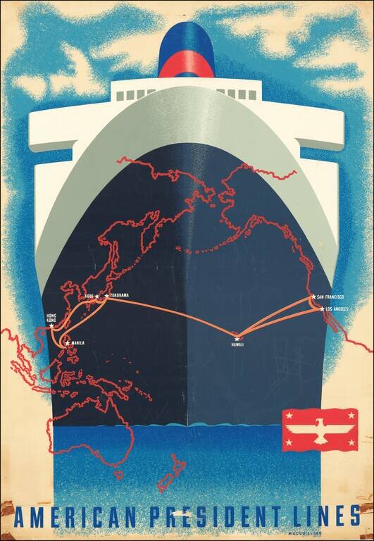
A San Francisco native, Macouillard was an accomplished artist, having studied at the California College of Arts and Crafts and the Art Students League of New York. He became Art Director of the Velvetone Poster Company in San Francisco and designed...

Wonderful 12-sheet Vietnamese-language color-lithographed map of the region around Hanoi in northern Vietnam. Bound as separate sheets in the original publisher's portfolio, along with a general map showing how the sheets combine. The twelve sheets...
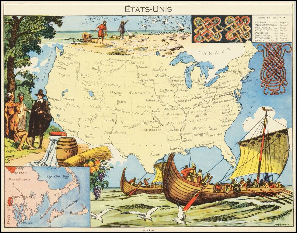
Decorative pictorial map of the United States, published by Children's book artist JP Pinchon.
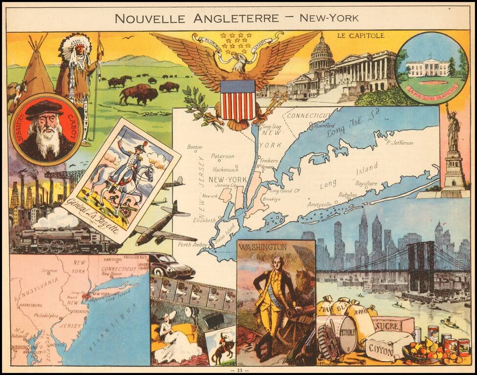
Decorative pictorial map of New England and New York, published by Children's book illustrator JP Pinchon. The map was used to educate primary school children in France in the first half of the 20th Century.
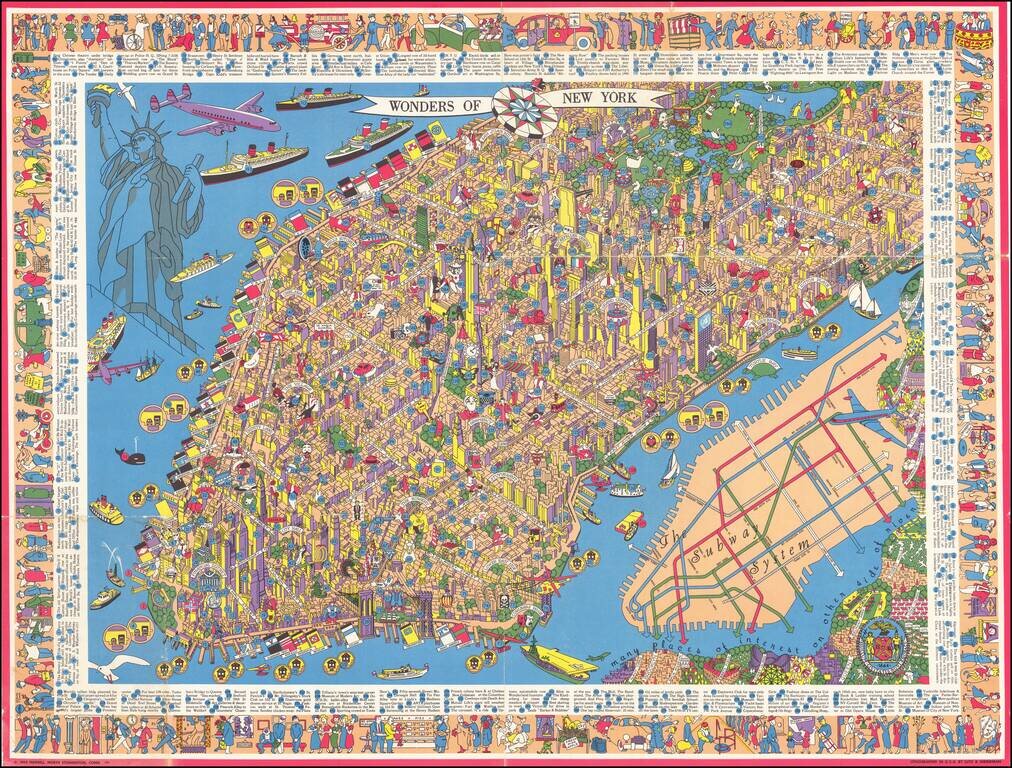
One of the Rarest and Most Sought After New York City Pictorial Maps Rare Large Pictorial Map of New York City, published by Nils Hansell and lithographed by Lutz & Sheinkman. Hansell's map is a whirlwind of whimsical imagery, focused on the...
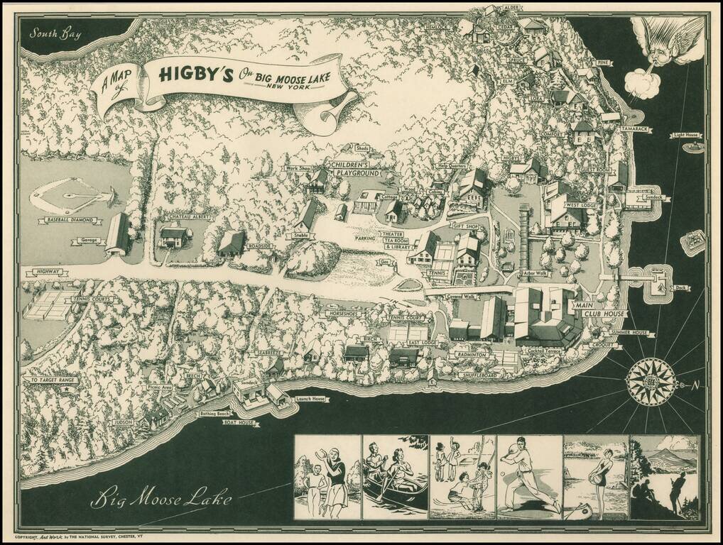
Scarce pictorial map of Big Moose Lake. As noted by Rumsey: Pictorial map of Higsby Campground on Big Moose Lake, New York. Shows roads, trails, beaches, buildings, Campgrounds, Sports and Recreation Facilities. Buildings are named. On bottom...
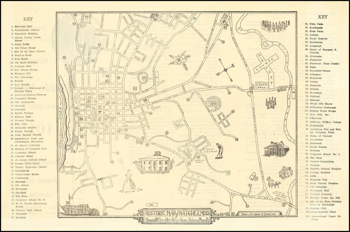
Scarce Pictorial map of the Natchez, Mississippi area, illustrating historical sites, extending frrom the Mississippi River to Sharpe Airport. On the verso, a key with points illustrating on the map is given.
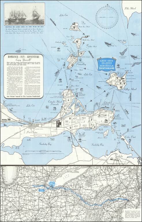
Lively pictorial map of the Lake Erie and Peninsula Vacationland, near Port Clinton Ohio, between Toledo and Cleveland on Lake Erie. The main map focuses on recreational opportunities on Marblehead and Catawba Island Peninsulas, with Port Clinton....
![[Tracing Route Map of Colorado] Colorado -- Explore the West with Scenic Guides](/map/small/69878.jpg)
Scarce folding map of Colorado, published to promote Weldon F. Heald's Scenic Guide to Colorado. The map was issued to promote Healds' travel book, highlighting natural points of interest and other details and emphasizing the major routes through...
![[Nevada] Travel-Time in Nevada](/map/small/70216.jpg)
Explore the West with Scenic Guides Scarce folding map of Nevada, published to promote Weldon F. Heald's Scenic Guide to Nevada. The map was issued to promote Healds' travel book, highlighting natural points of interest and other details and...
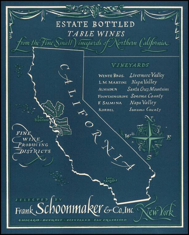
Rare advertising map promoting California wines. Frank Schoonmaker established himself in 1934 with his Complete Wine Book, and later, the classic Frank Schoonmaker's Encyclopedia of Wine. As a wine merchant he started "Frank Schoonmaker Selections"...
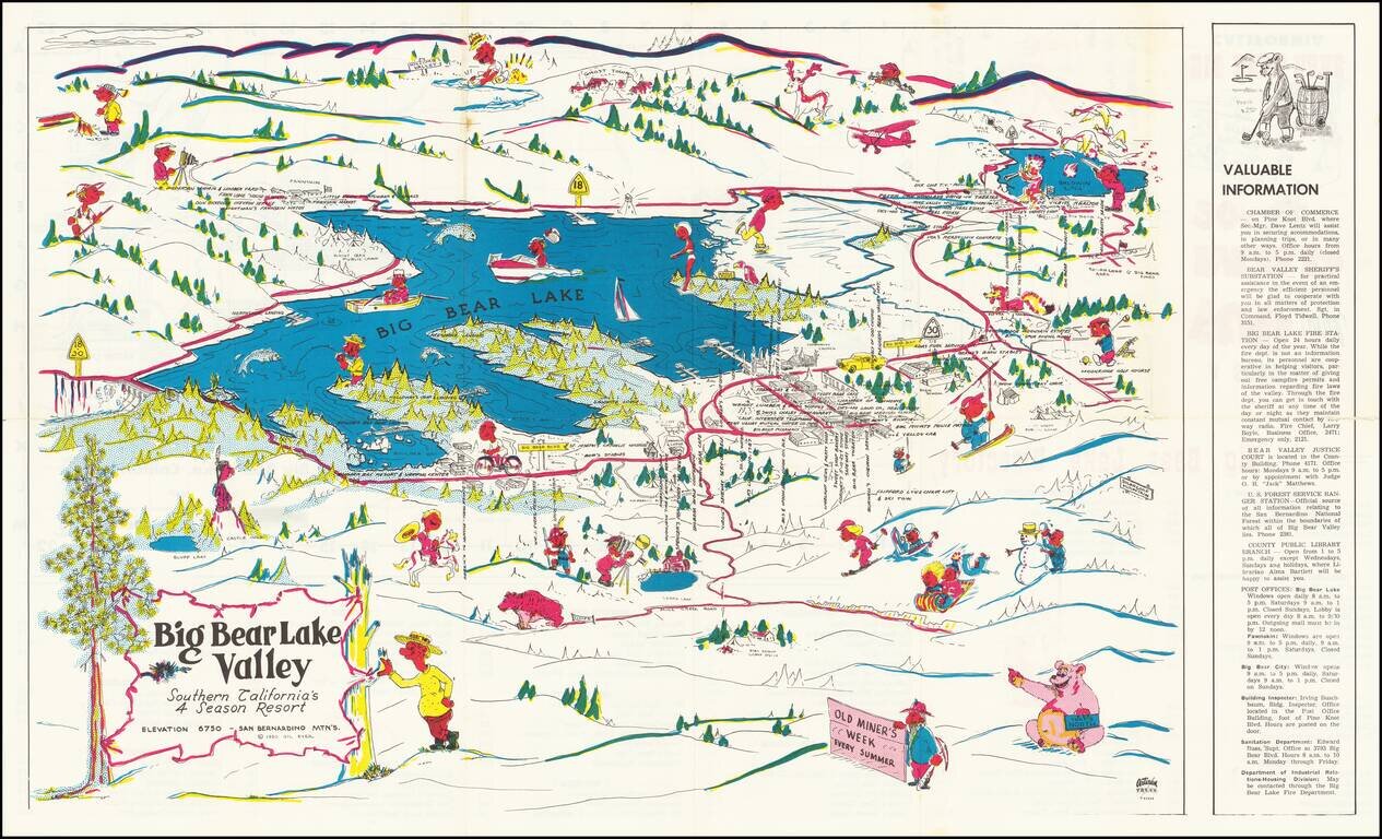
Rare Big Bear Lake pictorial tourist map, published by the Artisan Press in Azusa, California. The verso title is A Souvenir Fun and Street Map, with a price of 20 cents. The lake is filled with recreational and boating images, with the Clifford Lynn...
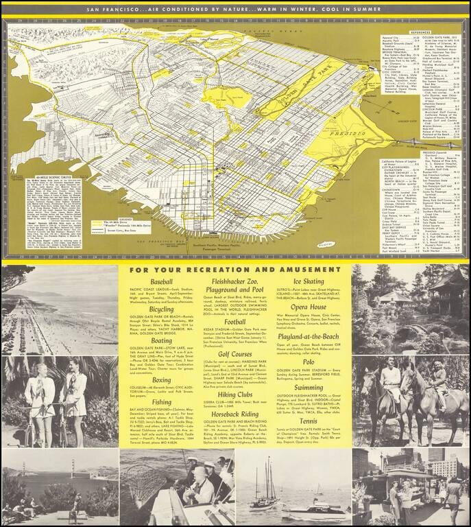
Interesting tourist map and promotional brochure of San Francisco, published in the early 1950s by the San Francisco Convention and Visitors Bureau. The map illustrates "The 49-Mile Drive" and the "'Wonder' Peninsula 100-Miles Drive", with a detailed...
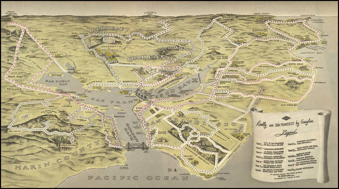
Birdseye view style map of the Bay Area, publisehd by the Gray LIne. The map illustrates 13 Gray Line sightseeking tours around the Bay area, extending out to Napa Valley, Mt. Diablo, Yosemite, Monterey, Carmel by the Sea, Half Moon Bay and the Muir...
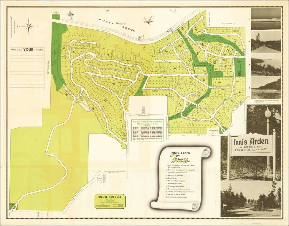
Explicit Racial Segregation in the Pacific Northwest. "Innis Arden A Restricted Residential Community". Interesting Midcentury promotional map for the community of Innis Arden, just north of Seattle, Washington. The map was published in 1950 to...
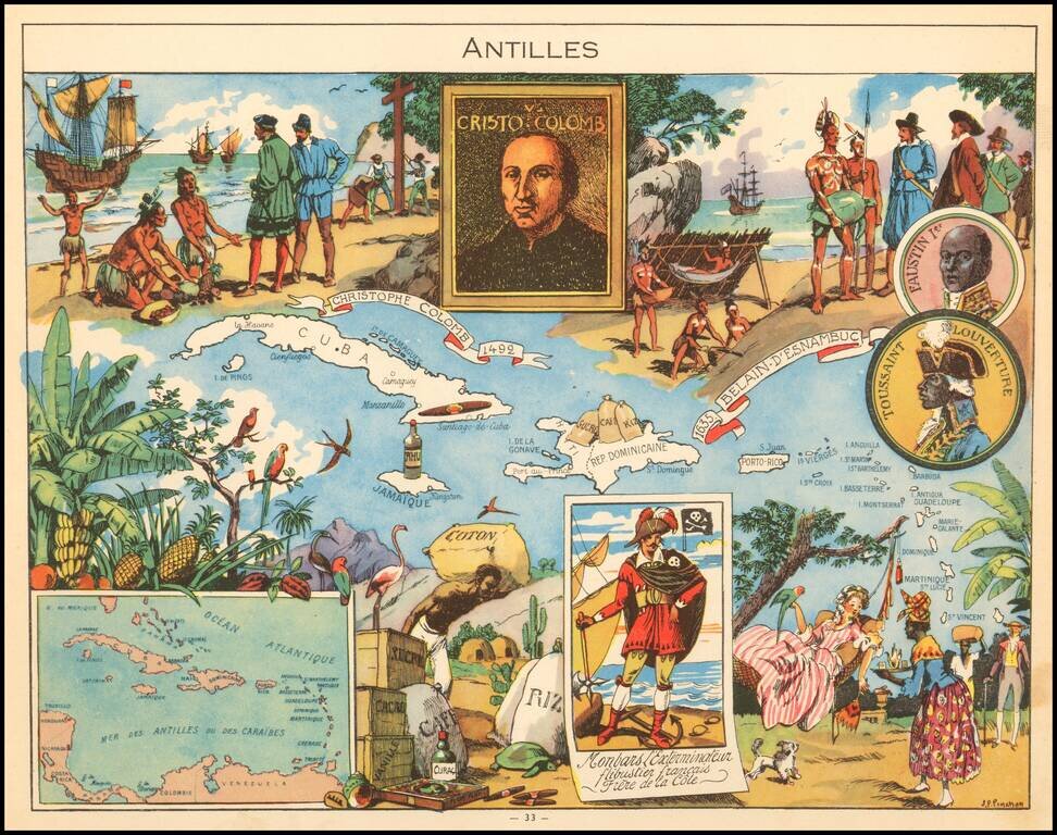
Decorative pictorial map of the Caribbean, published by Children's book artist JP Pinchon.