logo

1950. Geographia Map Company's Large Scale Map of Korea

  • Geographia Map Company's Large Scale Map of Korea
  • Geographia Map Company's Large Scale Map of Korea

Geographia Map Company's Large Scale Map of Korea information:

Year of creation: 
Resolution size (pixels): 
 16175x24627 px
Disk Size: 
 93.395MiB
Number of pages: 
 2
Place: 
 New York
Author: 

Print information. Print size (Width x height in inches):
Printing at 72 dpi 
  224.65 х 342.04
Printing at 150 dpi 
 107.83 х 164.18
Printing at 300 dpi 
 53.92 х 82.09

An example of detailing the file of this map of in a printable high-resolution:

Click to open in high resolution (open in new tab).
Attention! this is just the central piece (central area 960x960 px) of the map file!
This is an example, so that you can see and study the level of detail of a given map. The entire Map will be fully available after payment!

Geographia Map Company's Large Scale Map of Korea

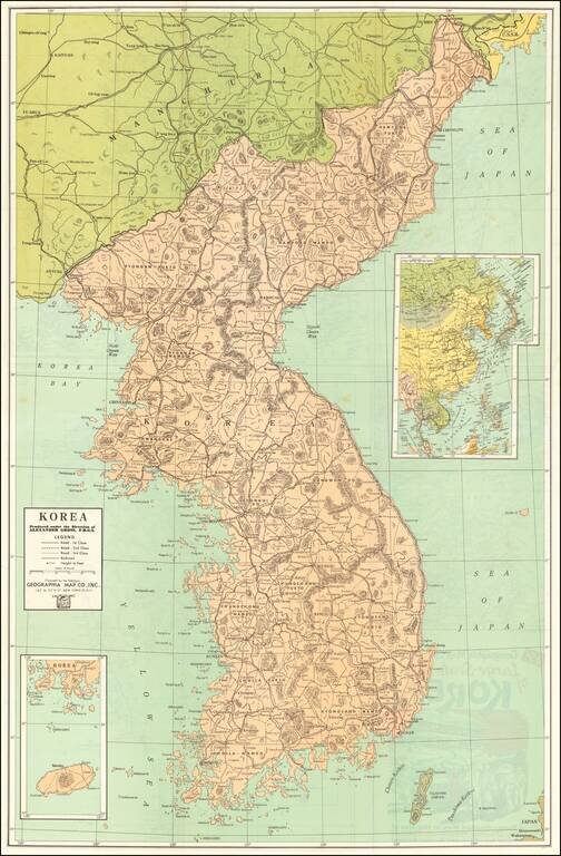
Vintage Korean War-Era map of the Korean Peninsula, published by Geographia Map Co. Inc., in New York City around 1950.

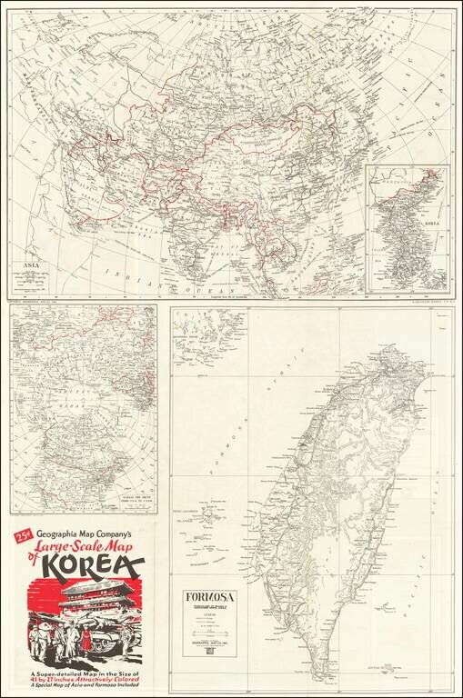
The title panel on the verso of the map includes an image of an M46 Patton (?) and G.I.s in a Korean town.

The verso includes a polar-projected map "Across the Arctic from the U.S.A. to U.S.S.R.", a general map of Asia, and a map of Taiwan "Formosa".


Special conditions for students!

If you are a student, write to us in telegram: @antiquemaps and indicate what material you need and for what work you need a map in high detail. We are ready to provide material on special terms. For students only!

Item information:

Year of creation:
Size:
16175x24627 px
Disk:
93.395MiB
Number of pages:
2
Place:
New York
Author:
Geographia.
$21.99

Related item