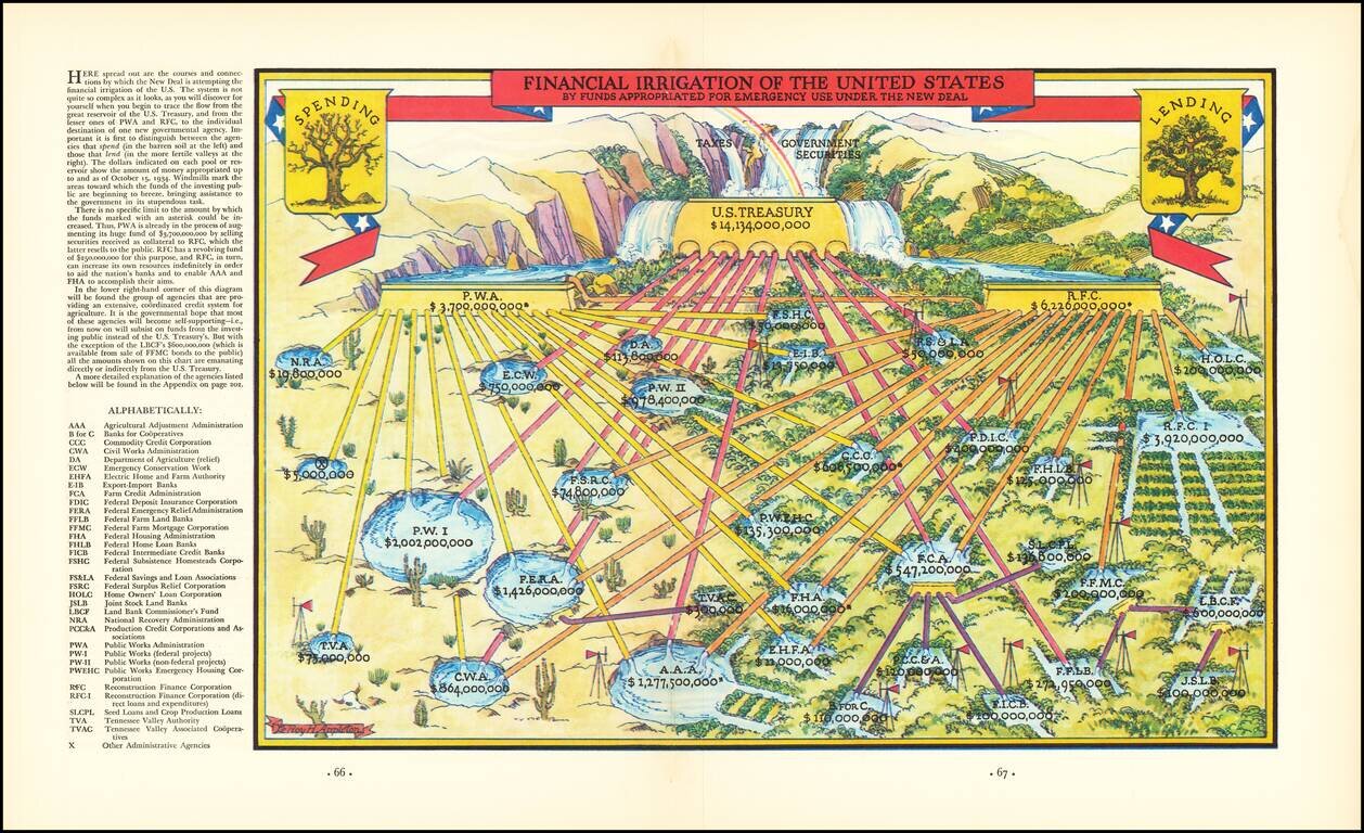
If Calvin Coolidge Could Be Brought Back To Life To View This Vast New Superstructure of Government He Would Probably Think Himself on Mars. Fascinating image intended to illustrate the flow of money spent by the Federal Government during the New...
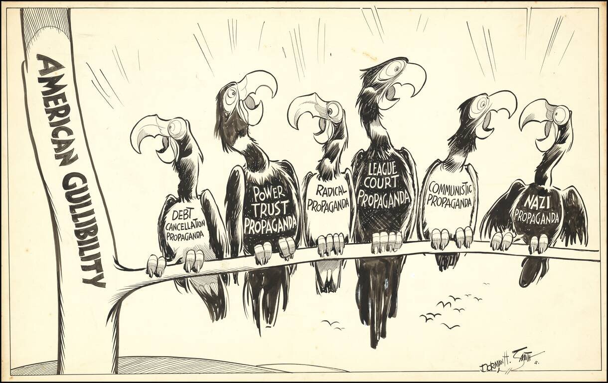
Original artwork for political cartoon drawn by Dorman H. Smith, a political cartoonist who worked in Cleveland and Chicago for over 30 years. Among Smith's more noteworthy milestones, in 1924 he accompanied Ernest Hemingway to Pamplona, Spain. For a...
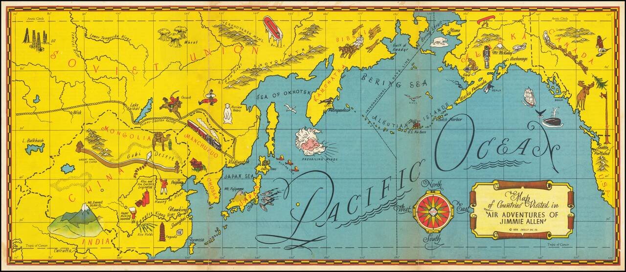
The Gold Age of Radio Theater -- The Air Adventures of 16 Year Old Crime Solving Pilot Jimmie Allen Rare pictorial map of the Pacific printed as a promotional premium for the Air Adventures of Jimmie Allen, theatrical radio production that aired from...
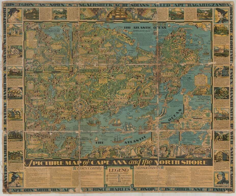
Finely illustrated pictorial map of Cape Ann area of northern coastal area of Massachusetts. Timelines and noteworthy feature descriptions border the map.
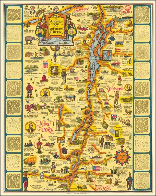
This is the second state of Eleanor Hall's map of the area centered on Lake Champlain, showing the region from northwesternmost Massachussetts to Quebec. The map abounds with pictographs representing historical events, famous figures, industries, and...
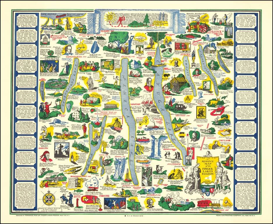
Decorative pictorial map of the Finger Lakes Region of New York. Provides numerous historical vignettes and facts about the region. Compiled by Sidney E. Ayres and Mrs. Walter A. Henricks.
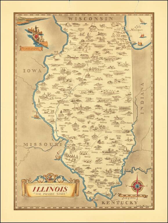
Scarce pictorial map of the Illinois, by the prolific illustrator Karl Smith. The map is filled with historical vignettes, telling the story of Illinois's history. Color vignette on upper left illustrating "Marquette and Jolliet the first white men...
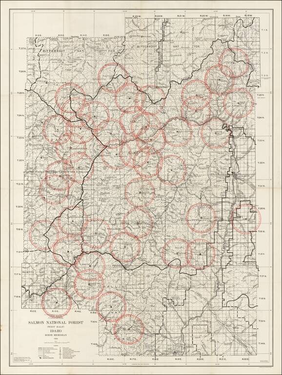
Detailed map of the Salmon National Forest, published by the Department of Agriculture in 1934. The Salmon National Forest was originally established in November 5, 1906 and renamed on March 4, 1907. On July 8, 1908, it was combined with the Challis...
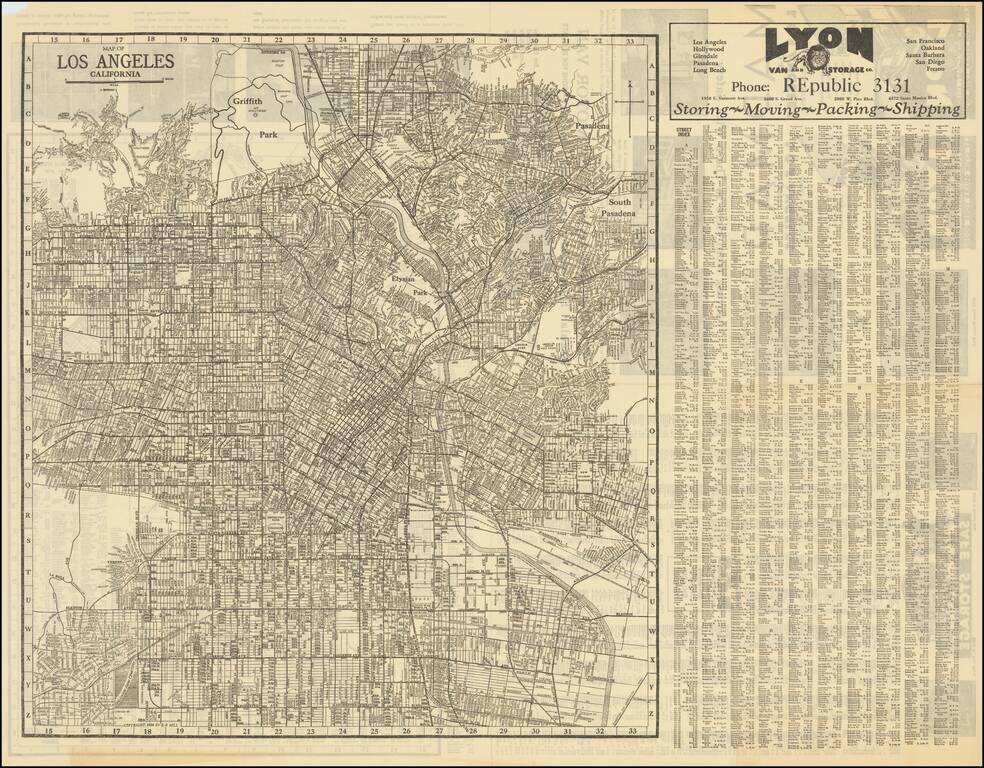
Detailed street map of 1930s Los Angeles, focusing specifically on Downtown Los Angeles and adjacent neighborhoods. On the verso is a "Map of Western Portions of Los Angeles" also by E.F. Hill, that stretches from Vista Del Mar to Santa Monica. The...
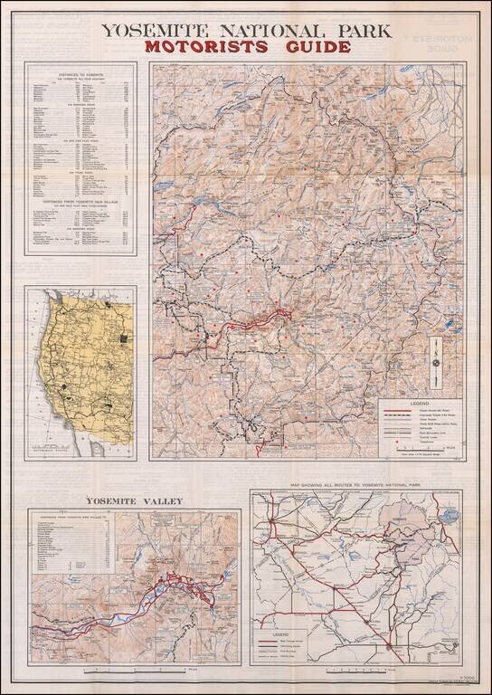
Including the Bear Feeding Platform! Large motorist guide map to Yosemite National Park, with smaller maps of Yosemite Valley, Routes to the park and a regional map. The primary maps locate Paved Roads (66 miles), Improved Roads (142 miles), Other...
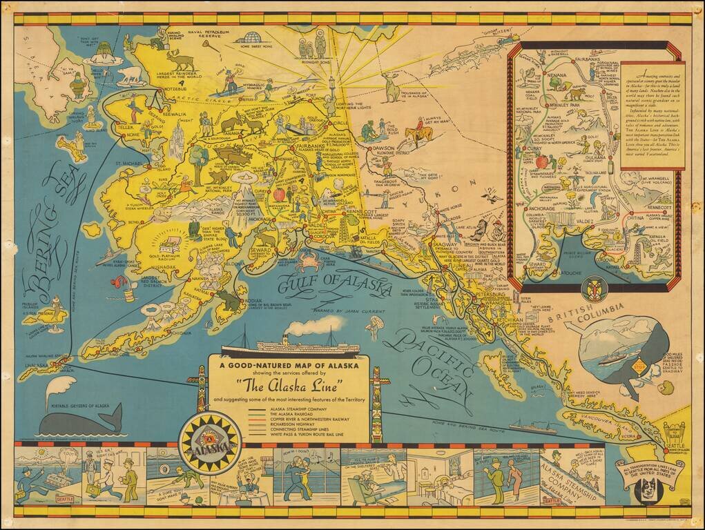
Nice example of the first edition of this decorative pictorial map of Alaska, first drawn by Edward Camy for the Alaska Steamship Company in 1934. A fine pictographic map of Alaska, with a large inset of the Alaska Railways Route from Seward to...
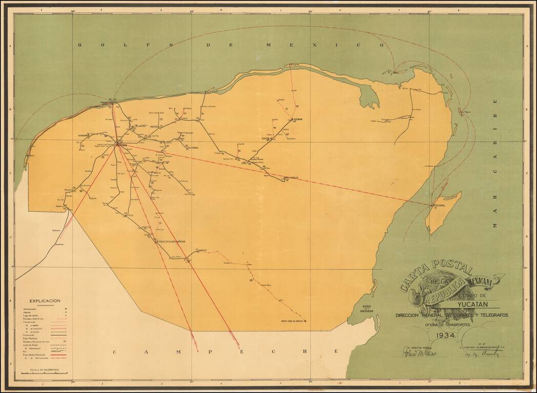
Postal Services In Mexico -- From Air Mail to Horseback Rare separately published map of the Postal Roads within the Mexican State of Yucatan, published in the year following the creation of the Dirección General de Correos y Telegrafos as a...
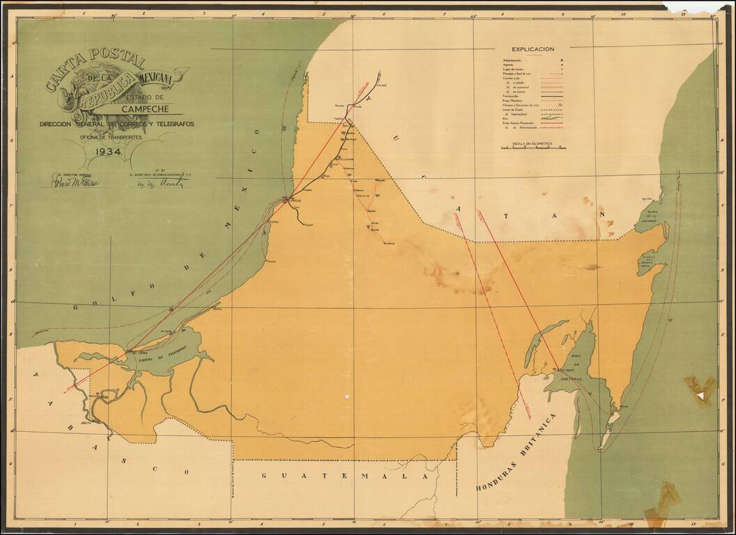
Postal Services In Mexico -- From Air Mail to Horseback Rare separately published map of the Postal Roads within the Mexican State of Campeche, published in the year following the creation of the Dirección General de Correos y Telegrafos as a...
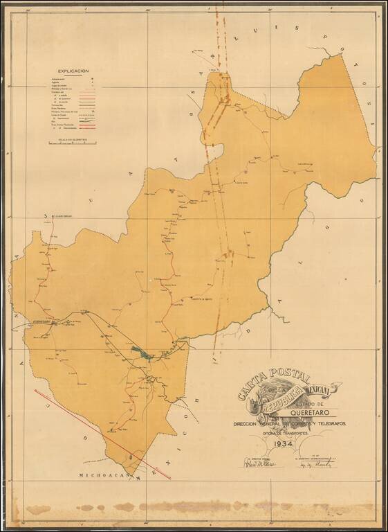
Postal Services In Mexico -- From Air Mail to Horseback Rare separately published map of the Postal Roads within the Mexican State of Queretaro published in the year following the creation of the Dirección General de Correos y Telegrafos as a...
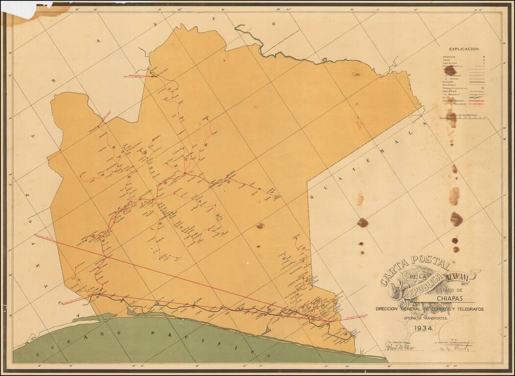
Postal Services In Mexico -- From Air Mail to Horseback Rare separately published map of the Postal Roads within the Mexican State of Chiapas published in the year following the creation of the Dirección General de Correos y Telegrafos as a...
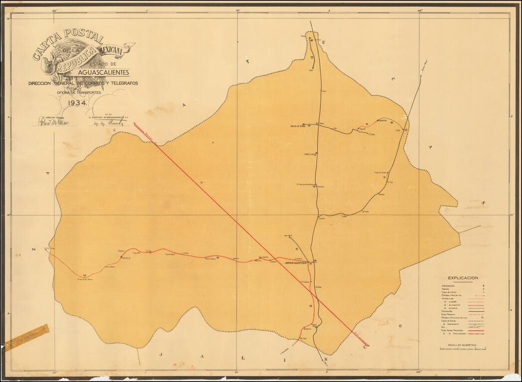
Postal Services In Mexico -- From Air Mail to Horseback Rare separately published map of the Postal Roads within the Mexican State of Aguascalientes, published in the year following the creation of the Dirección General de Correos y Telegrafos as a...