Map size in jpg-format: 35.9202MiB
Click to open in high resolution (open in new tab).

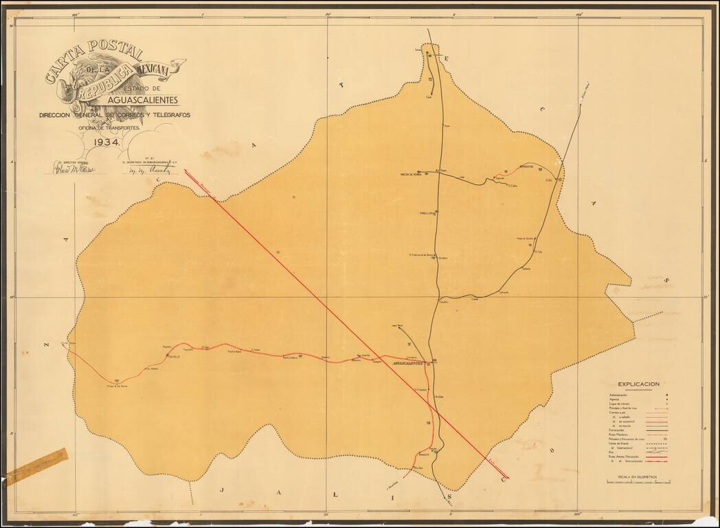
Postal Services In Mexico -- From Air Mail to Horseback
Rare separately published map of the Postal Roads within the Mexican State of Aguascalientes, published in the year following the creation of the Dirección General de Correos y Telegrafos as a consolidation of the Mexican Postal Service and the Mexican Telegraph Service.
One of the earliest postal route maps to focus on this state, illustrating the broad range of transportion modes used for mail delivery and the still relatively limited distribution available to local residents in the first half of the 20th Century in Mexico.
The map is quite remarkable, in that it integrates everything from Air Mail Services to mail routes serviced by foot and by horse.
The map explanation notes the following features:
Dirección General de Correos y Telegrafos
In 1933, by presidential order, the Postal service took control of the telegraph service in Mexico, creating the office "Dirección General de Correos y Telegrafos" (Executive Director of Postal Service and Telegraphs). In 1942, the President ordered the separation of the postal service and telegraph into two entities
Rarity
The map is apparently quite rare. We are unable to locate any other examples
If you are a student, write to us in telegram: @antiquemaps and indicate what material you need and for what work you need a map in high detail. We are ready to provide material on special terms. For students only!


![Map of Mexico, Central America, and the West Indies [Insets of Bermuda, Sandwich Islands, Jamaica and Panama Railroad]](/map/small/69133.jpg)