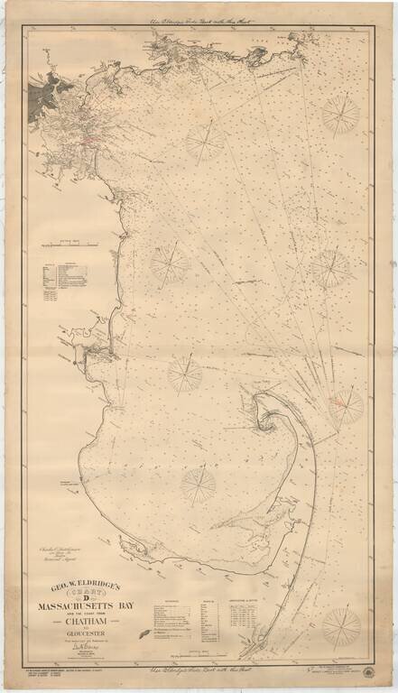
Detailed sailing chart showing Massachusetts Bay and the coast from Chatham, up to the tip of Cape Cod and then around as far as Gloucester northeast of Boston. Soundings are given throughout as are sailing directions. The coast line is accurately...
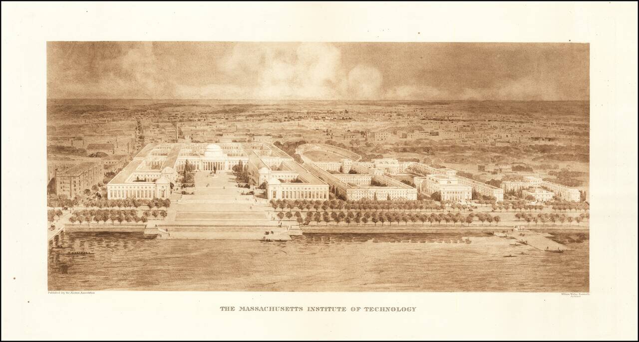
Rare Early View of MIT Fine example of William Welles Bosworth bird's-eye view of the Massachusetts Institute of Technology (MIT) campus in Cambridge, Massachusetts, published by the Alumni Association. Bosworth's view shows MIT from across the...

A View of Newark looking North To Brooklyn & Manhattan Fine large-format chromolithographic view of Newark, Kearny, Harrison, Jersey City, New York Bay, Manhattan and Brooklyn. A wonderful view showing Newark, Kearny, Arlington, Jersey City and...
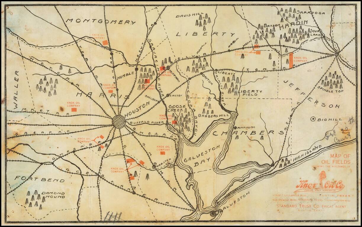
Extremely Rare Early Texas Oil Promotional Map, Featuring the First Oil Fields of the Texas Oil Industry. Separately issued promotional map printed in black (showing geographical features including towns and railroads) and red (showing the oil leases...
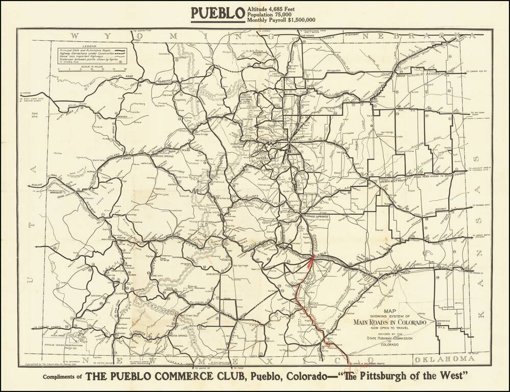
The Pittsburgh of the West Fine early road map of Colorado, published by the Colorado Highway Commission. The map differentiates different types of roads, including: Principal state and automobile roads (fat black line) Highway Connections under...
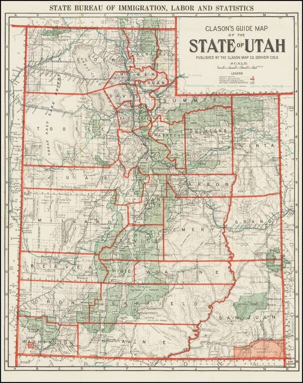
Rare Early Automobile Road Map of Utah Scarce map of the state of Utah, published by Clason for the Utah Bureau of Immigration, Labor and Statistics. The map shows County Seats, County Boundaries, Townships Unsubdivided and National Forest...
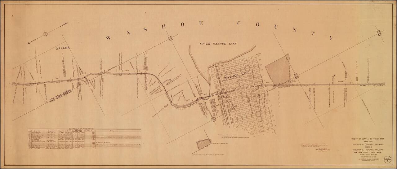
An Early Western Town Destroyed By The Arrival of the Railroad Interesting map of the area around Washoe City, published by the Virginia & Truckee Railway. Now nearly a ghost town, Washoe City was founded in 1860 as a lumbering camp for Virginia...
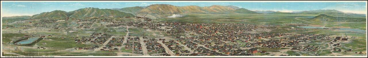
Rare Chromolithographic Panorama View of Butte -- Published in Montana Rare Panoramic View of Butte, Montana, published by "Published by Keefe Bros. Post Office News Stand Butte, Mont." and lithographed by Todd Photo & Film Co. The view provides...
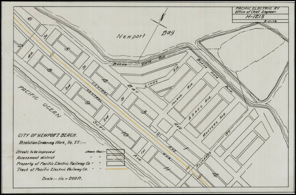
Detailed map of a portion of Newport Beach, bounded by Surf Avenue, Buena Vista Avenue, 4th Street and Alvarado Street. Shows the tracks of the Pacific Electric Railway and other details.
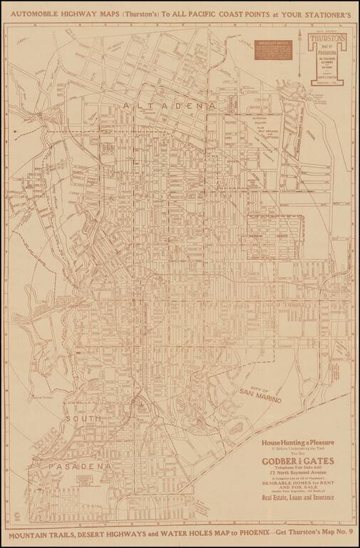
Scarce separately issued map of Pasadena, South Pasadena, Altadena and San Marino, published by Los Angeles map published Albert G. Thurston. The present example includes advertising from Godber & Gates, offering "A Complete List of All of...
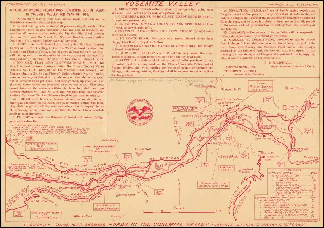
Rare early Automobile Guide map of Yosemite, printed (in red) by the Department of the Interior. Includes "Special Automobile Regulations Governing Use of Roads in Yosemite Valley For Year of 1916." Includes a list of distances and major landmarks....
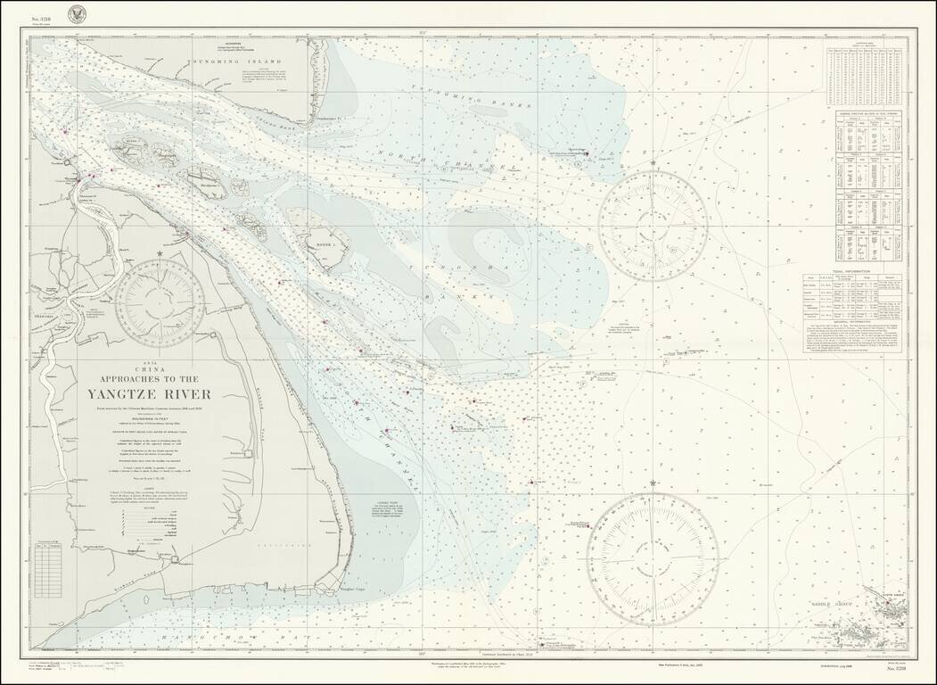
World War II-era hydrographical chart of the entrance to the Yangtze River and the Shanghai Region. Shanghai is shown at the left of the map, with details such as the railroads and their stations, the International Settlements, and local hamlets and...