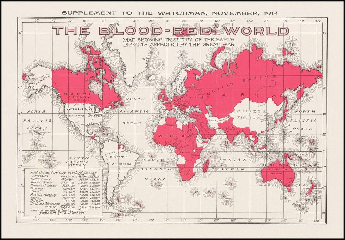
Interesting, small map issued as a supplement to the magazine The Watchmen magazine, which was published by the Southern Publishing Association of Nashville, Tenn. The map shows that 940,568,000 people were somehow affected by the war through living...
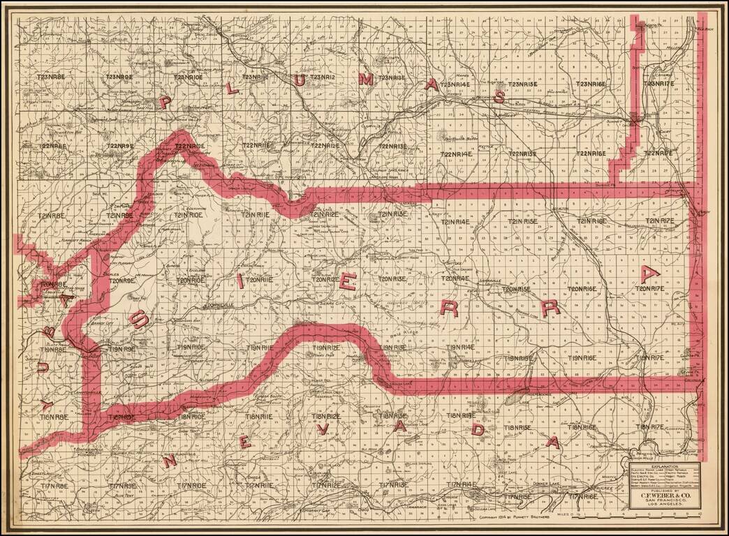
Highly detailed pocket map of Calaveras County, published by C.F. Weber. The map shows early railroads, roads, wagon roads, mines, lakes, mills, and many other details. Calaveras County was one of the original counties of the state of California,...
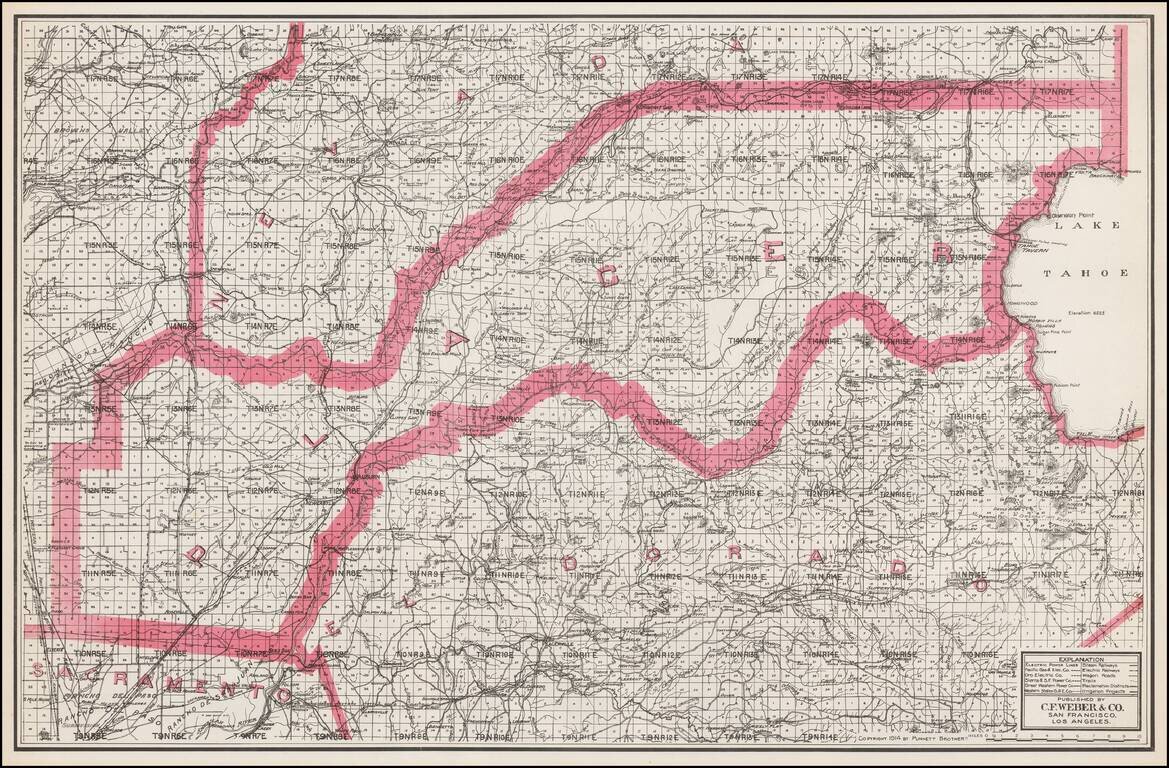
Separately issued unfolded map of Lake Tahoe, El Dorado County, Placer County, etc., published by C.F. Weber. The map shows early railroads, roads, wagon roads, mines, lakes, mills, and many other details.
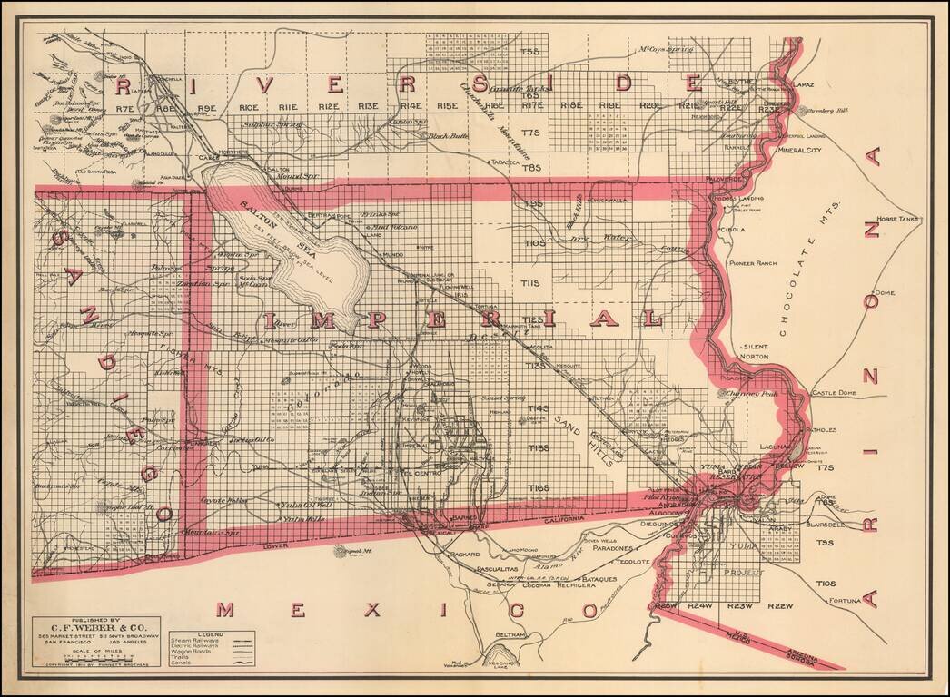
One of the Earliest Separate Maps of Imperial County Scarce separately issued map of Imperial County, published by C.F. Weber & Co. The map was issued just 7 years after the formation of the county and 9 years after the Salton Sea was created by...
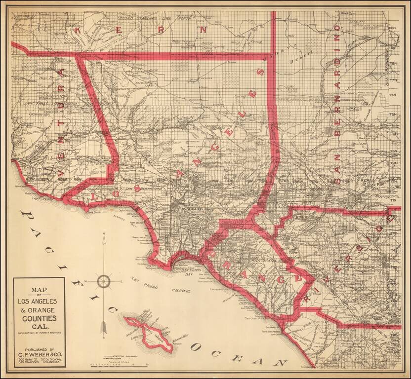
Highly detailed map of Los Angeles and Orange Counties, published by C.F. Weber. The map shows early railroads, roads, wagon roads, mines, lakes, mills, and many other details. A number of early ranchos are shown. There is additional detail of...
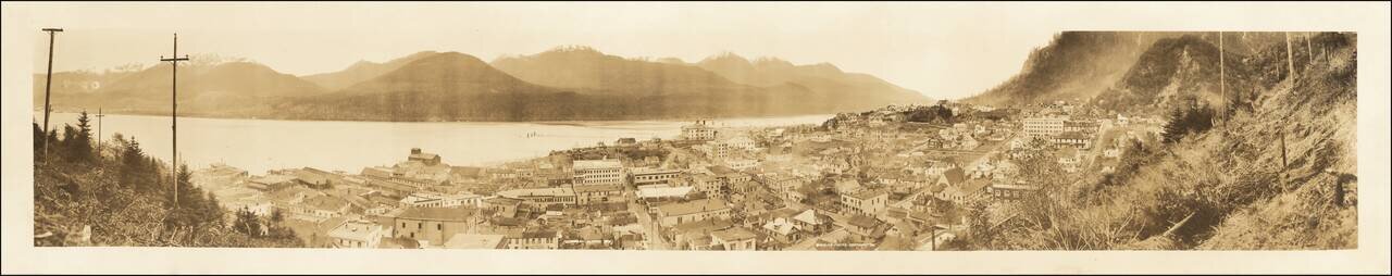
Fine panoramic photographic view of Juneau taken from the mainland with the city in the foreground and Douglas Island in the background. Sheelor, originally known for California scenic photography, went to Alaska and the Klondike where he photographed...
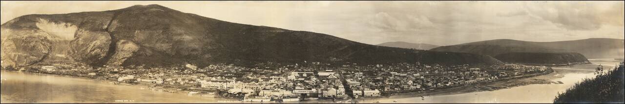
Panoramic photographic view of Dawson City in Yukon Territory, likely taken by Sheelor at the later end of the Klondike Gold Rush. Wonderful panorama of the town taken from a hill across the Yukon River. While at the time of this photo Dawson City...
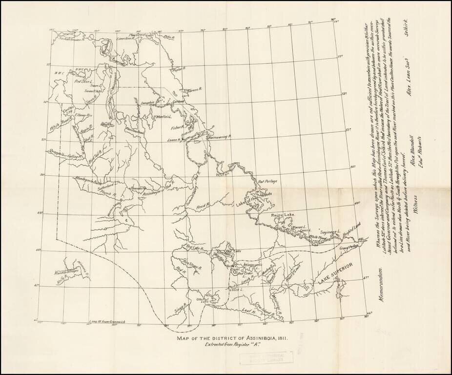
Early copy of one of the original maps delineating the Red River Colony, undertaken by Alex Lean, surveyor, in Selkirk. The name District of Assiniboia was used to describe the Red River Colony, (for official purposes), between 1812 and 1869. An...
![[WWI Russian Propagandist Broadside: 'The Air War. - The Feats of Pegu']
Voina v vozdukhe. – Podvig Pegu.](/map/small/37962.jpg)
A Rare Russian World War I Propagandist 'Lubok' broadside, celebrating the feats of French fighter ace Adolphe Célestin Pégoud, printed in Moscow by Ivan Stylin. This amazing Russian WWI broadside shows the French fighter ace Adolphe Célestin...
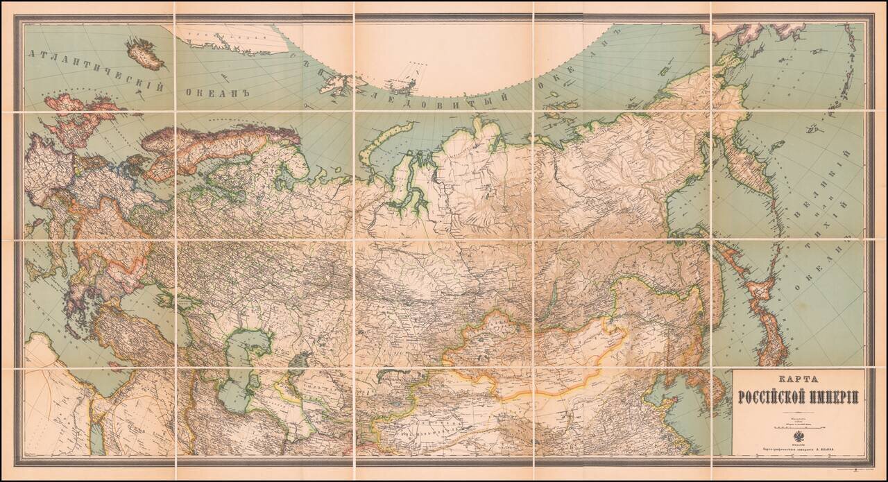
Excellent Russian-language antique map of Russia, published in the last years of the Russian Empire. The map was published by the Alexey Iliyn Cartograph Institute, which was named after one of Imperial Russia's great 19th-century cartographers. The...
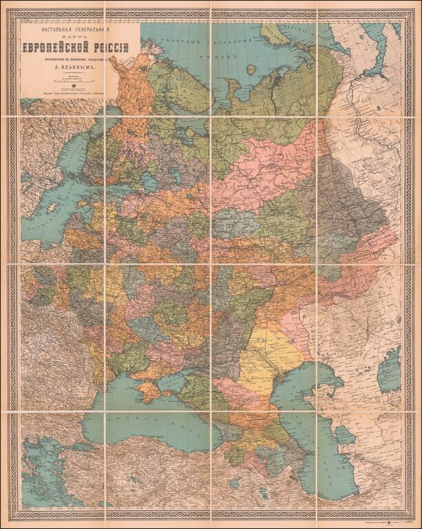
Attractive Russian-Language Map of Russia, from the World War I Era. Antique map of European Russia, published in Petrograd (Saint Petersburg) between 1914 and 1917. The map was published by the Alexey Iliyn Cartograph Institute, which was named...
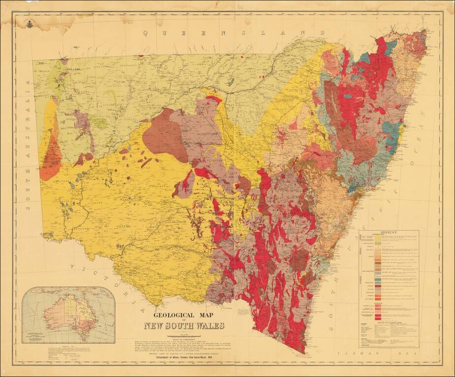
Detailed color-printed two-sheet geological map of New South Wales, published by the Department of Mines, Sydney, New South Wales, in 1914. The map was prepared under the direction of E.F. Pittman, A.R.S.M., a government geologist. The map contains a...