Map size in jpg-format: 162.054MiB
Click to open in high resolution (open in new tab).
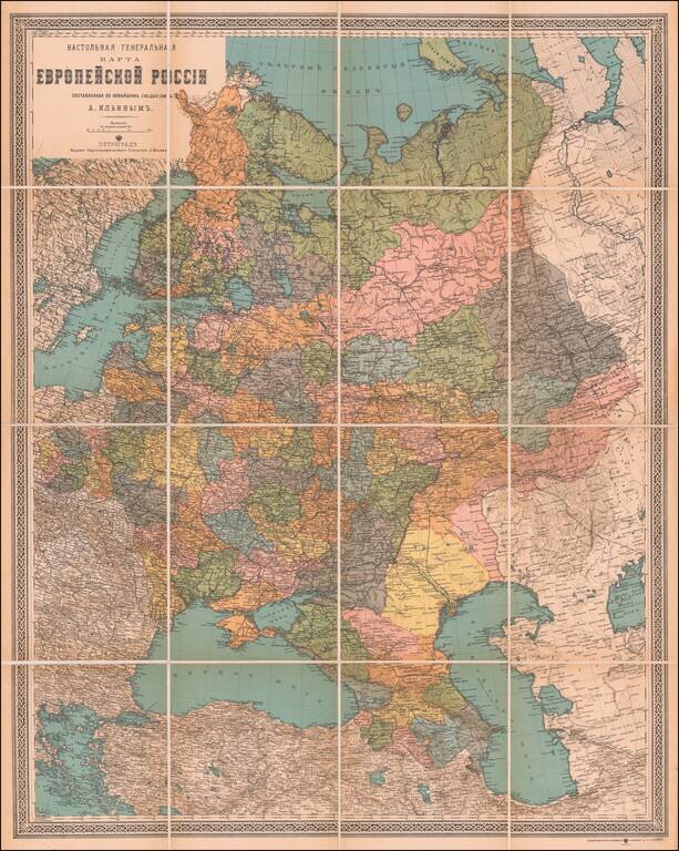
Attractive Russian-Language Map of Russia, from the World War I Era.
Antique map of European Russia, published in Petrograd (Saint Petersburg) between 1914 and 1917.
The map was published by the Alexey Iliyn Cartograph Institute, which was named after one of Imperial Russia's great 19th-century cartographers.
The map can be dated by its use of "Petrograd" rather than "Saint Petersburg", a convention adopted by the Russians to de-Germanize the city after the start of World War I. It carried this name from 1914 until it was renamed Leningrad in 1924.
If you are a student, write to us in telegram: @antiquemaps and indicate what material you need and for what work you need a map in high detail. We are ready to provide material on special terms. For students only!
![[Signed Political Satire Artwork] Vietnam ... Vietnam ... Vietnam ...](/map/small/68726.jpg)

