
Decorative and unusual trading card map from this famous series. Map is surrounded by decorative vignettes.

Decorative and unusual trading card map from this famous series. Map is surrounded by decorative vignettes.

Decorative and unusual trading card map from this famous series. Map is surrounded by decorative vignette, showing Wool raising and the Garfield Monument. Includes population statistics.
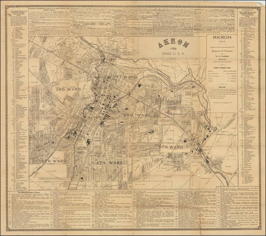
Great early map of Akron, Ohio by W.W. Warner, produced under the auspices of the Akron Board of Trade. The map shows the city divided into wards, with fine plot-level detail throughout the covered area. Some neighborhoods and landowners are named....
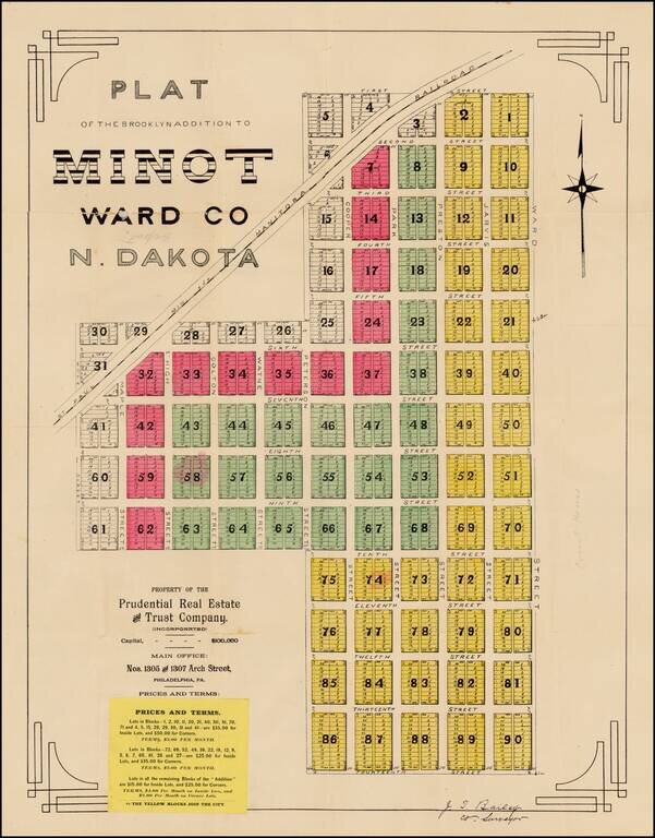
Fine early plat for a portion of downtown Minot, North Dakota, printed shortly after the creation of North Dakota in 1889, one of the earliest surviving maps of the town of Minot, North Dakota. The Brooklyn Addition is a part of Minot's central...
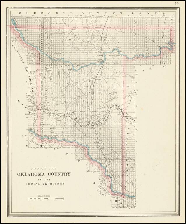
Unusual map of the "Oklahoma Country," published by George Cram in Chicago.
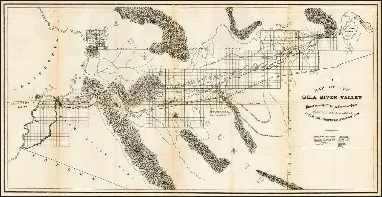
Scarce regional map of the region extending from Yuma and the Colorado River to Oatman Flat, which at the time was the site of a proposed reservoir. The map was prepared by the Citizens Executive Committee on a proposed reservoir and irrigation of Yuma...
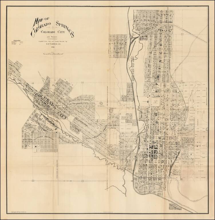
Unrecorded map of Colorado Springs, published by noted naturalist Edward Royal Warren in 1889. The map provides a meticulous view of the city, including early subdivision names, the location of major buildings, the location of the Colorado Midland...
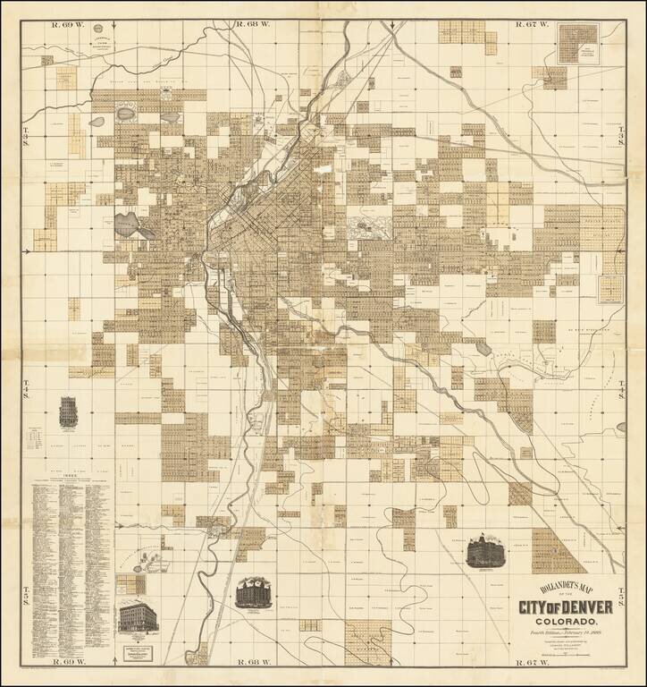
Fine separately issued map of Denver, published by Edward Rollandet in Denver. A fine large map, illustrating the early subdivisions in the city of Denver, with vignettes of the Windsor Hotel, Albany Hotel, Essex Building and Johnson Block. The map...
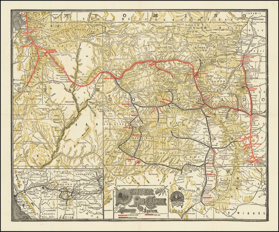
Detailed railroad map of Colorado and part of Utah. Promotional map for the Denver & Rio Grande Railroad. The border of Grand and Unitah Counties suggests a date of 1889 to 1890. The map was produced in numerous editions over the decades.
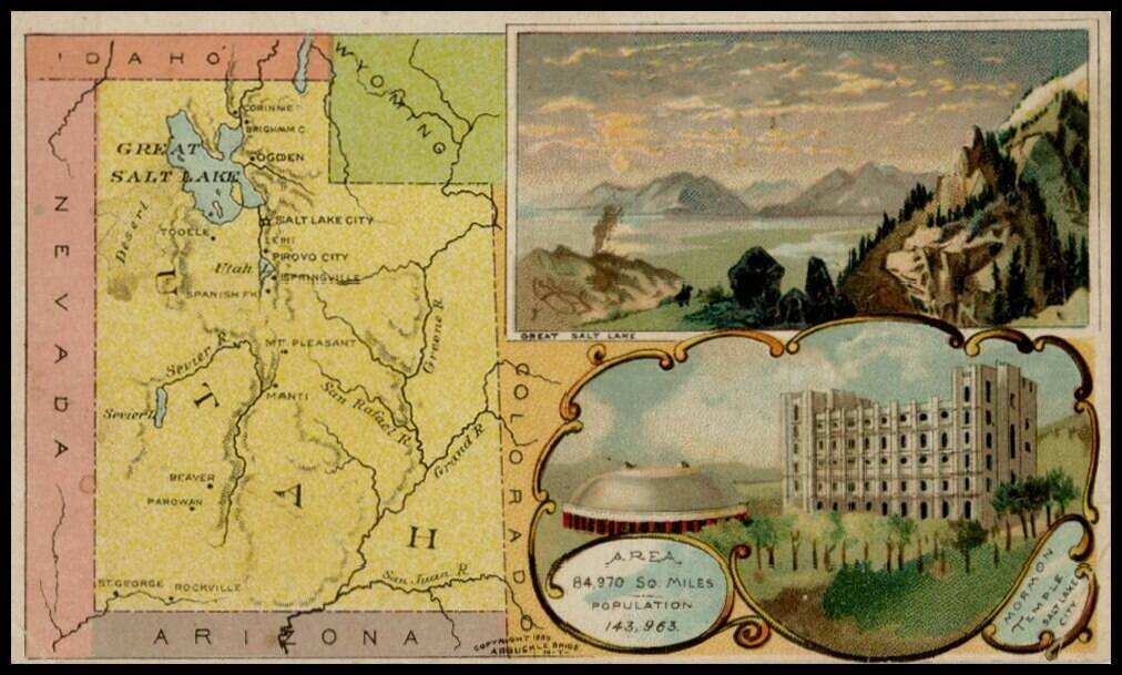
Decorative and unusual trading card map from this famous series. Map is surrounded by decorative vignette, showing Great Salt Lake and Mormon Temple. Includes population statistics.
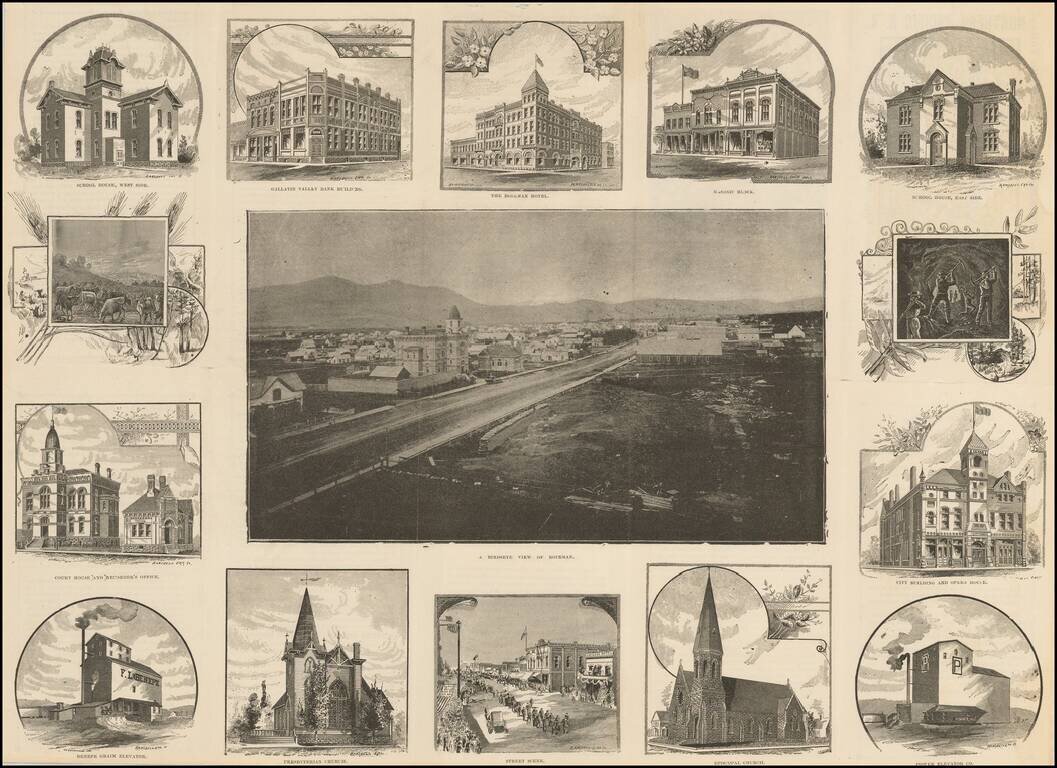
edRare Photographic Birdseye View of Bozeman, Montana Very rare promotional work, illustrated with a photographic view of Bozeman, Montana, surrounded by 14 views showing buildings, street scenes and other illustrations of contemporary life....
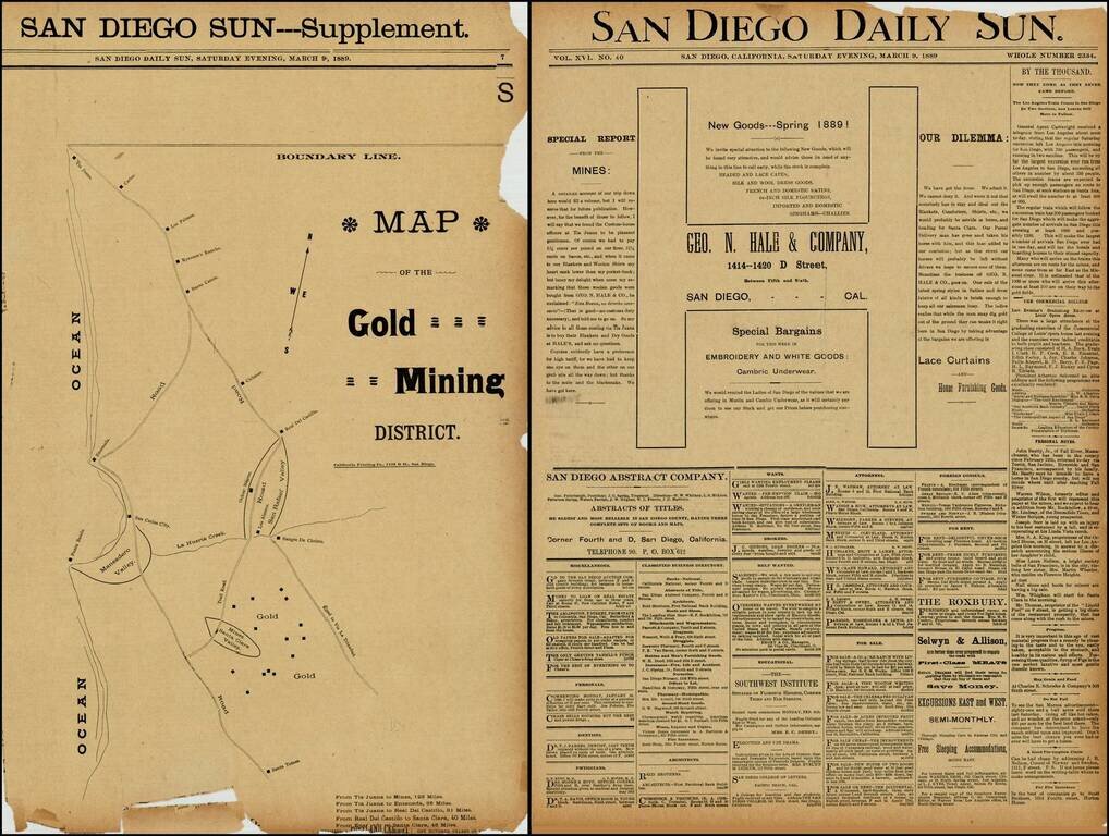
Rare map of the gold mining regions southeast of Ensenada near the Santa Clara Valley, published in the San Diego Sun in March 1889. The map shows the roads south from Tijuana to Ensenada and Santa Tomas, including the region identified as having Gold...
![[Illustrated San Francisco Advertising Map] Map Business Portion San Francisco Showing Location of Hotels, Theaters, Etc. Etc.](/map/small/50207.jpg)
Rare Illustrated San Francisco Advertising Map Rare illustrated 19th Century San Francisco advertising map, which incorporates a map of the San Francisco Business District with finely illustrated advertisements on the front and back of the map. The...
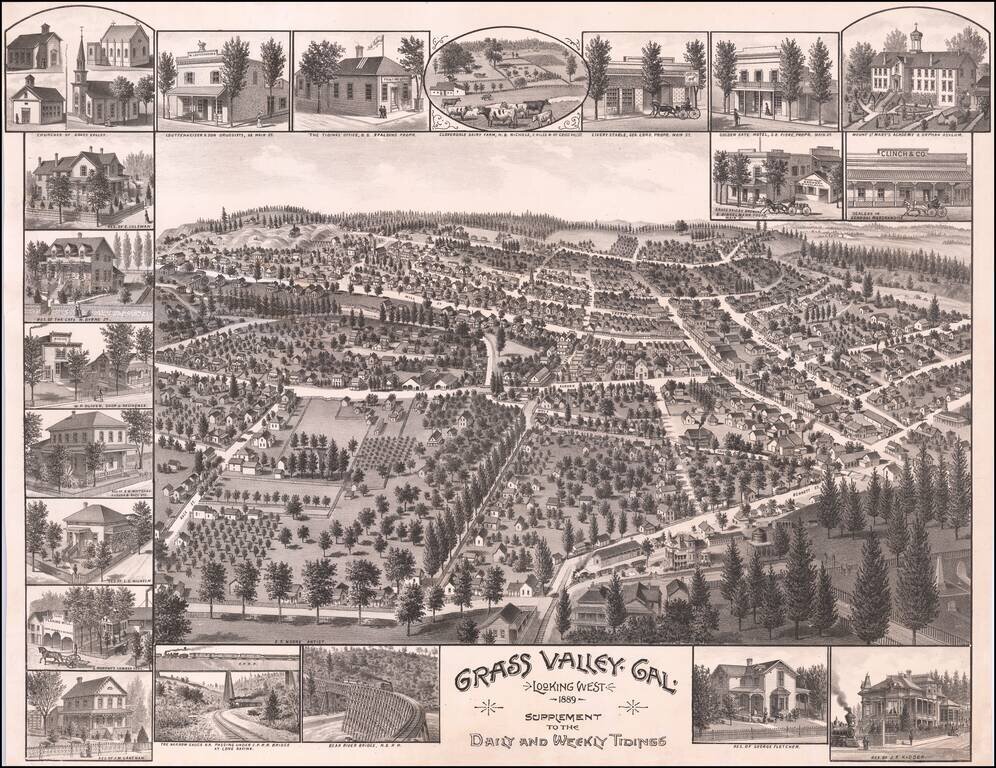
A Rare View of Grass Valley, California Finely executed birds-eye view of Grass Valley, California, created by E.S. Moore and published by Grass Valley's Newspaper, the Grass Valley Daily and Weekly Tidings. The view captures a mature Grass Valley,...
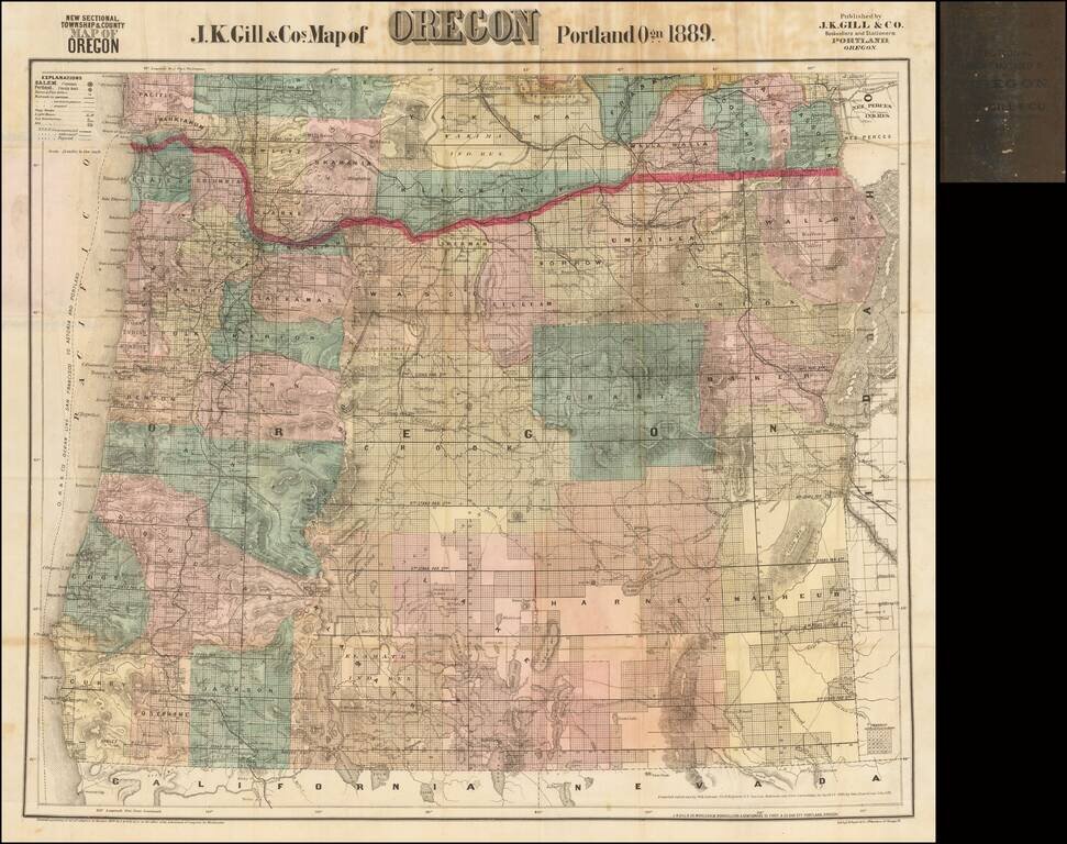
The Most Popular Separately Published Map of Oregon of Its Time -- Portland Publisher Scarce separately issued map of Oregon by J.K. Gill, the leading local seller of books and stationary in Portland at the time. Gill's maps were frequently updated....