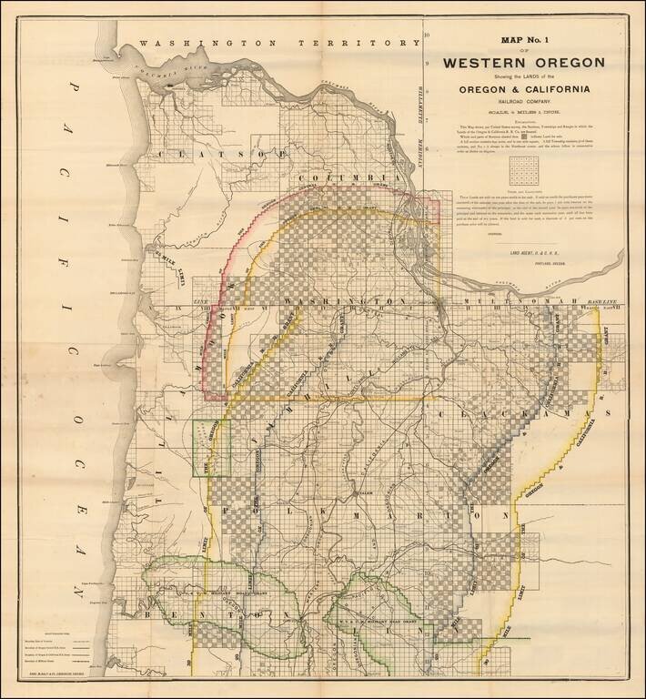
Lands Granted to the Oregon & California Railroad Rare separately published map of northwestern Oregon, printed by Rand McNally & Co. for the Oregon & California Railroad Company. The map extends from the Columbia River to Yaquina Bay and...
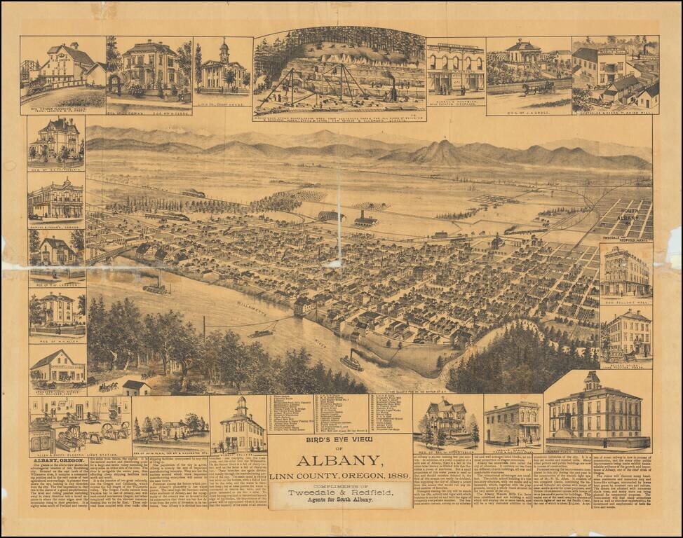
One of the Earliest Settlements in Oregon Rare separately published view of Albany, in Linn County, Oregon. Includes an interesting smaller view of the Albany Sand Stone Quarry and Allen & Goff's Electric Light Stations, along with the unusual...
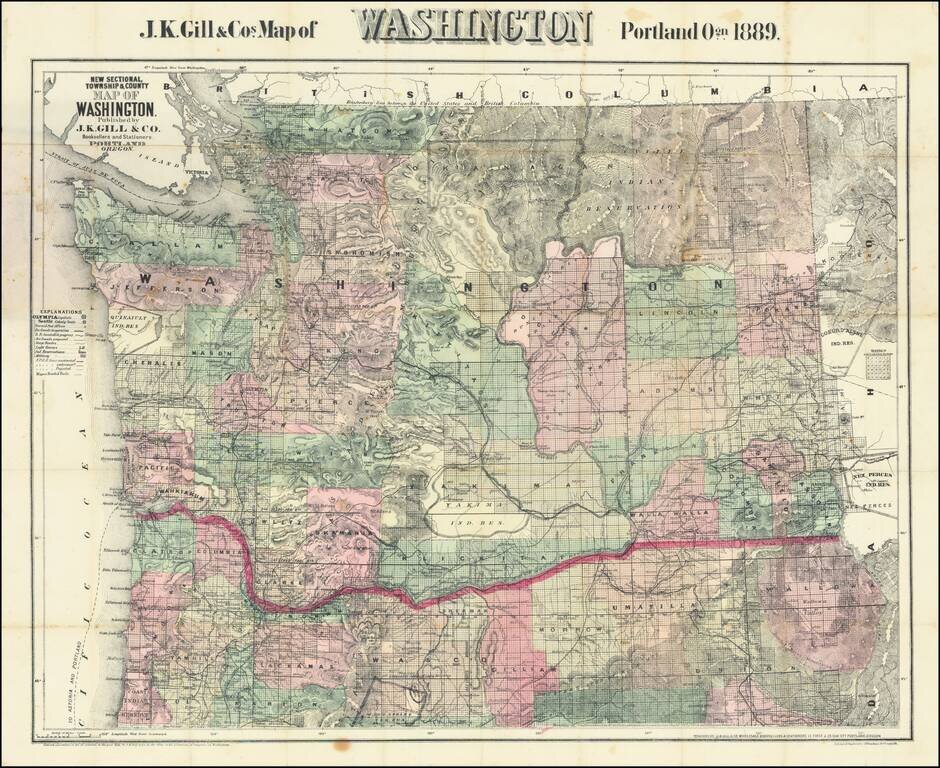
Large Separately published map of Washington. Scarce separately issued map of Washington by J.K. Gill, the leading local seller of books and stationery in Portland at the time. This would appear to be the third state of Gill's map, which was first...

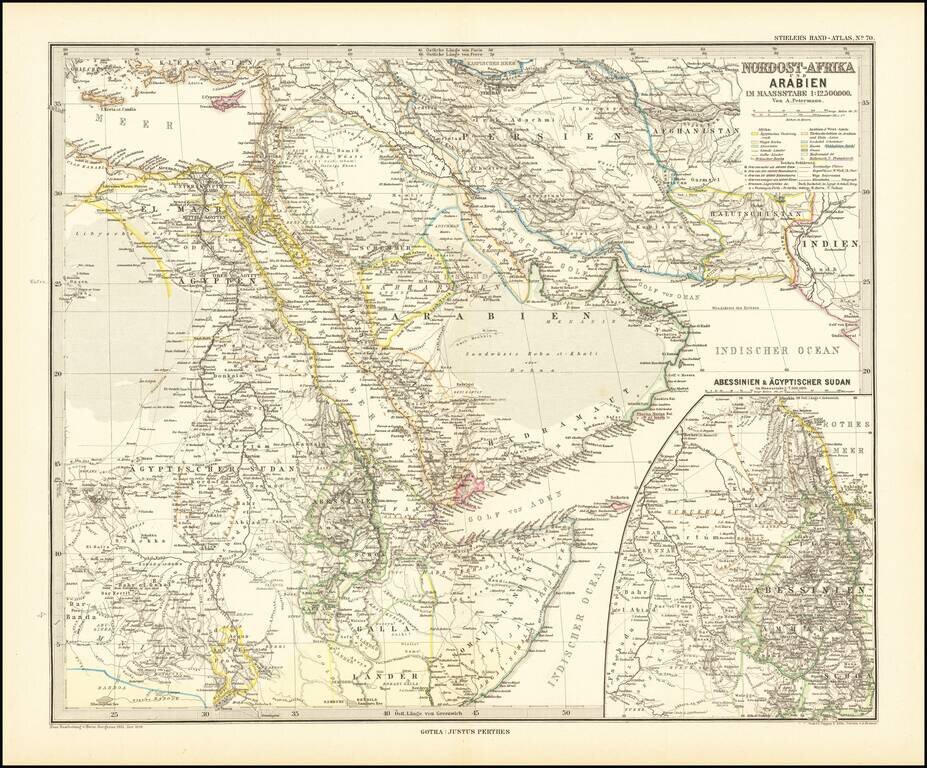
Finely detailed map centered on the Arabian Peninsula, published by Germany's leading mapmaker. Abu Dhabi is named (Abu-Debi), as is Schardscha (Sharjah), and Dibba. Katar (Qatar) is named, as is Sabara (Zubara), El Bedaa (Doha / El Bedaya) and Wakra...
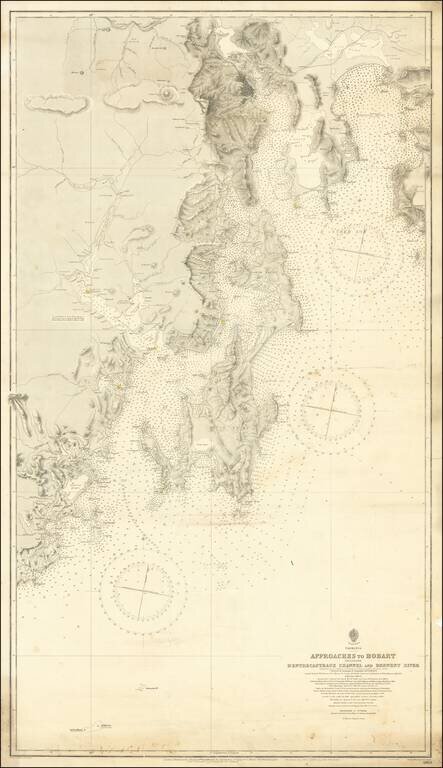
Detailed sea chart of the approaches to Hobart, first published by the British Admiralty in 1889. The present example is corrected to 1912 and presents a highly detailed look at the Tasmanian Coastlilne between Recherche Bay and the Tasman Peninsula,...
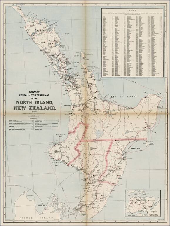
Map of the North Island of New Zealand showing railways, railway stations, post and telegraph offices and postal routes. Relief shown by hachures. Index locates places within the island. One of the largest maps of North Island to appear in a...