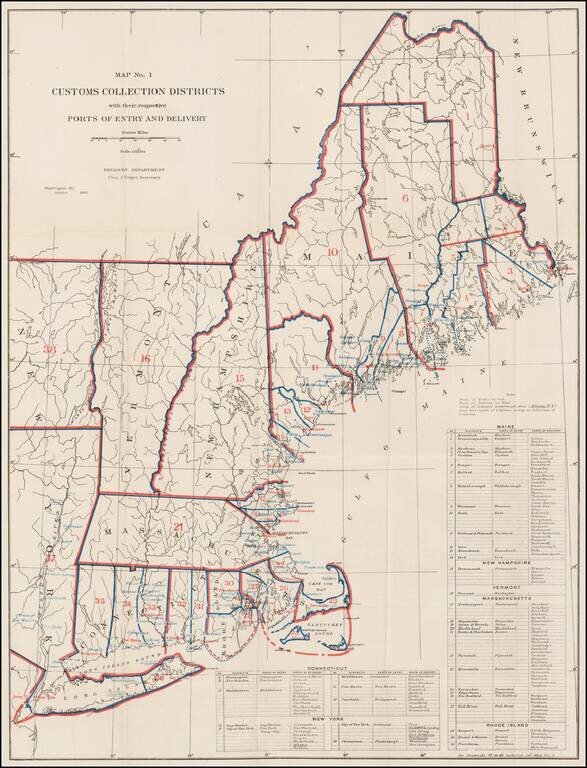
Rare Treasury Department Map of the New England and Northeast Region, identifying the customs port of entry. The following are annotated: Ports of Entry (red) Ports of Delivery (blue) The table identifies dozens of ports districts. A...
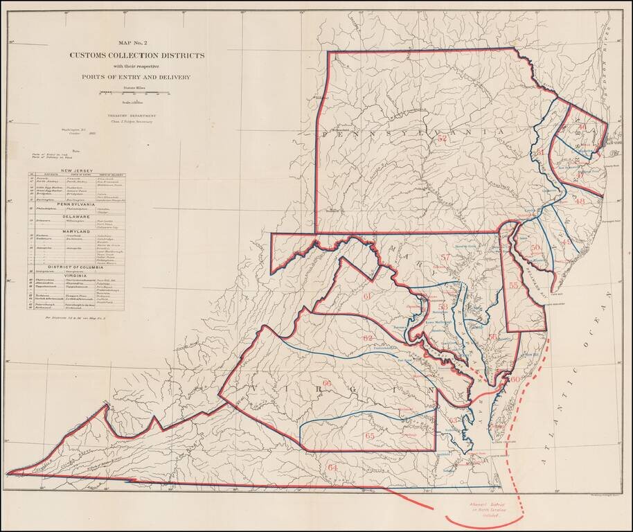
Rare Treasury Department Map of the Mid-Atlantic Region, identifying the customs port of entry. The following are annotated: Ports of Entry (red) Ports of Delivery (blue) The table identifies about 40 different ports districts. A fascinating...
![Outline Map of the County and City of Philadelphia and Vicinity [with] Philadelphia](/map/small/70517.jpg)
Large map of Philadelphia, with a smaller regional map and yet a third map showing the 23rd Ward. From one of the leading American map publisher of the 1870s and 1880s. Nice large format map.
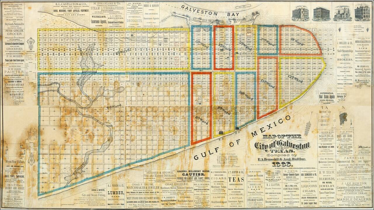
An Exceptional Wall Map of Galveston. The Only Known Copy. The only known copy of Hensoldt & Buttlar's massive six-sheet hand-colored lithographed wall map of Galveston, Texas. The map is replete with advertisements for local businesses,...
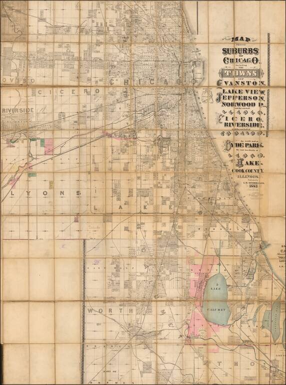
Massive, Detailed Wall Map of Chicago from the 1880s. L.M. Snyder & Co.'s extremely rare lithographed folding map of Chicago, published in Chicago during its major late-19th-century real estate boom. The map has considerable detail for its size;...
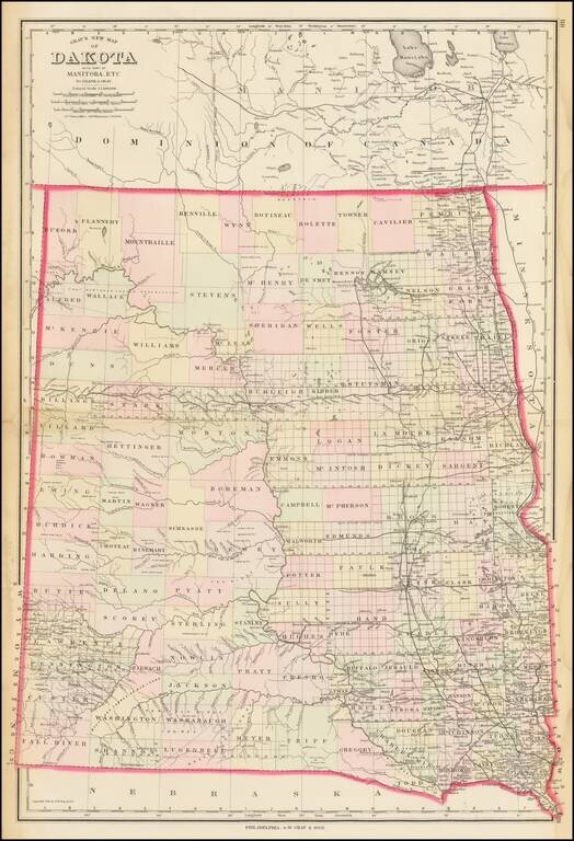
Highly detailed map of Dakota Territory, published by OW Gray & Son. The map is colored by counties and showing towns, roads, railroads, Post Offices, etc. Many counties not yet formed.
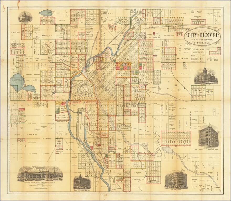
Rare Early Map of Denver Highly detailed map of the city of Denver, published by H.L. Thayer. The map is centered on the Platte River and includes the names of dozens of land owners, subdivisions and other details. In east Denver, the location of a...
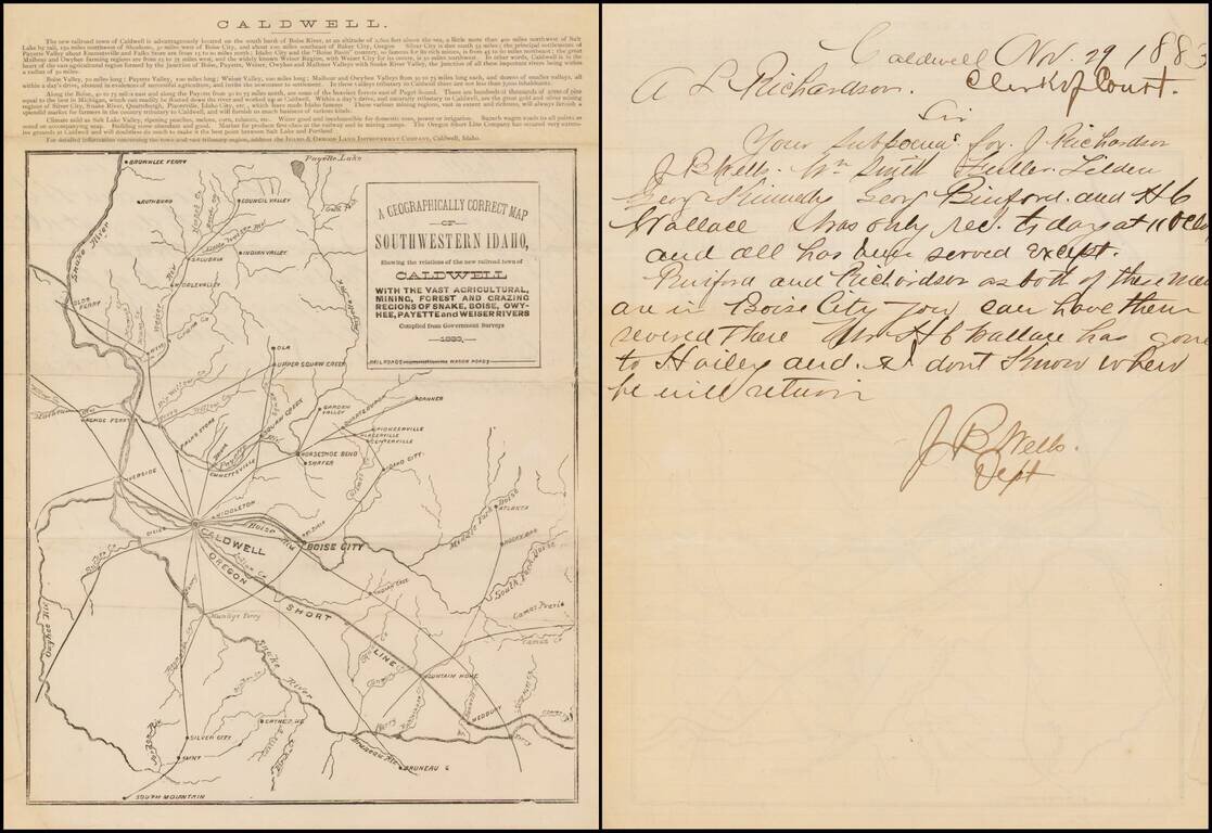
Fascinating early Idaho letter sheet, promoting the newly formed town of Caldwell, Idaho, published by its promoter, the Idaho & Oregon Land Improvement Company. The lettersheet provides a brief description of the location and advantages of...
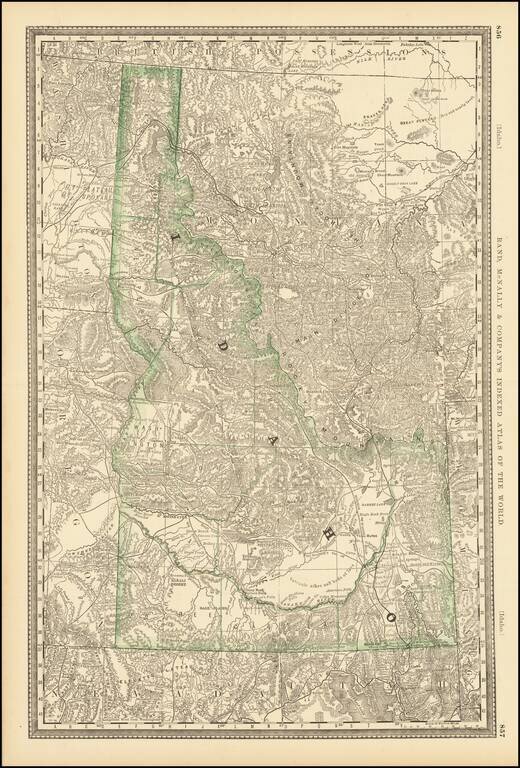
Early separate map of Idaho Territory. Highly detailed, showing towns, mines, roads, railroads, mountains, rivers, Indian Reservations, military reserves, post offices, forts, lakes, etc.
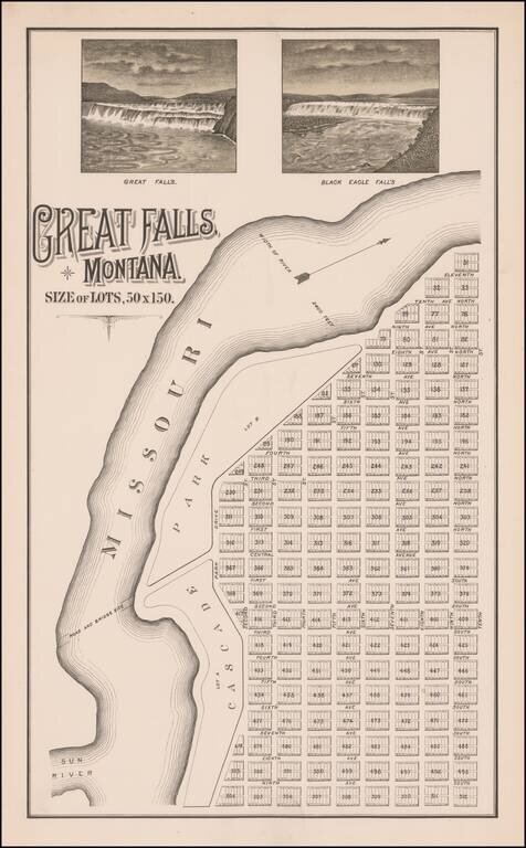
The Lost Original Map of the Townsite of Great Falls, Montana Flawless example of this previously unknown map of Great Falls, Montana, almost certainly published by its original founders (Great Falls Townsite Company) in December 1883. The map...
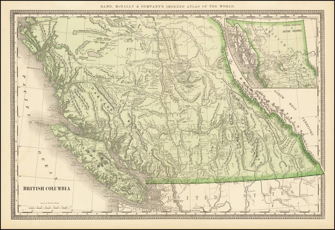
Highly detailed large format map of British Columbia from an early edition of Rand McNally's Indexed Atlas of the World. Exceptional detail. Includes towns, mountains, rivers, lakes, elevations, points, inlets, bays and many other details.
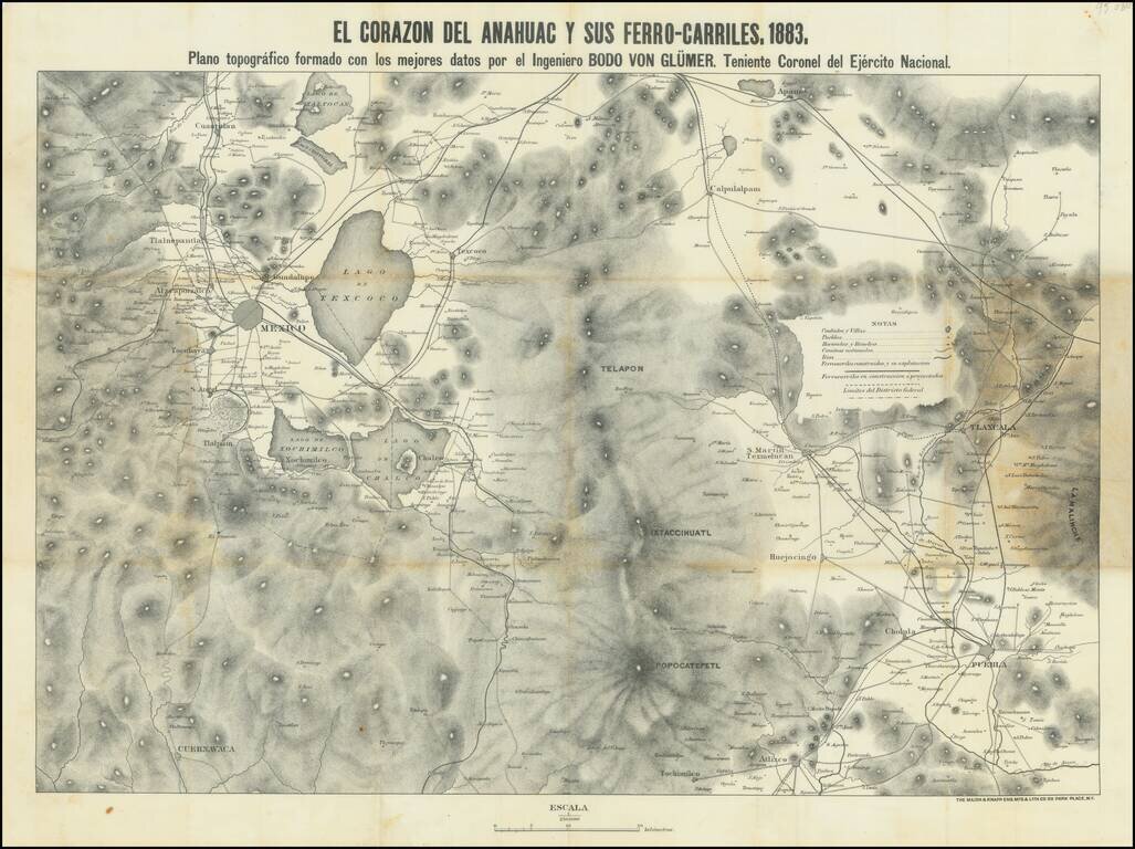
This is a map showing the region around Mexico City, focusing on the railroads of the area. Topography, cities, towns, rivers, and other roads are also shown. The title refers to the Nahuatl name for the Aztec homeland. Mexico City is visible in the...
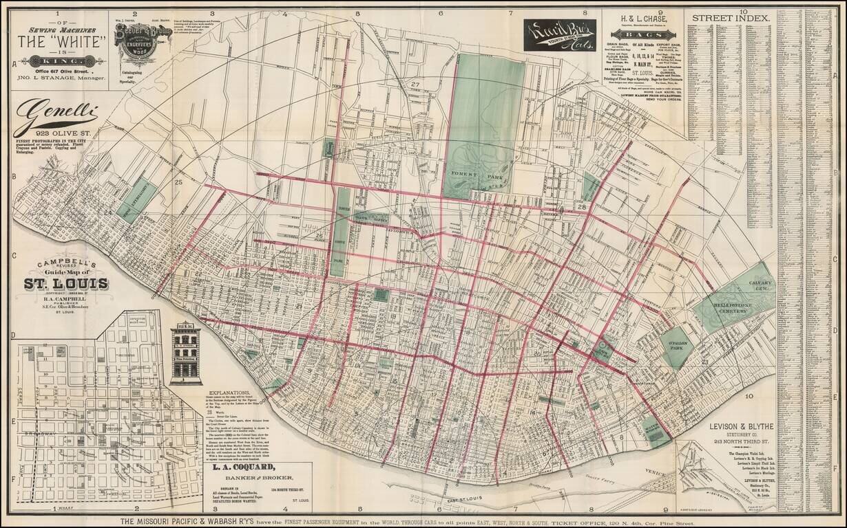
Scarce map of St. Louis, published by R. A. Campbell. Includes significant local advertising. Outline color highlighting each ward with parks in green. Street index included on map which folds into a 16x10 cardboard cover entitled "Campbell's Revised...
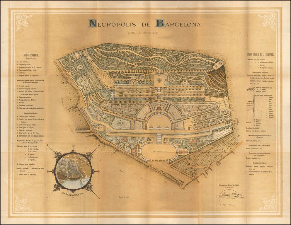
Striking chromolithographic view of the primary cemetery in Barcelona, with a smaller inset map showing the location in the city. An attractive multi-color chromolithographic image.
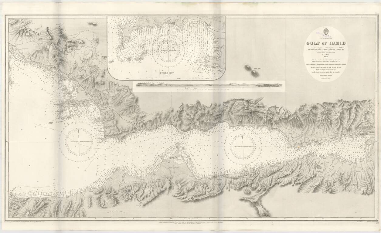
Detailed sea chart of the Gulf of Ismit, the easternmost part of the Sea of Marmara. This elaborate and highly detailed chart extends from Ismit in the east to Sedef Island (Prince Islands), Kartal and the southeastern suburbs of Istanbul in the North,...
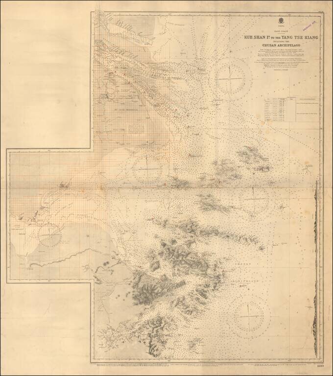
Redlined For Contemporary Use Detailed sea chart of the mouth of the Yangtze River in the north to the Zhousan Island, published by the British Admiralty. The chart includes thousands of soundings, islands, sailing directions and lighthouses,...