Map size in jpg-format: 1.12744MiB
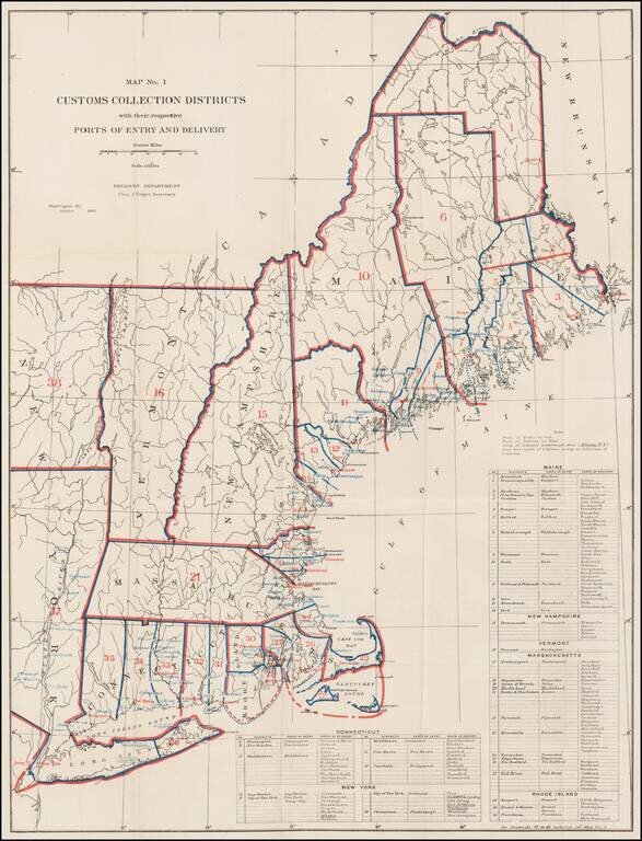
Rare Treasury Department Map of the New England and Northeast Region, identifying the customs port of entry.
The following are annotated:
The table identifies dozens of ports districts.
A fascinating look at government administration in the late 19th Century.
If you are a student, write to us in telegram: @antiquemaps and indicate what material you need and for what work you need a map in high detail. We are ready to provide material on special terms. For students only!
![[The First Maps in a la poupée Printed Color] Cartes en Couleur des Lieux Sujets aux tremblements de Terre Dans toutes les parties du Monde Selon le Sisteme de l’impulsion Solaire](/map/small/52293op.jpg)

