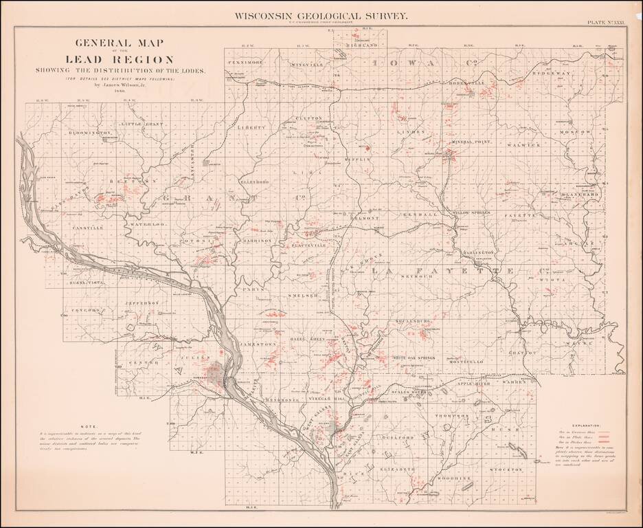
Scarce map of the Lead Region, including parts of Wisconsin, Illinois and Iowa, from the 1880 Geological Survey of Wisconsin. The map was included in a Geological Atlas by T.C. Chamberlin and Chief Geologist R.D. Irving.
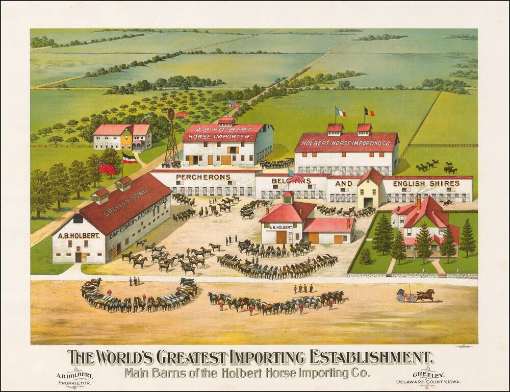
The most extensive importer, breeder and seller of registered horses in the United States Fine chromolithographic image of this outstanding horse farm in Greeley, Iowa. On the barns Holbert advertises that he carries the following breeds:...
![[Indian Territory [with Colorado on verso]](/map/small/69383.jpg)
Highly detailed map of Colorado [and Indian Territory on the back side], hand colored by counties and showing townships, towns, roads, mountains, rivers, lakes, mines, plateaus, railroads, etc. One of the most detailed maps of the period for each of...
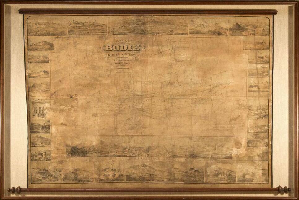
Edward Eysen's Mammoth View of Bodie, California. Remarkable view of Bodie, California, published by Edward Eysen in 1880. This spectacular wall map is arguably one of the most sought-after pieces from Bodie. The main body is a plan view map of...
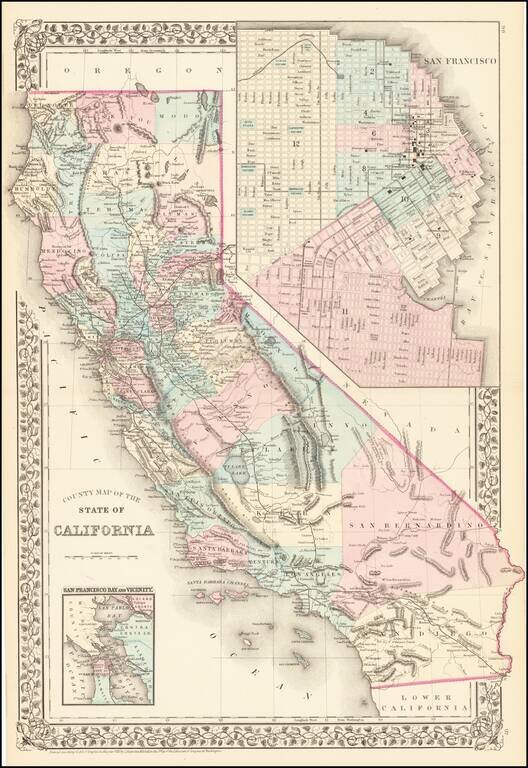
Attractive map of California, colored by county. Predates a number of Southern California Counties. Includes a detailed inset plan of San Francisco, colored by wards. Shows towns, roads, railroads, rivers, lakes, mountains, missions, etc. Decorative...
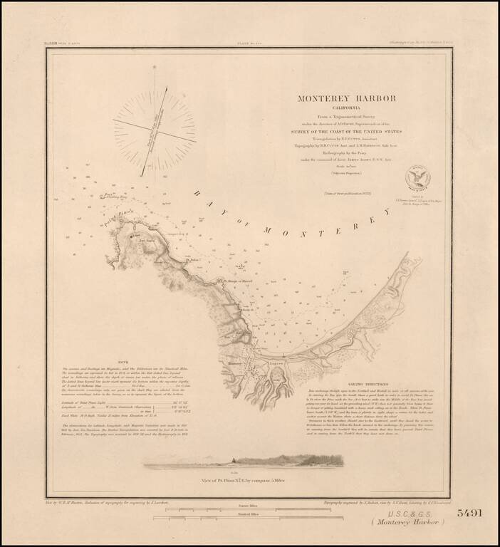
Nice example of this important early survey of Monterey Bay, published by the United States Coast & Geodetic Survey. Incudes a profile view of Pt. Pinos. Shows a Monterey town plan, Point Pinos, Pt. Anlon, Pt Almejor Mussell, the Lagoon, Fort,...
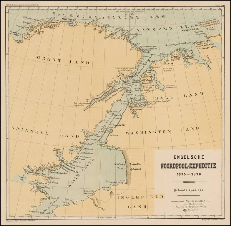
Detailed map illustrating the British Arctic Expedition of 1875-1876. The British Arctic Expedition of 1875-1876, led by Sir George Strong Nares, was sent by the British Admiralty to attempt to reach the North Pole via Smith Sound. Two ships, HMS...
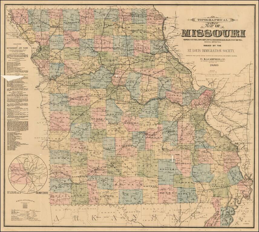
Rare separately published map of Missouri, published by the St. Louis Immigration Society. Inset map shows small map of Missouri, Illinois and nearby states, including the St. Louis railroad lines converging in St. Louis. The statistical table shows...
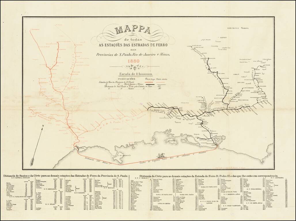
Rare separately published Railroad map, published in Sao Paulo in 1880. The map illustrates the railroad lines in the provinces of Sao Paolo (in red) and Rio de Janeiro e Minas (in black). The shipping line from Rio to Santos is also shown (330...
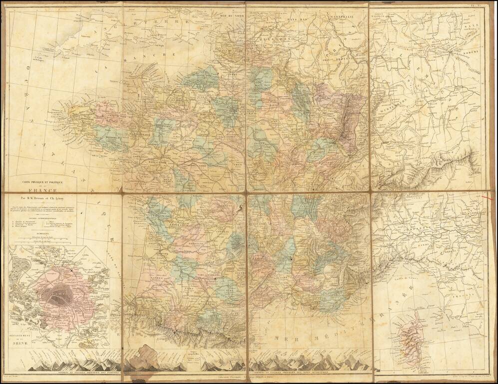
Scarce folding map of France, with large inset map of Paris.
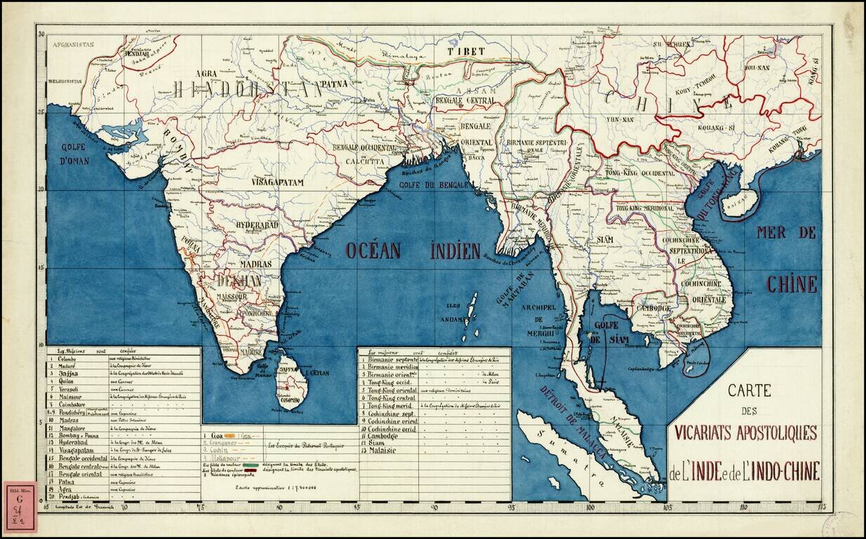
Rare and highly detailed map of Southeast Asia and India, divided into the regions established by the Catholic Missionaries. An extensive key at the bottom of the map identifies the various missions and branches of the Church which were overseeing...
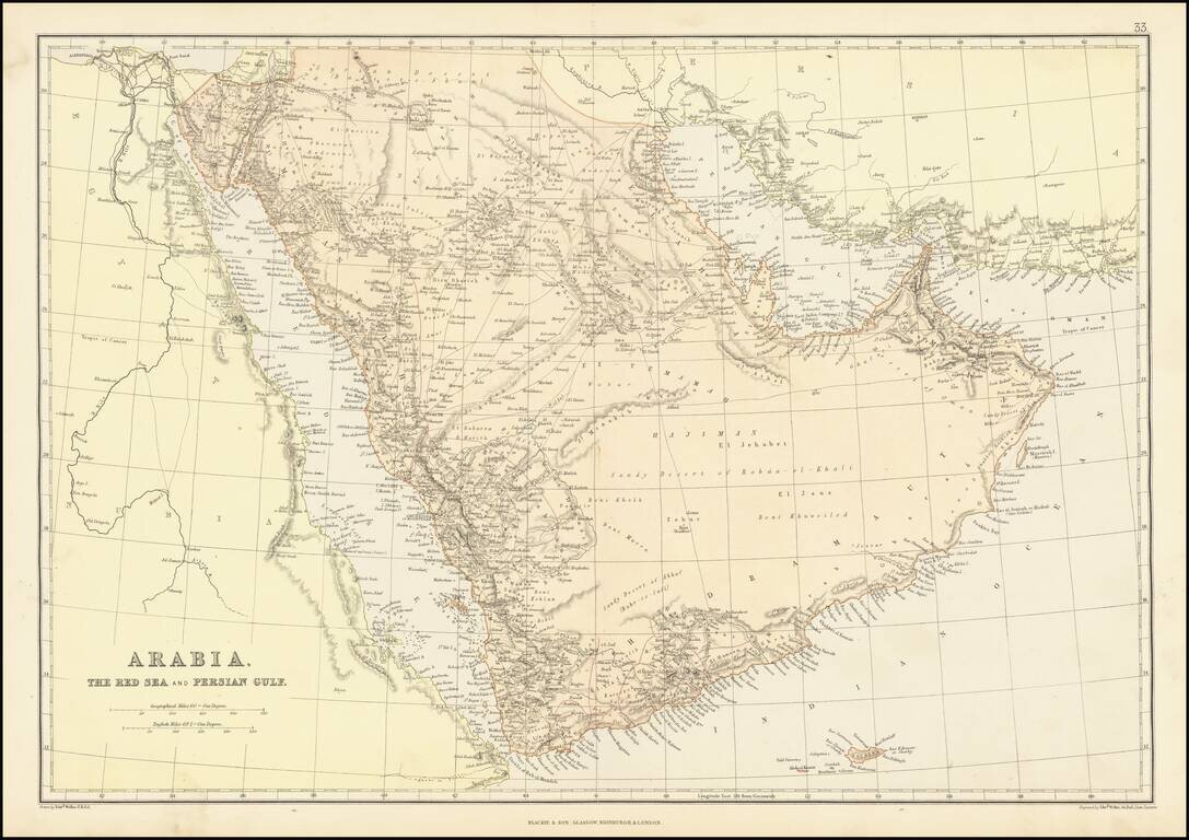
Detailed map of the Arabian Peninsula and Middle East, published by Edward Weller. The map includes a number of overland routes across the Arabian Peninsula. The map also locates Abou-Thubbi (Abu Dhabi), Debai (Dubai) and Sharja, as well as El Biddah...
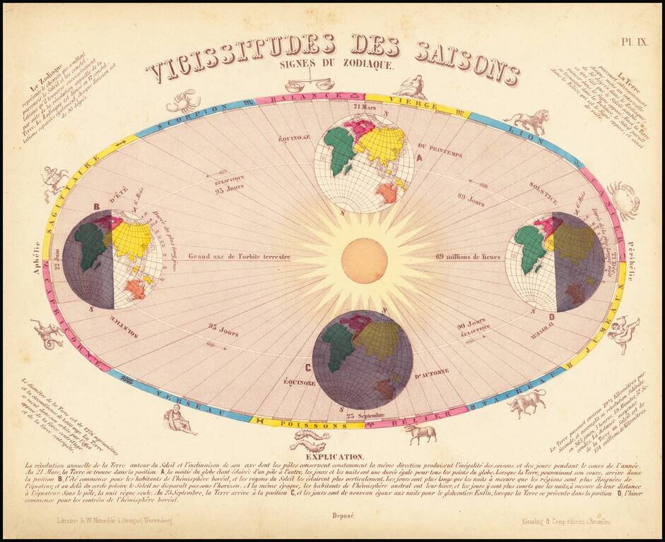
Striking image illustrating the seasons of the year and signs of the Zodiac.