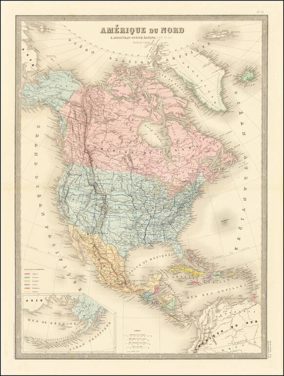
Excellent detailed map of North America, published in Paris. Alaska is now part of the United States and a massive British Columbia is outlined in red. The shape of Wyoming is very curious, with Yellowstone outlined as its own state.
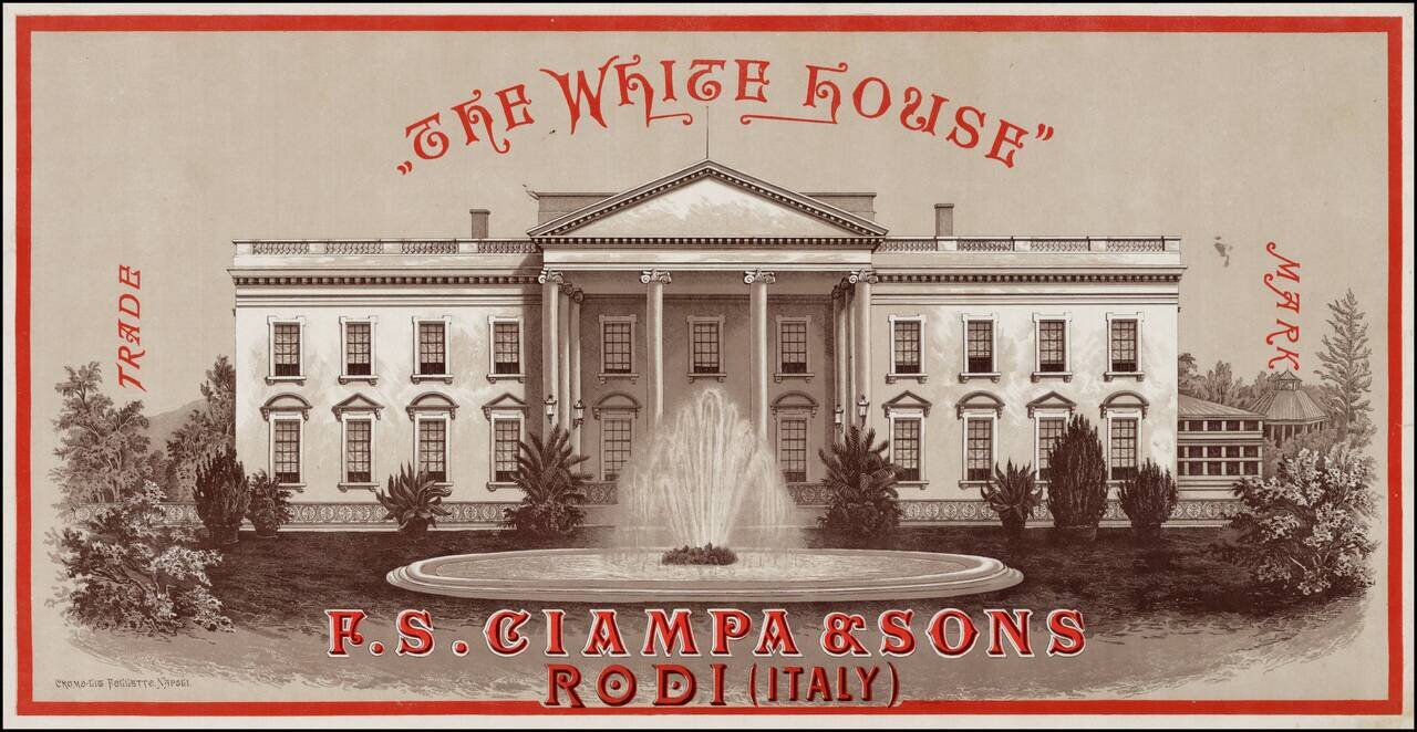
Rare advertising chromolithographic print of the White House, promoting the F.S. Chiampa & Sons of Rodi, Italy, one of a series of promotional prints published to promote the company's shipping services to America. The image provides a fine image...

Rare Mexican Version of the Game of Goose Mexican edition of the Game of Goose, published in Mexico City by Antonio Vanegas Arroyo. The gameboard shows 63 numbered spaces, or "casillas," each illustrated with people, birds, animals, and objects,...

Scarce Spanish map of the world by Jose Pilar Morales. The map shows the world on a homolographic projection, an equal-area projection in which the proportion between regions of unequal area is correctly shown. The map is set in Spanish text which...
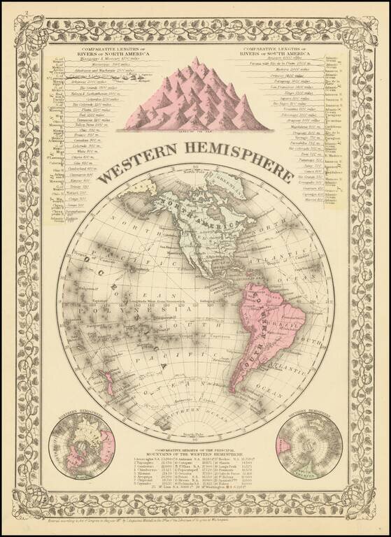
Detailed map of the Western Hemisphere with comparative lengths of river charts for North and South America. The map also shows mountain heights. Small tear in bottom margin to neat line. Beautiful decorative borders. SA Mitchell Jr. acquired his...
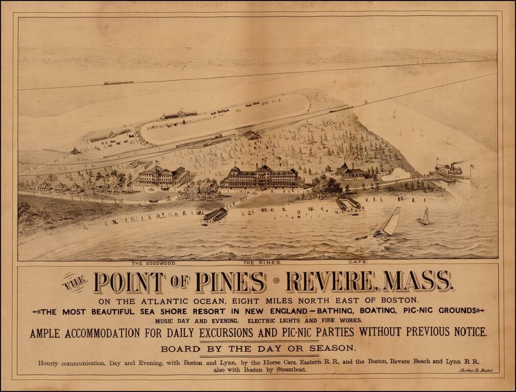
Rare view of The Point of Pines, in Revere Massachusetts, promoting this beach resort 8 miles northeast of Boston. The view shows two hotels (The Pines and the Goodwood) and a Cafe, along with the a horse racing track, the local train depot and scenes...
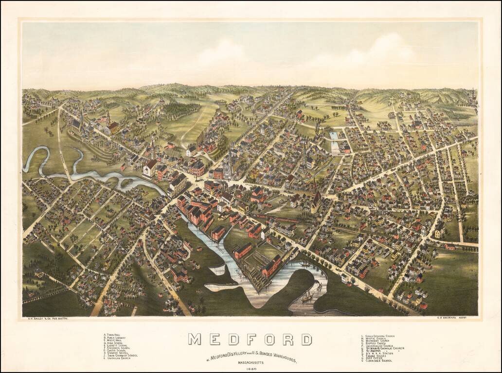
Rare bird's-eye view of Medord, Massachusetts, published by O.H. Bailey in Boston. The view shows a booming commercial town on the banks of the Mystic River, looking northward from the general direction of Tufts University (which would be just below...
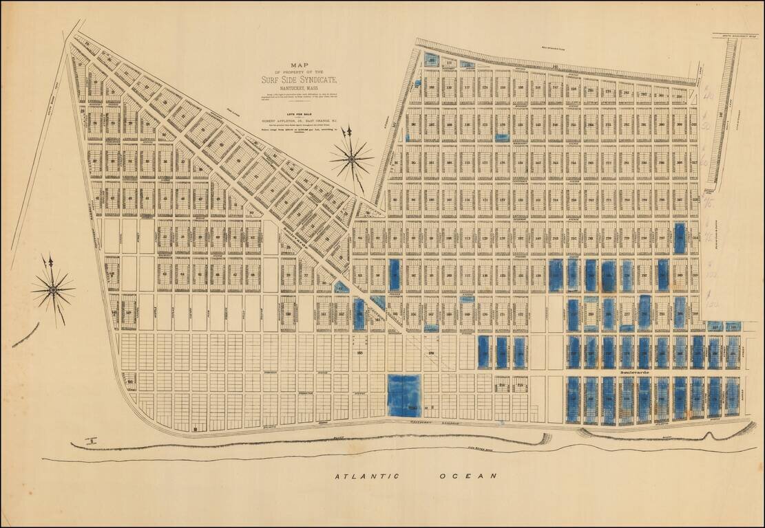
An extremely rare 1880s plat of lots for sale in Surfside on Nantucket’s South Shore. Note: This plat was acquired in partnership with Boston Rare Maps as part of an archive of some 150 Nantucket real estate maps and plats. The group includes...
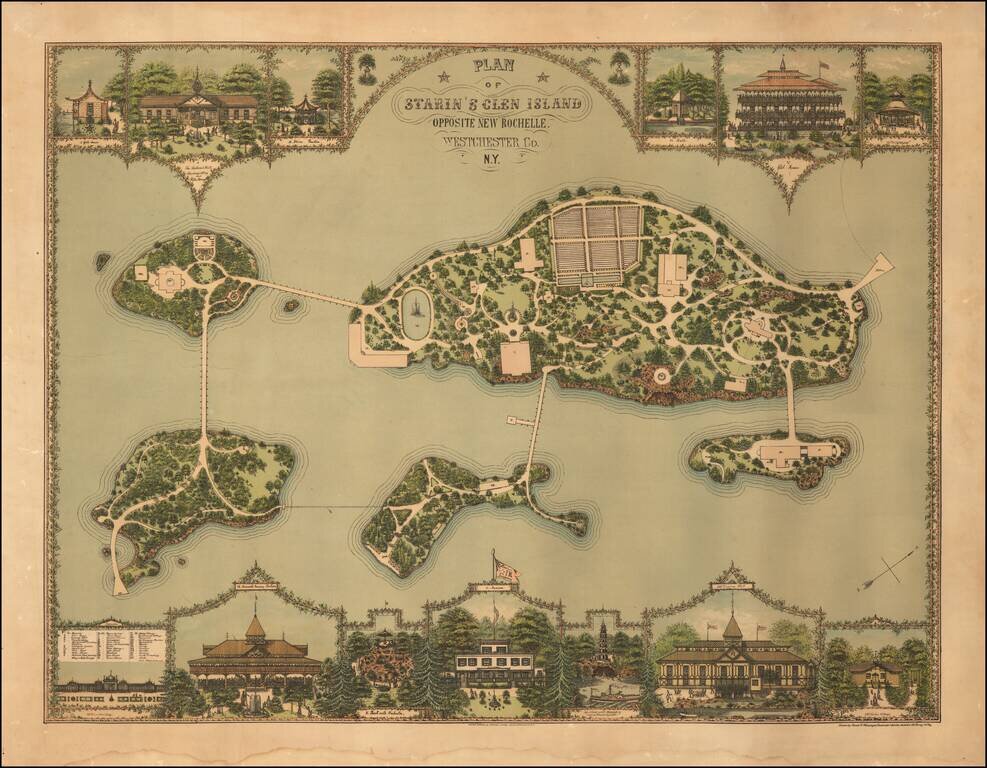
Gilded Age Landscape Design of "the First Theme Park in the Country". Superb chromolithograph landscape design map, showing the layout for Starin's Glen Island in Long Island Sound, off New Rochelle. The print is the work of Franz Xaver Heissinger, a...
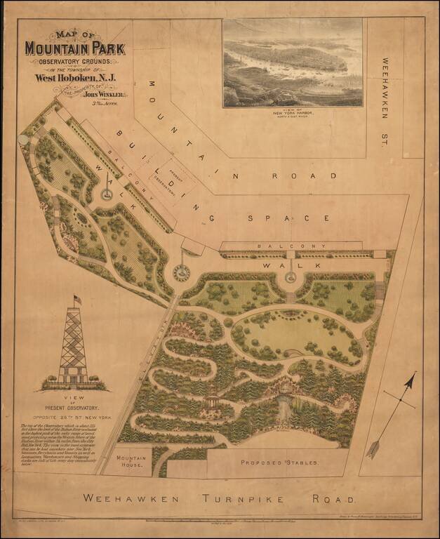
A Gilded Age Design for an Observatory Overlooking Manhattan. Unrecorded color-lithographed architectural plan for the grounds surrounding the Hoboken observatory overlooking Manhattan. The observatory in Hoboken echoed the Latting Observatory on a...
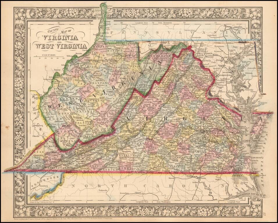
Detailed map of Virginia and West Virginia, hand colored by county, showing towns, roads, railroads, rivers, mountains, forts, etc. All counties except Mingo, Lincoln, Summers, Mineral, and Grant are shown in West Virginia.
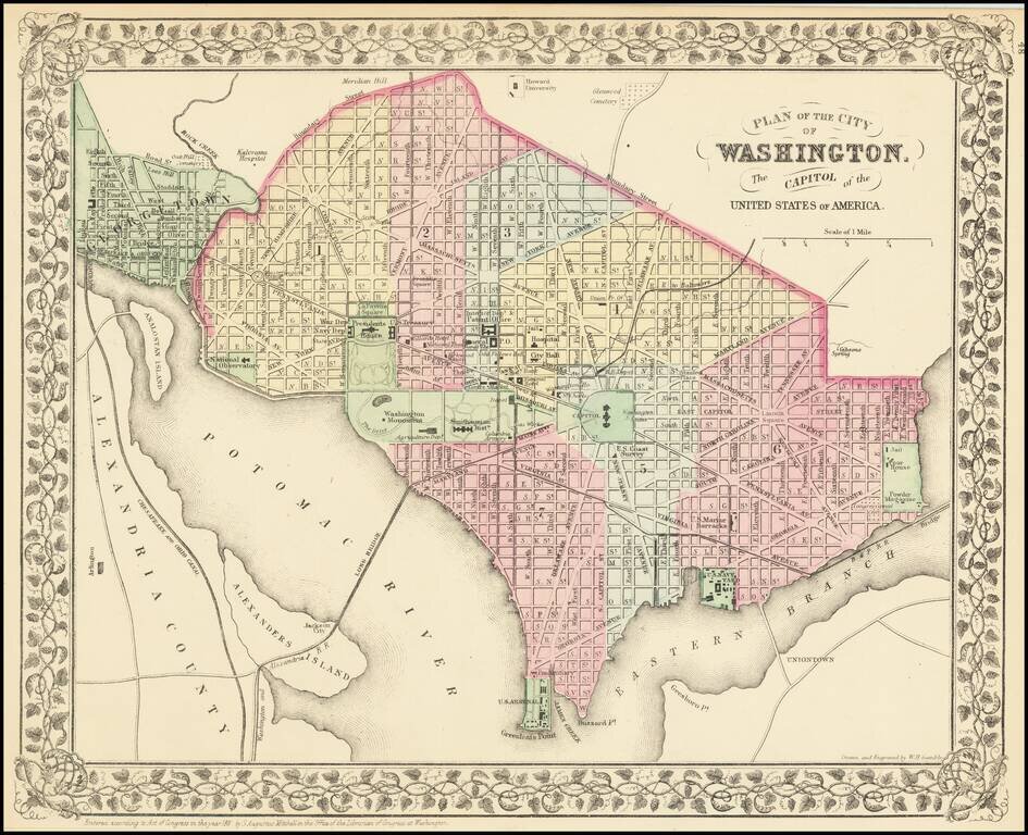
Detailed map of Washington DC, hand colored by wards. Shows the Long Bridge, Bridge to Union Town and the streets, buildings and other places of significance in the District. Decorative grapevine border. A nice map of Washington DC, one of the best...
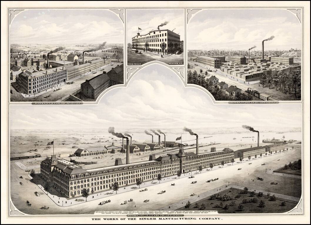
Striking view of the Singer Manufacturing works at Elizabeth, New Jersey. Includes smaller views showing Singer's Silk Mills in Newark, N.J. and its works in Glasgow, Scotland and South Bend, Indiana.
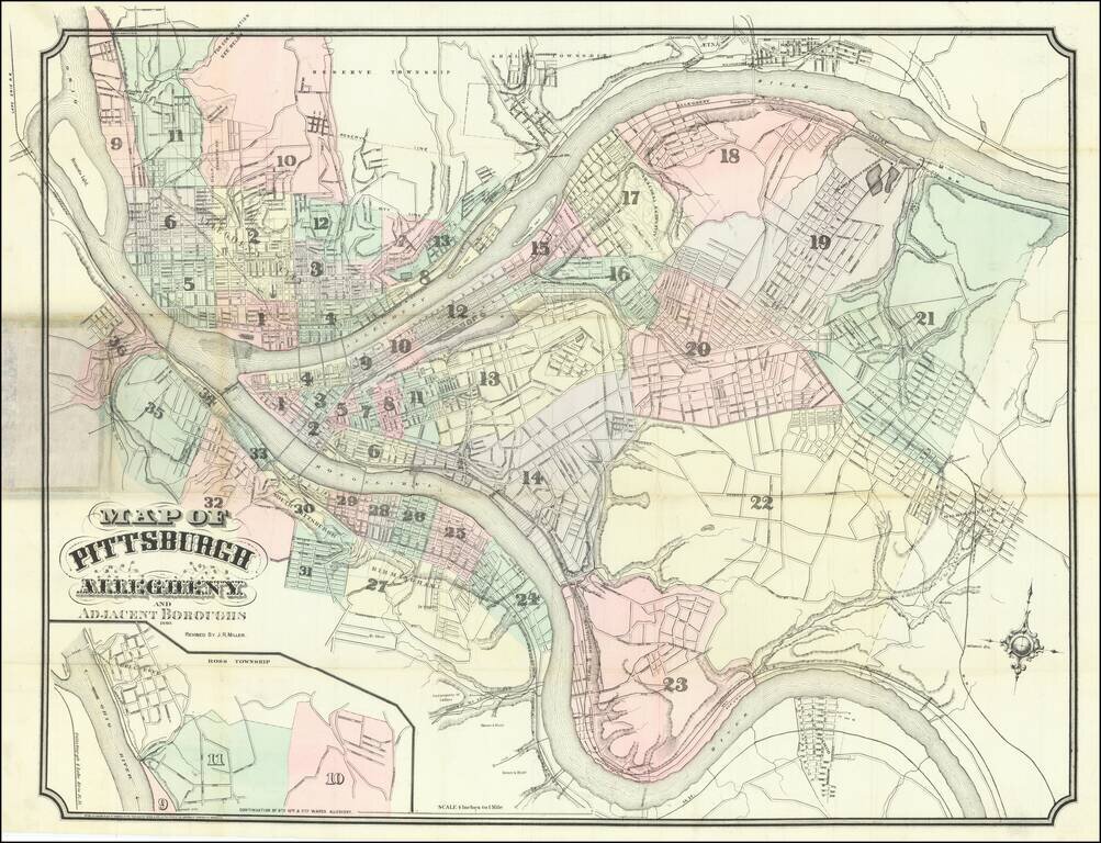
Large antique hand-colored lithographed folding map of Pittsburgh, Pennsylvania, initially published by Krebs & Brother in 1869, here in an edition updated to 1880 by J.R. Miller. The map is hand-colored and numbered by ward. It extends as far...
![[Texas] Map showing the route of the Corpus Christi, San Deigo & Rio Grande Railroad, and its connections.](/map/small/70187.jpg)
Rare Texas Railroad Map Interesting map of Texas, illustrating the route of the Corpus Christi, San Diego & Rio Grande Railroad and connecting routes, including an extension into Mexico. The map was prepared to illustrate a US government...
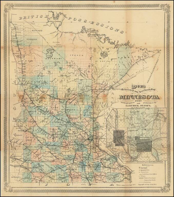
Final? Edition of Rice's Important Map of Minnesota. Rare 1880 St. Paul-published map of Minnesota, by the state's foremost early map publisher. The map includes an inset titled "Vicinity of St. Paul, and Minneapolis." The inset shows local train and...